
Highlighted Media
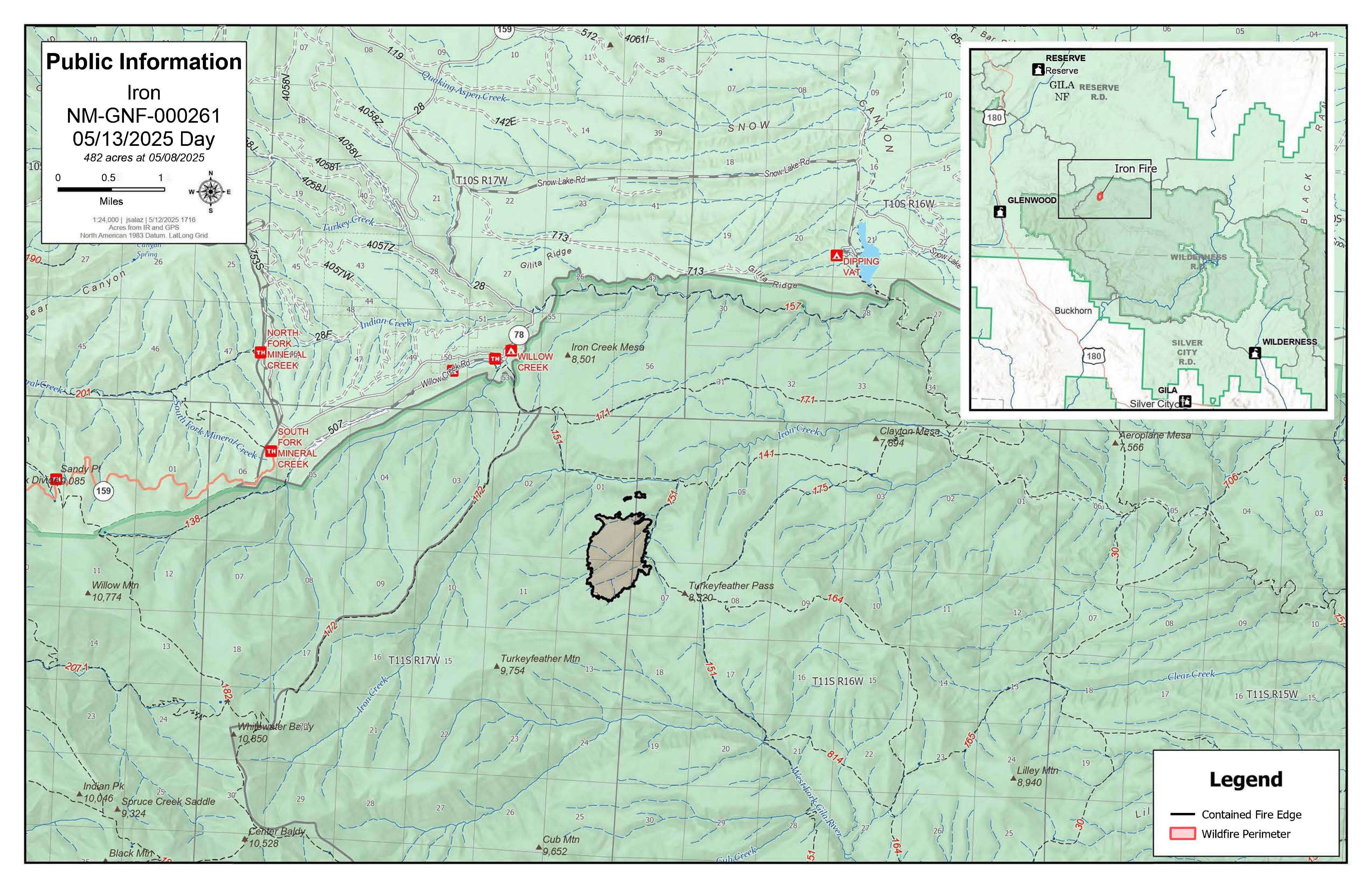
Iron Fire Public Information Map May 13, 2025
Wed, 05/14/2025 - 00:12
Iron Fire Public Information Map May 13, 2025 showing 100% containment
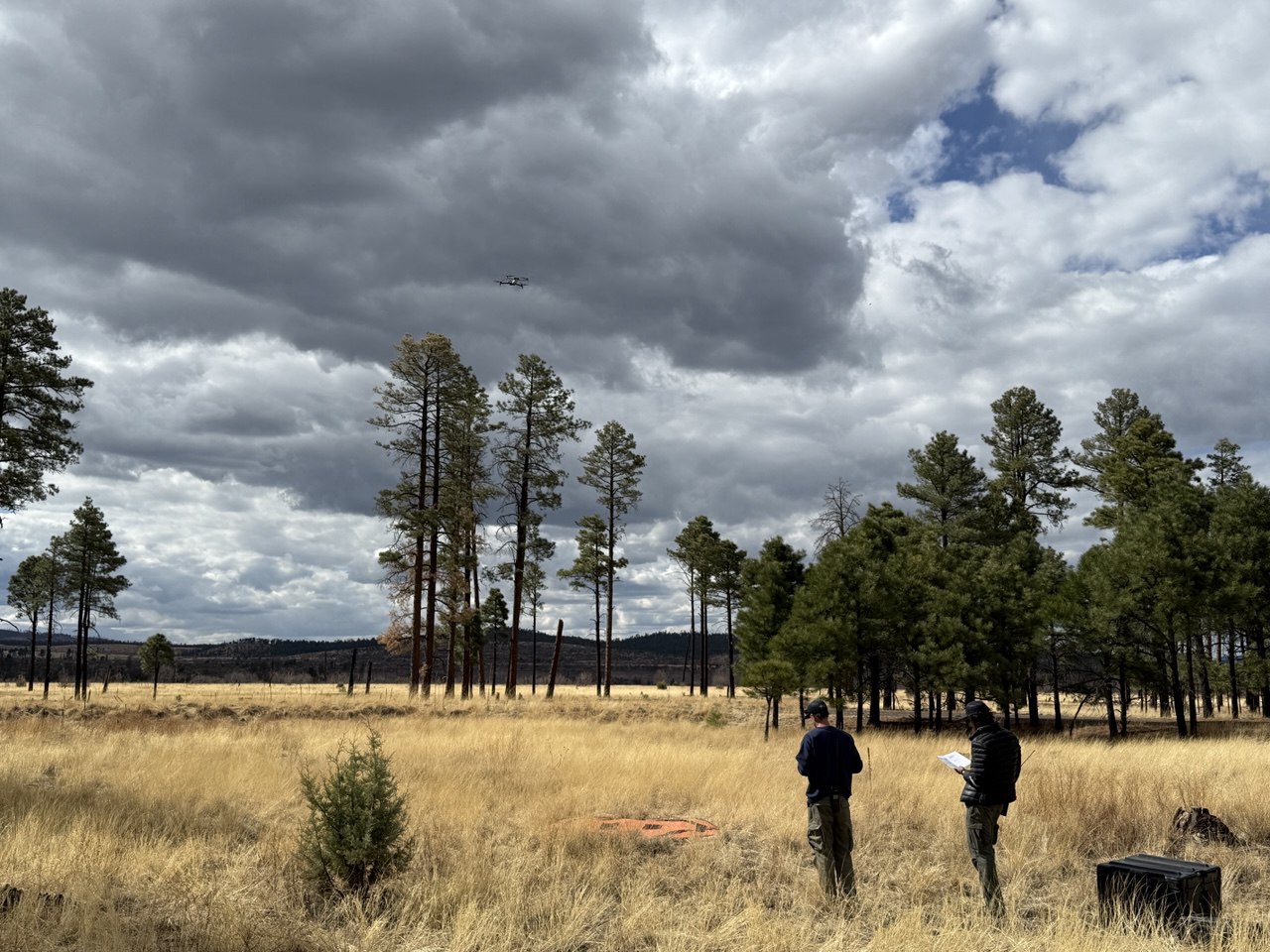
Drone Operations on the Iron Fire May 8, 2025
Mon, 05/12/2025 - 09:56
Two members of the Drone Module launch a drone visible just above the tree tops to fly missions over the Iron Fire on Thursday, May 8, 2025
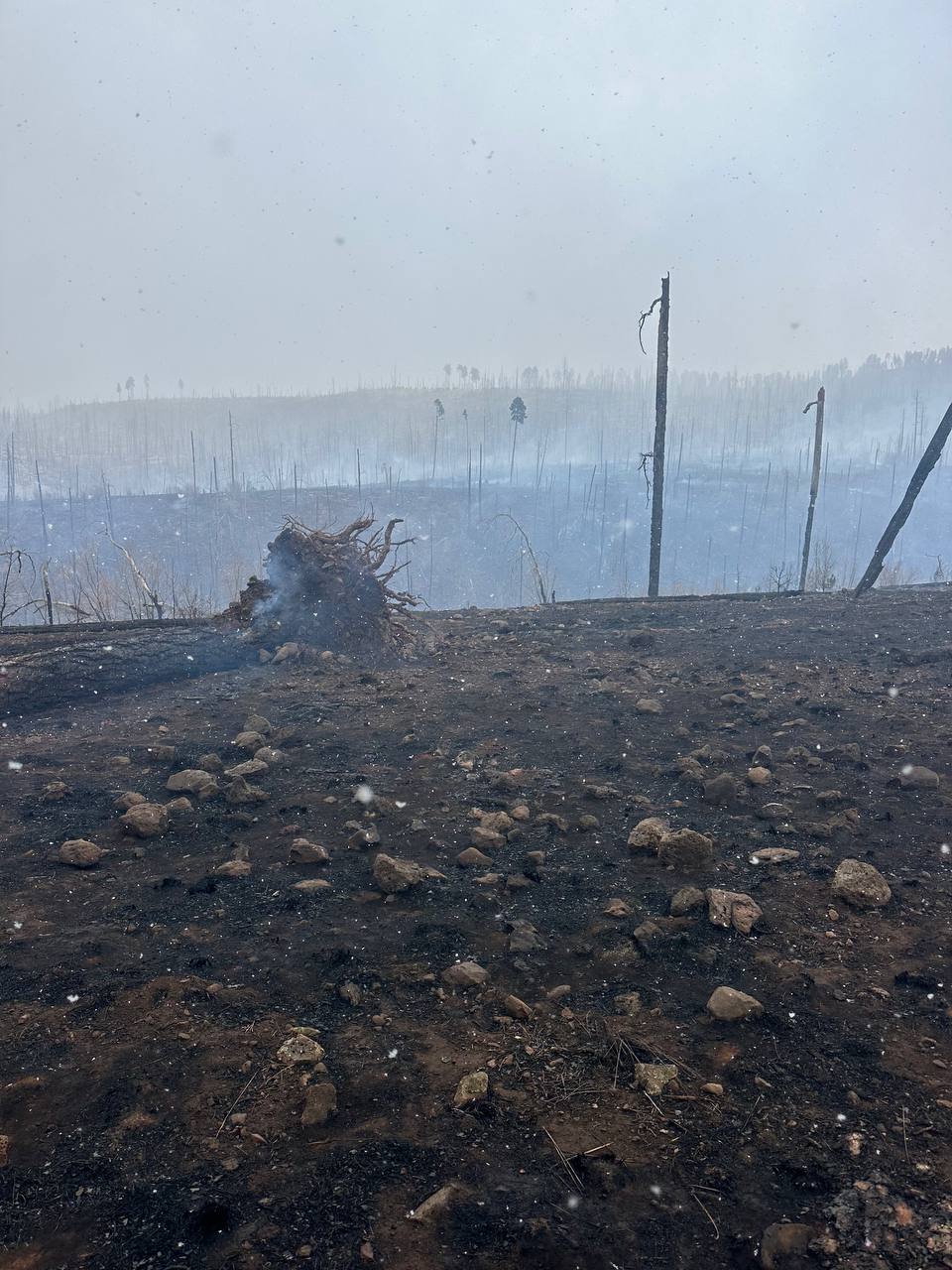
Iron Fire Burned Area May 5, 2025
Sat, 05/10/2025 - 22:47
Burned area of the Iron Fire on May 5, 2025
On Monday, May 12, the fire was called 100% contained. As of Wednesday, May 14, Command of the Iron Fire was transferred back to the Gila National Forest. This incident will no longer be updated.
The Iron Fire was detected Sunday, May 4, 2025 around noon. It is located in Cooper Canyon south of Iron Mesa and northeast of Turkeyfeather Mountain, inside the Gila Wilderness, south of Willow Creek Campground.
| Current as of | Wed, 05/14/2025 - 00:15 |
|---|---|
| Incident Type | Wildfire |
| Cause | Lightning |
| Date of Origin | |
| Incident Time Zone | Mountain Standard Time |
| Location | Cooper Canyon in Gila Wilderness, 3 miles south of Willow Creek Subdivision |
| Incident Commander | Gila National Forest Type 5 Organization |
| Coordinates |
33° 21' 23'' Latitude
-108° 33' 18
'' Longitude
|
| Size | 482 Acres |
|---|---|
| Percent of Perimeter Contained | 100% |