Highlighted Media

CURRENT SITUATION:
The Vista Fire was reported on Sunday, July 7th, 2024, at around 9:51 AM in the San Bernardino National Forest.
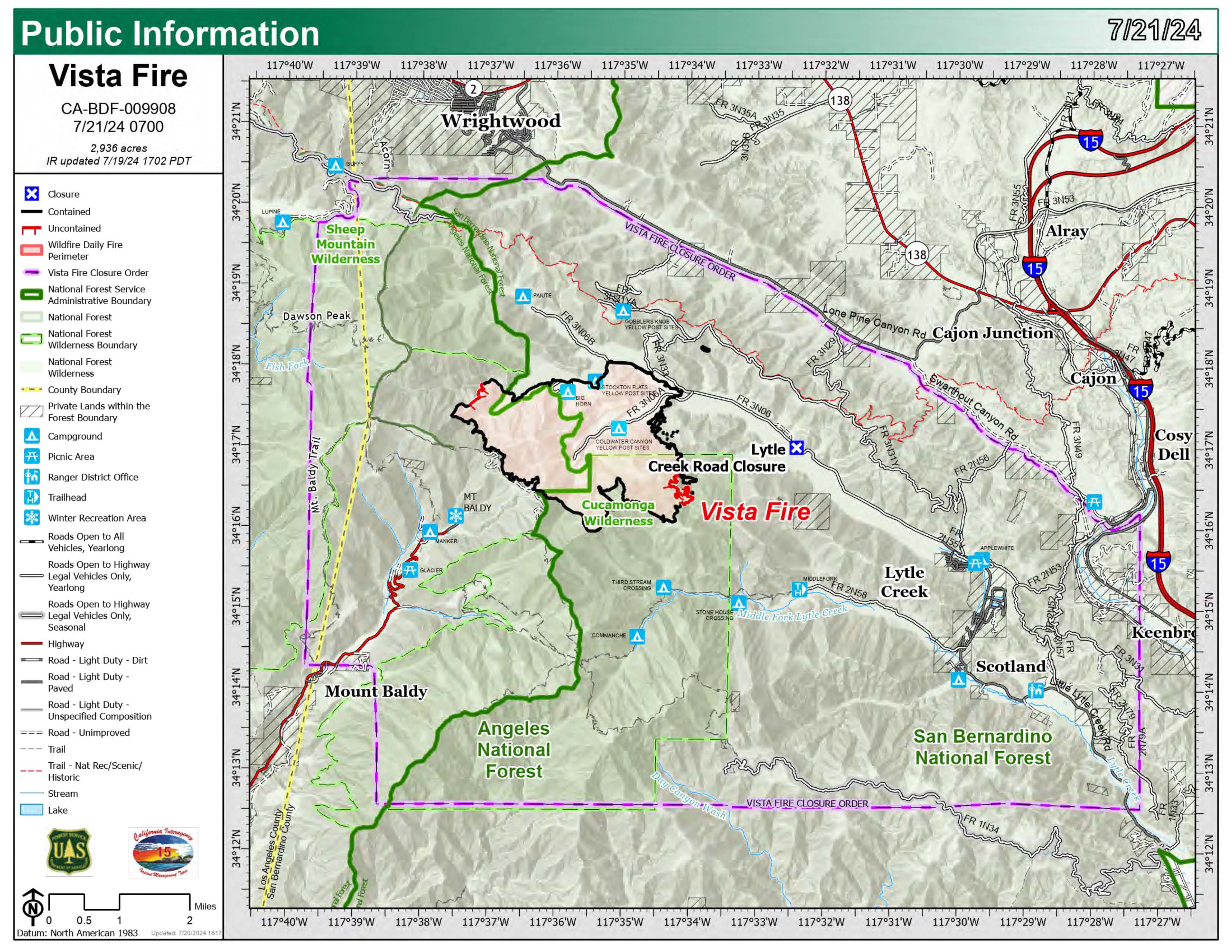
It burned approximately 2936 acres and is 100% contained as of 12-31-24.
ROAD CLOSURES:
Forest Service Roads listed in the current closure order.
EVACUATIONS:
Note: In an effort to quickly communicate information on impending dangers, the San Bernardino County Sheriff Department and San Bernardino County Fire Department send high-speed mass notifications via telephone and text messages. This system is known as the Telephone Emergency Notification System (TENS). To learn more about this service, visit the website for more information: https://sbcfire.org/alertwarning/.
CLOSURES:
More information about the current closure order is available on the national forest websites at https://www.fs.usda.gov/alerts/sbnf/alerts-notices and https://www.fs.usda.gov/alerts/angeles/alerts-notices.
FIRE RESTRICTIONS:
The San Bernardino National Forest has implemented increased fire restrictions. Campfires are restricted to those developed areas listed in the Forest Order.
KNOW WHERE YOU CAN FLY: Drones pose a serious risk to firefighting and cause air operations to cease. When drones interfere with firefighting efforts, a wildfire has the potential to grow larger and cause more damage. A FAA Temporary Flight Restriction (TFR) is in effect for the area. Any private aircraft or drone that violates the TFR could face serious criminal charges. For more information on drones, visit the FAA’s website at www.KnowBeforeYouFly.org. “If you fly, we can’t!”
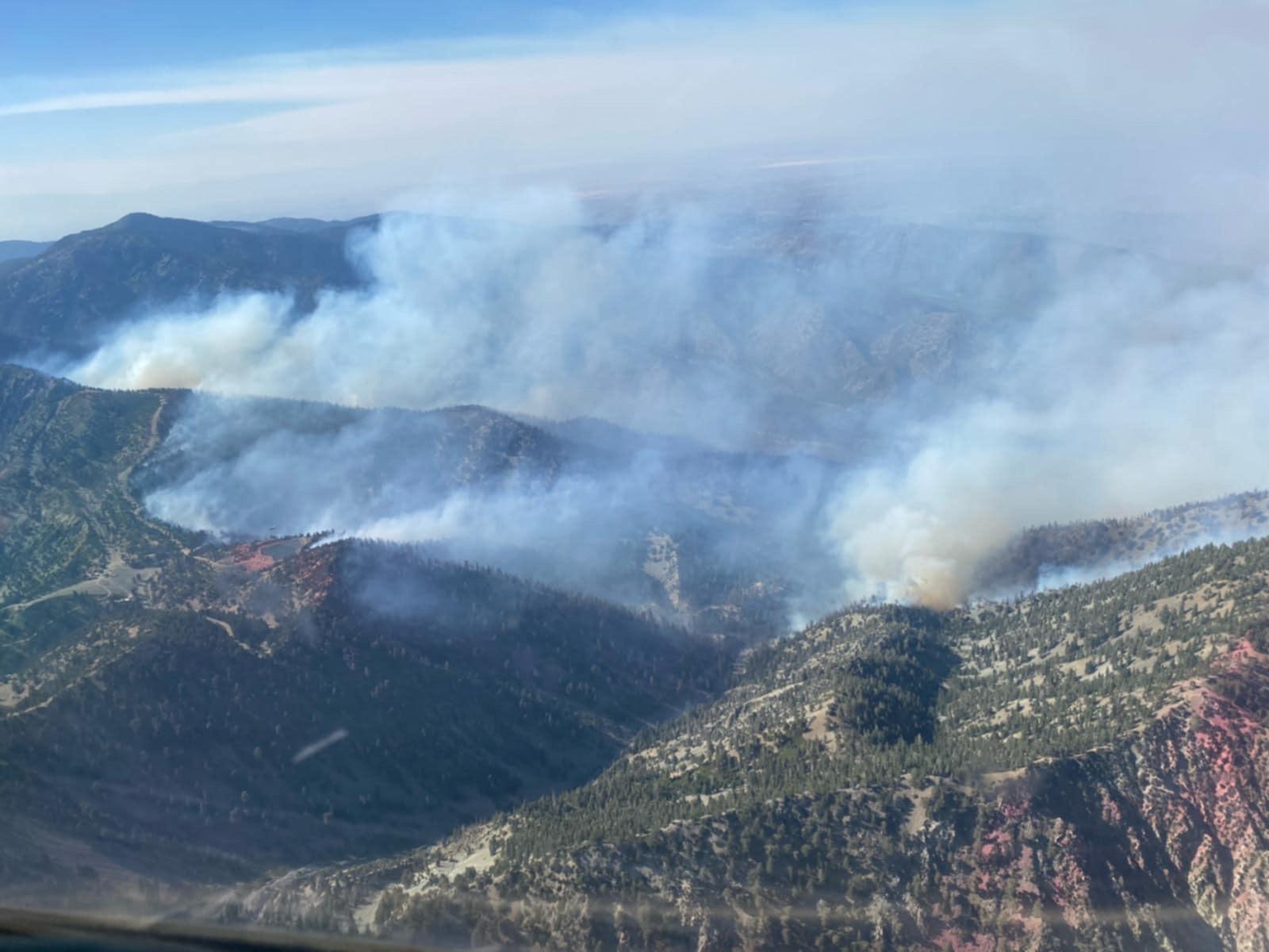
Photo: Aerial view of the Vista Fire on Tuesday, July 9th, 2024. Courtesy of Air Attack 12, assigned to the Vista Fire.
| Current as of | Tue, 12/31/2024 - 11:14 |
|---|---|
| Incident Time Zone | America/Los_Angeles |
| Incident Type | Wildfire |
| Cause | Under Investigation |
| Date of Origin | |
| Location | Lytle Creek |
| Incident Commander | California Interagency Incident Team 15 reverted management of the incident to the San Bernardino National Forest. |
| Incident Description | The Vista Fire was reported on Sunday, July 7th, 2024, at around 9:51 AM in the San Bernardino National Forest. It burned approximately 2936 acres and is 100% contained as of 12-31-24. |
| Coordinates |
34° 18' 7'' Latitude
-117° 35' 27
'' Longitude
|
| Total Personnel: | 297 |
|---|---|
| Size | 2,936 Acres |
| Percent of Perimeter Contained | 100% |
| Fuels Involved | Timber (grass and understory, litter and understory). Brush (2 feet). |
| Significant Events | The current plan includes to continue monitoring the area as needed through December, or when significant precipitation occurs. |
| Planned Actions |
The current plan includes to continue monitoring the area as needed through December, or when significant precipitation occurs. |
|---|---|
| Projected Incident Activity |
The current plan includes to continue monitoring the area as needed through December, or when significant precipitation occurs. |
| Weather Concerns | Hot and dry weather will continue for the area throughout the week. |
|---|

 InciWeb
