
Announcements Closures News Photographs Maps
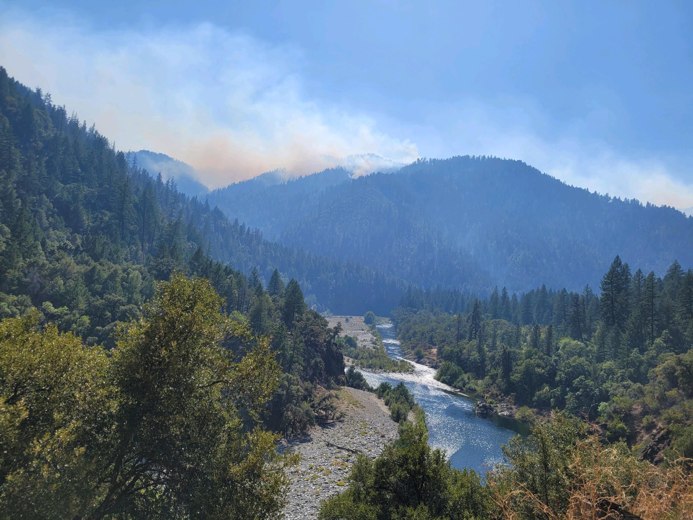
On the evening of August 17, the Six Rivers National Forest and Redwood National and State Parks received 150 lighting strikes across the area spanning almost 1 million acres. After the significant lightning event there were 27 confirmed fires.
The largest fires on the Six Rivers National Forest included the Pearch, Mosquito, Bluff #1, Blue Creek #2, Marlow and Copper. The Copper, Blue Creek #2, Bluff #1fires have now merged with the Mosquito Fire.
Additional information can be found on the 2023 SRF Lightning Complex and Redwood Lightning Complex Facebook Page.
Operational Briefing videos can be watched on the 2023 SRF Lighting Complex and Redwood Lightning Complex YouTube page.
More information on the strategy being used to contain the Bluff #1 and Mosquito Fires can be watched here.
Area and campground closures are in effect on portions of the Six River National Forest. Information and can be found by visiting this website Six River National Forest Closures .
Visit this website to see fire closure information for Redwood National and State Park. Redwood National and State Park
Evacuation warnings by Siskiyou County and can be viewed on the Siskiyou County Emergency Services website.
Evacuation warnings by Humboldt County and can be viewed on the Humboldt Sheriff’s Office website.
Evacuation status can be checked by visiting this website. Map and Zone Identification.
Siskiyou County residents can register for community notifications by visiting the Code Red Alert Notification website
Humboldt County Residents can register for Humboldt Alert Notifications by visiting the Humboldt County Alert website.
Announcements Closures News Photographs Maps
On the evening of August 17, the Six Rivers National Forest and Redwood National and State Parks received 150 lighting strikes across the area spanning almost 1 million acres. After the significant lightning event there were 27 confirmed fires.
The largest fires on the Six Rivers National Forest included the Pearch, Mosquito, Bluff #1, Blue Creek #2, Marlow and Copper. The Copper, Blue Creek #2, Bluff #1fires have now merged with the Mosquito Fire.
Additional information can be found on the 2023 SRF Lightning Complex and Redwood Lightning Complex Facebook Page.
Operational Briefing videos can be watched on the 2023 SRF Lighting Complex and Redwood Lightning Complex YouTube page.
More information on the strategy being used to contain the Bluff #1 and Mosquito Fires can be watched here.
Area and campground closures are in effect on portions of the Six River National Forest. Information and can be found by visiting this website Six River National Forest Closures .
Visit this website to see fire closure information for Redwood National and State Park. Redwood National and State Park
Evacuation warnings by Siskiyou County and can be viewed on the Siskiyou County Emergency Services website.
Evacuation warnings by Humboldt County and can be viewed on the Humboldt Sheriff’s Office website.
Evacuation status can be checked by visiting this website. Map and Zone Identification.
Siskiyou County residents can register for community notifications by visiting the Code Red Alert Notification website
Humboldt County Residents can register for Humboldt Alert Notifications by visiting the Humboldt County Alert website.
| Current as of | Thu, 10/26/2023 - 18:05 |
|---|---|
| Incident Type | Wildfire |
| Cause | Lightning |
| Date of Origin | |
| Location | Lower Trinity and Orleans District, 22 miles north of Hoopa, CA |
| Incident Commander | The Six Rivers National Forest has assumed command of the incident. |
| Incident Description | This is a Complex Fire. |
| Coordinates |
41° 22' 12'' Latitude
-123° 37' 51
'' Longitude
|
| Size | 50,198 Acres |
|---|---|
| Percent of Perimeter Contained | 100% |
| Estimated Containment Date | 10/29/2023 |
| Fuels Involved | Timber (Grass and Understory) Brush (2 feet) Hardwood Litter The primary carrier of fire at lower elevations is timber litter with a substantial hardwood dead and down component. Upper elevations are dominated by light brush with in the timber under-story and conifer litter beneath a conifer overstory. The fire area is interspersed with patchwork of previous fire history with a range of fire severity and densities. These fuels are positioned on steep, inaccessible terrain with fuels best characterized by three fire behavior fuel models (GS2, SH9, TU5). |
| Remarks |
Acreage and Containment as of 10/26/2023 Bigfoot .8 Acres 100% containment Blue Creek 0.1 Acres 100% containment Blue Creek 2 9,751.13 Acres 100% containment Bluff #1 4,269.99 Acres 100% containment Copper 2,183.65 Acres 100% containment Creek 8.37 Acres 100% containment Flat 2.42 Acres 100% containment Hancock 1,728.14 100% containment Iron 20.02 Acres 100% containment Let er-Buck 95.92 Acres 100% containment Marlow 1,997.21 Acres 100% containment Merrill 2.08 Acres 100% containment Monument 2.28 Acres 100% containment Mosquito 17,983.53 Acres 100% containment Pearch 12,152.4 Acres 100% containment |
|---|