***This incident is no longer being updated and is for reference only***
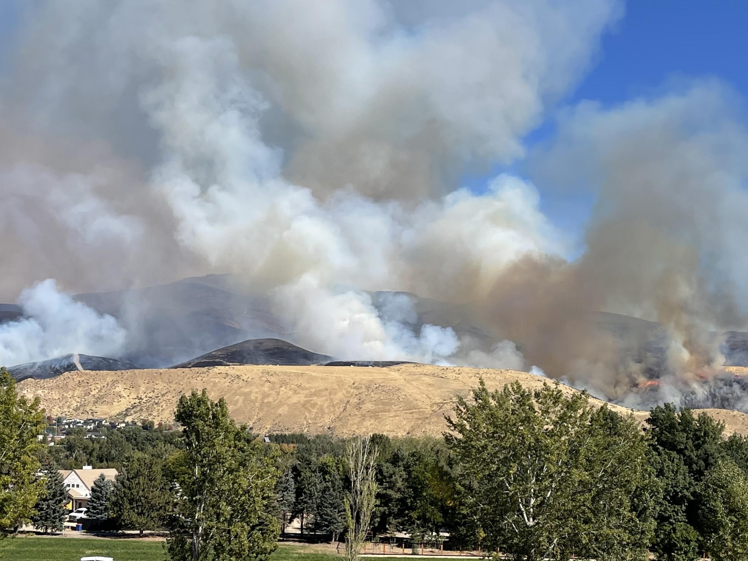
The Valley Fire was reported Friday, October 4, 2024, about 1 mile east of Boise on the north side of Highway 21. The fire was very visible from East Boise as it burned in mostly grassy fuels in the Boise Foothills. Quick work on initial attack stopped the fire from reaching nearby homes. The Bureau of Land Management, Boise District, along with the Boise Fire Department and other local agencies led firefighting efforts in the first several days. Crews included a hotshot crew, engines, dozers, and aerial resources. Aircraft were visible from southeast Boise as continuous water drops were executed to assist firefighting efforts on the ground.
| Current as of | Tue, 10/22/2024 - 18:27 |
|---|---|
| Incident Time Zone | America/Boise |
| Incident Type | Wildfire |
| Cause | Under investigation |
| Date of Origin | |
| Location | Boise Foothills near Warm Springs Avenue and Hwy 21 |
| Incident Commander | Nevada Team 2 Type 3 Team |
| Incident Description | Effective initial attack of the Valley Fire was made possible by crews creating containment lines with the assistance of bull dozers and similar equipment. Crews also conducted burning operations to reduce fuels to hold containment lines. Road closures impacted the junction of Highway 21 north on Warm Springs Road to Eckert Road for public and firefighter safety in the fire's early stages, as well as the closure of nearby schools. The northeast side of the fire had more timber fuels which helped the fire progress toward Robie Creek. |
| Coordinates |
43° 33' 39'' Latitude
-116° 03' 17
'' Longitude
|
| Total Personnel: | 159 |
|---|---|
| Size | 9,904 Acres |
| Percent of Perimeter Contained | 95% |
| Fuels Involved | Vegetation/grasses and timber |
| Projected Incident Activity |
Suppression repair and seeding is complete. |
|---|

 InciWeb