Highlighted Media
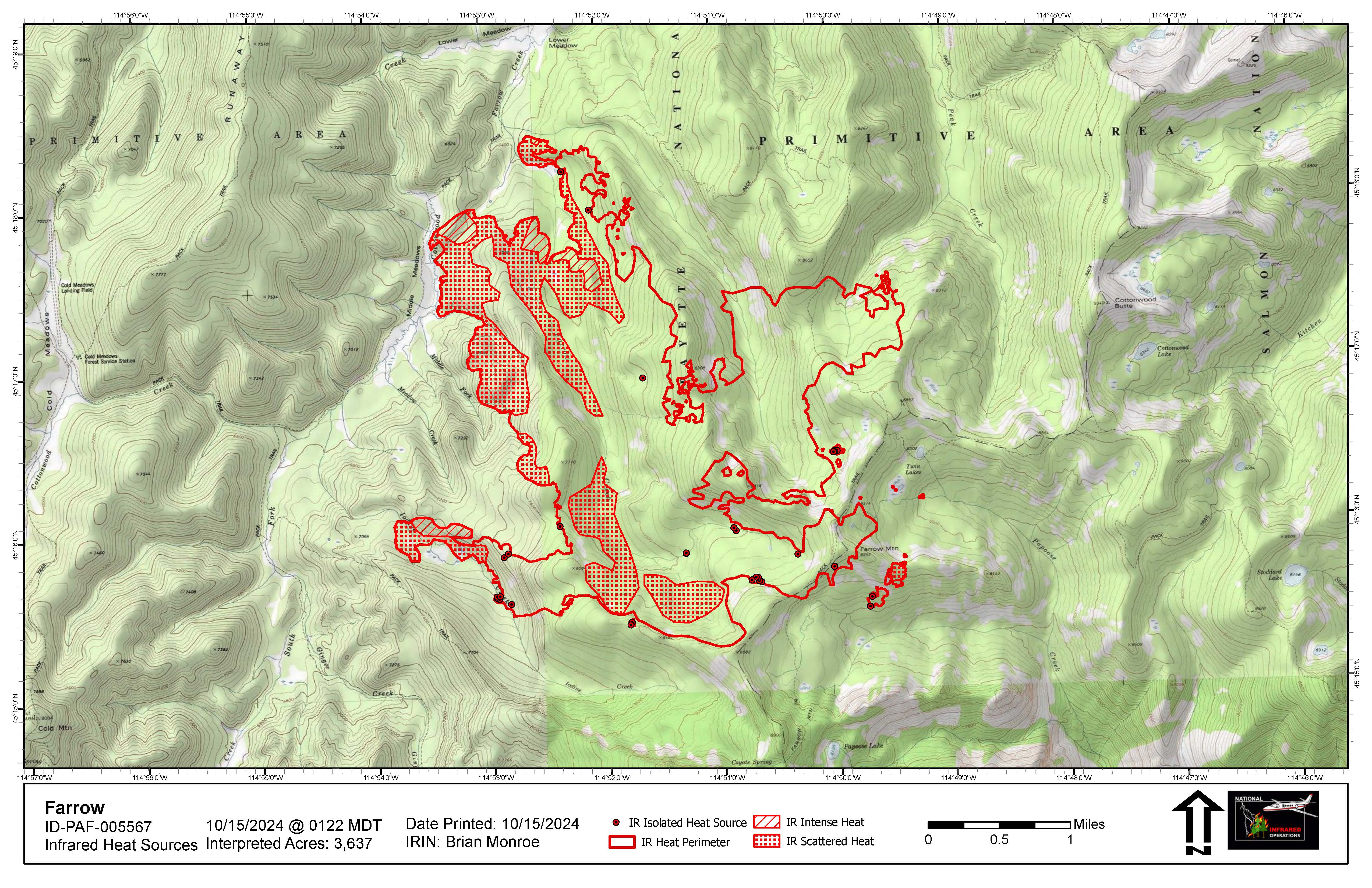
The Farrow Fire is at 3,637 acres as of October 15th. This page will be updated as information becomes available or as warranted.
The fire was detected on August 5th and caused by lightning. Initially located approximately 5.5 miles east-southeast of Cold Meadows Guard Station. The cold front that passed over the fire area on October 4th fanned the flames of the Farrow fire with fire spread to the southwest down towards the South Fork of Cottonwood Creek sand into the upper drainage of Iodine Creek. Since that fire spread, the fire has only been slowly spreading with low burn intensity, and no expected growth potential. A weather system over the fire area this weekend is expected to further limit the fires potential.
The fire 2.5 miles from Cold Meadows Guard Station and all structure protection equipment has been removed from the guard station.
Monitoring of this fire has shown that favorable effects are taking place across the burn area. This lightning caused fire is being permitted to play, as nearly as possible, its natural ecological role within the Wilderness. Zone/Point Protection measures will be taken if necessary and is being monitored by air.
- No area or trail closures are in place for this fire - people recreating in this area need to be alert for fire related hazards.
For a summary of wildfires burning in the Payette National Forest's part of the Frank Church River of No return Wilderness, visit this Inciweb link.
| Current as of | Tue, 10/22/2024 - 17:13 |
|---|---|
| Incident Type | Wildfire |
| Coordinates |
45° 16' 61'' Latitude
-114° 50' 8
'' Longitude
|
| Size | 3,637 Acres |
|---|

 InciWeb
