
Highlighted Activity
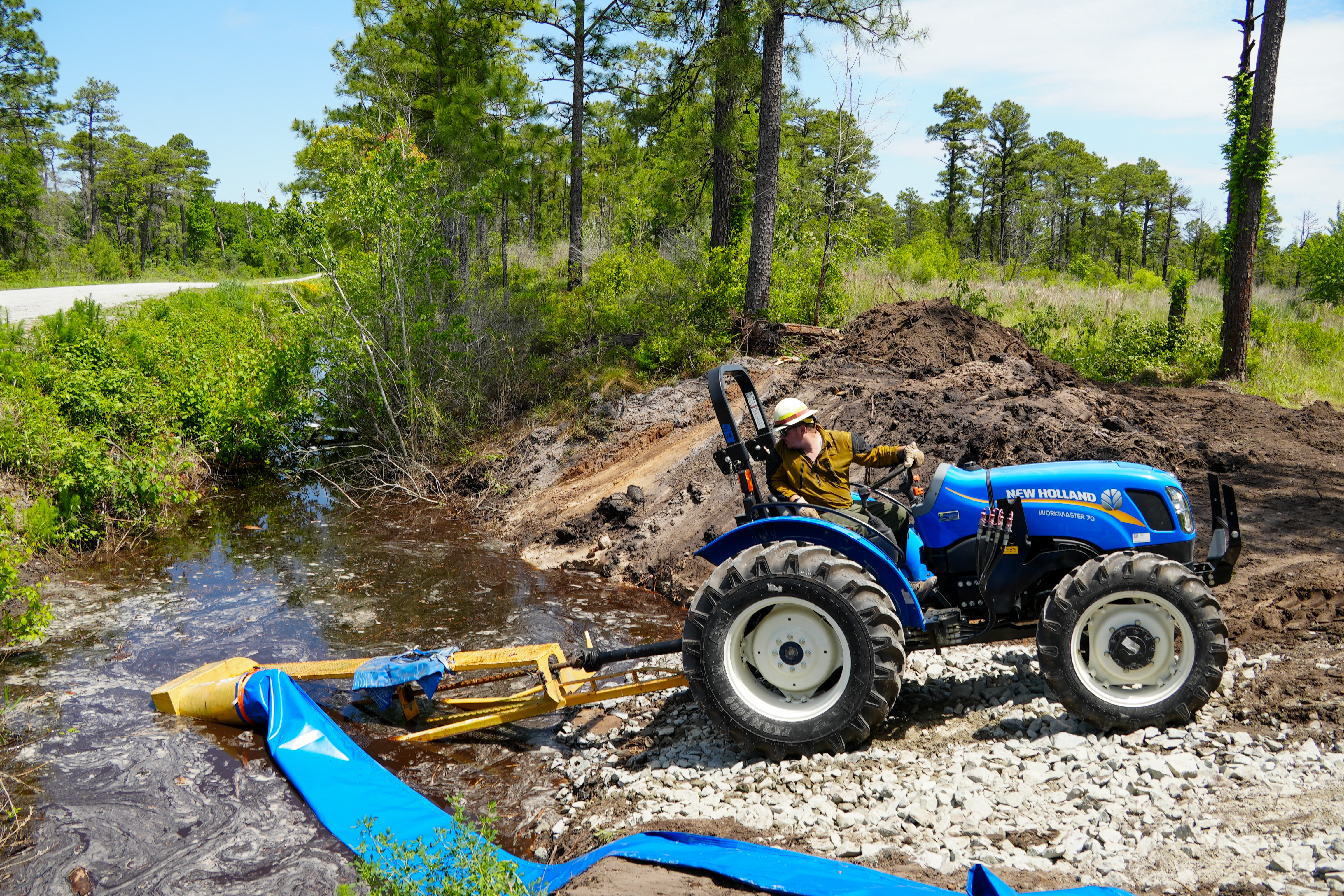
The Black Swamp Fire began on April 27th around noon. After quick growth in the first several days, the fire's growth has slowed, but the nature of the fuels has kept the fire burning. The Black Swamp Fire is burning largely in a pocosin environment, comprised of dense, sandy peat soils. These fuels burn slowly and can only be extinguished by saturation with water.
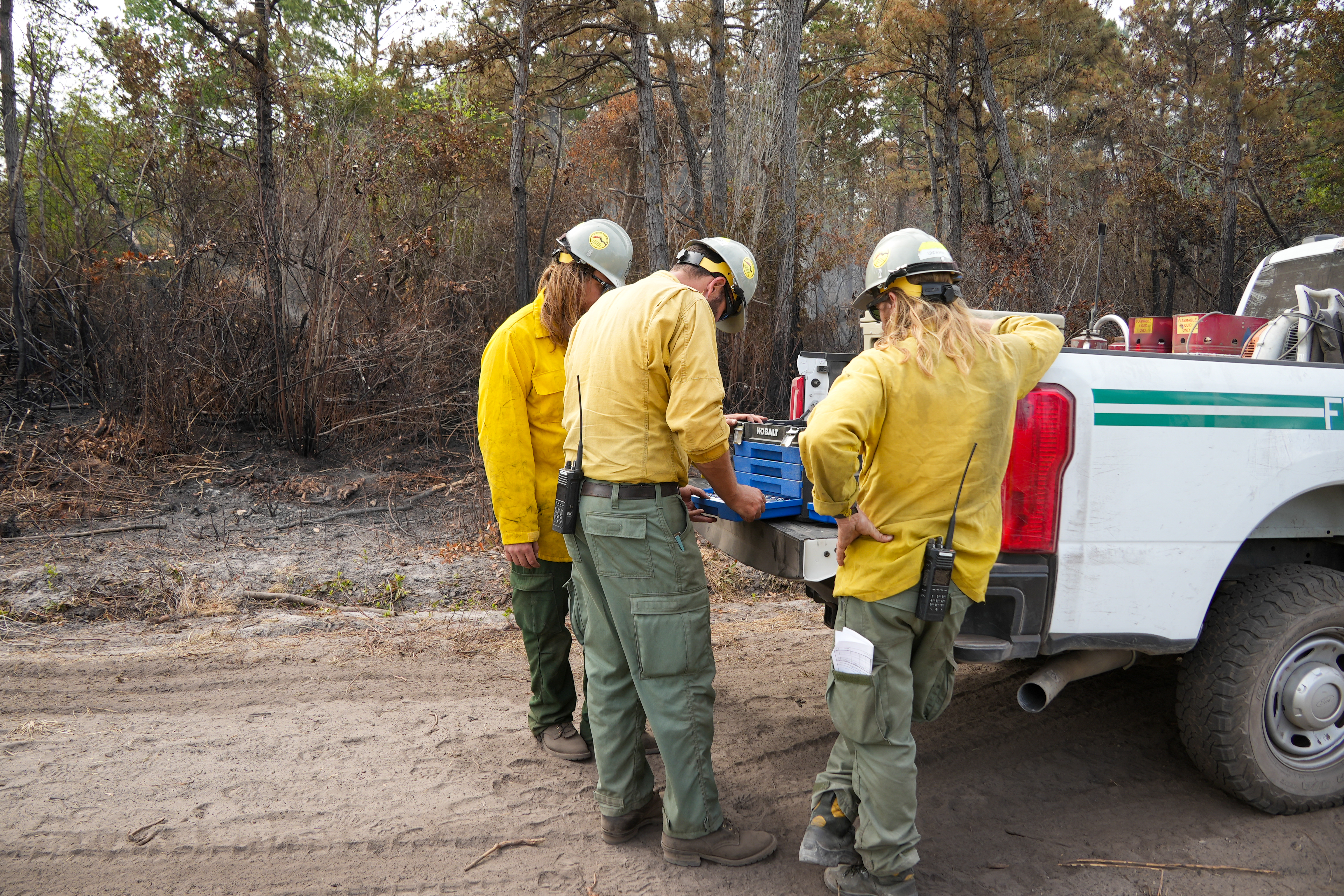
Firefighters continue working to meet this objective, pumping water into the fire area to flood the soils. Additionally, crews work to maintain containment lines and prevent growth of the fire footprint. Staff supporting this fire are from from the USDA Forest Service, North Carolina Forest Service and U.S. Fish and Wildlife Service are currently assigned to the fire.
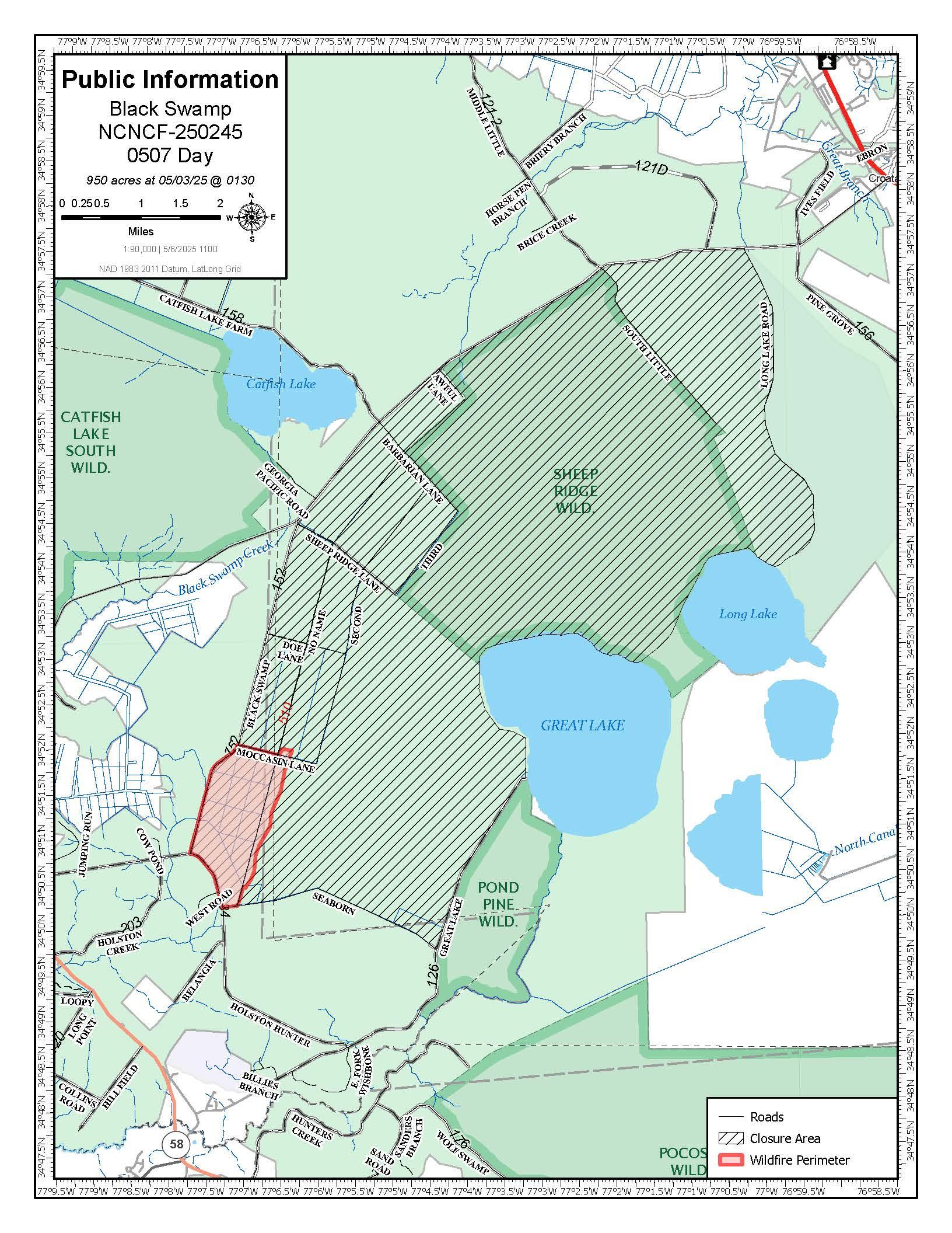
In response to the fire, the National Forests in North Carolina today temporarily closed the Great Lake Boating Access Area and Sheep Ridge Wilderness Area, as well as portions of Great Lake Road, Seaborn Road and Holsten Hunter Road. Black Swamp Road and the Black Swamp OHV area remain closed.
Smoke from the fire can cause limited visibility and may impact local air quality. Drive slowly and use caution on roads where smoke may be settling. The public can check for air quality alerts at https://airquality.climate.ncsu.edu/ or https://fire.airnow.gov.
For the latest wildfire updates, follow the National Forests in North Carolina on Facebook at U.S. Forest Service - National Forests in North Carolina or visit https://www.fs.usda.gov/r08/northcarolina.
The Black Swamp Fire began on April 27th around noon. After quick growth in the first several days, the fire's growth has slowed, but the nature of the fuels has kept the fire burning. The Black Swamp Fire is burning largely in a pocosin environment, comprised of dense, sandy peat soils. These fuels burn slowly and can only be extinguished by saturation with water.
Firefighters continue working to meet this objective, pumping water into the fire area to flood the soils. Additionally, crews work to maintain containment lines and prevent growth of the fire footprint. Staff supporting this fire are from from the USDA Forest Service, North Carolina Forest Service and U.S. Fish and Wildlife Service are currently assigned to the fire.
In response to the fire, the National Forests in North Carolina today temporarily closed the Great Lake Boating Access Area and Sheep Ridge Wilderness Area, as well as portions of Great Lake Road, Seaborn Road and Holsten Hunter Road. Black Swamp Road and the Black Swamp OHV area remain closed.
Smoke from the fire can cause limited visibility and may impact local air quality. Drive slowly and use caution on roads where smoke may be settling. The public can check for air quality alerts at https://airquality.climate.ncsu.edu/ or https://fire.airnow.gov.
For the latest wildfire updates, follow the National Forests in North Carolina on Facebook at U.S. Forest Service - National Forests in North Carolina or visit https://www.fs.usda.gov/r08/northcarolina.
| Current as of | Wed, 05/07/2025 - 11:25 |
|---|---|
| Incident Time Zone | Eastern Standard Time |
| Incident Type | Wildfire |
| Cause | Under Investigation |
| Date of Origin | |
| Incident Time Zone | Eastern Standard Time |
| Location | Jones County, 6 miles SE of Maysville, NC |
| Incident Commander | Matt Nelson US Forest Service |
| Incident Description | Smoldering, flanking, creeping, isolated torching |
| Coordinates |
34° 51' 45'' Latitude
-77° 6' 51
'' Longitude
|
| Total Personnel: | 103 |
|---|---|
| Size | 950 Acres |
| Percent of Perimeter Contained | 60% |
| Estimated Containment Date | 05/15/2025 |
| Fuels Involved | Chaparral (6 feet), Southern Rough |
| Significant Events | Minimal |
| Planned Actions |
Mop up, hold and improve, flood the fire area. |
|---|---|
| Projected Incident Activity |
12 hours: minimal |
| Weather Concerns | Today was partly cloudy skies, winds from the SW 5-10 mph, relative humidity (RH) mid 30's. Tomorrow's weather forecast calls for mostly sunny, highs in the mid 80's, RH in the mid 30's, light winds, SW 5-7 mph. |
|---|