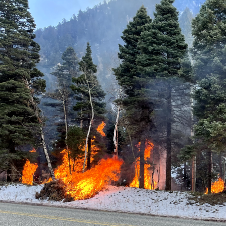
Crews did not move forward with pile burning today. A test fire did not successfully burn down piles due to moisture levels. Fire managers will continue to look for future opportunities to continue implementation.
Carson National Forest fire crews are planning to target piles from 41 acres of thinning along the Wheeler Peak Trail (#90) between the junction with the Long Canyon Trail (#63) and Bull-of-the-Woods Meadow. The trail will remain open, but hikers should prepare for smoke and flame during their trip.
Crews may also focus on piles along the highway between the mouth of the canyon and Taos Ski Valley.
Meanwhile, crew members continue to patrol and monitor nearby piles burned in November, when about half of the 300-acre project was treated.
Background
This work is part of the Highway 150 Corridor Wildland Urban Interface Project. Local organizations in 2014 came together to form the Taos Valley Watershed Coalition, which named the highway corridor as one of its priorities for protecting the forest and watershed that communities depend on.
| Current as of | Wed, 02/19/2025 - 15:19 |
|---|---|
| Incident Time Zone | America/Denver |
| Incident Type | Prescribed Fire |
| Location | Highway 150 in Rio Hondo Canyon and Wheeler Peak Trail |
| Coordinates |
36° 34' 28.1'' Latitude
-105° 30' 28.1
'' Longitude
|
| Size | 300 Acres |
|---|---|
| Fuels Involved | Piles from thinning |

 InciWeb