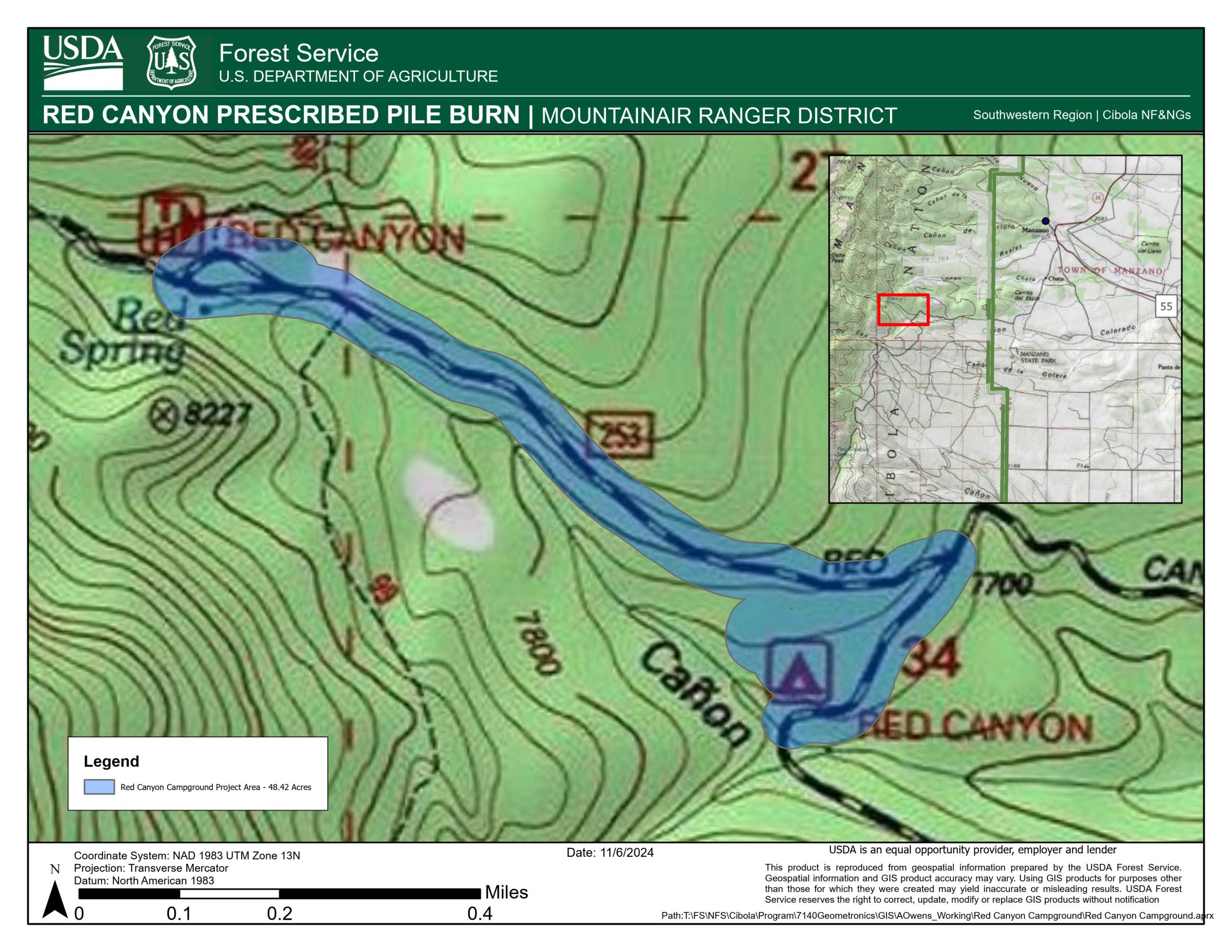
ALBUQUERQUE, NM – January 16, 2025 – Pending favorable conditions, fire managers on the Cibola National Forest & National Grasslands (NF & NGs) may implement the previously announced Red Canyon Campground Piles Prescribed (Rx) Fire on the Mountainair Ranger District as early as Tues., January 21 through Thurs., January 23.
The Red Canyon Campground Piles Rx Fire is 48 acres of piles in the Hazard Tree Mitigation Project located adjacent to Upper Red canyon Campground in the Manzano Mountains, approximately 12 miles northwest of the town of Mountainair in the southern half of the Manzano Mountains, in Torrance County, NM. Smoke may be visible in the surrounding areas of Mountainair, Punta de Agua, Manzano, or the Estancia Valley. See map attached.
Ignition start will depend upon agency administrator approval and conditions within the ranges outlined in burn plan. Optimal conditions will result in effective smoke ventilation and dispersal and help achieve the desired effects needed to accomplish the burn plan objectives. Winter is an optimal time to burn piled slash and woody debris from earlier forest restoration work since snow on the ground keeps fire from spreading to adjacent vegetation.
| Current as of | Tue, 01/21/2025 - 15:49 |
|---|---|
| Incident Time Zone | America/Denver |
| Incident Type | Prescribed Fire |
| Date of Origin | |
| Location | Manzano Mountains - Torrance County, NM. |
| Incident Commander | USDA Forest Service Cibola National Forest & National Grasslands Mountainair Ranger District |
| Coordinates |
34° 37' 20.1'' Latitude
-106° 24' 48
'' Longitude
|
| Size | 48 Acres |
|---|---|
| Fuels Involved | Piles of Douglas Fir from hazard tree mitigation from several years of Tussock Moth infestation. |
| Significant Events | 1/16/2025: Pending favorable conditions, fire managers on the Cibola National Forest & National Grasslands (NF & NGs) may implement the previously announced Red Canyon Campground Piles Prescribed (Rx) Fire on the Mountainair Ranger District as early as Tues., January 21 through Thurs., January 23.
|

 InciWeb