
Incident Media Maps
Could not determine your location.
 Wildfire
 Prescribed Fire
 Burned Area
Response
Burned Area
Response Other
Other
Maps Gallery
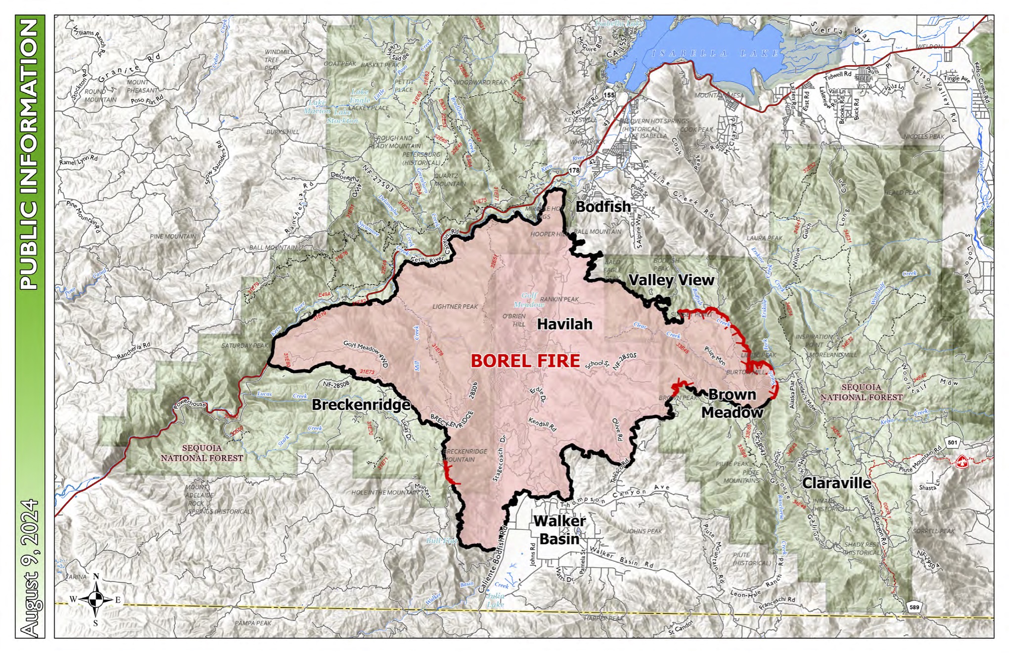
This map shows land ownership in shades of white and green, fainter lines for roads and highways, blue for bodies of water, and the Borel Fire perimeter in pink. The outline of the fire perimeters varies from red to black; the black portions represent containment.
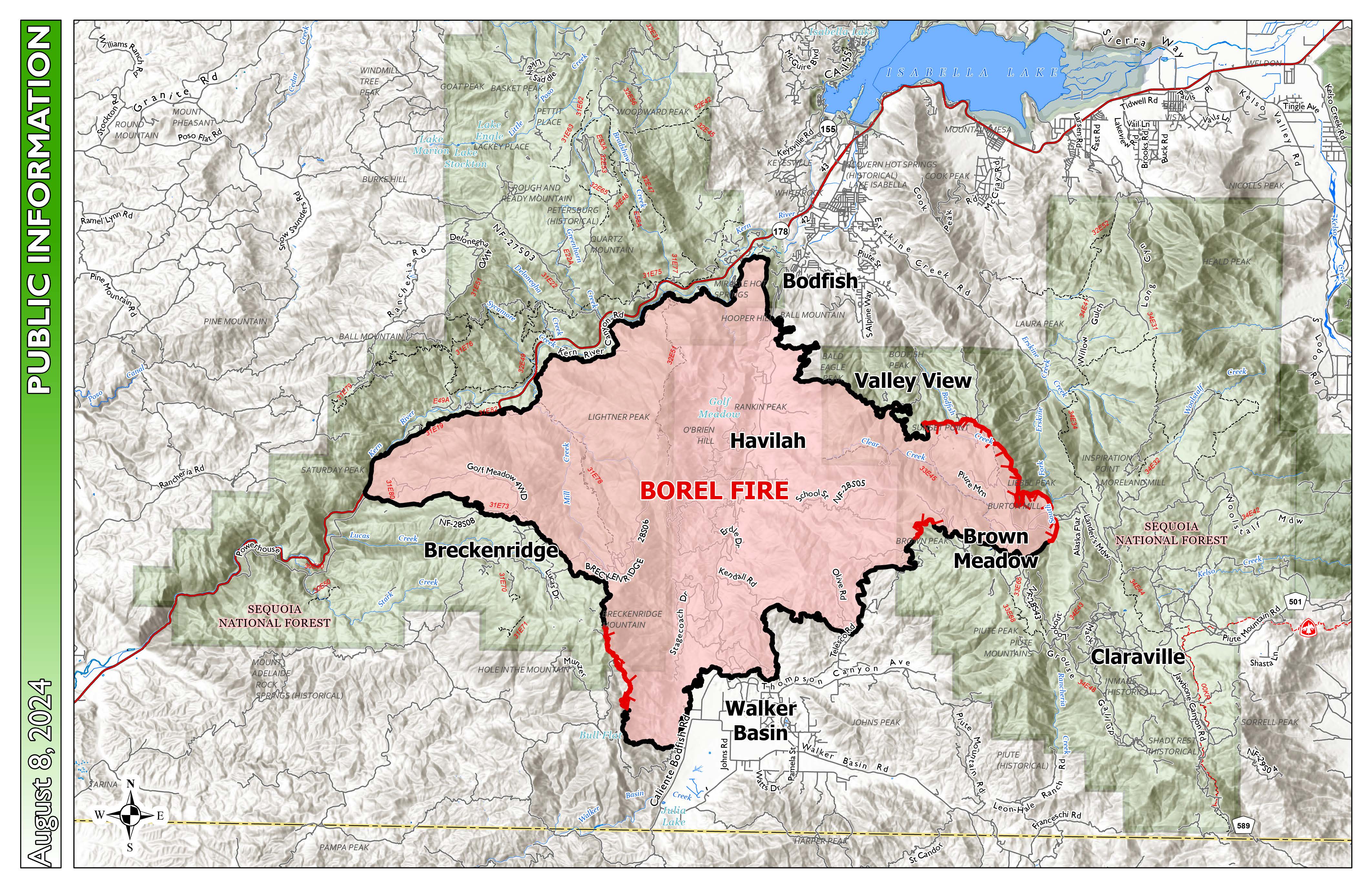
This map shows land ownership in shades of white and green, fainter lines for roads and highways, blue for bodies of water, and the Borel Fire perimeter in pink. The outline of the fire perimeters varies from red to black; the black portions represent containment.

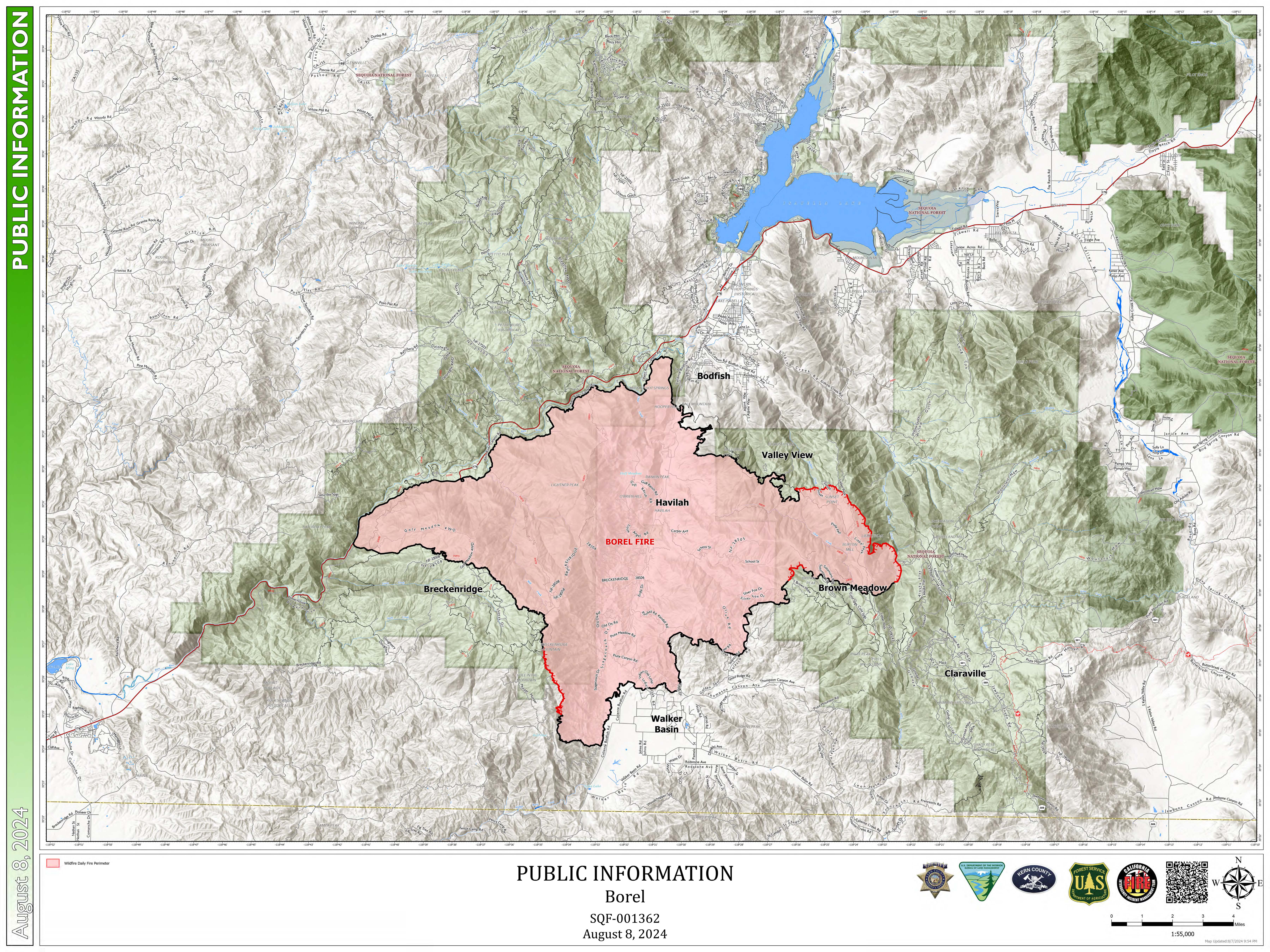
This map shows land ownership in shades of white and green, fainter lines for roads and highways, blue for bodies of water, and the Borel Fire perimeter in pink. The outline of the fire perimeters varies from red to black; the black portions represent containment.