Incident Media Maps
Could not determine your location.
 Wildfire
 Prescribed Fire
 Burned Area
Response
Burned Area
Response Other
Other
Maps Gallery
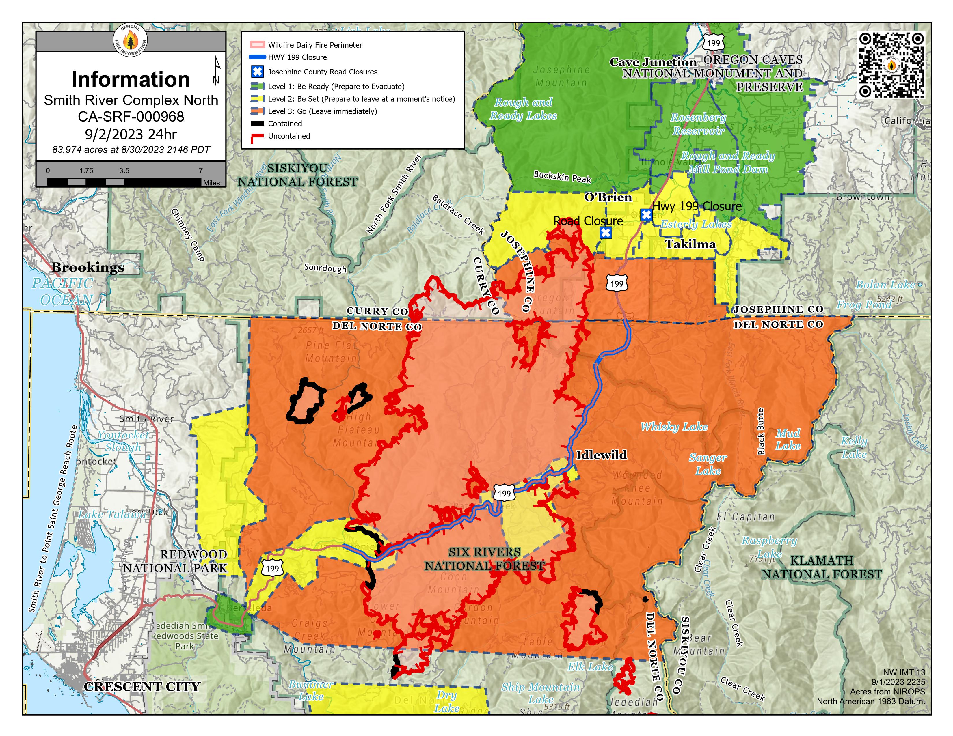
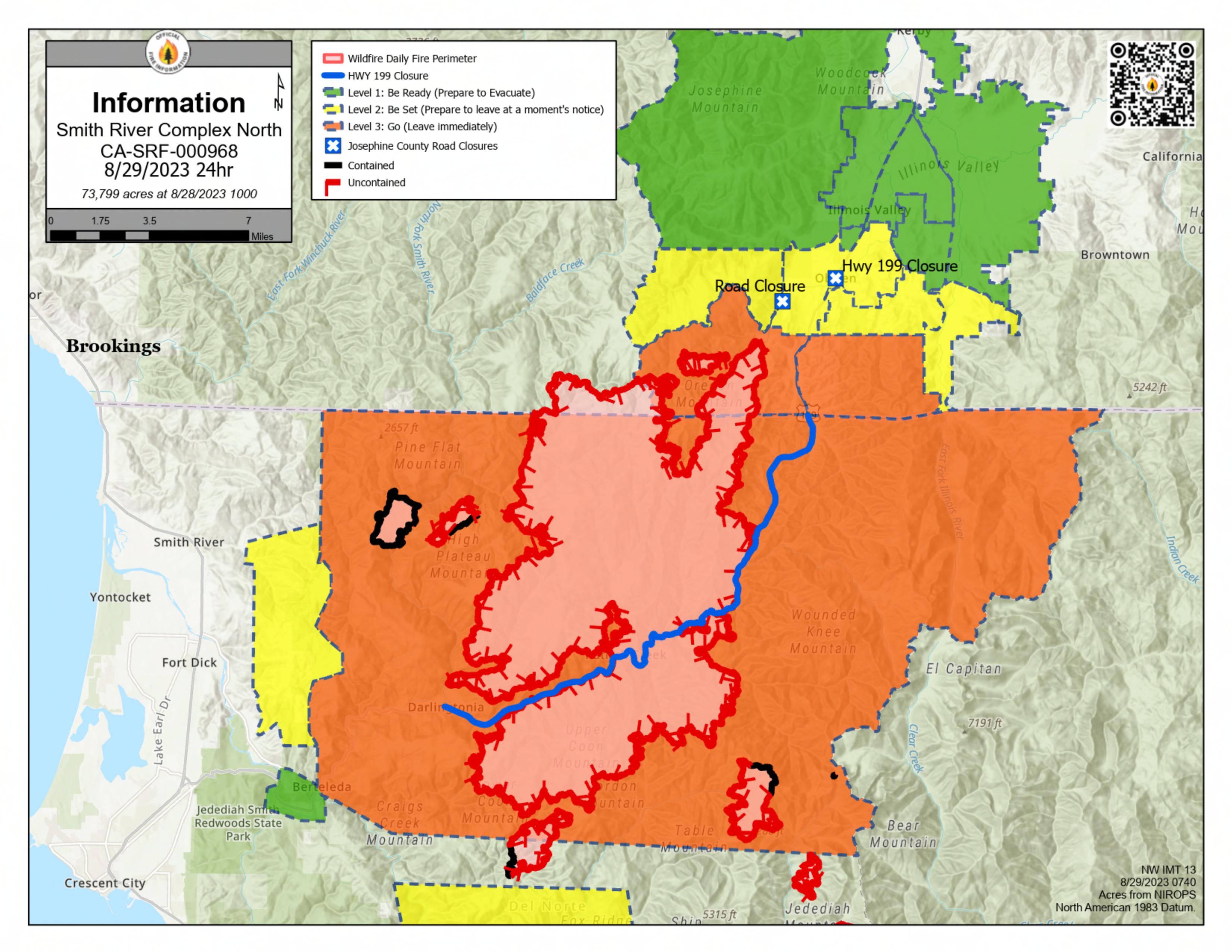
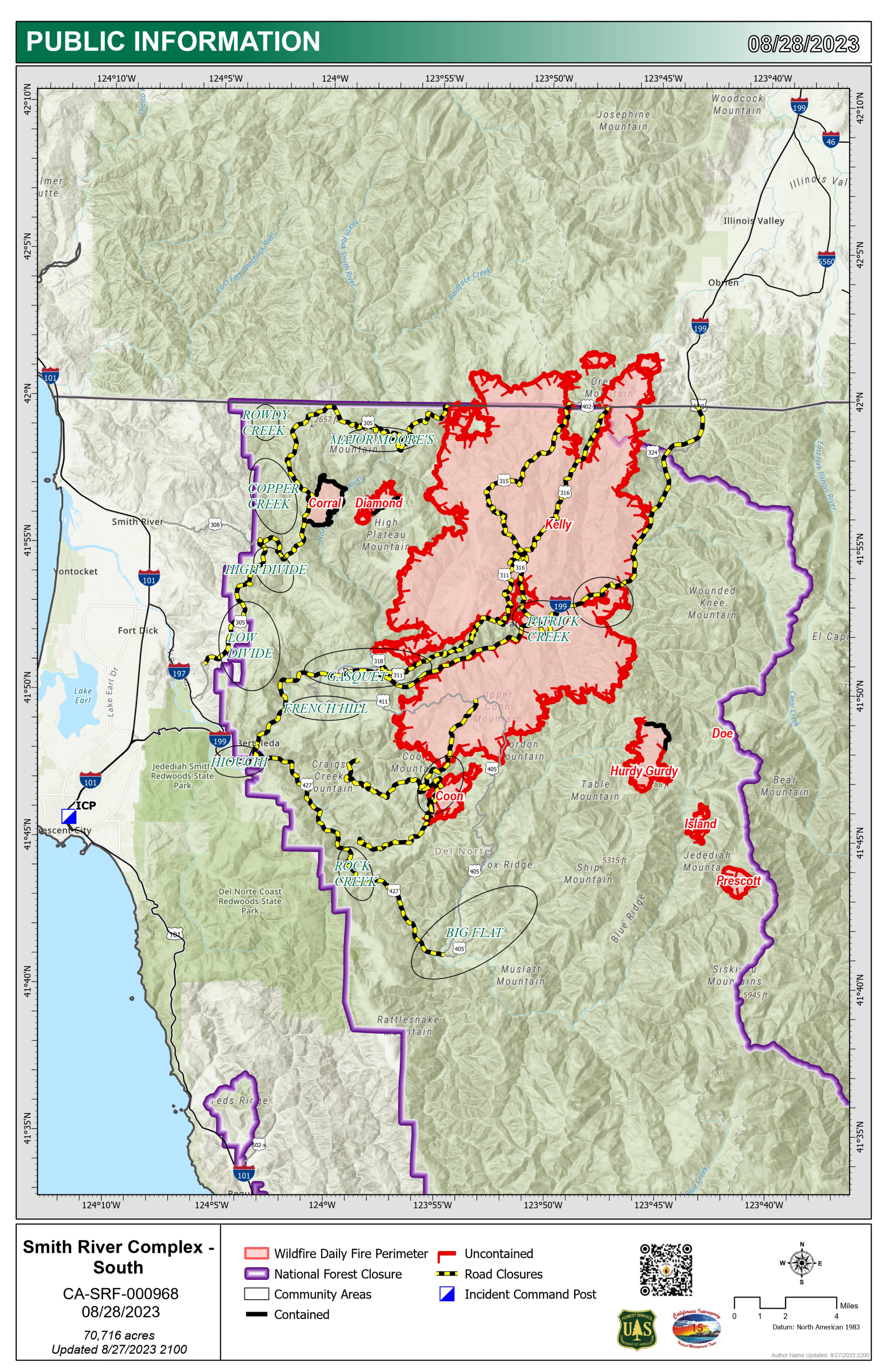
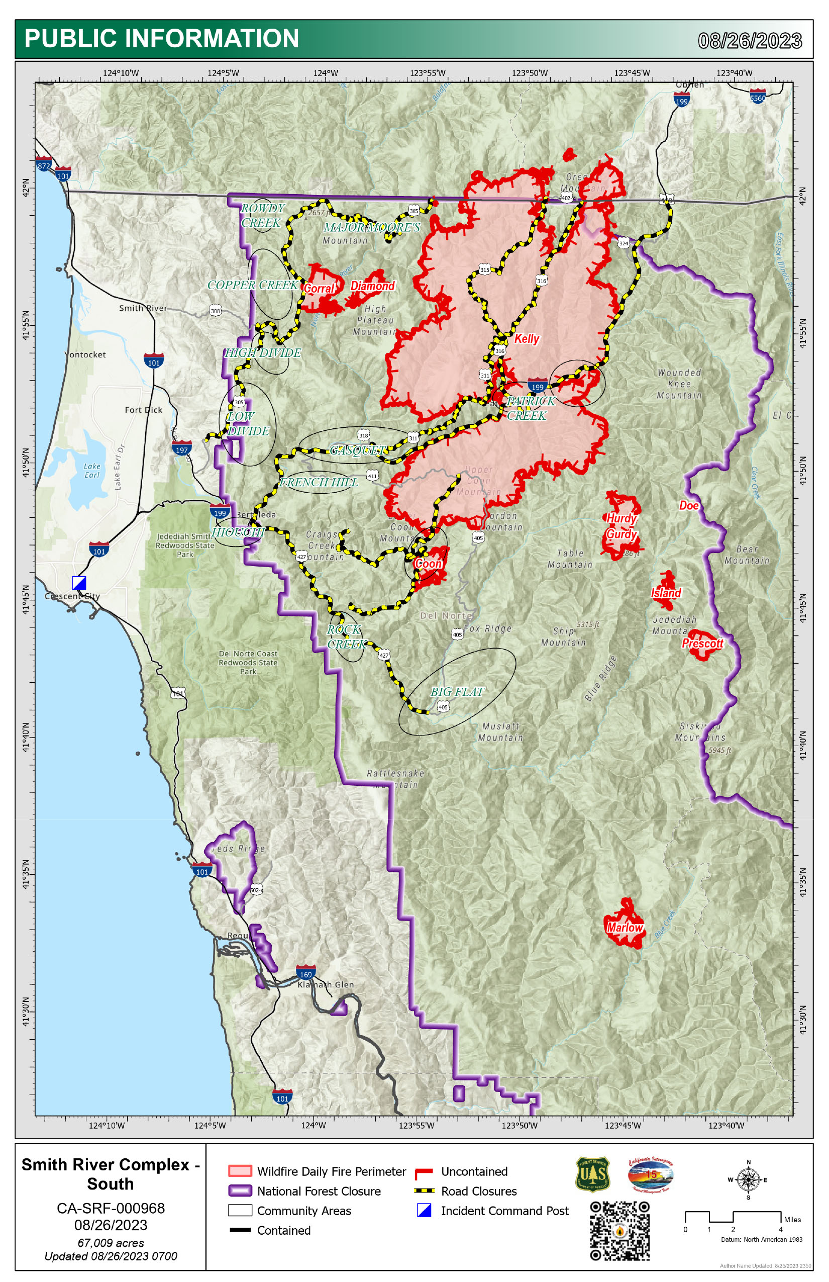
Smith River Complex North PIO Map 9/2/2023 with evacuations and Hwy 199 closure. Solid black lines on the fire edges indicate containment.
NOTE: Del Norte County Sheriff's Office has changed some evacuations. For the latest evacuation levels please check the Fire First Response Map found at https://www.rvem.org/
or visit the Del Norte County Office of Emergency Services Facebook page at https://www.facebook.com/DelNorteOfficeOfEmergencyServices/.
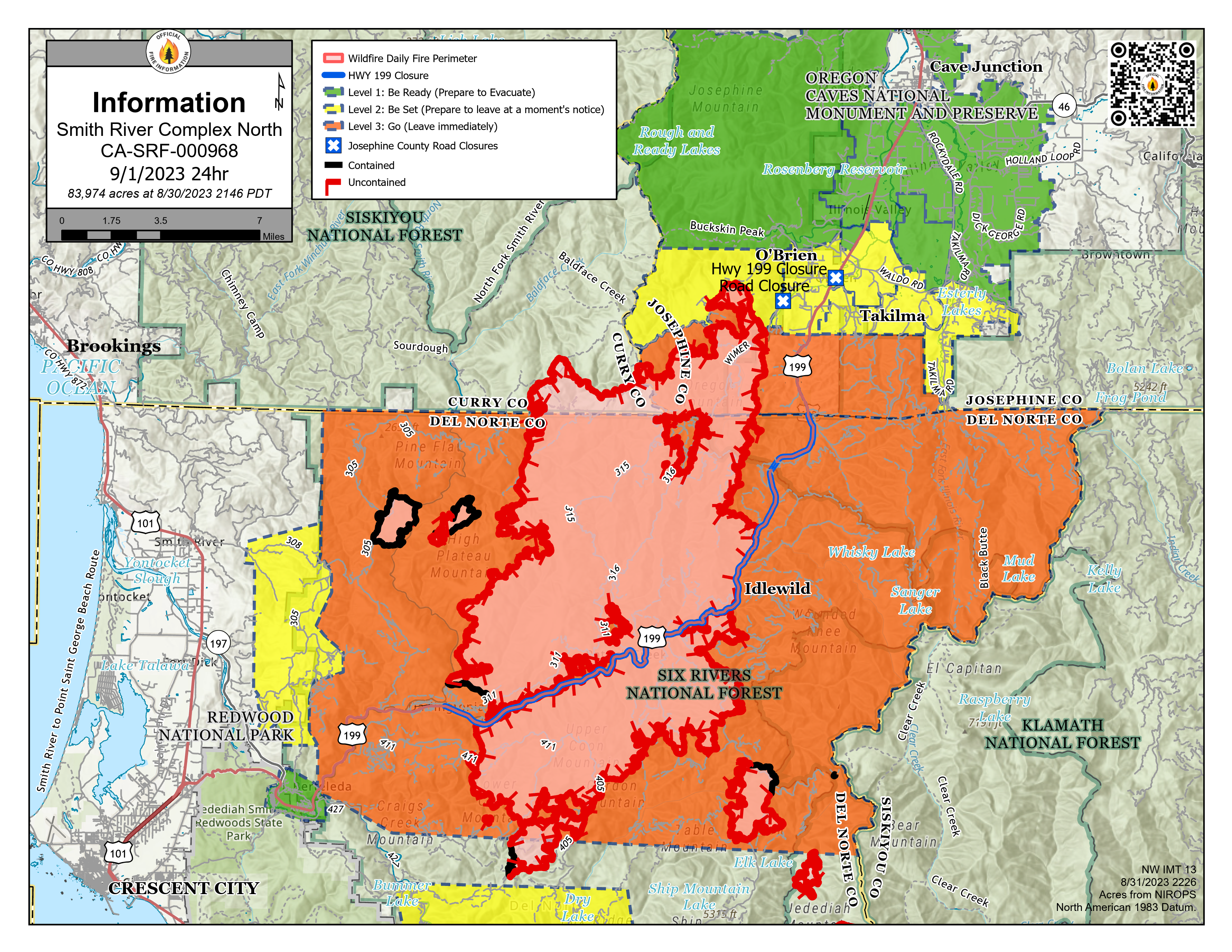
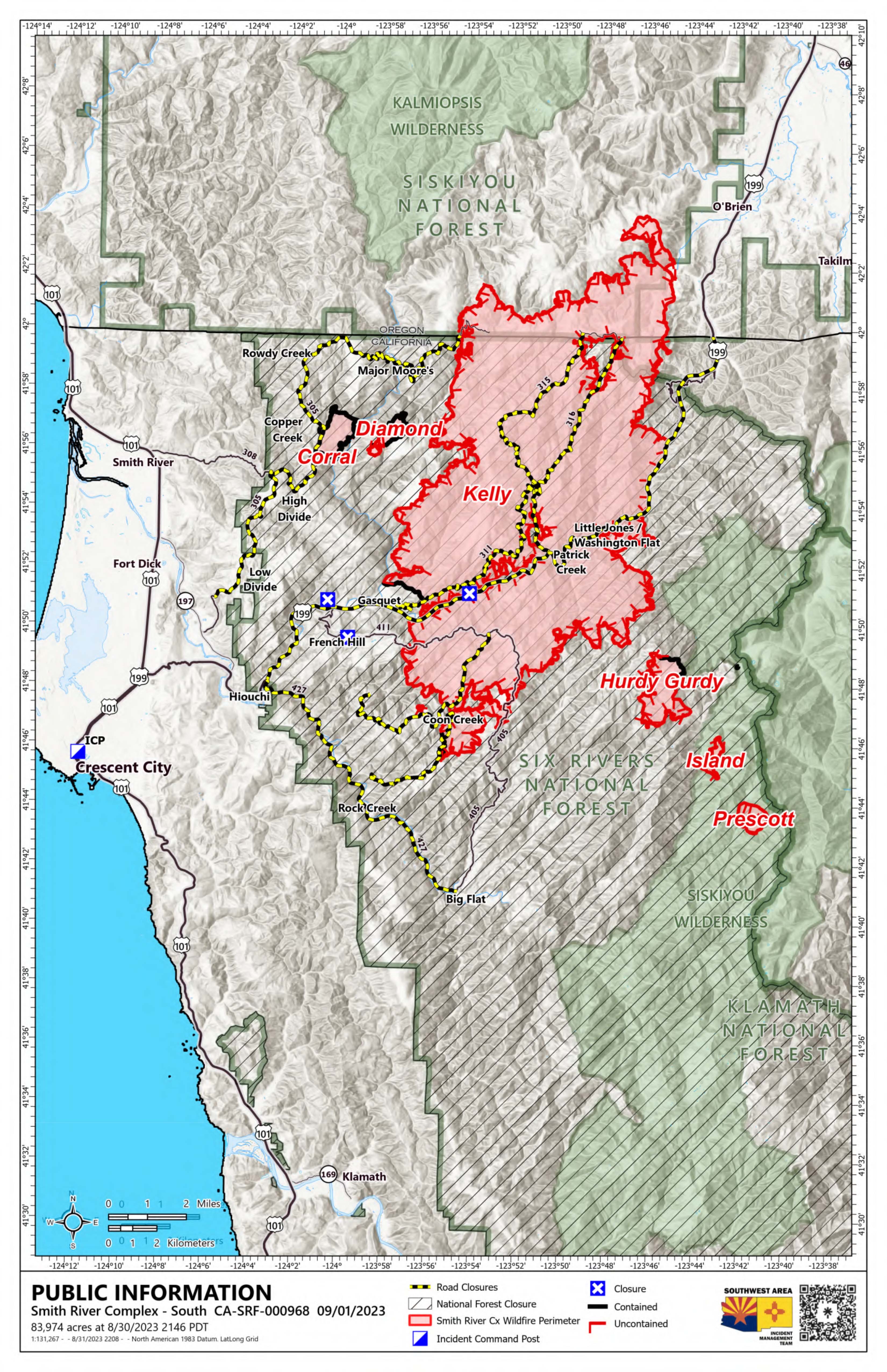
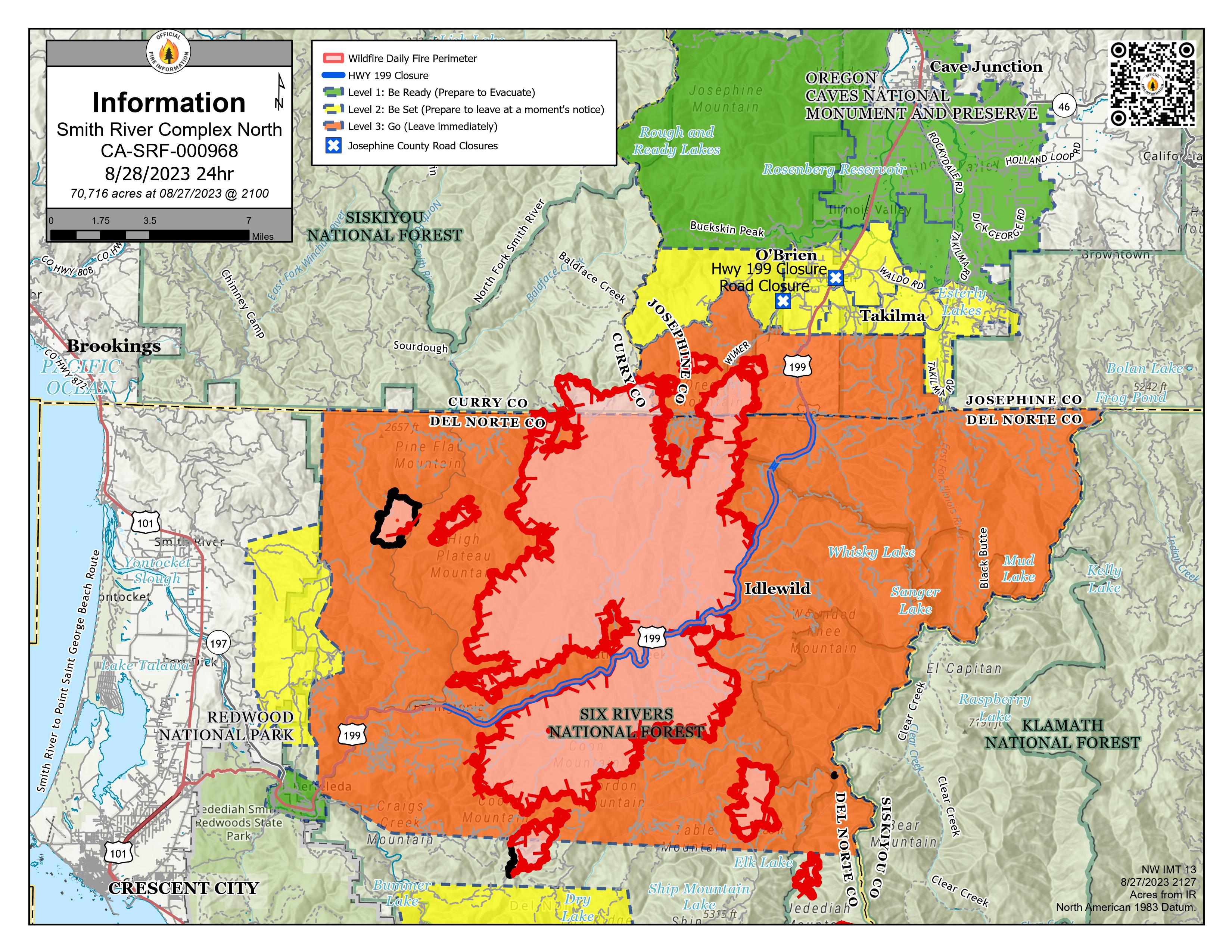
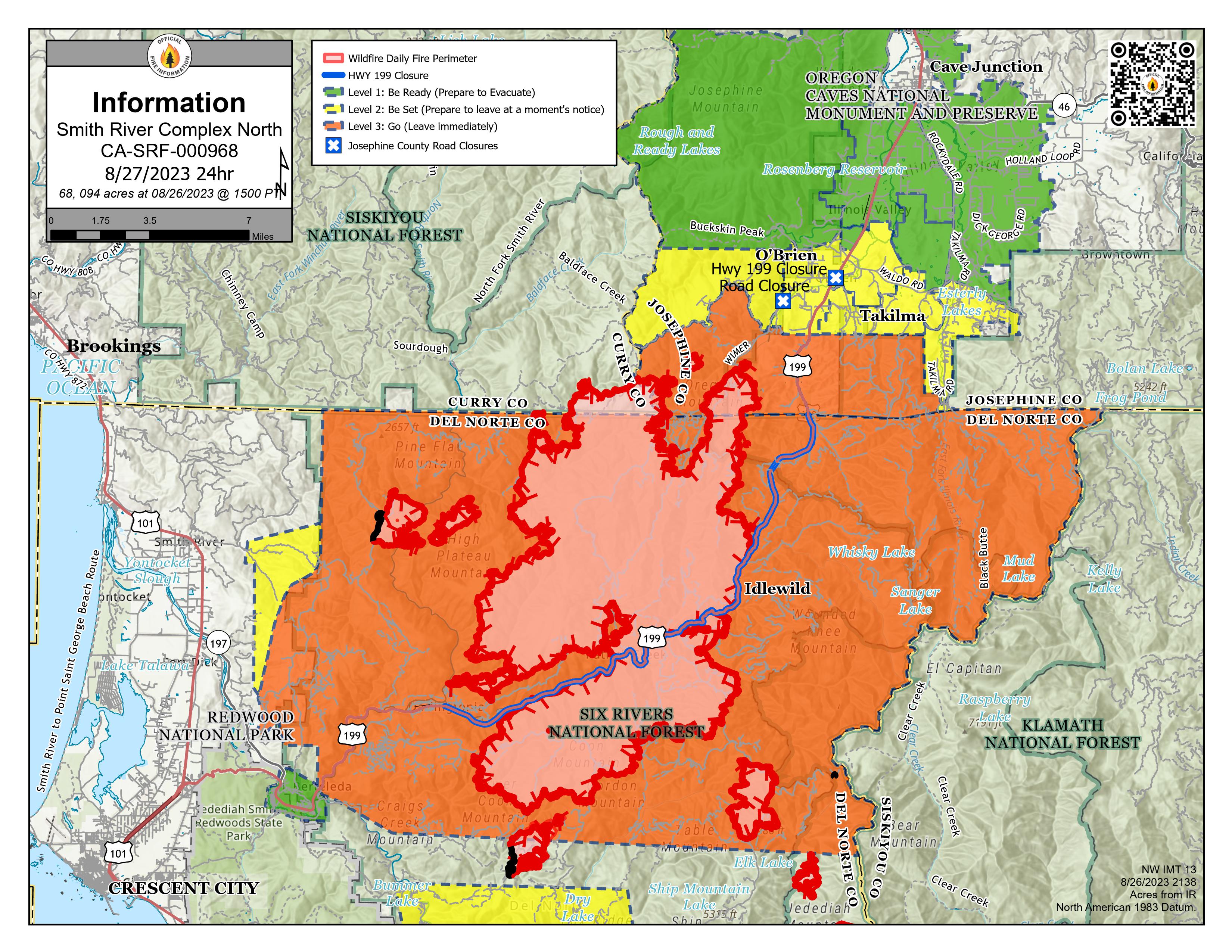
Smith River Complex North PIO Map 9/1/2023 with evacuations and Hwy 199 closure. Solid black lines on the fire edges indicate containment.
NOTE: Del Norte County Sheriff's Office has changed some evacuations from Level 3 - GO NOW to Level 2 - Get Set. For the latest evacuation levels please check the Fire First Response Map found at https://www.rvem.org/ or visit the Del Norte County Office of Emergency Services Facebook page at https://www.facebook.com/DelNorteOfficeOfEmergencyServices/.