
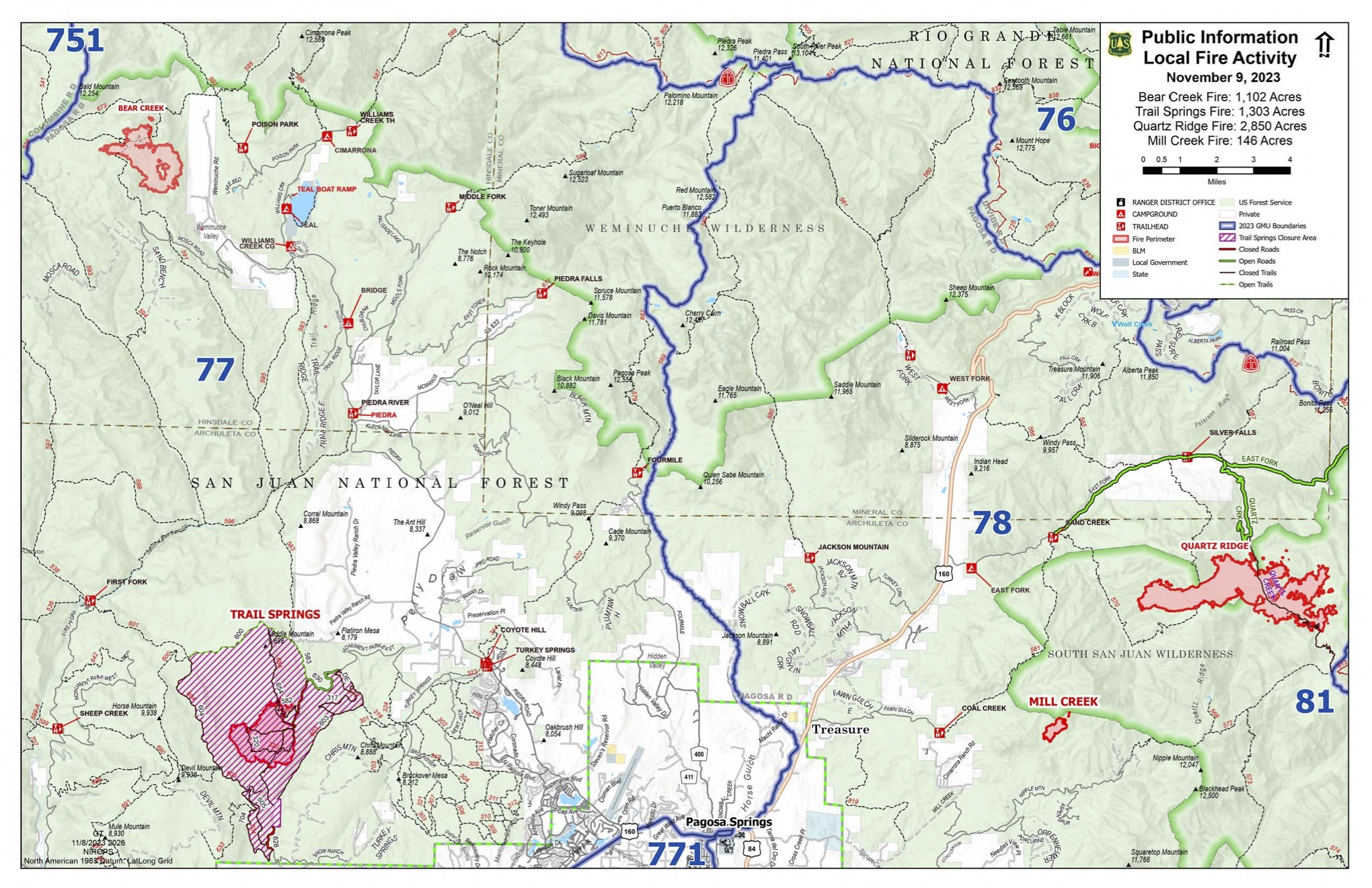
Incident Media Maps
Settings - change map background and toggle additional layers
Filter - control incident types displayed on map.
Zoom to your location
Reset map zoom and position
Could not determine your location.
Show Legend
 Wildfire
 Prescribed Fire
 Burned Area
Response
Burned Area
Response Other
Other
Mill Creek 2 Fire
Unit Information
Incident Contacts
- Public InformationPhone:(970) 426-5370Hours:8a.m. - 8p.m.
Maps Gallery
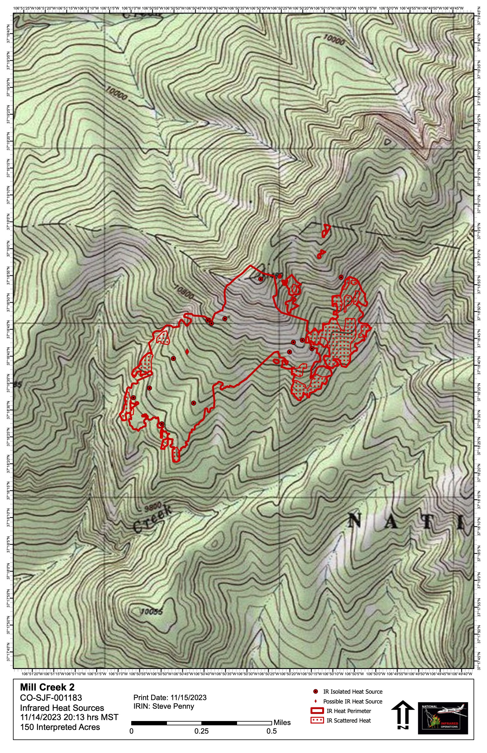
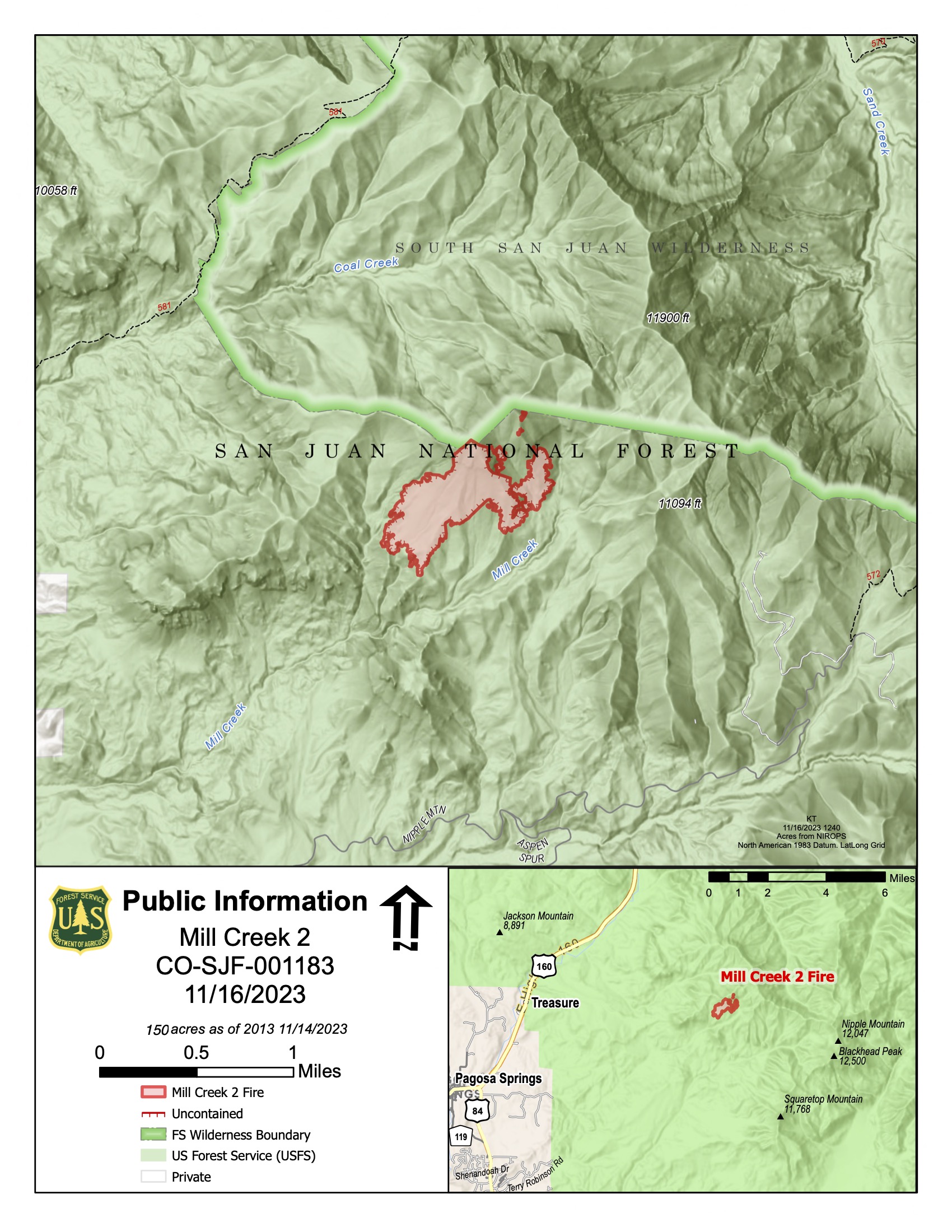
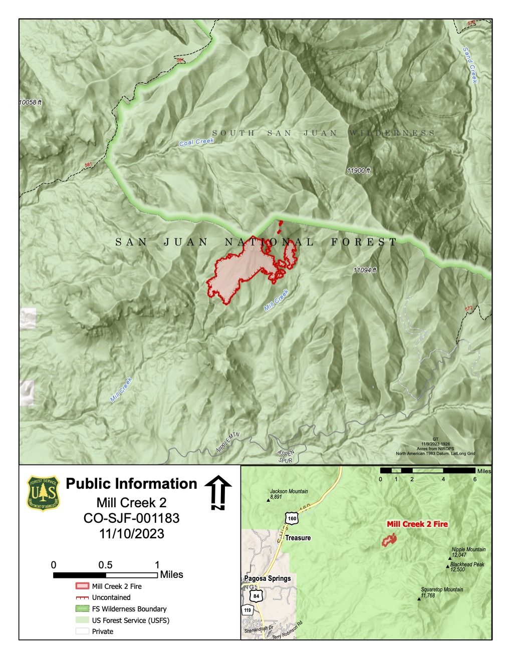
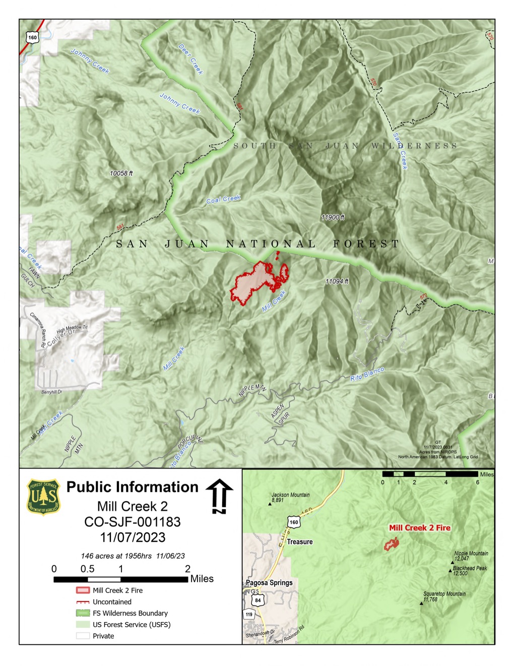
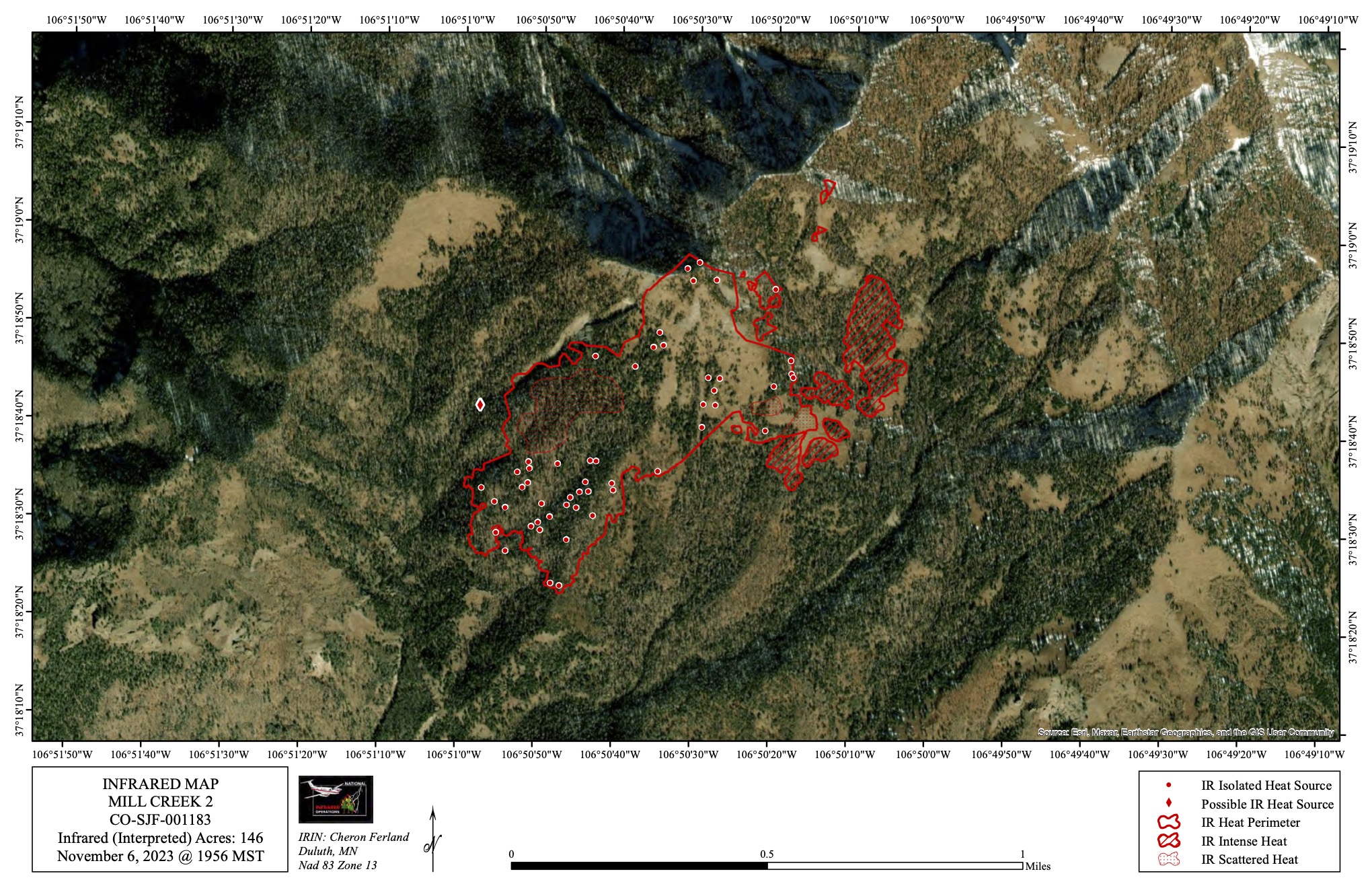

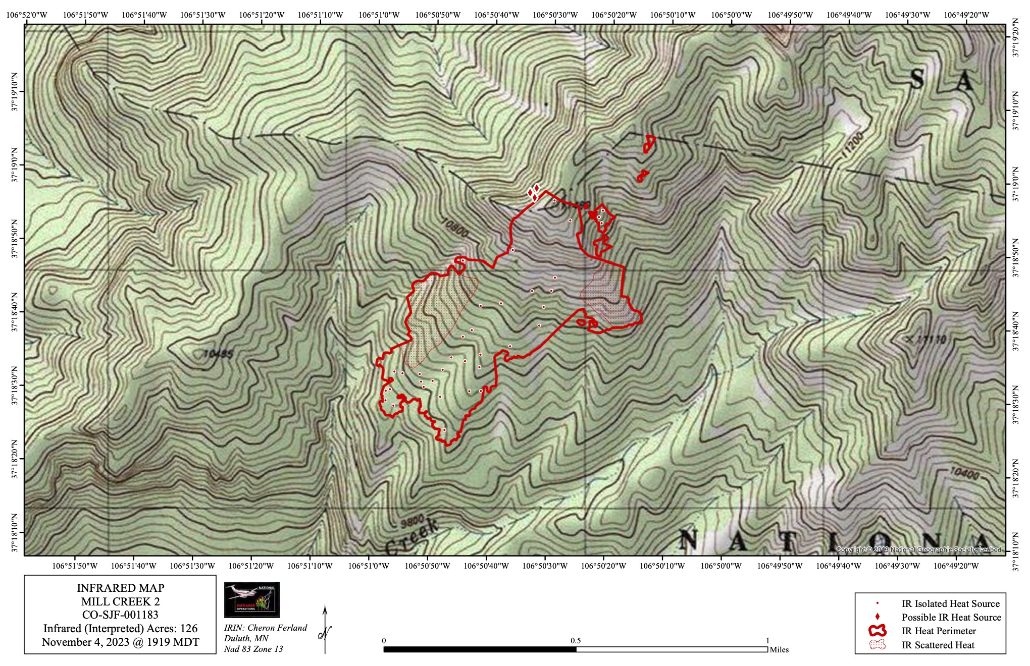

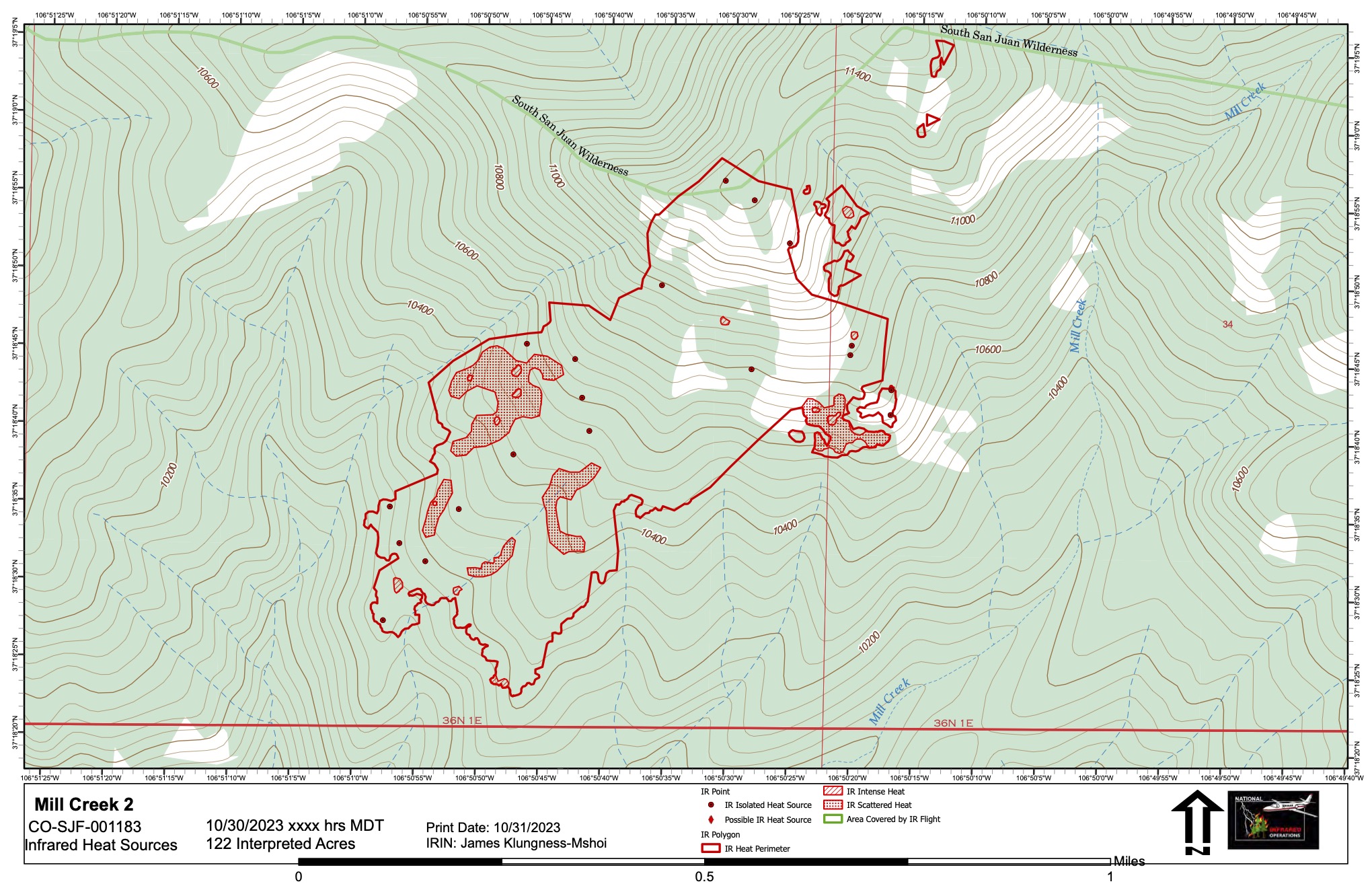

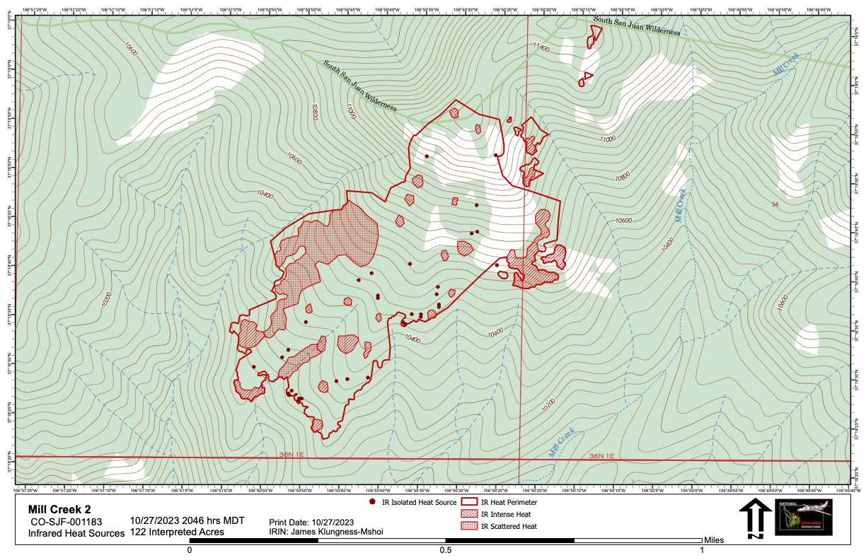
A map of the Mill Creek 2 Fire as of October 27, 2023 showing remaining sources of heat. While little fire activity has been observed, the fire does continue to smolder. With colder and moister weather predicted, fire managers expect little further growth and we will no longer be updating this map on a daily basis. Acres inside the perimeter: 122.