Incident Media Maps
Could not determine your location.
 Wildfire
 Prescribed Fire
 Burned Area
Response
Burned Area
Response Other
Other
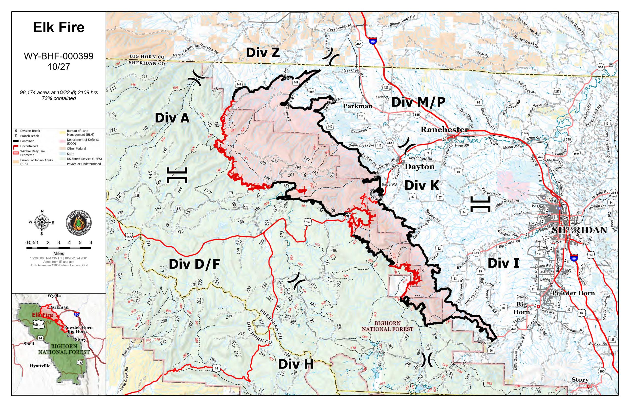
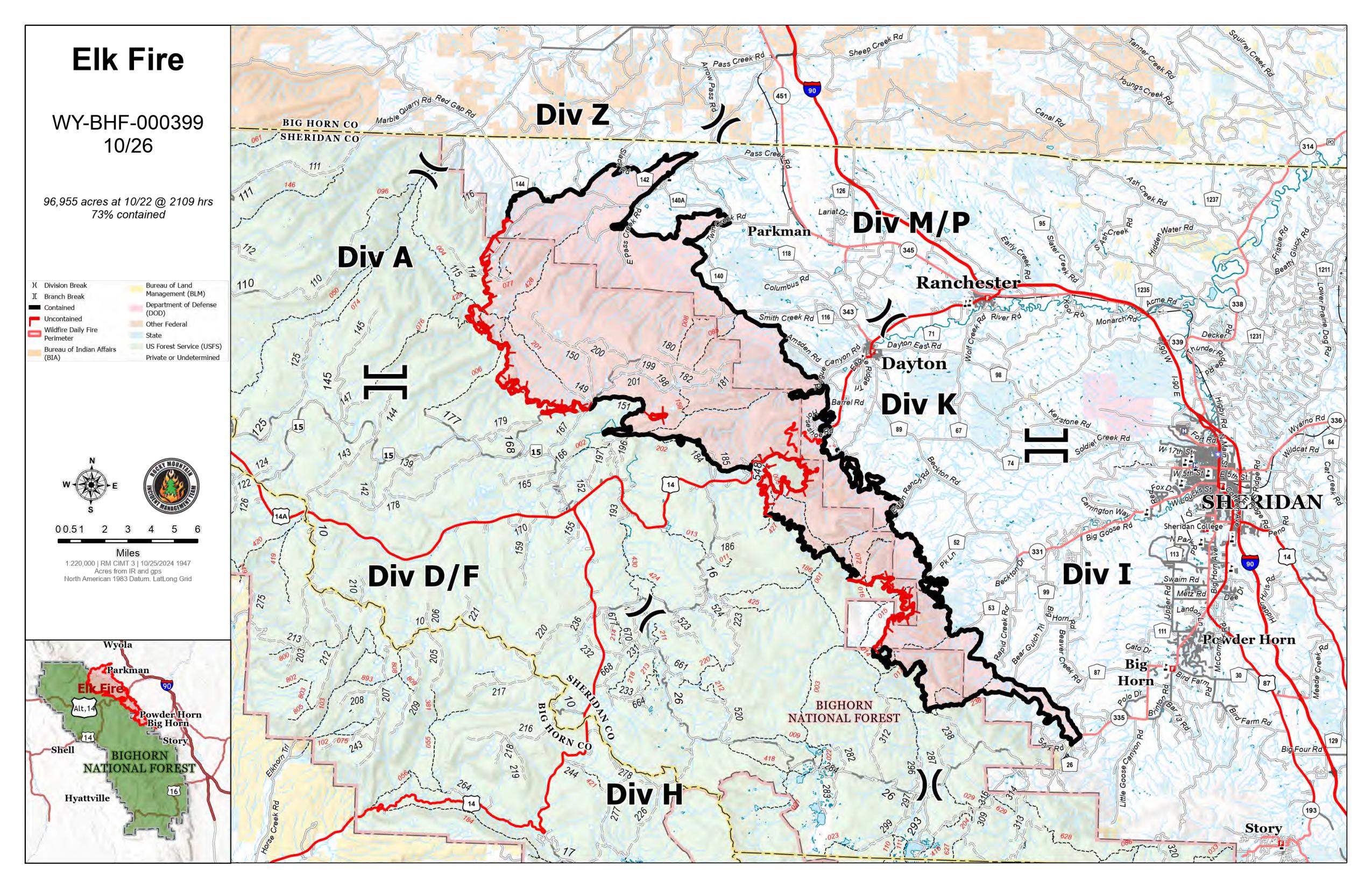
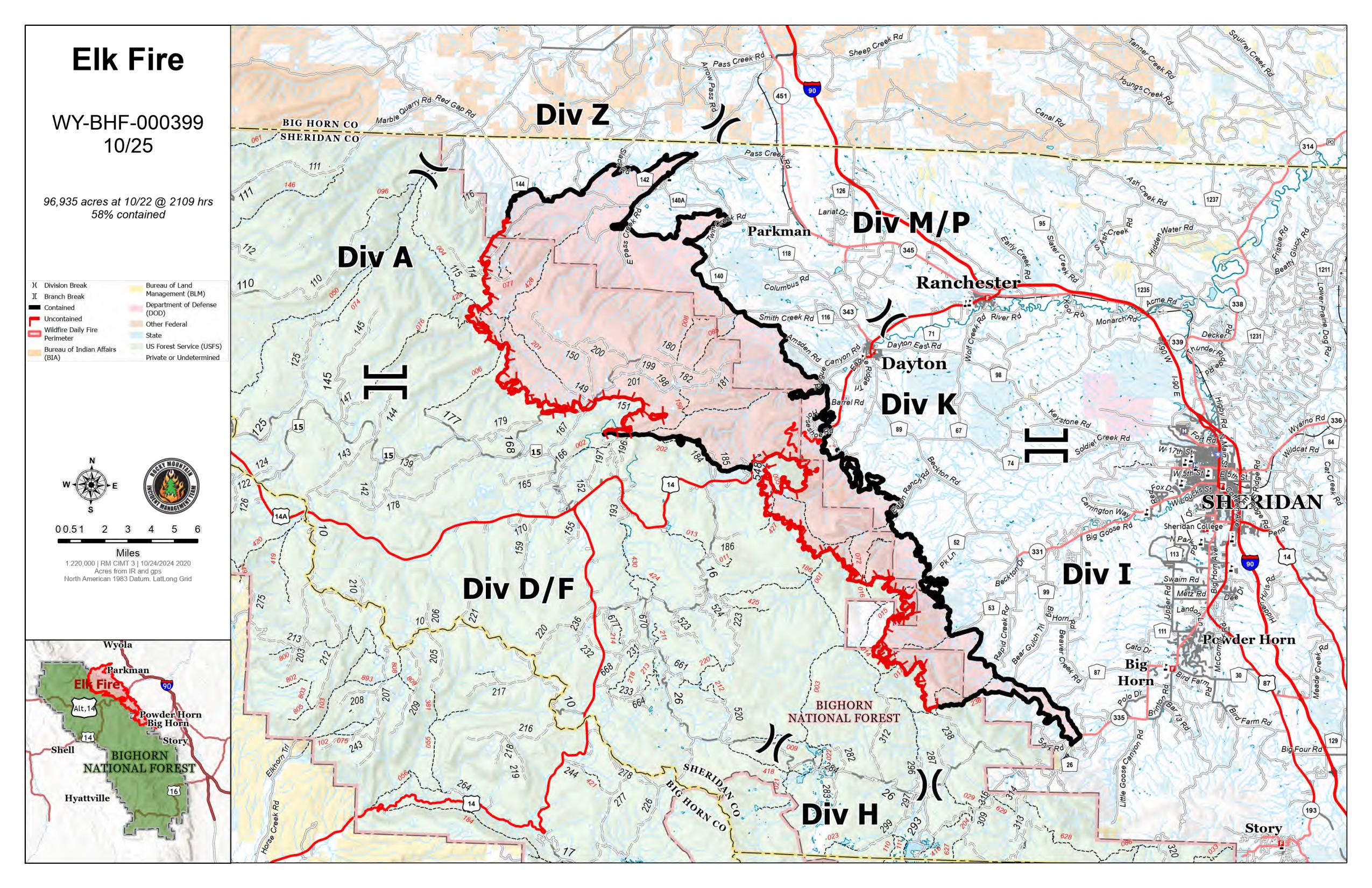
Elk Fire 2024
Unit Information
Incident Contacts
- Bighorn National Forest Type 4Phone:307-674-2600Hours:8 a.m. - 4:30 p.m.
Maps Gallery
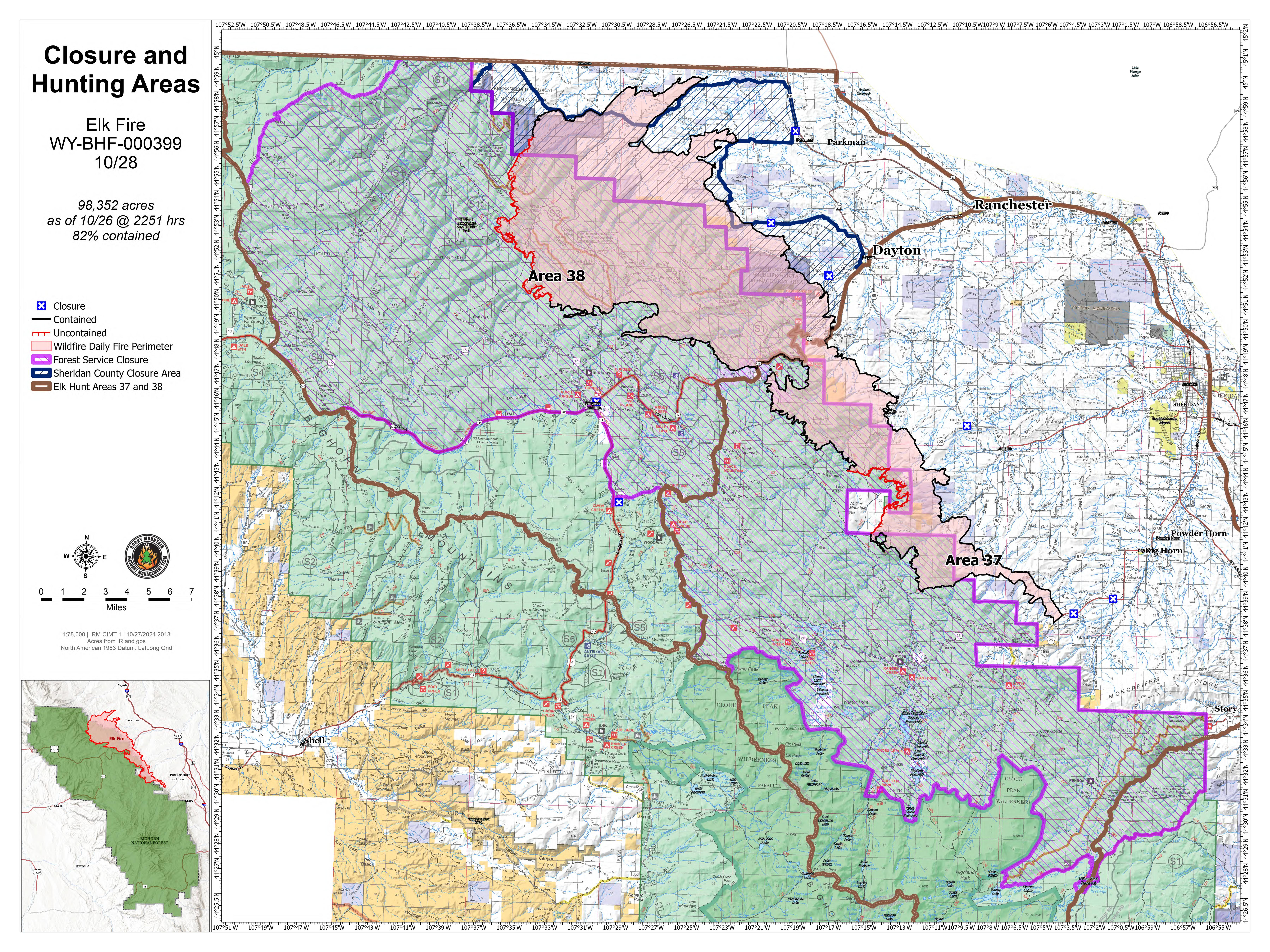
Map showing the reduced closure for the Bighorn National Forest and hunting areas
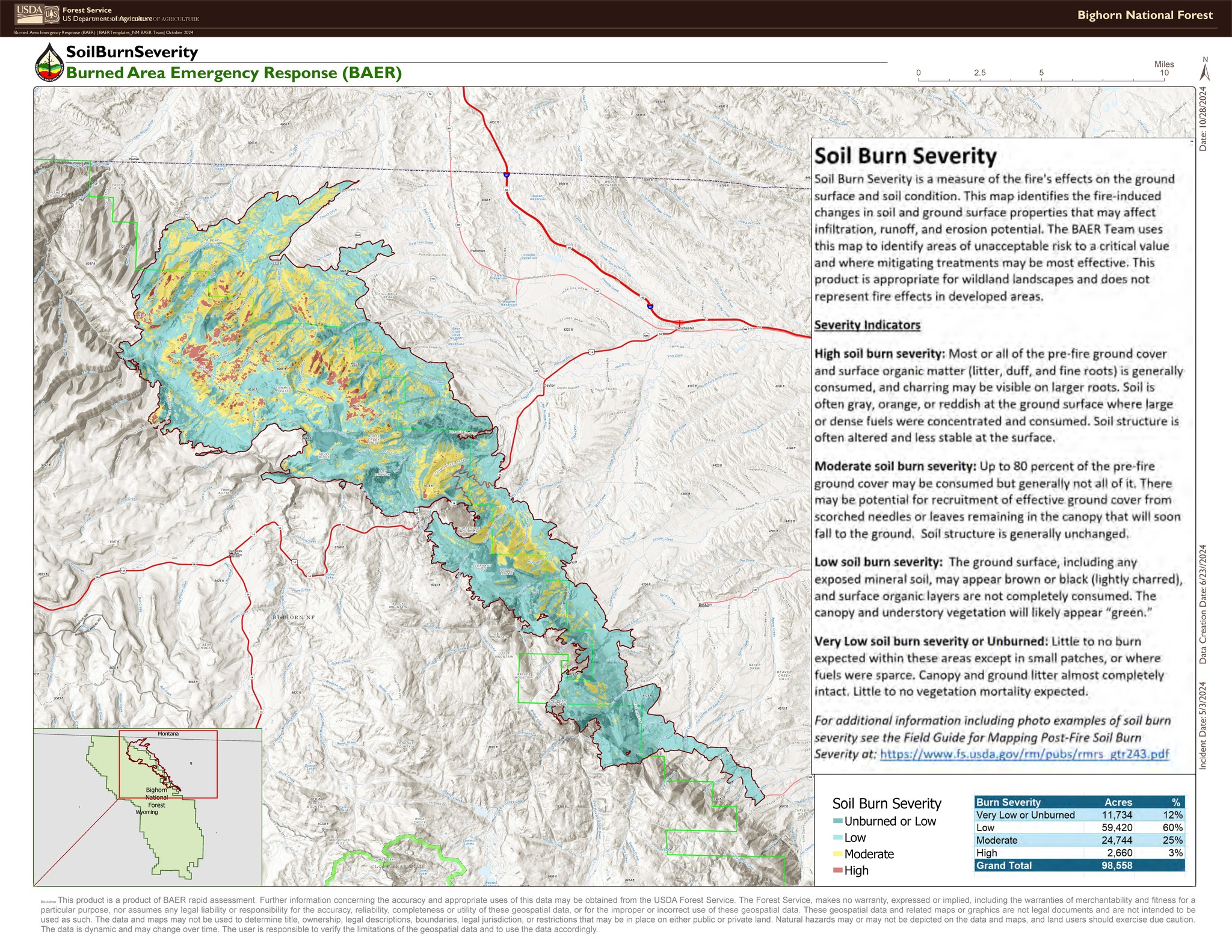
Soil Burn Severity is a measure of the fire's effects on the ground surface and soil condition. This map identifies the fire-induced changes in soil and ground surface properties that may affect infiltration, runoff, and erosion potential. The Burned Area Emergency Response (BAER) Team uses this map to identify areas of unacceptable risk to a critical value and where mitigating treatments may be most effective. This product is appropriate for wildland landscapes and does not represent fire effects in developed areas. Note: You can download a high-resolution version of this map by clicking on the "PDF" link at the top of the page.