
Incident Media Photographs
Could not determine your location.
 Wildfire
 Prescribed Fire
 Burned Area
Response
Burned Area
Response Other
Other
Southern California Post-Fire BAER 2024
Unit Information
Incident Contacts
- BAER InformationEmail:
Photographs Gallery
Looking down the Rugged Santa Ana River Canyon towards Seven Oaks Dam (out of sight)-just above the Confluence of Bear Creek within the Phase 2 of the Line Fire Perimeter
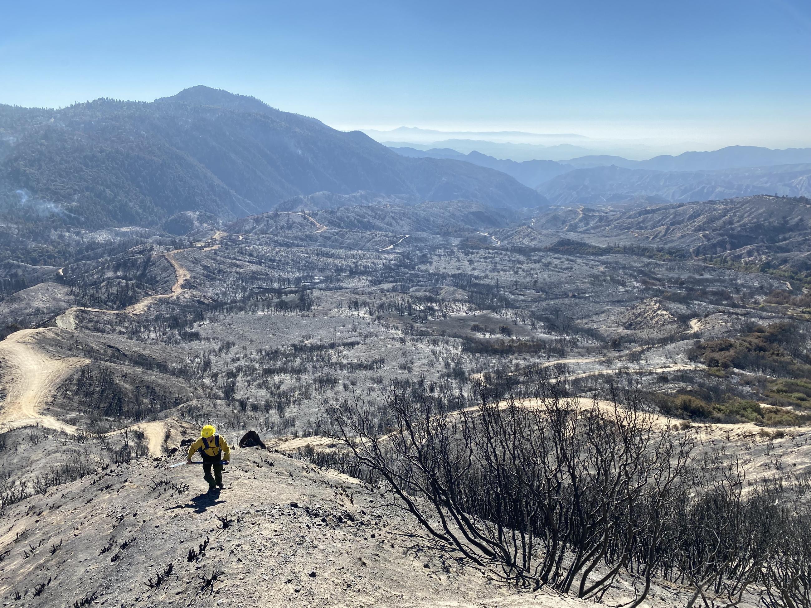
BAER Specialist Assessing Phase 2 Line Post-Fire Burn Area

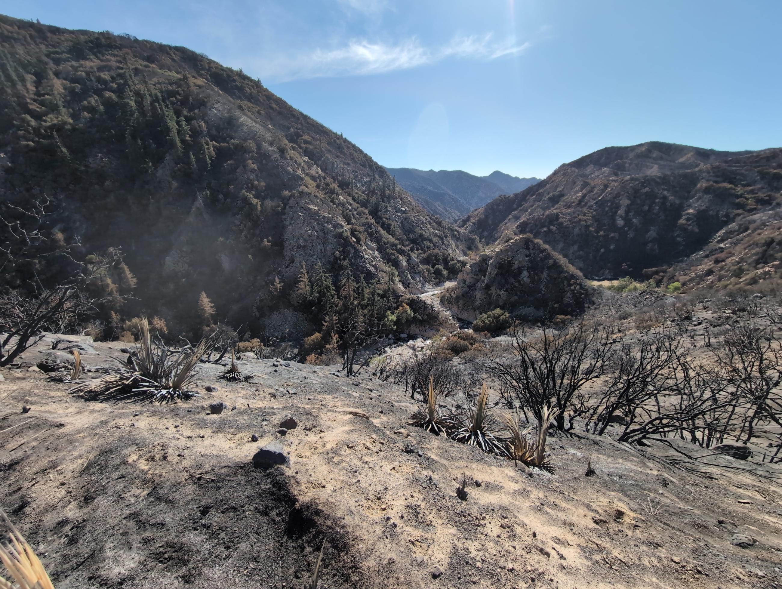
Bear Creek above the Santa Ana River Confluence-Slide Peak is in View-Looking up Stream in Bear Creek within the Phase 2 of the Line Fire Perimeter
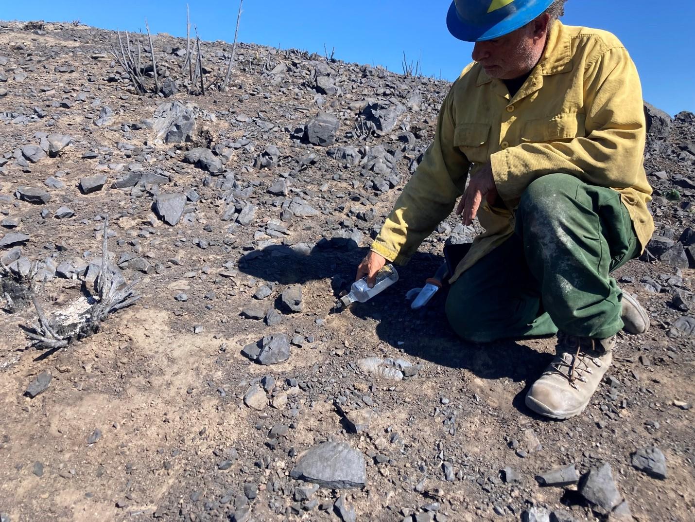
BAER Soil Scientist Eric Nicita pours water onto burned soil to test for water repellency
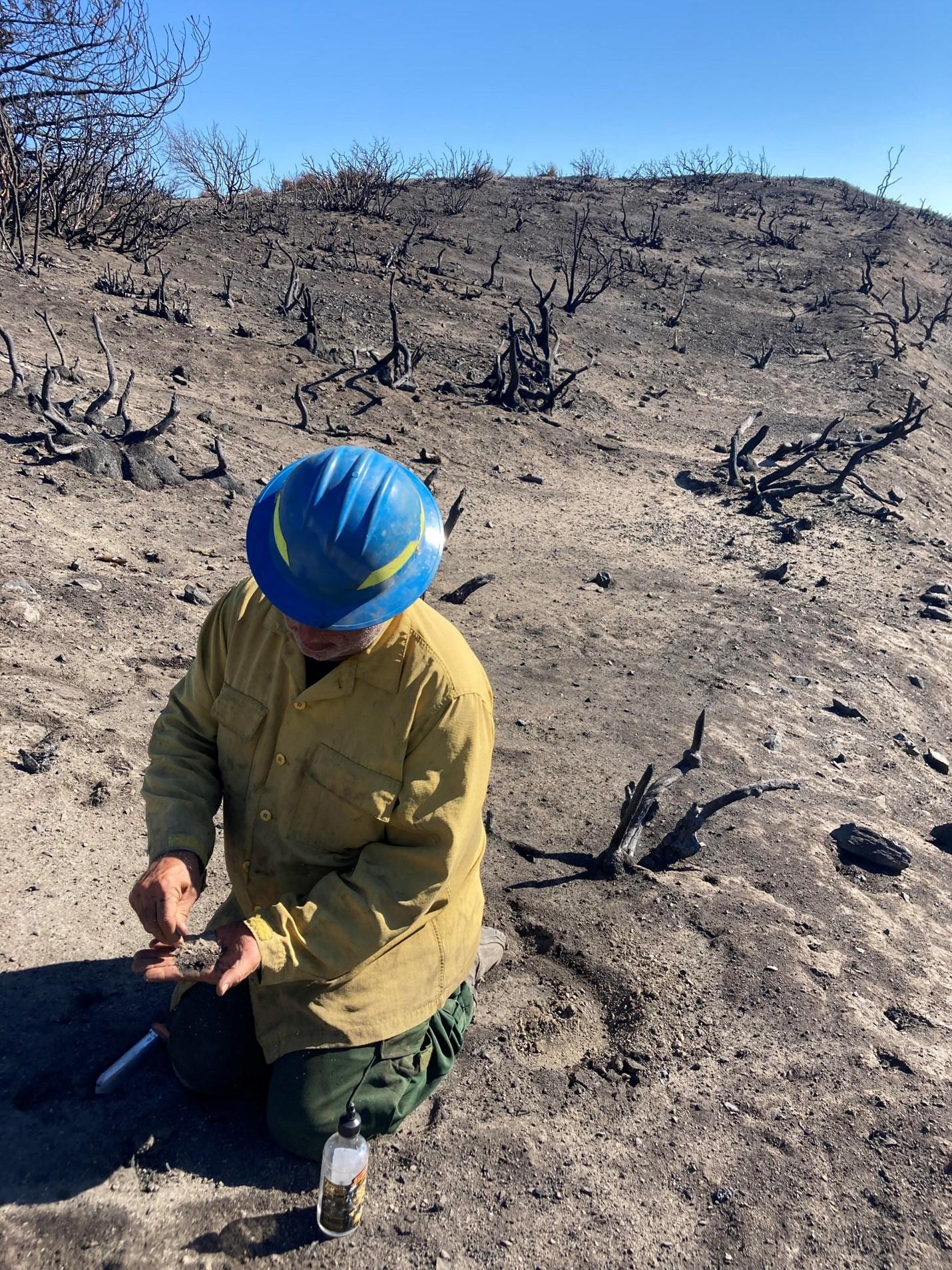
BAER Soil Scientist Eric Nicita examines burned soil structure within the wildfire burned area
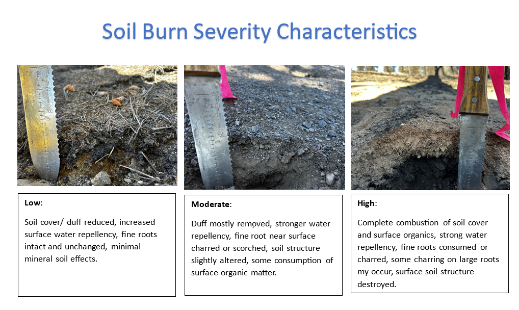
Bridge Post-Fire Soil Characteristics
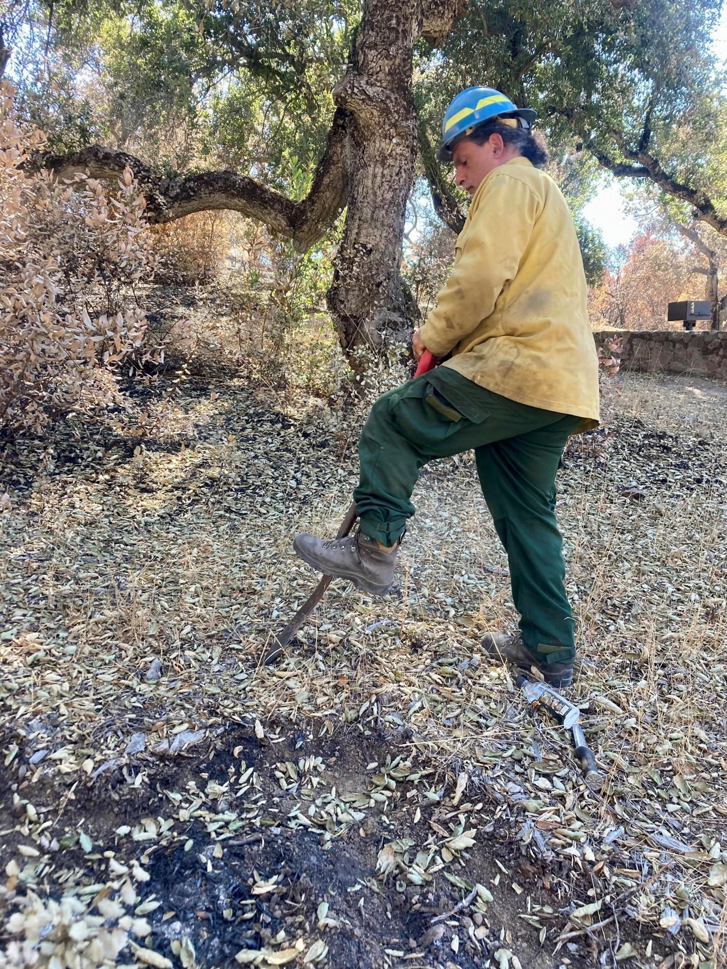
BAER Soil Scientist Eric Nicita digs a soil test hole in wildfire burned area
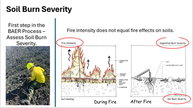
Fire Intensity vs. Soil Severity
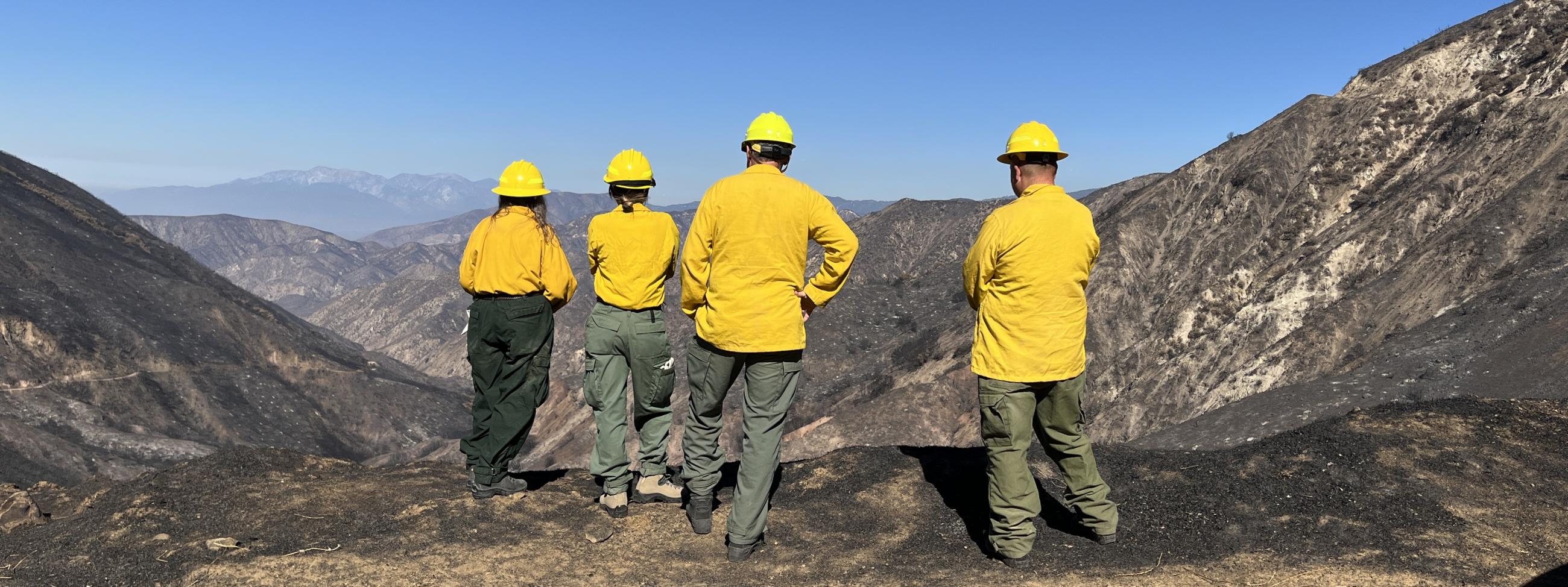
BAER Specialists Todd Ellsworth, Kim Boss, Vanessa Mendez and Lance Wooley assessing Warm Springs Creek in the Line Fire burned area
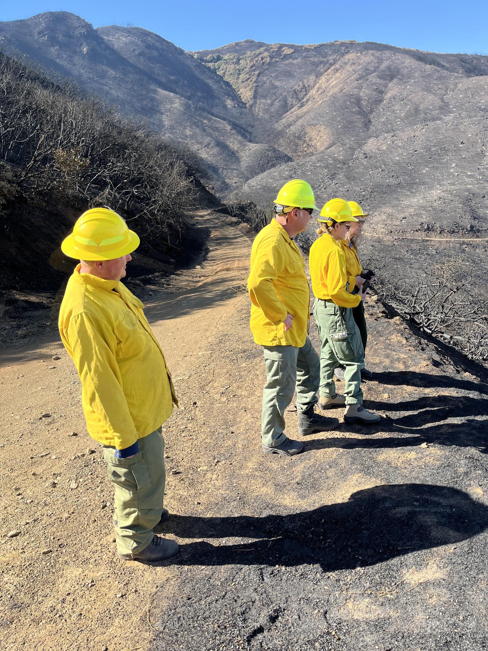
BAER Specialists Todd Ellsworth, Kim Boss, Vanessa Mendez and Lance Wooley assessing Warm Springs Creek in the Line Fire burned area
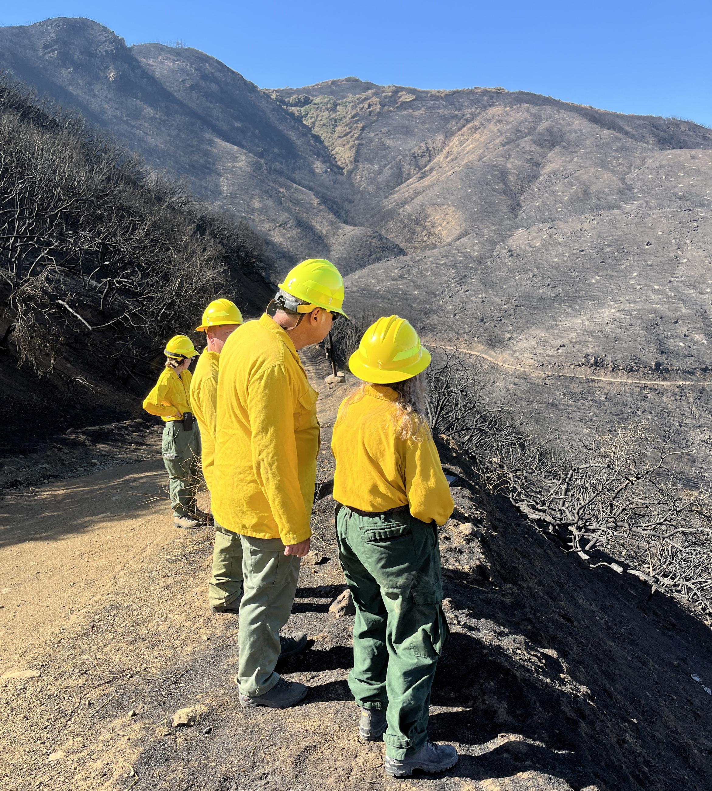
BAER Specialists Todd Ellsworth, Kim Boss, Vanessa Mendez and Lance Wooley assessing Warm Springs Creek in the Line Fire burned area
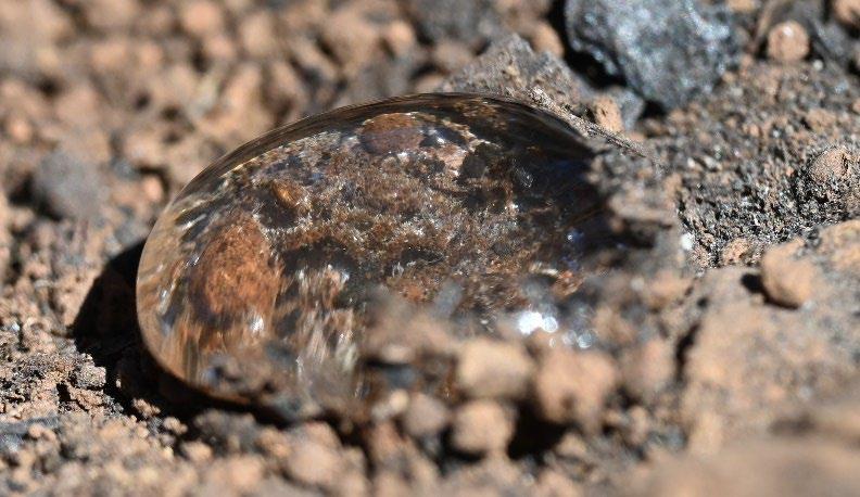
Beading water on the burned soil as a result of water repellency from the fire