
Incident Media Photographs
Could not determine your location.
 Wildfire
 Prescribed Fire
 Burned Area
Response
Burned Area
Response Other
Other
2025 - Cleveland National Forest, Forest Health Treatments
Unit Information
Incident Contacts
Photographs Gallery
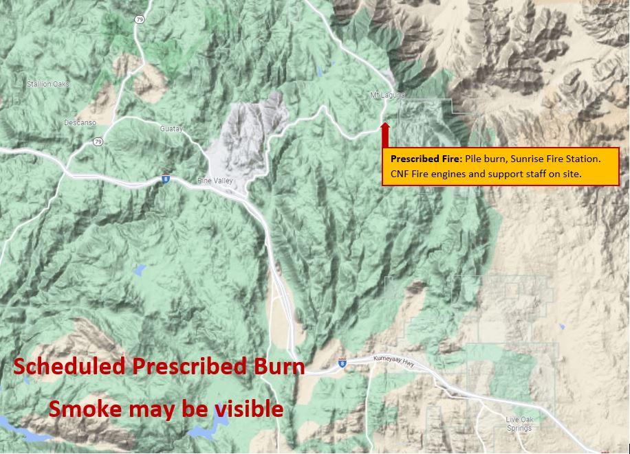
Map showing where the Sunrise Station Pile Burn is.
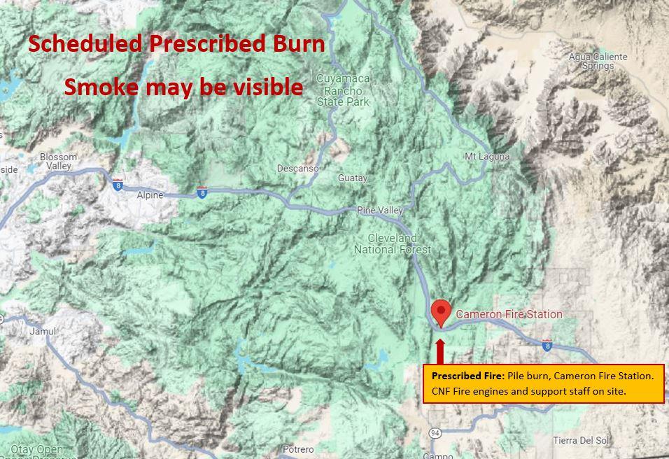
Map showing where the Cameron Station Pile Burn is.
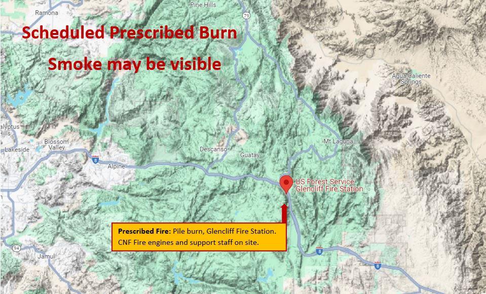
Map showing where the Glencliff Station Pile Burn is.
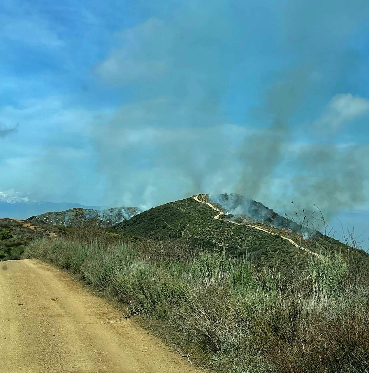
Image of fire and smoke on a ridge with firefighters working on the prescribed burn.
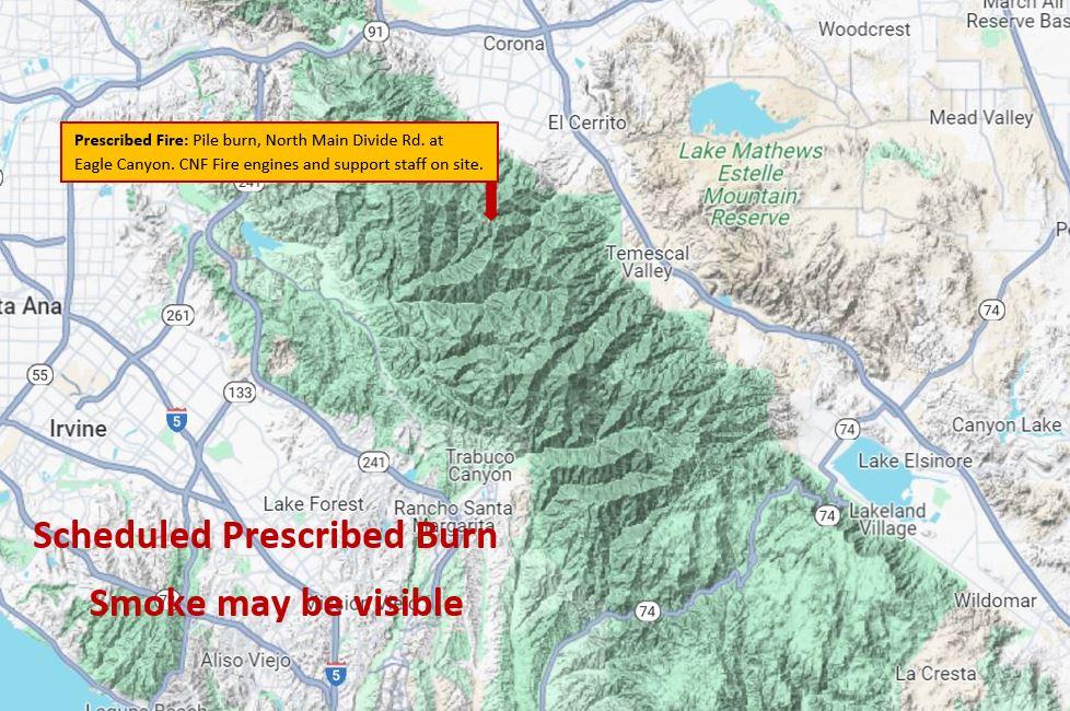
Map that shows location of the North Main Prescibed Burn.
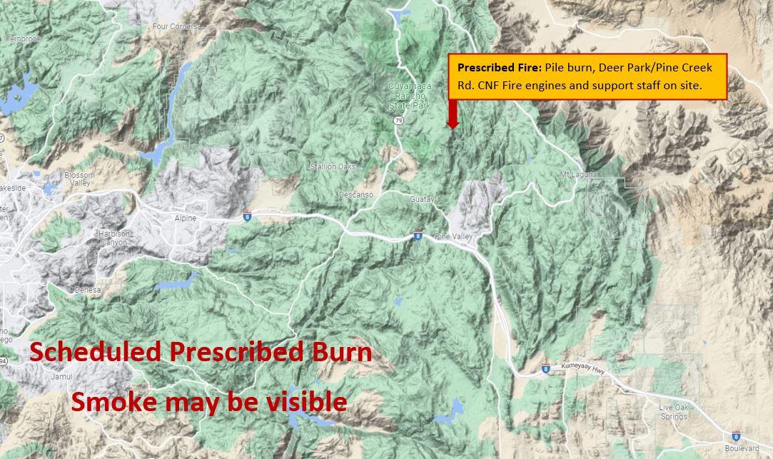
Map showing where the prescribed fire is burning.
Ariel View of the North Main Broadcast Burn from January 20th through February 1st.
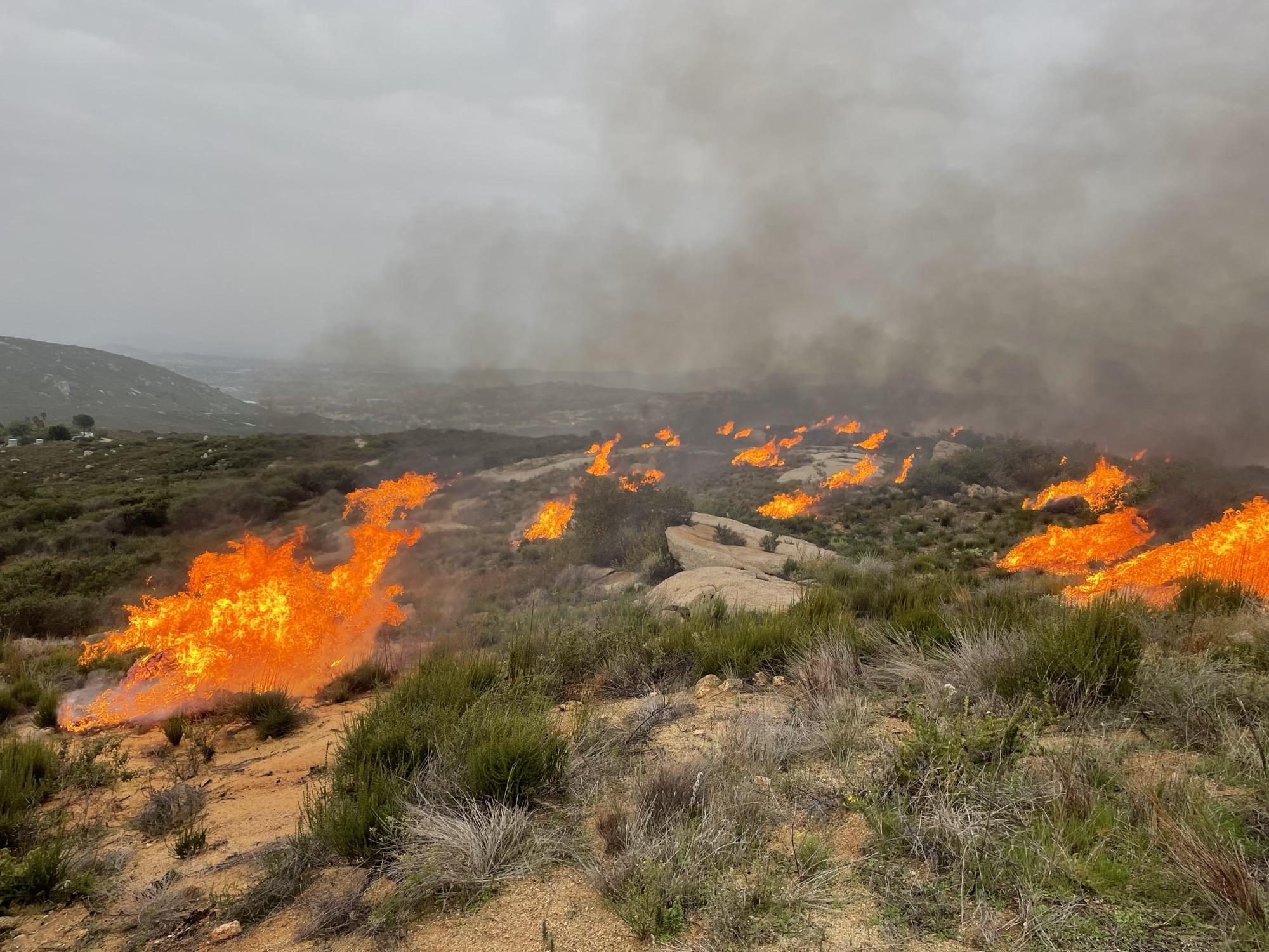
Picture showing fuels being consumed on the broadcast burn.
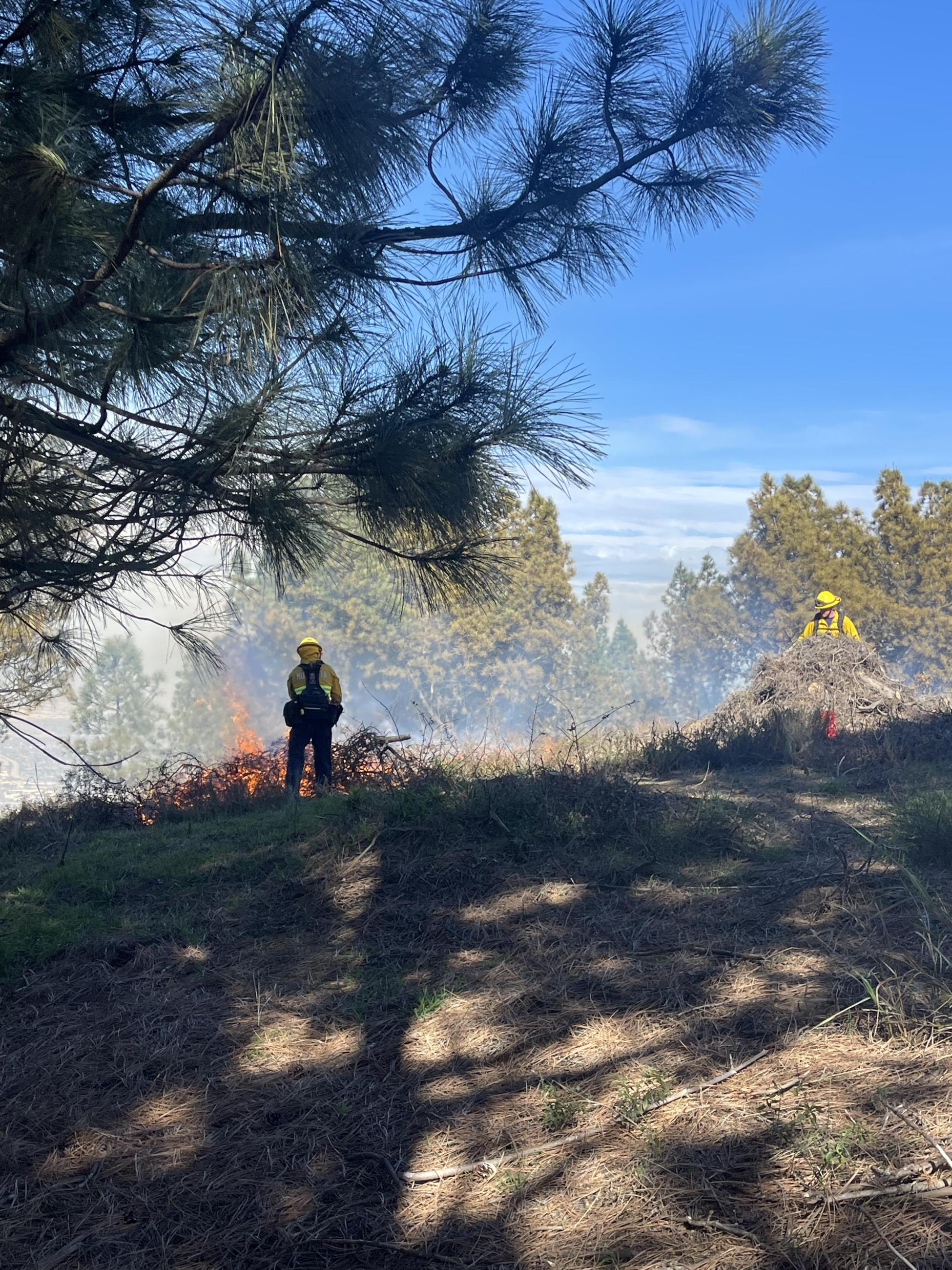
Picture of firefighters ignition burn piles around the North Main Broadcast Burn.
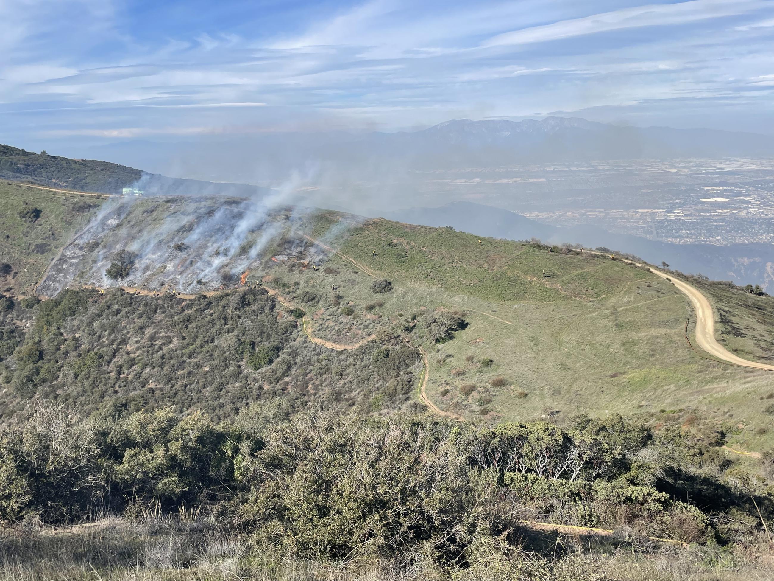
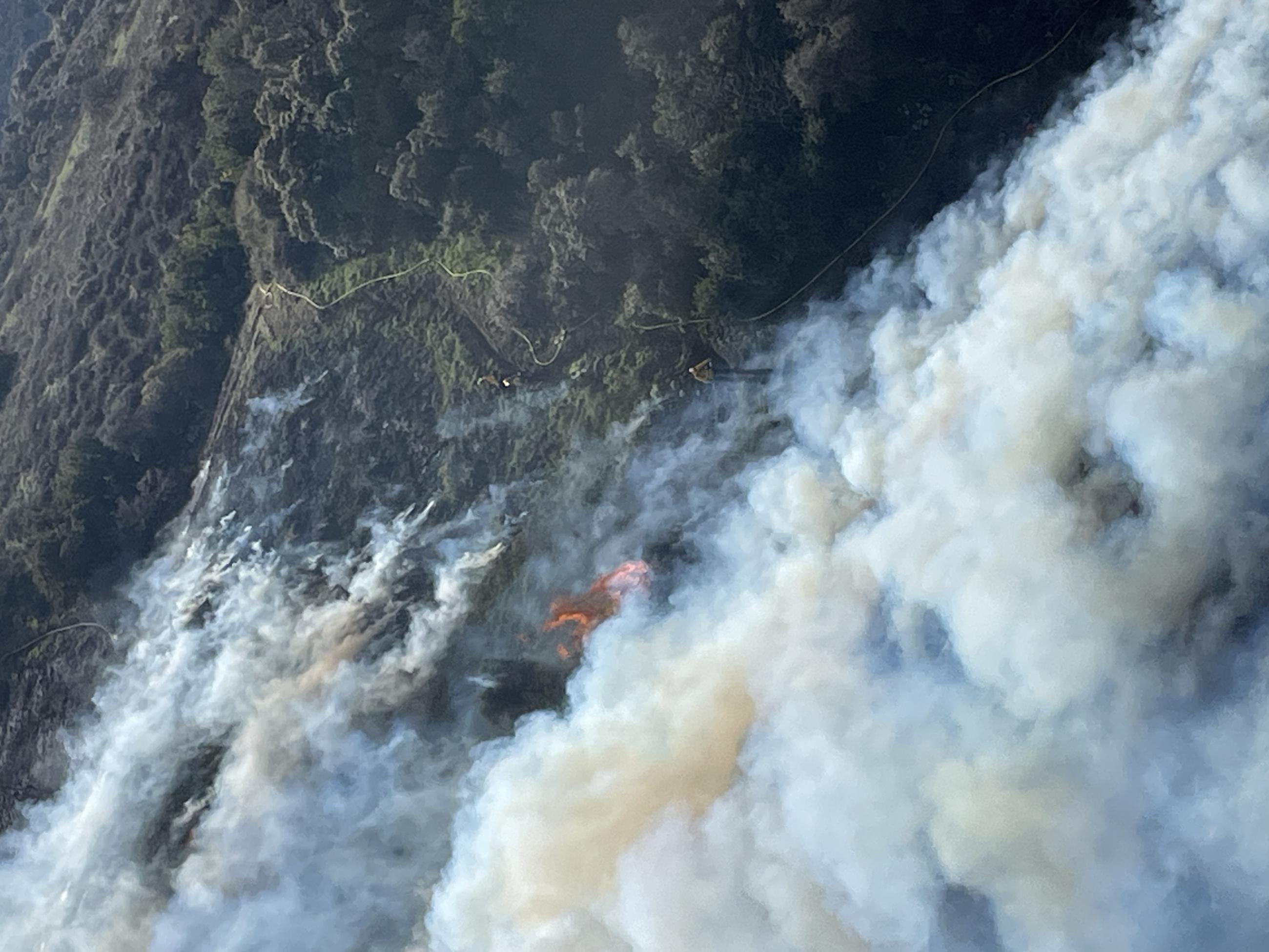
Picture from aerial coverage showing the broadcast burn, firefighters, and hose lays.
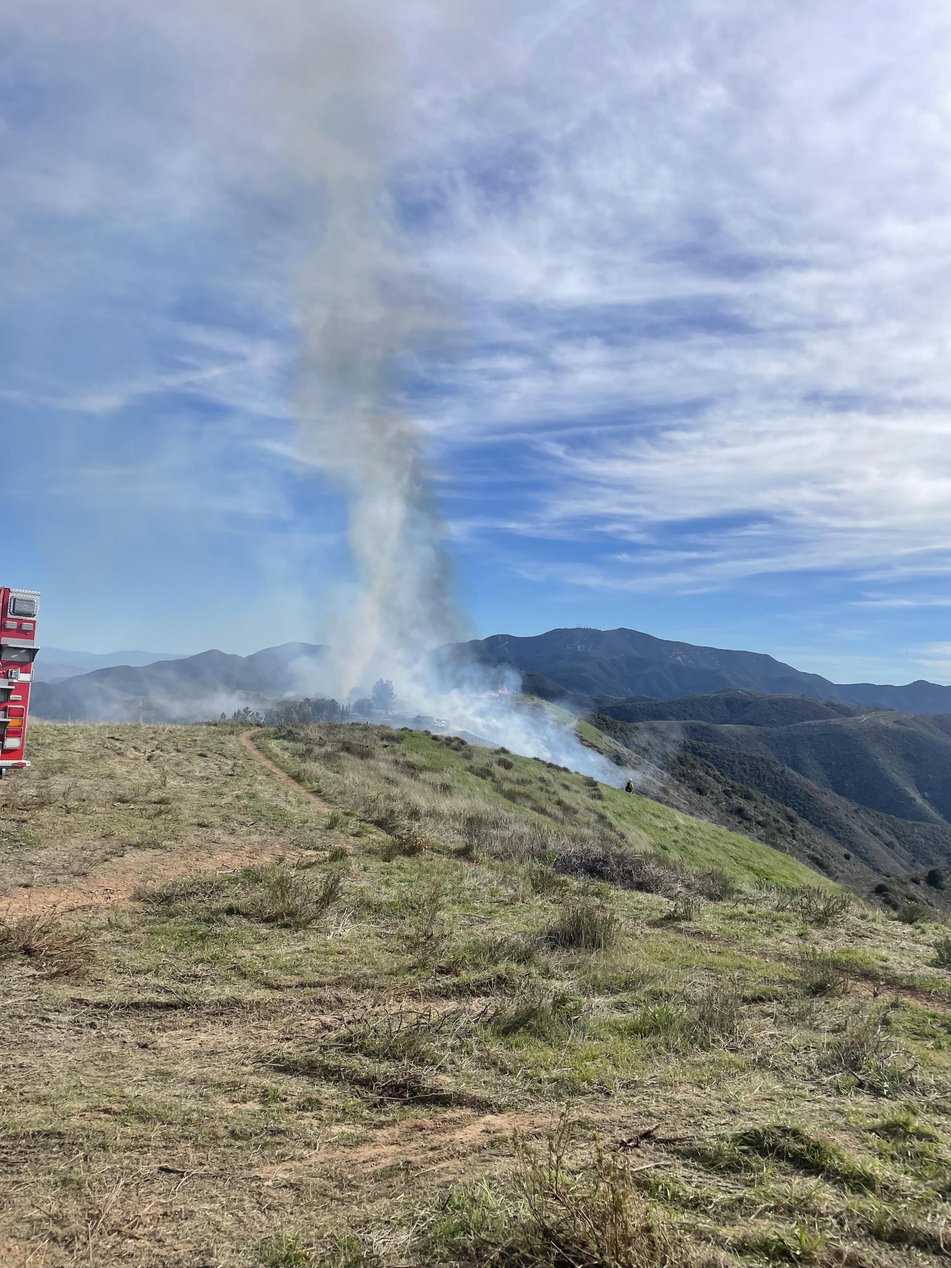
Smoke rising from the North Main Braodcast Burn
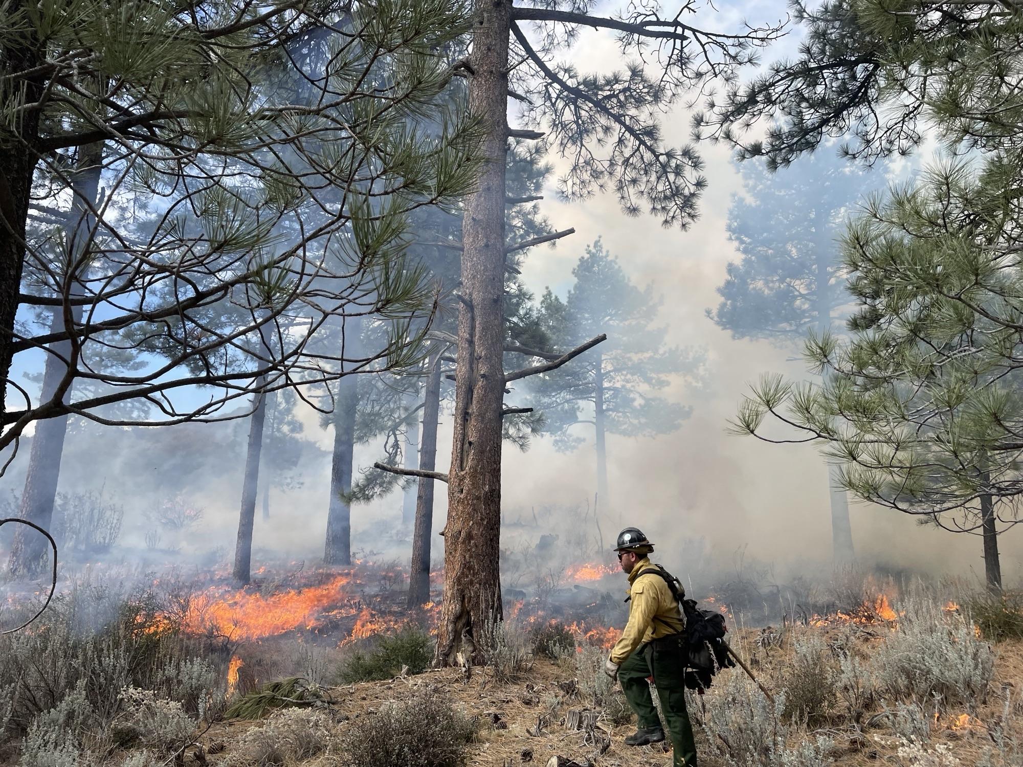
Picture of firefighter walking through forest with prescribed fire on the landscape