
Incident Publication
BAER INFORMATION BRIEF The Three Phases of Wildfire Recovery01 18 2025
Related Incident: Eaton-Hurst Post-Fire BAER
Publication Type: News
BAER INFORMATION BRIEF: Three Phases of Wildfire Recovery
There are three phases of recovery following wildfires on federal lands:
- Fire Suppression Repair
- Emergency Stabilization-Burned Area Emergency Response (BAER)
- Long-Term Recovery and Restoration
Fire Suppression Repair is a series of immediate post-fire actions taken to repair damages and minimize potential soil erosion and impacts resulting from fire suppression activities and usually begins before the fire is contained, and before the demobilization of an Incident Management Team. This work repairs the hand and dozer fire lines, roads, trails, staging areas, safety zones, and drop points used during fire suppression efforts.
- Emergency Stabilization-Burned Area Emergency Response (BAER) is a rapid assessment of burned watersheds by a BAER team to identify imminent post-wildfire threats to human life and safety, property, and critical natural or cultural resources on National Forest System lands and take immediate actions to implement emergency stabilization measures before the first post-fire damaging events. Fires result in loss of vegetation, exposure of soil to erosion, and increased water runoff that may lead to flooding, increased sediment, debris flows, and damage to critical natural and cultural resources. BAER actions such as: mulching, seeding, installation of erosion and water run-off control structures, temporary barriers to protect recovering areas, and installation of warning signs may be implemented. BAER work may also replace safety related facilities; remove safety hazards; prevent permanent loss of habitat for threatened and endangered species; prevent the spread of noxious weeds and protect critical cultural resources.
- Long-Term Recovery and Restoration utilizes non-emergency actions to improve fire-damaged lands that are unlikely to recover naturally and to repair or replace facilities damaged by the fire that are not critical to life and safety. This phase may include restoring burned habitat, reforestation, other planting or seeding, monitoring fire effects, replacing burned fences, interpreting cultural sites, treating noxious weed infestations, and installing interpretive signs.
BAER SAFETY MESSAGE: Everyone near and downstream from the burned areas should remain alert and stay updated on weather conditions that may result in heavy rains and increased water runoff. Flash flooding may occur quickly during heavy rain events--be prepared to act. Current weather and emergency notifications can be found at National Weather Service website: www.weather.gov/lox/.
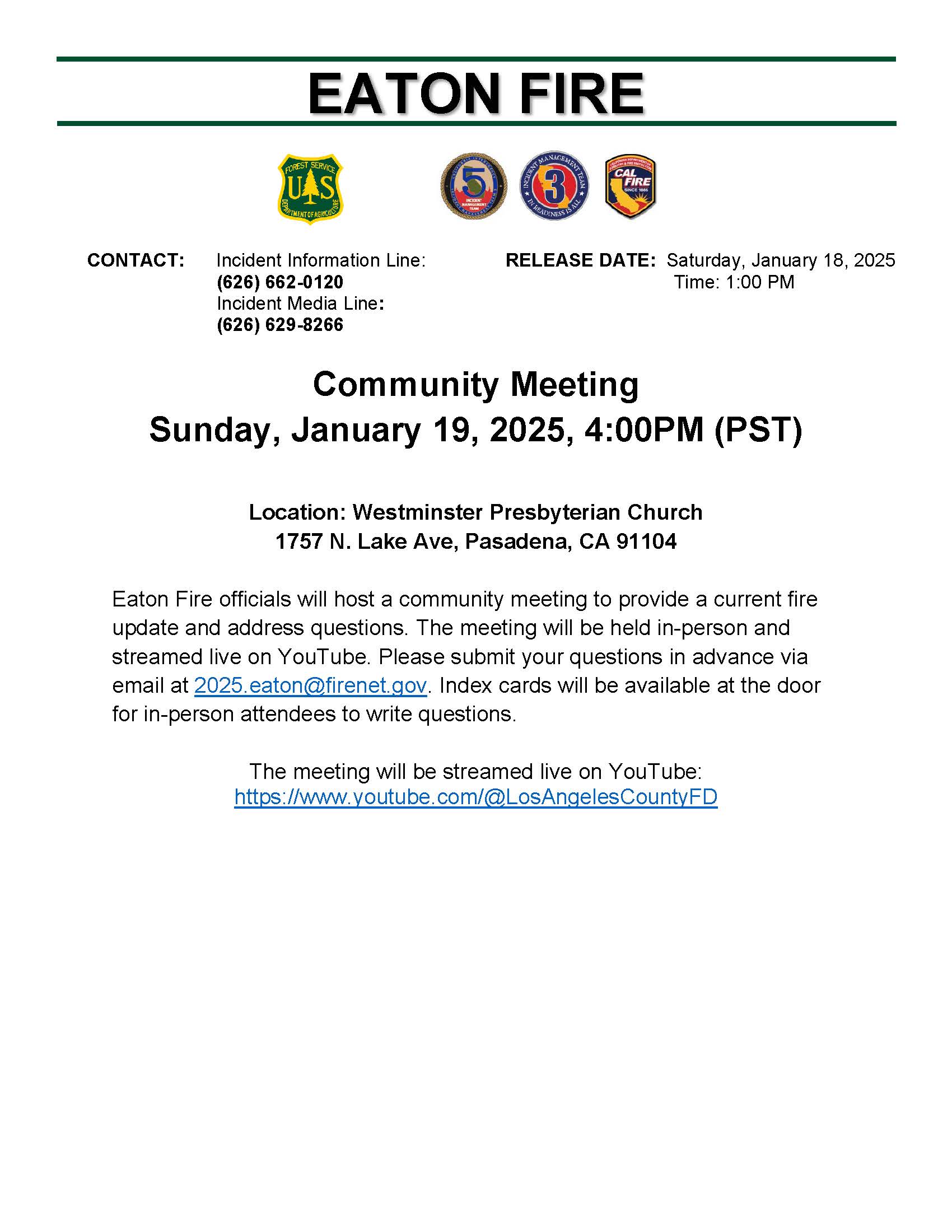
Eaton Fire Inperson Community Meeting Sunday January 192025 01 18 2025
Related Incident: Eaton Fire
Publication Type: Announcement
Community Meeting
Sunday, January 19, 2025, 4:00PM (PST)
Location: Westminster Presbyterian Church
1757 N. Lake Ave, Pasadena, CA 91104
Eaton Fire officials will host a community meeting to provide a current fire update and address questions. The meeting will be held in-person and streamed live on YouTube. Please submit your questions in advance via email at 2025.eaton@firenet.gov. Index cards will be available at the door for in-person attendees to write questions.
The meeting will be streamed live on YouTube:
Horton Fire Update 01 18 2025
Related Incident: Horton Fire 2024
Publication Type: News
This will be the final Horton Fire update, unless significant activity occurs.
Horton Fire Update: January 18, 2025
Acres: 8,346 Containment: 94% Start Date: December 14, 2024
Location: Payson Ranger District, Arizona Cause: Under Investigation
Personnel: 107 Fuels: Timber, chaparral
Resources: 1 crew | 5 engines | 1 bulldozer | 1 water tender
Highlights: With the increase in containment and decrease in fire activity, fire officials are downsizing the incident. This will be the final written update on the Horton Fire, unless significant activity were to occur. After today, fire information will no longer be posted throughout the effected communities. Management of the Horton Fire will transition from a Type 3 team to a Type 4 team on Tuesday morning.
Operations: Crews will continue to patrol and monitor the fire until it is fully contained, controlled, and called out. In addition, crews will work on completing the remainder of the suppression repair work throughout the area. Use of heavy equipment on the Forest Service Road 76 is nearing completion.
Burned Area Emergency Response (BAER): The BAER team’s initial assessments show that greater than 99% of the burned area experienced low severity fire effects meaning the soil structure remains intact and that only minimal impacts to fine roots within the soils has occurred. The BAER team will continue to assess and mitigate any potential risks as needed.
Weather: Cool and dry conditions will continue, with slightly higher winds. Visitors are asked to be safe with sparks and flames to help prevent wildfires while conditions remain dry. More information can be found at https://smokeybear.com/
Smoke: Smoke will continue to be visible as pockets of vegetation burn well within the interior of the fire footprint.
Forest Orders: Forest Order 03-12-00-25-02 is in place to protect public health and safety during the Horton Fire as well as protecting firefighting personnel engaging in wildland firefighting operations. To see the latest Forest closure please visit: https://www.fs.usda.gov/alerts/tonto/alerts-notices/?aid=92588
Evacuations: On January 10, 2025, all communities returned to the READY evacuation status. The READY stage is continuous and involves preparing for all possible hazards before they strike.
Firewise: Creating “survivable space” around homes is one way to be prepared for future wildfires. For more information on creating a fire wise home surrounded by survivable space visit: www.fs.usda.gov/Internet/FSE_DOCUMENTS/stelprdb5339207.pdf
Road Closures: AZ Department of Transportation (ADOT) still has reduced speed limits along the fire effected areas of SR-260 but there are currently no closures. Please slow down for firefighters and apparatuses working on the roads. For current roadway status and conditions visit ADOT at https://www.az511.com/
Eaton Fire Morning Update 01 18 2025
Related Incident: Eaton Fire
Publication Type: News
Location: Eaton Canyon, Pasadena
Acres Burned: 14,117
Containment: 73%
Start Date: January 7, 2025
Cause: Undetermined
Structures Threatened: 11,927
Verified Structures Destroyed: 8,988
Verified Structures Damaged: 972
Firefighter Injuries: 7
Civilian Fatalities: Contact LA County Sheriff’s Department
Personnel: 2,782 Water Tenders: 50 Helicopters: 13 Engines: 243 Hand Crews: 43 Dozers: 14
Virtual Community Meeting Saturday, January 18th 4:00 p.m.: Eaton Fire officials will host a virtual community meeting and provide an update on the current fire situation, address questions, and discuss recovery. The meeting will be streamed live on YouTube: https://www.youtube.com/@LosAngelesCountyFD. A question-and-answer session will follow the presentation. Please submit your questions in advance via email at 2025.eaton@firenet.gov.
Current Situation: Today, the incident will continue infrastructure assessments, ensuring safety of personnel and equipment working in the area. The HazMat response will remain active, providing decontamination to personnel and equipment as needed. Air Operations will continue to assist firefighters in extinguishing hot spots that are inaccessible by ground. Containment continues to grow, with a total of 60 miles of control lines established around the fire’s perimeter, including 8 miles of hand lines. As repopulation efforts progress, the focus remains on ensuring that people are brought back into a safe and secure environment.
Weather: Marine influence will gradually diminish throughout the day. By Sunday, relative humidity will most likely return to around 30 percent. Mild, terrain-driven winds will continue through Sunday. Very dry conditions are predicted for Monday and Tuesday, with minimum relative humidity as low as 8 percent.
Damage Assessment: Damage inspection teams have completed inspections for 90% of all structures within the fire perimeter.
Recovery Information: https://recovery.lacounty.gov/eaton-fire/
The Disaster Resource Center will be available to the public 9:00 a.m. to 8:00 p.m., daily.
Location: Pasadena City College Community Education Center - 3035 E. Foothill Blvd. Pasadena, CA 91107
Evacuations: For the most up-to-date evacuation information visit Genasys Protect using the link: https://protect.genasys.com/search
Evacuations remain in place due to continued fire activity, numerous downed trees, downed power lines, gas leaks and power outages. If you have questions or need specific clarification regarding evacuations in your area, please reach out to your city’s official government website to receive further information.
Evacuation Point(s):
Pasadena Civic Center - 300 East Green Street, Pasadena, CA 91101
Parking at 155 E. Green St. Please enter from Marengo Ave. The Humane Society is on-site to accept small pets for boarding. Service animals will be allowed inside the Convention Center.
Pomona Fairplex (Gate 3) - 1101 W McKinley Ave, Pomona, CA 91768
Animal Care: Small and Large Animal Evacuation
Pasadena Humane - 361 S. Raymond Ave, Pasadena, CA 91103 (Small Animals)
Industry Hills Expo Center - 16200 Temple Avenue, City of Industry, CA 91744 (Large Animals) Pomona Fairplex (Gate 3) - 1101 W McKinley Ave, Pomona, CA 91768 (Small and Large Animals)
Animal Rescue: Pasadena Humane: (626) 577-3752
Angeles National Forest Closure: https://www.fs.usda.gov/detail/angeles/news-events/?cid=FSEPRD1222074
The entire Angeles National Forest and San Gabriel Mountain National Monument are temporarily closed for public safety and the protection of natural resources through Friday, January 24, 2025, at 12:00 midnight. This closure is tied to critical fire danger. During this time, the following acts are prohibited within the Angeles National Forest and San Gabriel Mountains National Monument:
- Going into or being upon the Angeles National Forest. 36 C.F.R. § 261.52(e).
- Being on any National Forest System Road within the Angeles National Forest. 36 C.F.R. § 261.54(e).
- Being on any National Forest System Trail within the Angeles National Forest. 36 C.F.R. § 261.55(a).
Local Road Closures: https://pw.lacounty.gov/roadclosures/
State Road Closures: https://quickmap.dot.ca.gov/
Cooperating Agencies: Gabrieleno Band of Mission Indians - Kizh Nation, Southern California Edison, Southern California Gas, LA County Public Health, LA County Medical Examiner, Pasadena Water and Power, Metropolitan Water District (five water districts), LA County Department of Public Works, Pasadena Public Health, LA County Mental Health, Disaster Management Area D, California Department of Corrections and Rehabilitation, California National Guard, Federal Bureau of Investigation, Air Quality Management District, FEMA, American Red Cross, CALTRANS, Cal OES, California Highway Patrol (CHP), Sierra Madre Fire Department, Arcadia Fire Department, Monrovia Fire Department, JPL Fire Department, Monrovia Police Department, LA County Office of Emergency Management, Pasadena Unified School District, LA County Office of Education, LA County Independent School District, and Pasadena Humane, in addition to several assisting companies and organizations (city, county, police, and utility).
Actualizacin matutina del incendio Eaton 01 18 2025
Related Incident: Eaton Fire
Publication Type: News
Reunión comunitaria virtual viernes, 18 de enero a las 4:00 p.m.: Los funcionarios del incidente Eaton organizarán una reunión comunitaria virtual y darán información sobre el incendio y responderán preguntas. La reunión se transmitirá en vivo en YouTube: https://www.youtube.com/@LosAngelesCountyFD. Luego de la presentación habrá una sesión de preguntas y respuestas. Envíe sus preguntas al correo electrónico 2025.eaton@firenet.gov.
Situación actual: Hoy, se continuarán realizando evaluaciones de infraestructura para garantizar la seguridad del personal y el equipo que trabaja en la zona. Los equipos de HazMat continuaran trabajando en la descontaminación según sea necesario. Las operaciones aéreas seguirán ayudando a los bomberos a extinguir los puntos críticos a los que no se pueden alcanzar por tierra. La contención sigue aumentando, con un total de 60 millas de líneas de control establecidas alrededor del perímetro del incendio. A medida que avanzan los esfuerzos de repoblación, el enfoque sigue siendo garantizar que las personas regresen a un lugar seguro y protegido.
Clima: La influencia marina disminuirá gradualmente a lo largo del día. Para el domingo, la humedad relativa probablemente regresará a alrededor del 30 por ciento. Los vientos suaves impulsados por el terreno continuarán hasta el domingo. Se pronostican condiciones muy secas para el lunes y el martes, con una humedad relativa mínima de tan solo el 8 por ciento.
Evaluación de daños: Los equipos de inspección de daños han completado inspecciones del 90% de todas las estructuras dentro del área del incendio.
Información sobre recuperación de áreas afectadas: https://recovery.lacounty.gov/eaton-fire/
El Centro de Recursos por Desastres estará disponible al público de 9:00 a. m. a 8:00 p. m., todos los días.
Ubicación: Pasadena City College Community Education Center, 3035 E. Foothill Blvd. Pasadena, CA
Cierre de escuelas: Las escuelas del Distrito Escolar Unificado de Pasadena permanecerán cerradas del 13 al 17 de enero de 2025. Para obtener más información, consulte: https://secure.smore.com/n/sgk78
Evacuaciones: Para obtener información de evacuaciones, visite Genasys Protect mediante el sito: https://protect.genasys.com/search
Evacuaciones continúan debido a la actividad continua de incendios, numerosos árboles caídos, cables eléctricos caídos, fugas de gas y cortes de energía. Si tiene preguntas o necesita una aclaración sobre las evacuaciones en su área, visite el sitio web oficial del gobierno de su ciudad para recibir más información.
Centros de evacuación:
Pasadena Civic Center - 300 East Green Street, Pasadena, CA 91101
Estacionamiento en 155 E. Green St. Ingrese por Marengo Ave. The Humane Society estará presente para aceptar mascotas pequeñas para hospedaje. Se permitirán animales de servicio adentro del Pasadena Civic Center
Pomona Fairplex (Gate 3) - 1101 W McKinley Ave, Pomona, CA 91768
Cuidado de animales: Evacuación de animales pequeños y grandes
Pasadena Humane - 361 S. Raymond Ave, Pasadena, CA 91103 (animales pequeños)
Industry Hills Expo Center - 16200 Temple Avenue, City of Industry, CA 91744 (animales grandes)
Pomona Fairplex (Gate 3) - 1101 W McKinley Ave, Pomona, CA 91768 (animales pequeños y grandes)
Rescate de animales: Pasadena Humane, (626) 577-3752
Cierre del Bosque Nacional Ángeles: https://www.fs.usda.gov/detail/angeles/news-events/?cid=FSEPRD1222074
El cierre temporal de todo el Bosque Nacional de Angeles y el Monumento Nacional de la Montaña San Gabriel se ha extendido desde el 18 de enero de 2025 a las 12:00 a.m. hasta el viernes 24 de enero de 2025 a las 12:00 de la medianoche. Este cierre está vinculado al peligro de incendio crítico y es para la seguridad pública y la protección de los recursos naturales. Durante este tiempo, se prohíben los siguientes actos dentro del Bosque Nacional de los Ángeles y el Monumento Nacional de las Montañas San Gabriel:
1.Entrar o estar en el Bosque Nacional de los Ángeles. 36 C.F.R. § 261.52(e).
2.Estar en cualquier carretera del Sistema Forestal Nacional dentro del Bosque Nacional de los Ángeles. 36 C.F.R. § 261.54(e).
3.Estar en cualquier sendero del Sistema Forestal Nacional dentro del Bosque Nacional de los Ángeles. 36 C.F.R. § 261.55(a).
Cierres de carreteras locales: https://pw.lacounty.gov/roadclosures/
Cierres de carreteras estatales: https://quickmap.dot.ca.gov/
Agencias colaboradoras: Gabrieleno Band of Mission Indians - Kizh Nation, Southern California Edison, Southern California Gas, LA County Public Health, LA County Medical Examiner, Pasadena Water and Power, Metropolitan Water District (five water districts), LA County Department of Public Works, Pasadena Public Health, LA County Mental Health, Disaster Management Area D, California National Guard, Federal Bureau of Investigation, Air Quality Management District, FEMA, American Red Cross, CALTRANS, Cal OES, California Highway Patrol (CHP), Sierra Madre Fire, Arcadia Fire, Monrovia Fire, JPL Fire Department, Monrovia Police Department, LA County Office of Emergency Management, Pasadena Unified School District, LA County Office of Education, and LA County Independent School District, además de varias empresas y organizaciones que prestan asistencia (ciudad, condado, policía y servicios públicos).
Eaton Fire Evening Update 01 17 2025
Related Incident: Eaton Fire
Publication Type: News
Location: Eaton Canyon, Pasadena
Acres Burned: 14,117
Containment: 65%
Start Date: January 7, 2025
Cause: Undetermined
Structures Threatened: 11,927
Verified Structures Destroyed: 8,690
Verified Structures Damaged: 938
Firefighter Injuries: 7
Civilian Fatalities: Contact LA County Sheriff’s Department
Personnel: 2,782 Water Tenders: 50 Helicopters: 13 Engines: 243 Hand Crews: 43 Dozers: 14
Virtual Community Meeting Saturday, January 18th 4:00 p.m.: Eaton Fire officials will host a virtual community meeting and provide an update on the current fire situation, address questions, and discuss recovery. The meeting will be streamed live on YouTube: https://www.youtube.com/@LosAngelesCountyFD. A question-and-answer session will follow the presentation. Please submit your questions in advance via email at 2025.eaton@firenet.gov.
Current Situation: Firefighters continue to extinguish hot spots in steep, inaccessible canyons near Winters Creek, Mt. Lowe, and Mt. Wilson. Crews and water dropping helicopters are working in unison to extinguish any remaining heat in these areas. A total of 60 miles of control lines have been established around the fire’s perimeter, including 8 miles of hand line. Tactical patrols and mop up continue throughout the communities along the southern flank of the fire. Infrastructure work is in progress, with efforts focused on restoring utilities and critical services to support repopulation and long-term recovery in affected areas.
Weather: The marine influence will peak overnight, with relative humidity reaching 80% across the fire area. Low marine clouds and fog are possible early Saturday morning. A weakening south wind will allow the marine influence to wane through the weekend. Dry conditions are expected to return next week.
Damage Assessment: Damage inspection teams have completed inspections for 85% of all structures within the fire footprint.
Recovery Information: https://recovery.lacounty.gov/eaton-fire/
The Disaster Resource Center will be available to the public 9:00 a.m. to 8:00 p.m., daily.
Location: Pasadena City College Community Education Center - 3035 E. Foothill Blvd. Pasadena, CA 91107
Evacuations: For the most up-to-date evacuation information visit Genasys Protect using the link: https://protect.genasys.com/search
Evacuations remain in place due to continued fire activity, numerous downed trees, downed power lines, gas leaks and power outages. If you have questions or need specific clarification regarding evacuations in your area, please reach out to your city’s official government website to receive further information.
Evacuation Point(s):
Pasadena Civic Center - 300 East Green Street, Pasadena, CA 91101
Parking at 155 E. Green St. Please enter from Marengo Ave. The Humane Society is on-site to accept small pets for boarding. Service animals will be allowed inside the Convention Center.
Pomona Fairplex (Gate 3) - 1101 W McKinley Ave, Pomona, CA 91768
Animal Care: Small and Large Animal Evacuation
Pasadena Humane - 361 S. Raymond Ave, Pasadena, CA 91103 (Small Animals)
Industry Hills Expo Center - 16200 Temple Avenue, City of Industry, CA 91744 (Large Animals) Pomona Fairplex (Gate 3) - 1101 W McKinley Ave, Pomona, CA 91768 (Small and Large Animals)
Animal Rescue:
Pasadena Humane: (626) 577-3752
Angeles National Forest Closure: https://www.fs.usda.gov/detail/angeles/news-events/?cid=FSEPRD1222074
The entire Angeles National Forest and San Gabriel Mountain National Monument are temporarily closed for public safety and the protection of natural resources through Friday, January 24, 2025, at 12:00 midnight. This closure is tied to critical fire danger. During this time, the following acts are prohibited within the Angeles National Forest and San Gabriel Mountains National Monument:
- Going into or being upon the Angeles National Forest. 36 C.F.R. § 261.52(e).
- Being on any National Forest System Road within the Angeles National Forest. 36 C.F.R. § 261.54(e).
- Being on any National Forest System Trail within the Angeles National Forest. 36 C.F.R. § 261.55(a).
Local Road Closures: https://pw.lacounty.gov/roadclosures/
State Road Closures: https://quickmap.dot.ca.gov/
Cooperating Agencies: Gabrieleno Band of Mission Indians - Kizh Nation, Southern California Edison, Southern California Gas, LA County Public Health, LA County Medical Examiner, Pasadena Water and Power, Metropolitan Water District (five water districts), LA County Department of Public Works, Pasadena Public Health, LA County Mental Health, Disaster Management Area D, California Department of Corrections and Rehabilitation, California National Guard, Federal Bureau of Investigation, Air Quality Management District, FEMA, American Red Cross, CALTRANS, Cal OES, California Highway Patrol (CHP), Sierra Madre Fire Department, Arcadia Fire Department, Monrovia Fire Department, JPL Fire Department, Monrovia Police Department, LA County Office of Emergency Management, Pasadena Unified School District, LA County Office of Education, LA County Independent School District, and Pasadena Humane, in addition to several assisting companies and organizations (city, county, police, and utility).
Forest Order Closure Order 05012503 01 17 2025
Related Incident: Eaton Fire
Publication Type: Closures
Release Date: Jan 17, 2025
Contact(s): Dana Dierkes (626) 698-8482
ARCADIA, Calif., January 17, 2025—The entire Angeles National Forest and San Gabriel Mountain National Monument are temporarily closed for public safety and the protection of natural resources through Friday, January 24, 2025, at 12:00 midnight. This closure is tied to critical fire danger. During this time, the following acts are prohibited within the Angeles National Forest and San Gabriel Mountains National Monument:
- Going into or being upon the Angeles National Forest. 36 C.F.R. § 261.52(e).
- Being on any National Forest System Road within the Angeles National Forest. 36 C.F.R. § 261.54(e).
- Being on any National Forest System Trail within the Angeles National Forest. 36 C.F.R. § 261.55(a).
Pursuant to 36 C.F.R. § 261.50(e), the following persons are exempt from this order:
- Any Federal, State or local officer, or member of an organized rescue or fire-fighting force in the performance of an official duty.
- Persons with Forest Service Permit No. FS-7700-48 (Permit for Use of Roads, Trails, or Areas Restricted by Regulation or Order), specifically exempting them from this Order.
Persons with a valid California Campfire Permit are not exempt from the prohibitions listed above.
These prohibitions are in addition to the general prohibitions in 36 C.F.R. Part 261, Subpart A. A violation of these prohibitions is punishable by a fine of not more than $5,000 for an individual or $10,000 for an organization, or imprisonment for not more than six months or both 16 U.S.C. § 551, and 18 U.S.C. §§ 3559, 3571, and 3581
For more information about Forest Order No. 05-01-25-03, click here.
To see the previous forest order extension, which extends through Sunday, Jan. 19, 2025, Forest Order No. 05-01-25-02, click here.
Actualizacin de Incendio Eaton por la tarde 01 17 2025
Related Incident: Eaton Fire
Publication Type: News
Reunión comunitaria virtual viernes, 18 de enero a las 4:00 p.m.: Los funcionarios del incidente Eaton organizarán una reunión comunitaria virtual y darán información sobre el incendio y responderán preguntas. La reunión se transmitirá en vivo en YouTube: https://www.youtube.com/@LosAngelesCountyFD. Luego de la presentación habrá una sesión de preguntas y respuestas. Envíe sus preguntas al correo electrónico 2025.eaton@firenet.gov.
Situación actual: Los equipos de bomberos continúan extinguiendo puntos calientes en cañones empinados e inaccesibles cerca de Winters Creek, Mt. Lowe y Mt. Wilson. Equipos de bomberos y los helicópteros que lanzan agua están trabajando al unísono para extinguir el calor restante en estas zonas. Se han establecido un total de 60 millas de líneas de control alrededor del perímetro del incendio, incluidas 8 millas hechas por equipos de combate de mano. Las patrullas tácticas continúan en las comunidades a lo largo del flanco sur del incendio. El trabajo de infraestructura está en progreso, con esfuerzos centrados en restaurar los servicios públicos y críticos para apoyar la repoblación y la recuperación a largo plazo en las áreas afectadas.
Clima: La influencia marina alcanzará su punto máximo durante la noche, con una humedad relativa que alcanzará el 80% en toda el área del incendio. Es posible que haya nubes marinas bajas y niebla el sábado por la mañana. Un viento del sur debilitado permitirá que la influencia marina disminuya durante el fin de semana. Se espera que las condiciones secas regresen la próxima semana.
Evaluación de daños: Los equipos de inspección de daños han completado inspecciones del 85% de todas las estructuras dentro del área del incendio.
Información sobre recuperación de áreas afectadas: https://recovery.lacounty.gov/eaton-fire/
El Centro de Recursos por Desastres estará disponible al público de 9:00 a. m. a 8:00 p. m., todos los días.
Ubicación: Pasadena City College Community Education Center, 3035 E. Foothill Blvd. Pasadena, CA
Cierre de escuelas: Las escuelas del Distrito Escolar Unificado de Pasadena permanecerán cerradas del 13 al 17 de enero de 2025. Para obtener más información, consulte: https://secure.smore.com/n/sgk78
Evacuaciones: Para obtener información de evacuaciones, visite Genasys Protect mediante el sito: https://protect.genasys.com/search
Evacuaciones continúan debido a la actividad continua de incendios, numerosos árboles caídos, cables eléctricos caídos, fugas de gas y cortes de energía. Si tiene preguntas o necesita una aclaración sobre las evacuaciones en su área, visite el sitio web oficial del gobierno de su ciudad para recibir más información.
Centros de evacuación:
Pasadena Civic Center - 300 East Green Street, Pasadena, CA 91101
Estacionamiento en 155 E. Green St. Ingrese por Marengo Ave. The Humane Society estará presente para aceptar mascotas pequeñas para hospedaje. Se permitirán animales de servicio adentro del Pasadena Civic Center
Pomona Fairplex (Gate 3) - 1101 W McKinley Ave, Pomona, CA 91768
Cuidado de animales: Evacuación de animales pequeños y grandes
Pasadena Humane - 361 S. Raymond Ave, Pasadena, CA 91103 (animales pequeños)
Industry Hills Expo Center - 16200 Temple Avenue, City of Industry, CA 91744 (animales grandes)
Pomona Fairplex (Gate 3) - 1101 W McKinley Ave, Pomona, CA 91768 (animales pequeños y grandes)
Rescate de animales: Pasadena Humane, (626) 577-3752
Cierre del Bosque Nacional Ángeles: https://www.fs.usda.gov/detail/angeles/news-events/?cid=FSEPRD1222074
El cierre temporal de todo el Bosque Nacional de Angeles y el Monumento Nacional de la Montaña San Gabriel se ha extendido desde el 18 de enero de 2025 a las 12:00 a.m. hasta el viernes 24 de enero de 2025 a las 12:00 de la medianoche. Este cierre está vinculado al peligro de incendio crítico y es para la seguridad pública y la protección de los recursos naturales. Durante este tiempo, se prohíben los siguientes actos dentro del Bosque Nacional de los Ángeles y el Monumento Nacional de las Montañas San Gabriel:
1.Entrar o estar en el Bosque Nacional de los Ángeles. 36 C.F.R. § 261.52(e).
2.Estar en cualquier carretera del Sistema Forestal Nacional dentro del Bosque Nacional de los Ángeles. 36 C.F.R. § 261.54(e).
3.Estar en cualquier sendero del Sistema Forestal Nacional dentro del Bosque Nacional de los Ángeles. 36 C.F.R. § 261.55(a).
Cierres de carreteras locales: https://pw.lacounty.gov/roadclosures/
Cierres de carreteras estatales: https://quickmap.dot.ca.gov/
Agencias colaboradoras: Gabrieleno Band of Mission Indians - Kizh Nation, Southern California Edison, Southern California Gas, LA County Public Health, LA County Medical Examiner, Pasadena Water and Power, Metropolitan Water District (five water districts), LA County Department of Public Works, Pasadena Public Health, LA County Mental Health, Disaster Management Area D, California National Guard, Federal Bureau of Investigation, Air Quality Management District, FEMA, American Red Cross, CALTRANS, Cal OES, California Highway Patrol (CHP), Sierra Madre Fire, Arcadia Fire, Monrovia Fire, JPL Fire Department, Monrovia Police Department, LA County Office of Emergency Management, Pasadena Unified School District, LA County Office of Education, and LA County Independent School District, además de varias empresas y organizaciones que prestan asistencia (ciudad, condado, policía y servicios públicos).
Current Pile Burning Activity SOUTH ZONE 01 17 2025
Related Incident: Arapaho and Roosevelt National Forests Pile Burning
Publication Type: Announcement
Jefferson, Boulder and Gilpin Counties. Clear Creek and Boulder Ranger Districts - Week of Jan 20 to Jan 27, 2025
Fire managers are monitoring conditions to burn piles in Clear Creek and Boulder Ranger Districts, with the next possibile ignitions window starting on Monday, January 20. Piles could be burned in the following Jefferson, Boulder, and Gilpin County locations:
Evergreen: Hand piles near Cub Creek Trailhead, five miles southwest of Evergreen.
Forsythe II Unit 44: Hand piles west of Gross Reservoir, two miles north of Wondervu and half a mile south of Lazy Z.
Lump Gulch Units 27 & 37: Hand piles half a mile north of the intersection of Highway 119 and South Beaver Creek Road, near Pine Drive.
Lump Gulch Unit 35: Hand piles two miles south of Rollinsville on the west side of Highway 119.
Lump Gulch Unit 18: Hand piles half a mile north of Rollinsville on the west side of Highway 119.
Lump Gulch Unit 38: Hand piles on the south side of South Beaver Creek Road. One mile northeast of the intersection of Highway 119 and South Beaver Creek Road.
Note: Local fire crews are currently focusing on burning piles in locations with sufficient snow. With more snow forecasted this coming weekend, crews may be able to address piles at these locations which have not yet had adequate snow cover.
Horton Fire Daily Update 01 17 2025
Related Incident: Horton Fire 2024
Publication Type: News
Containment increased as crews contained the remaining line along SR-260.
Horton Fire Update: January 17, 2025
Acres: 8,346 Containment: 94% Start Date: December 14, 2024
Location: Payson Ranger District, Arizona Cause: Under Investigation
Personnel: 109 Fuels: Timber, chaparral
Resources: 1 crew | 5 engines | 1 bulldozer | 1 water tender
Highlights: A lot of progress on containment and repairs were made yesterday. Containment along the SR-260 road was completed and AZ Public Service helped to clear vegetation along the powerlines to further secure the lines. Work on FS road 284 has been completed.
Operations: Today, crews are continuing restoration work in areas around the fire. Firefighters are patrolling the FS 76 and 300 roads and conducting mop up as needed. Use of heavy equipment will depend on road conditions at higher elevations and the amounts of snow and ice received overnight.
Burned Area Emergency Response (BAER): The BAER team's initial assessments show that greater than 99% of the burned area soil structure remains intact and that only minimal impacts to fine roots within the soils has occurred. The BAER team will continue to assess and mitigate any potential risks as needed.
Weather: Cool and dry conditions will return and persist through the weekend. Visitors are asked to be safe with sparks and flames to help prevent wildfires while conditions remain dry. More information can be found at https://smokeybear.com/
Smoke: Smoke will continue to be visible as pockets of vegetation burn well within the interior of the fire footprint.
Forest Orders: As of January 13, 2025, the forest closure order was revised and reduced to reflect current conditions. Forest Order 03-12-00-25-02 is in place to protect public health and safety during the Horton Fire as well as protecting firefighting personnel engaging in wildland firefighting operations. To see the latest Forest closure please visit: https://www.fs.usda.gov/alerts/tonto/alerts-notices.
Evacuations: On January 10, 2025, all communities returned to the READY evacuation status. The READY stage is continuous and involves preparing for all possible hazards before they strike.
Firewise: Creating “survivable space” around homes is one way to be prepared for future wildfires. For more information on creating a fire wise home surrounded by survivable space visit: https://www.fs.usda.gov/Internet/FSE_DOCUMENTS/stelprdb5339207.pdf
Road Closures: AZ Department of Transportation (ADOT) still has reduced speed limits along the fire effected areas of SR-260 but there are no closures, at this time. Please slow down for firefighters and apparatuses working on the roads. For current roadway status and conditions visit ADOT at https://www.az511.com/