
Incident Publication
Horton Fire Emergency Closure Order for Public Health Safety 12 31 2024
Related Incident: Horton Fire 2024
Publication Type: Closures
This Order shall be in effect from December 30, 2024, at 5:00pm through May 30, 2025, at 06:00pm, unless rescinded.
The purpose of this Order is to protect public health and safety due to firefighting operations and fire danger associated with the uncontrolled Horton Fire on the Tonto and Apache-Sitgreaves National Forests.
The Described Area consists of all National Forest System (NFS) lands, roads, and trails within the boundary starting at the intersection of the State Route (SR)-260 and NFS Road 289, then following north along NFS Road 289 for approximately 3.85 miles to the junction with Tonto Creek near Hatchery Trailhead, then following north along Tonto Creek for approximately 1.5 miles to the junction of the three National Forest Boundaries (Tonto, Coconino and Apache-Sitgreaves), then following northeast along the Coconino and Apache-Sitgreaves National Forests boundaries for approximately 0.45 miles to the junction with NFS Road 300, then following generally southeast along the north side of NFS Road 300 for approximately 18 miles to the intersection with SR-260 then following generally west along the north side of SR-260 approximately 13 miles back to the point of beginning at the intersection with NFS Road 289 and SR-260.
For complete details, see order below or visit the National Forest closure page, linked below.
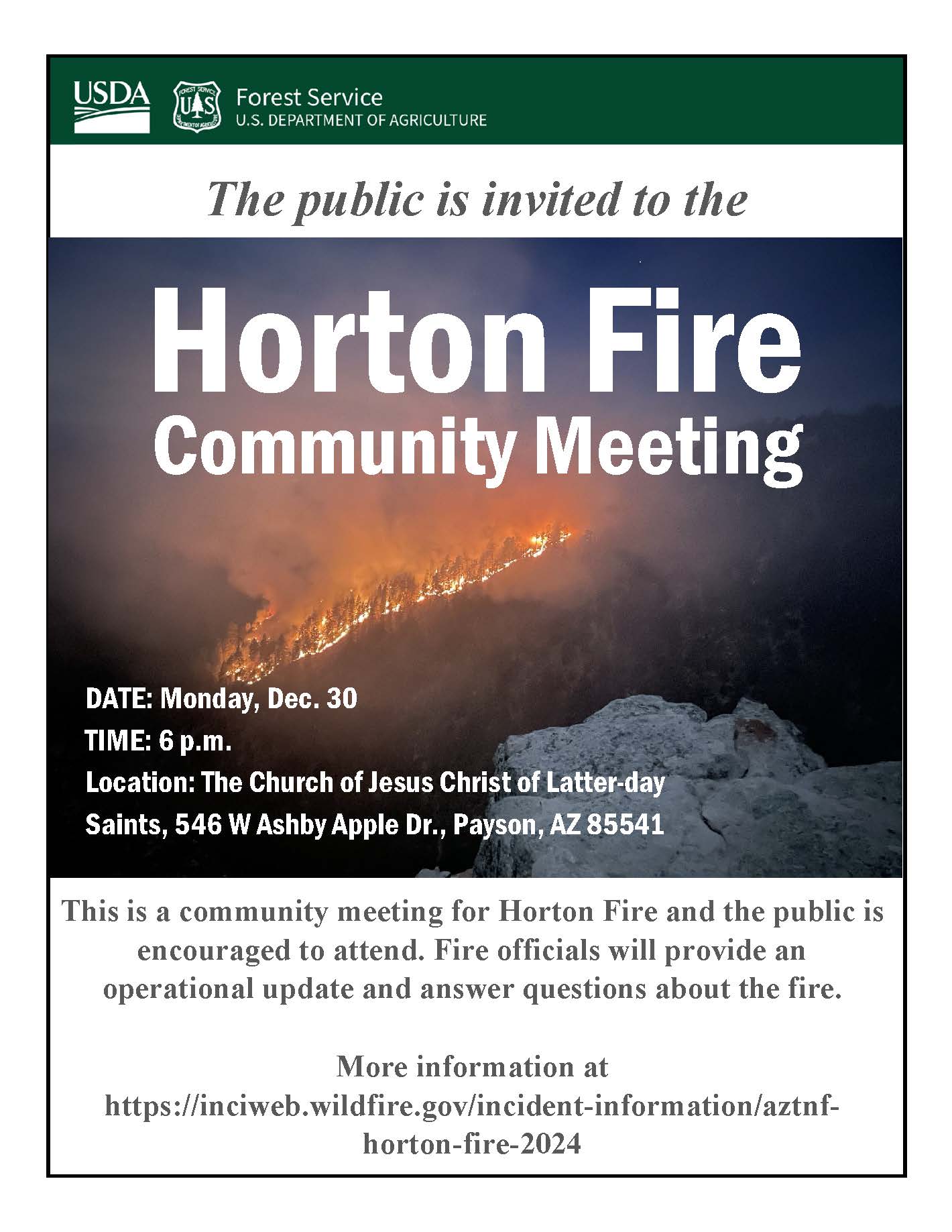
Horton Fire Community Meeting on December 30 2024 12 30 2024
Related Incident: Horton Fire 2024
Publication Type: Announcement
Horton Fire public meeting will take place on Monday, December 30, 2024. The meeting is scheduled for 6 p.m. at The Church of Jesus Christ of Latter-Day Saints, located at 546 W Ashby Apple Dr., Payson, AZ 85541.
Horton Fire Daily Update 12 30 2024
Related Incident: Horton Fire 2024
Publication Type: News
Horton Fire Daily Update
December 30, 2024
Size: 1,095 acres
Cause: Under Investigation
Containment: 17%
Total personnel: 181
Start Date: December 14, 2024
Location: Payson Ranger District, Arizona
Fuels: Ponderosa pine, mixed conifer, chaparral
Highlights: The Horton Fire increased to 1,095 acres and remains at 17% containment. No firing operations occurred on the Horton Fire yesterday.
Tonight’s community meeting is scheduled for 6 p.m. on at The Church of Jesus Christ of Latter-Day Saints, located at 546 W Ashby Apple Dr., Payson, AZ 85541.
Tomorrow, December 31, 2024, Southwest Area Incident Management Team 1 will assume command and management of the Horton Fire.
Operations: Yesterday, crews patrolled the fire area and secured fuel breaks and contingency lines near powerlines and roadways west of Christopher Creek.
Today, increased fire activity is expected near the Promontory Point area, with fire continuing to move east and south along Promontory Point and east of Horton Springs. Crews will assess conditions and conduct firing operations where needed to secure Forest Road 300, FR 76 and other values at risk.
Weather: Today’s forecast calls for sunny skies and high temperatures in the mid-50s to low-60s with relative humidity near 20% and light to moderate winds. Local weather is forecasted to be above average temperature for this time of year with low relative humidity and no precipitation anticipated.
Closures: An emergency closure order for the Horton Fire is in effect from Dec. 18, 2024, to Jan. 31, 2025. The public is asked to avoid the fire area. The purpose of the closure order is to protect public health and safety during the Horton Fire, and to protect assigned firefighting personnel engaging in wildland firefighting operations. Please visit the Alerts and Notices page for more information. https://www.fs.usda.gov/alerts/tonto/alerts-notices. The Tonto Creek Fish Hatchery is also closed due to the Horton Fire.
Safety: The communities of Tonto Creek Estates, Tonto Christian Camp, Tonto Fish Hatchery, and Zane Grey Cabins remain in SET evacuation status. The health and safety of firefighters and the public are always the first priority. Members of the public are asked to avoid the fire area.
Highway closures are not currently in effect due to the Horton Fire. Travelers are encouraged to monitor roadway status and conditions via AZ Department of Transportation at https://www.az511.com/.
Smoke: Increased smoke from the Horton Fire may be visible in the surrounding areas for many days. Smoke Outlook information is available at https://outlooks.wildlandfiresmoke.net/outlook/. Air quality information is available at https://www.azdeq.gov/.
Information Links and Contacts:
Tonto National Forest https://www.fs.usda.gov/tonto
InciWeb https://inciweb.wildfire.gov/incident-information/aztnf-horton-fire-2024
Fire Email 2024.horton@firenet.gov
Fire Information Line (602)-551-7327 • Office Hours: 8 a.m. – 5 p.m.
Horton Fire Daily Update 12 29 2024
Related Incident: Horton Fire 2024
Publication Type: News
Horton Fire Daily Update
December 29, 2024
Size: 1,074 acres
Cause: Under Investigation
Containment: 17%
Total personnel: 169
Start Date: December 14, 2024
Location: Payson Ranger District, Arizona
Fuels: Ponderosa pine, mixed conifer, chaparral
Highlights: The Horton Fire increased to 1,074 acres and remains at 17% containment. Increased activity occurred near the Promontory Point area, with fire continuing to move east and south along Promontory Point and east of Horton Springs.
As a reminder, a community meeting is scheduled for 6 p.m. on Monday, December 30, 2024, at The Church of Jesus Christ of Latter-Day Saints, located at 546 W Ashby Apple Dr., Payson, AZ 85541.
Operations: Yesterday, crews patrolled the fire area and secured handlines and bulldozer control lines. Firefighters also conducted hand ignitions on the 76L road to keep fire west of FR 76. As the region continues to experience above average temperatures and extremely dry conditions, utilizing firing operations helps to contain the fire within planning area. By doing this, firefighters strategically ignite fuels within control lines to meet the main fire with the intent of better controlling the fire’s spread. This tactic is utilized in full suppression fire to “fight fire with fire” and ultimately work toward increasing containment. Today, crews will conduct firing operations where needed to secure Forest Road 300, FR 76 and other values at risk.
Weather: Temperatures will range from the low-30s to high-55s today with relative humidity dropping again, ranging from 20-30%. Light to moderate winds are expected, up to 20mph. Local weather is forecasted to be above average temperature for this time of year with lower relative humidity dropping below 20% over the next seven days.
Closures: An emergency closure order for the Horton Fire is in effect from Dec. 18, 2024, to Jan. 31, 2025. The public is asked to avoid the fire area. The purpose of the closure order is to protect public health and safety during the Horton Fire, and to protect assigned firefighting personnel engaging in wildland firefighting operations. Please visit the Alerts and Notices page for more information. https://www.fs.usda.gov/alerts/tonto/alerts-notices. The Tonto Creek Fish Hatchery is also closed due to the Horton Fire.
Safety: The communities of Tonto Creek Estates, Tonto Christian Camp, Tonto Fish Hatchery, and Zane Grey Cabins remain in SET evacuation status. The health and safety of firefighters and the public are always the first priority. Members of the public are asked to avoid the fire area.
Highway closures are not currently in effect due to the Horton Fire. Travelers are encouraged to monitor roadway status and conditions via AZ Department of Transportation at https://www.az511.com/.
Smoke: Increased smoke from the Horton Fire may be visible in the surrounding areas for many days. Smoke Outlook information is available at https://outlooks.wildlandfiresmoke.net/outlook/. Air quality information is available at https://www.azdeq.gov/.
Information Links and Contacts:
Tonto National Forest https://www.fs.usda.gov/tonto
InciWeb https://inciweb.wildfire.gov/incident-information/aztnf-horton-fire-2024
Fire Email 2024.horton@firenet.gov
Fire Information Line (602)-551-7327 • Office Hours: 8 a.m. – 5 p.m.
Horton Fire Daily Update 12 28 2024
Related Incident: Horton Fire 2024
Publication Type: News
Horton Fire Daily Update
December 28, 2024
Size: 969 acres
Cause: Under Investigation
Containment: 17%
Total personnel: 160
Start Date: December 14, 2024
Location: Payson Ranger District, Arizona
Fuels: Ponderosa pine, mixed conifer, chaparral
Highlights: The current Horton Fire incident management team will begin the processes of transitioning management of the Horton Fire to the Southwest Area Incident Management Team 1 this weekend. Team 1 is scheduled to assume command of the fire early next week.
A community meeting is scheduled for at 6 p.m. on Monday, December 30, 2024, at The Church of Jesus Christ of Latter-Day Saints, located at 546 W Ashby Apple Dr., Payson, AZ 85541.
Operations: The Horton Fire increased to 969 acres and remains at 17% containment with the latest growth observed on the east flank of the fire, northeast of Horton Spring.
Yesterday, crews scouted along underpasses and roadways, continuing to strengthen control lines where needed.
Today, crews will patrol the area to monitor fire growth and complete additional prep work for values at risk including roadways, heritage sites and other infrastructure. Firefighters will initiate firing operations as needed to reduce threats to Forest Road 300, FR 76 and other values at risk. The Horton Fire continues to be managed as a full suppression fire.
Weather: Temperatures will range from the low-30s to mid-50s today with relative humidity dropping to 25-30% and light winds from 5-10mph. Light cloud cover is possible through Sunday.
Closures: An emergency closure order for the Horton Fire is in effect from Dec. 18, 2024, to Jan. 31, 2025. The public is asked to avoid the fire area. The purpose of the closure order is to protect public health and safety during the Horton Fire, and to protect assigned firefighting personnel engaging in wildland firefighting operations. Please visit the Alerts and Notices page for more information. https://www.fs.usda.gov/alerts/tonto/alerts-notices. The Tonto Creek Fish Hatchery is also closed due to the Horton Fire.
Safety: The communities of Tonto Creek Estates, Tonto Christian Camp, Tonto Fish Hatchery, and Zane Grey Cabins remain in SET evacuation status. The health and safety of firefighters and the public are always the first priority. Members of the public are asked to avoid the fire area.
Highway closures are not currently in effect due to the Horton Fire. Travelers are encouraged to monitor roadway status and conditions via AZ Department of Transportation at https://www.az511.com/.
Smoke: Increased smoke from the Horton Fire may be visible in the surrounding areas for many days. More information is available on the Arizona Department of Environmental Quality website at https://www.azdeq.gov/.
Information Links and Contacts:
Tonto National Forest https://www.fs.usda.gov/tonto
InciWeb https://inciweb.wildfire.gov/incident-information/aztnf-horton-fire-2024
Fire Email 2024.horton@firenet.gov
Fire Information Line (602)-551-7327 • Office Hours: 8 a.m. – 5 p.m.
0312002471 Horton Fire Emergency Closure Order for Public Health Safety 12 18 2024
Related Incident: Horton Fire 2024
Publication Type: Closures
This Order shall be in effect from December 18, 2024, at 10:00am through January 31, 2024, at 06:00pm, unless rescinded.
The purpose of this Order is to protect public health and safety due to firefighting operations and fire danger associated with the uncontrolled Horton Fire on the Tonto and Apache-Sitgreaves National Forests.
Recreation Sites that are closed include: Lower and Upper Tonto Creek Campgrounds, Horton Creek Day Use Area, Hatchery Trailhead, Horton Trailhead, See Canyon Trailhead, and See Canyon Trailhead.
Non-Motorized Trails that are closed within the boundary include: Trail 31 Highline, Trail 32 Derrick Spur, Trail 33 Derrick, Trail 184 See Canyon. Trail 185 See Spring, Trail 285 Horton Creek, and Trail 292 Horton Spring.
Routes that remain open include State Route 260, NFS Road 300 (Besides the closed section), and Christopher Creek Loop Road.
Routes along the Described Area boundary that are closed include: NFS Road 289, NFS Road 208S, NFS Road 284, Trail 184 See Spring, Trail 185 See Canyon. A section of route NFS Road 300 is closed between NFS Road 115 and NFS Road 89.
Horton Fire Daily Update 12 27 2024
Related Incident: Horton Fire 2024
Publication Type: News
Horton Fire Daily Update
December 27, 2024
Size: 928 acres
Cause: Under Investigation
Containment: 17%
Total personnel: 150
Start Date: December 14, 2024
Location: Payson Ranger District, Arizona
Fuels: Ponderosa pine, mixed conifer, chaparral
Highlights: The Horton Fire remains at 928 acres with an increase in containment to 17%.
Operations: Yesterday, fire activity primarily occurred on the east end of the fire area, resulting in slow and steady east and south progression northeast of Horton Spring.
Today, increased fire activity and smoke are possible as the region experiences another drying trend, and fuels continue to burn within the rugged terrain of the Mogollon Rim. The remoteness of this area make access challenging and containment of the east flank difficult, but crews continue to monitor conditions. Additional firing operations may occur to reduce threats to Forest Road 300 and FR 76 and other values at risk. Crews will patrol the area, improve containment lines and conduct point protection of infrastructure as needed.
Weather: Temperatures will reach the mid-50s today with relative humidity at 30-40% and light winds from 5-10mph.
Closures: An emergency closure order for the Horton Fire is in effect from Dec. 18, 2024, to Jan. 31, 2025. The public is asked to avoid the fire area. The purpose of the closure order is to protect public health and safety during the Horton Fire, and to protect assigned firefighting personnel engaging in wildland firefighting operations. Please visit the Alerts and Notices page for more information. https://www.fs.usda.gov/alerts/tonto/alerts-notices. The Tonto Creek Fish Hatchery is also closed due to the Horton Fire.
Safety: The communities of Tonto Creek Estates, Tonto Christian Camp, Tonto Fish Hatchery, and Zane Grey Cabins remain in SET evacuation status. The health and safety of firefighters and the public are always the first priority. Members of the public are asked to avoid the fire area.
Smoke: Increased smoke from the Horton Fire may be visible in the surrounding areas for many days. More information is available on the Arizona Department of Environmental Quality website at https://www.azdeq.gov/.
Information Links and Contacts:
Tonto National Forest https://www.fs.usda.gov/tonto
InciWeb https://inciweb.wildfire.gov/incident-information/aztnf-horton-fire-2024
Fire Email 2024.horton@firenet.gov
Fire Information Line (602)-551-7327 • Office Hours: 8 a.m. – 5 p.m.
Horton Fire Daily Update 12 26 2024
Related Incident: Horton Fire 2024
Publication Type: News
Horton Fire Daily Update
December 26, 2024
Size: 928 acres
Cause: Under Investigation
Containment: 15%
Total personnel: 150
Start Date: December 14, 2024
Location: Payson Ranger District, Arizona
Fuels: Ponderosa pine, mixed conifer, chaparral
Highlights: The Horton Fire grew to 928 acres with 15% containment.
Operations: Crews monitored and patrolled yesterday, observing continued slow creeping and smoldering conditions across the majority of the fire area. Smoke production did increase yesterday near East Horton Creek and Horton Spring area between Forest Roads 76U and 76K as fire consumed heavier fuels in drainages. No firing operations occurred.
Today, resources will patrol and secure fireline across the fire area, making improvements where needed and extinguishing hot spots when present. Firing operations may occur on the north end of the fire to manage pockets of unburned fuels that could threaten the 300 Rd.
Crews will hold the fire west of Forest Road 76, north of the Highline Trail and Forest Road 76K, and east of Horton Trail. Ground resources will monitor the fire's eastern spread and prep additional control lines and conduct point protection on infrastructure and other values at risk.
Weather: Temperatures will reach the low 40s today with relative humidity around 40% and light winds.
Closures: An emergency closure order for the Horton Fire is in effect from Dec. 18, 2024, to Jan. 31, 2025. The public is asked to avoid the fire area. The purpose of the closure order is to protect public health and safety during the Horton Fire, and to protect assigned firefighting personnel engaging in wildland firefighting operations. Please visit the Alerts and Notices page for more information. https://www.fs.usda.gov/alerts/tonto/alerts-notices. The Tonto Creek Fish Hatchery is also closed due to the Horton Fire.
Safety: The communities of Tonto Creek Estates, Tonto Christian Camp, Tonto Fish Hatchery, and Zane Grey Cabins remain in SET evacuation status. The health and safety of firefighters and the public are always the first priority. Members of the public are asked to avoid the fire area.
Smoke: Increased smoke from the Horton Fire may be visible in the surrounding areas for many days. More information is available on the Arizona Department of Environmental Quality website at https://www.azdeq.gov/.
Information Links and Contacts:
Tonto National Forest https://www.fs.usda.gov/tonto
InciWeb https://inciweb.wildfire.gov/incident-information/aztnf-horton-fire-2024
Fire Email 2024.horton@firenet.gov
Fire Information Line (602)-551-7327 • Office Hours: 8 a.m. – 5 p.m.
Horton Fire Daily Update 12 25 2024
Related Incident: Horton Fire 2024
Publication Type: News
Horton Fire Daily Update
December 25, 2024
Size: 898 acres
Cause: Under Investigation
Containment: 15%
Total personnel: 150
Start Date: December 14, 2024
Location: Payson Ranger District, Arizona
Fuels: Ponderosa pine, mixed conifer, chaparral
Highlights: The Horton Fire remains at 898 acres with 15% containment with crews remaining on-scene today to monitor the fire.
Operations: Minimal fire activity was observed across the fire area yesterday, including slow creeping and smoldering conditions with short flame lengths less than 1 foot. Crews patrolled and secured the fireline along Forest Road 300 and Highway 260.
Today, resources on the western end of the fire will be patrolling and securing fireline, making improvements where needed and extinguishing hot spots when present. Fire still has potential for continued, though minimal, growth in east Horton drainage. Firefighters will hold fire south of Forest Road 300, east of Horton Trail and north of Highway 260 while conducting point protection as needed on infrastructure and other values at risk.
Weather: Temperatures will range from lows in the 20s to highs in the low 50s with relative humidity at 36-40% today. Wind gusts up to 25mph are expected today with light precipitation through tomorrow. No snow accumulation or significant wetting rain is expected.
Closures: An emergency closure order for the Horton Fire is in effect from Dec. 18, 2024, to Jan. 31, 2025. The public is asked to avoid the fire area. The purpose of the closure order is to protect public health and safety during the Horton Fire, and to protect assigned firefighting personnel engaging in wildland firefighting operations. Please visit the Alerts and Notices page for more information. https://www.fs.usda.gov/alerts/tonto/alerts-notices. The Tonto Creek Fish Hatchery is also closed due to the Horton Fire.
Safety: The communities of Tonto Creek Estates, Tonto Christian Camp, Tonto Fish Hatchery, and Zane Grey Cabins remain in SET evacuation status. The health and safety of firefighters and the public are always the first priority. Members of the public are asked to avoid the fire area.
Smoke: Light smoke from the Horton Fire may be visible in the surrounding areas for many days. More information is available on the Arizona Department of Environmental Quality website at https://www.azdeq.gov/.
Information Links and Contacts:
Tonto National Forest https://www.fs.usda.gov/tonto
InciWeb https://inciweb.wildfire.gov/incident-information/aztnf-horton-fire-2024
Fire Email 2024.horton@firenet.gov
Fire Information Line (602)-551-7327 • Office Hours: 8 a.m. – 5 p.m.
Horton Fire Daily Update 12 24 2024
Related Incident: Horton Fire 2024
Publication Type: News
Horton Fire Daily Update
December 24, 2024
Size: 898 acres
Cause: Under Investigation
Containment: 15%
Total personnel: 139
Start Date: December 14, 2024
Location: Payson Ranger District, Arizona
Fuels: Ponderosa pine, mixed conifer, chaparral
Highlights: The Horton Fire is currently 898 acres with 15% containment. A weather shift is expected through Christmas Day, with cooler temperatures and increased humidity forecasted. Crews will remain on-scene throughout Christmas Eve and Christmas Day.
Operations: Fire activity remained moderate yesterday with personnel observing smoldering conditions and minimal spread across the fire area. Crews patrolled the area and identified several areas of containment on the northwest and western perimeter. Firefighters also conducted additional prep work on the north end of the fire and completed fireline around the Christopher Creek Community to Highway 260.
Today, crews will focus efforts on the north and western portions of the fire, monitoring conditions and taking action as needed. Firefighters will patrol and hold the line, cold-trailing and extinguishing hot spots where present throughout the holiday. Fire is expected to make continued, though minimal, growth in east Horton drainage.
Weather: Temperatures will continue to drop through mid-week as a cold front moves into the region. Temperatures will remain in the mid-50s to low 60s today, dropping to low 40s-mid 50s by Christmas day and lows in the 20s at night. Winds will increase to 10-20mph with higher gusts possible. Relative humidity will also increase, bringing with it a potential for light precipitation (tenth of an inch of rain in lower elevations and snow in higher elevations). No snow accumulation or significant wetting rain is expected.
Closures: An emergency closure order for the Horton Fire is in effect from Dec. 18, 2024, to Jan. 31, 2025. The public is asked to avoid the fire area. The purpose of the closure order is to protect public health and safety during the Horton Fire, and to protect assigned firefighting personnel engaging in wildland firefighting operations. Please visit the Alerts and Notices page for more information. https://www.fs.usda.gov/alerts/tonto/alerts-notices. The Tonto Creek Fish Hatchery is also closed due to the Horton Fire.
Safety: The communities of Tonto Creek Estates, Tonto Christian Camp, Tonto Fish Hatchery, and Zane Grey Cabins remain in SET evacuation status. The health and safety of firefighters and the public are always the first priority. Members of the public are asked to avoid the fire area.
Smoke: Smoke from the Horton Fire may be visible in the surrounding areas for many days. Smoke will be heavier in the mornings as it settles into the lower elevations and will lift as temperatures increase. Smoke-sensitive individuals and people with respiratory problems or heart disease are encouraged to take precautionary measures. Learn more about smoke impacts on the Arizona Department of Environmental Quality website at https://www.azdeq.gov/.
Information Links and Contacts:
Tonto National Forest https://www.fs.usda.gov/tonto
InciWeb https://inciweb.wildfire.gov/incident-information/aztnf-horton-fire-2024
Fire Email 2024.horton@firenet.gov
Fire Information Line (602)-551-7327 • Office Hours: 8 a.m. – 5 p.m.