
Welder Fire Evacuations March 4 2024 03 05 2025
Related Incident:
Publication Type: Announcement
Evacuation Orders for Welder Fire
Currently there is an evacuation order put in place for the Welder Fire. The area currently under evacuation orders is east of Business Highway 77, north of US Highway 181, south of Chiltipin Creek, and west of TX-89. Residents within this area are advised to evacuate the area and take shelter at the San Patricio County Fairgrounds where there are organizations set up to care for evacuees.
Residents should take with them their pets and family members, enough personal items (changes of clothes, toothbrush, toothpaste) for 24-48 hours, and prescriptions they may need, personal documents (social security cards, birth certificates), and priceless items with them. These evacuations orders have been issued with the public's safety in mind as firefighters are working tirelessly to protect the public and their structures.
Dawson pile burn update 342025 03 04 2025
Related Incident:
Publication Type: News
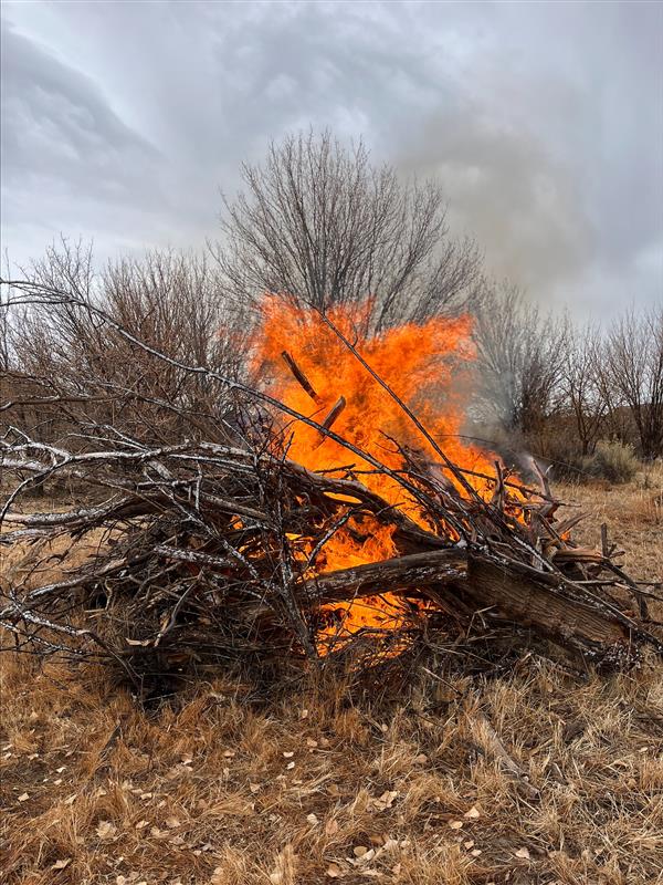
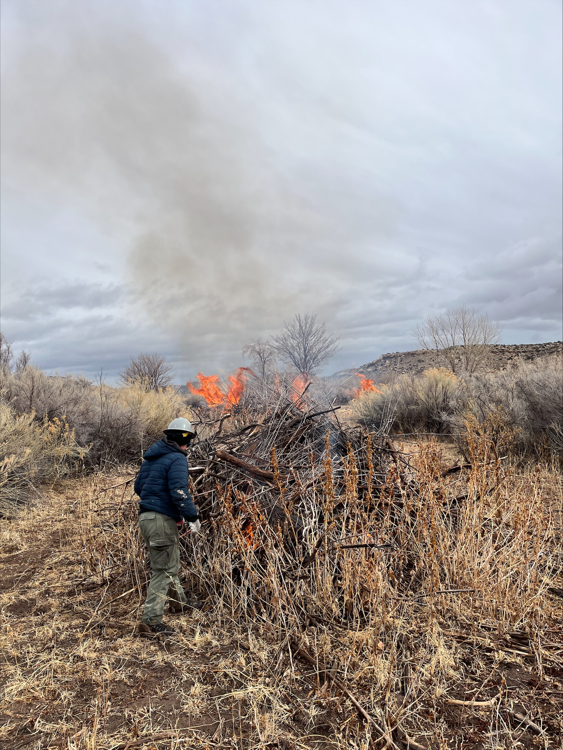
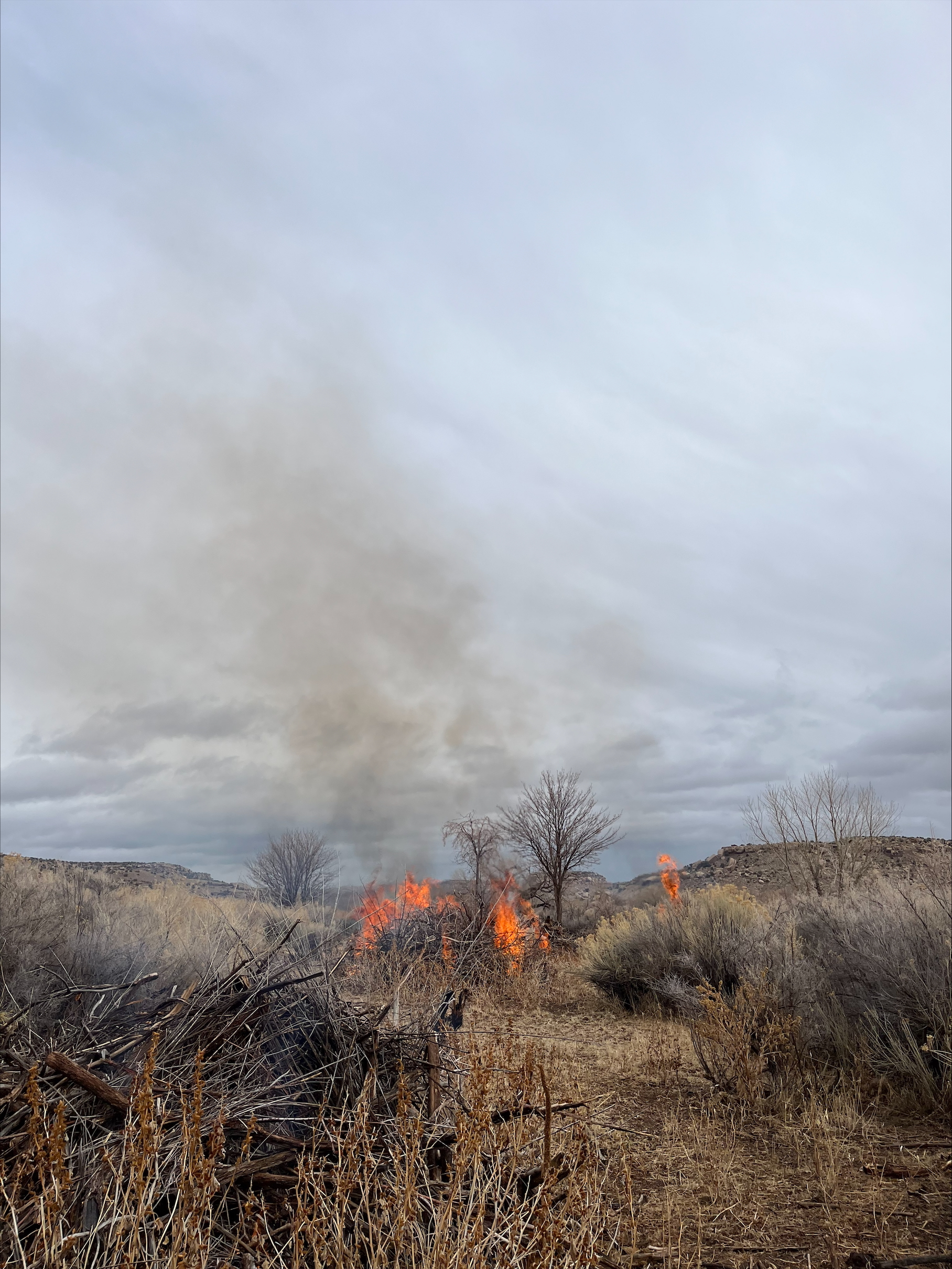
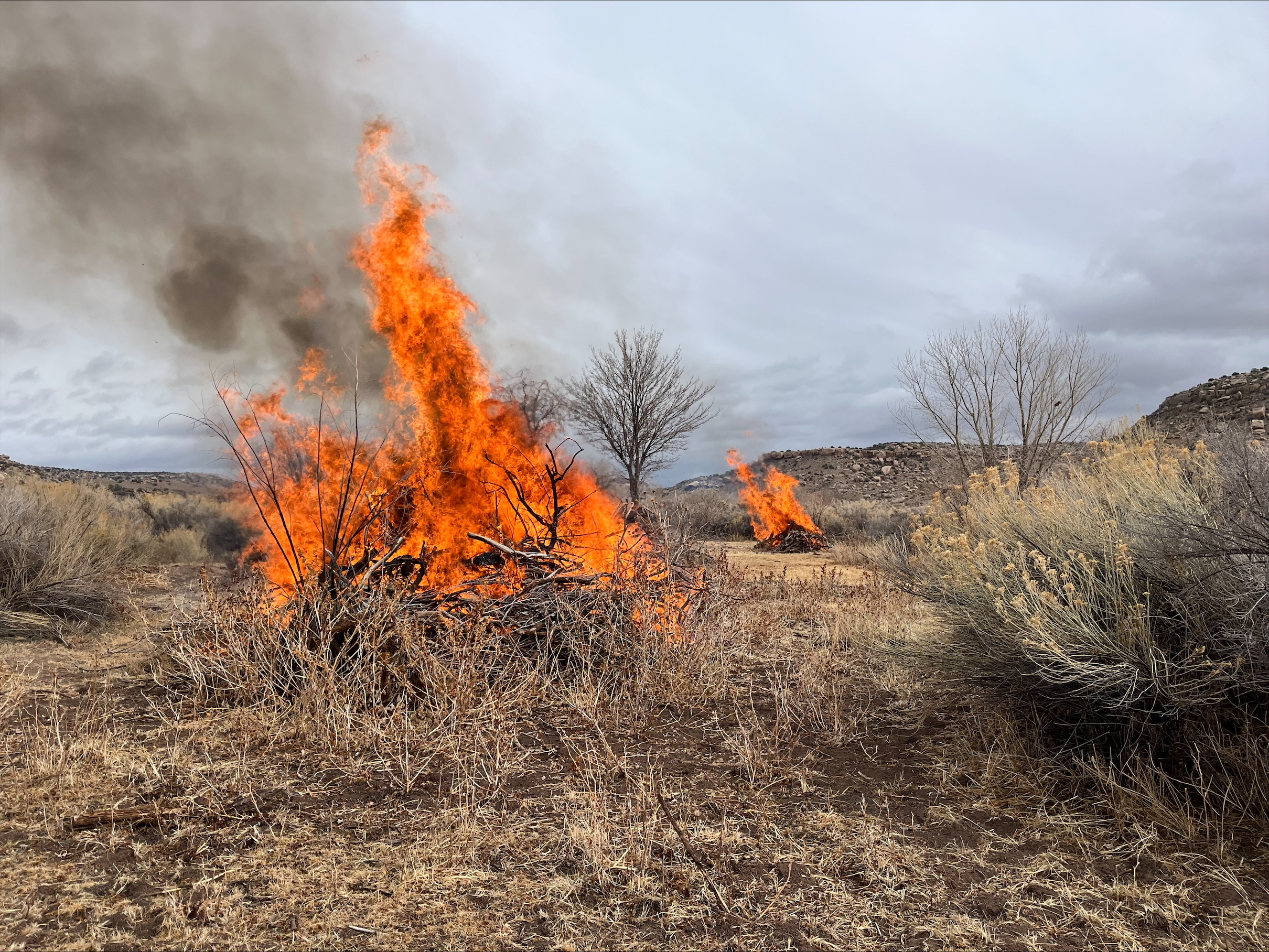
Recent snowfall has made pile burning conditions favorable. BLM Southwest Fire will be conducting a prescribed pile burn on the Dawson vegetation project located in the Tres Rios Field Office today (3/4/2025) through the remainder of the week. Fire crews will hand light slash piles and will remain on scene to monitor the fire activity. Smoke from the pile burn will be visible throughout the day of the burn, mostly during the warmest part of the day. With cooler temperatures in the evening, smoke may linger and accumulate in low-lying areas.
Yellow Jacket Pile Burn Update 03 04 2025
Related Incident:
Publication Type: News
BLM fire crews took full advantage of the weather conditions to successfully complete the Yellow Jacket pile burn. A total of 30 piles were ignited over 20 acres. Fire crews remained on scene throughout the day patrolling the burn area. Fire crews will continue to return to the burn area to monitor and patrol.
Smoke may still linger during the heat of the day and accumulate in low-lying areas a few days after the burn. The completion of the Yellow Jacket project is an ongoing effort to reduce the hazardous fuel loading and the elimination of noxious and invasive plants from public lands.
Combs Fire Final Update 1200 PM 342025 03 04 2025
Related Incident:
Publication Type: News
Combs Fire Final Update
Containment: 100%
Size: 375 acres
This morning, fire personnel reported beneficial rainfall over the Combs fire area. No fire activity or concerns were noticed. Crews monitored and patrolled the fire into the afternoon until comfortable to release resources from the fire. South flank of the fire was secured and there are no concerns of rekindle.
Prescribed Fire Updates 03 04 2025
Related Incident: Mendocino NF Fall 2024/Spring 2025 Prescribed Fire Projects
Publication Type: News
Starting today through Thursday, firefighters on the Grindstone Ranger District plan to burn piles in the Letts Lake basin, potentially 20 acres pending favorable conditions. Firefighters are taking advantage of cool and wet weather conditions to burn piles in preparation of future reforestation in these units.
Please avoid areas where burning operations will be taking place. Some smoke may be visible. People should not be alarmed as the fires are carefully monitored. Local fire and government authorities are notified prior to burn days and kept informed throughout prescribed fire operations.
Maps of pile burn operations can be found on Inciweb under the Maps tab.
HUGHES POSTFIRE BAER ASSESSMENT REPORT SUMMARY RELEASED 03 04 2025
Related Incident: Hughes Post-Fire BAER
Publication Type: News
HUGHES POST-FIRE BAER ASSESSMENT REPORT SUMMARY RELEASED
The Forest Service—Angeles National Forest completed a Burned Area Emergency Response (BAER) post-fire assessment of the Hughes Fire burn area and affected watersheds to determine their response, soil conditions, potential threats, and recommended BAER emergency stabilization measures and actions on National Forest System (NFS) lands. BAER emergency treatments and activities are designed to decrease possible impacts to critical values from the burned areas during rainstorm events such as: human life and safety, property, critical natural resources, and cultural resources.
NOTE: Attached below as “Related Information” is a PDF documents called “Hughes Post-Fire BAER Assessment Summary Report_PUBLIC”.
BAER SAFETY MESSAGE: Everyone near and downstream from the burned areas should remain alert and stay updated on weather conditions that may result in heavy rains and increased water runoff. Flash flooding may occur quickly during heavy rain events--be prepared to act and note emergency alerts issued by Los Angeles County. Current weather and emergency notifications can also be found at the National Weather Service website: www.weather.gov/lox/.
Combs Fire 342025 845 AM Update 03 04 2025
Related Incident:
Publication Type: News
Combs Fire
Containment: 75%
Size: 357 acres
Cause Unknown
Last night 3/3/2025, fire crews stopped forward progression of the fire around midnight and continued to improve fire line construction where they could, but rough terrain and night conditions made it harder for effective work to be done. Crews were released from the fire at 1:30 am, after fire conditions diminished and forward progression was stopped.
For today 2/4/2025, plan is to secure lines on the south flank of the fire due to the high northwest wind shift that the fire area experienced this morning. Aviation was requested this morning for tactical use over the fire area, but as winds got higher this morning air craft was cancelled. Drizzling was reported over the fire area this morning. Crews are going to continue mopping up and improving lines where needed.
All roads in fire area have been reopened at this time.
March 4 St Regis Compound Pile Burn 03 04 2025
Related Incident:
Publication Type: Announcement
Conditions permitting, the Superior Ranger District will conduct pile burning tomorrow, March 3 to reduce the fuel loading created from Compound clean up.
Superior Ranger District: Firefighters will burn up to 10 acres of piles at the St. Regis Compound located ¾ miles northwest of St. Regis. Smoke may be visible from St. Regis and Interstate 90.
Prescribed fire is implemented in compliance with Montana air quality standards and coordinated with the Montana Department of Environmental Quality and the appropriate county health departments to minimize the impacts of smoke.
Prescribed Fire Updates 03 03 2025
Related Incident: Mendocino NF Fall 2024/Spring 2025 Prescribed Fire Projects
Publication Type: News
Today on the Upper Lake Ranger District, firefighters will attempt up to 12 acres of pile burning in the North Shore project, pending favorable conditions. The unit is located above High Valley Ridge across from the Lakeview Campground. Firefighters are taking advantage of a short break in wet weather to burn these hand piles in preparation of future tree planting. Communities in the North Shore may see smoke but should not be alarmed as prescribed fire activities are closely monitored.
Please avoid areas where prescribed fire activities are happening. Maps of pile burn operations can be found on Inciweb under the Maps tab.
Prescribed Fire Updates 02 26 2025
Related Incident: Mendocino NF Fall 2024/Spring 2025 Prescribed Fire Projects
Publication Type: News
Today on the Grindstone Ranger District, firefighters will attempt burning up to 52 acres of piles along the M5 Road and at administrative sites, Paskenta Station and Stonyford Station. Pending favorable conditions, firefighters will continue pile burning tomorrow in units along the M5 Road.
Firefighters on the Upper Lake District have completed 42 acres of pile burning along the M1 Road since last week. The district is looking at additional burning opportunities next week in the North Shore project area.
Please avoid areas where prescribed fire activities are happening. Maps of pile burn operations can be found on Inciweb under the Maps tab.