
Highlighted Activity
Highlighted Media
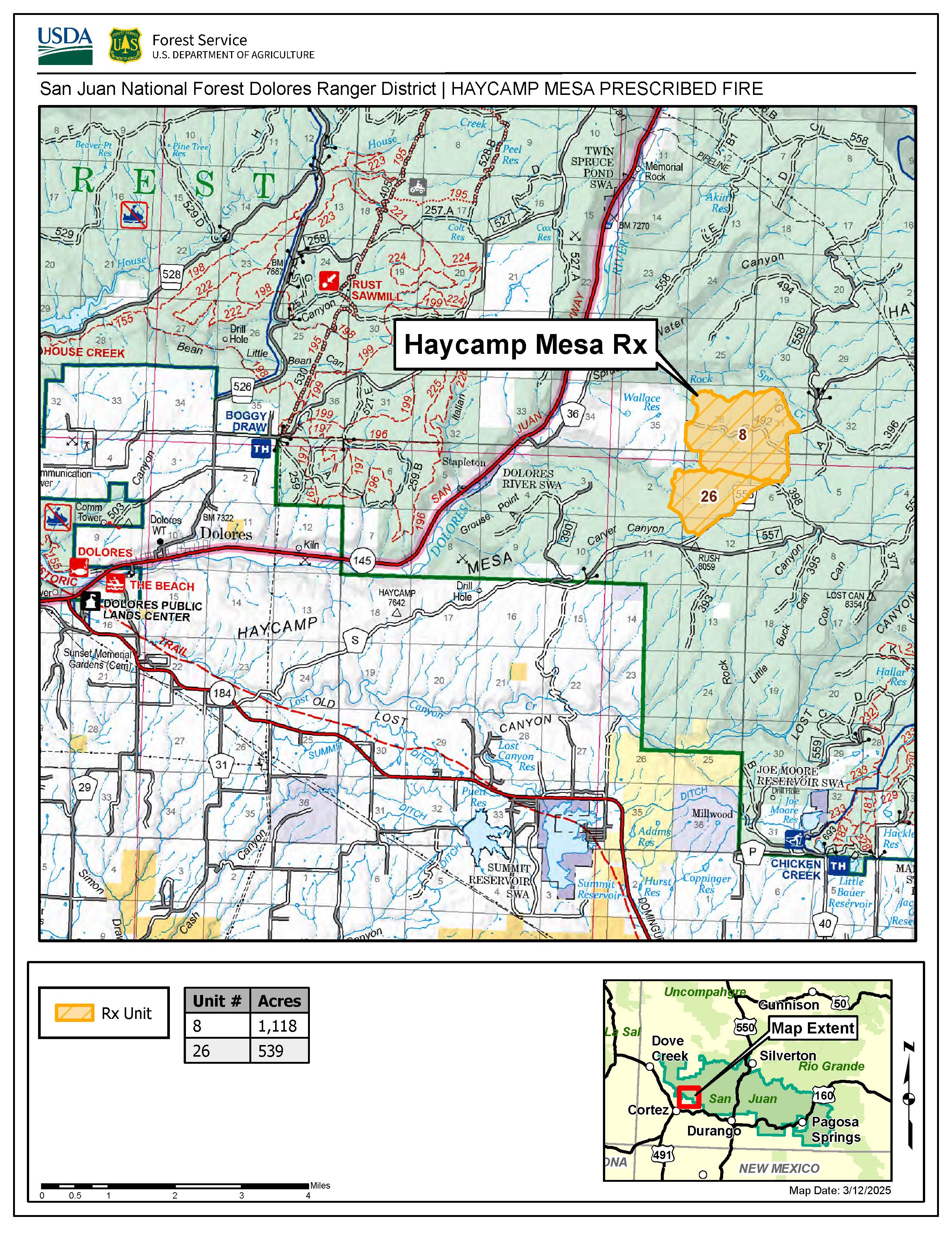
Haycamp Mesa Prescribed Fire map, located on the San Juan National Forest Dolores Ranger District
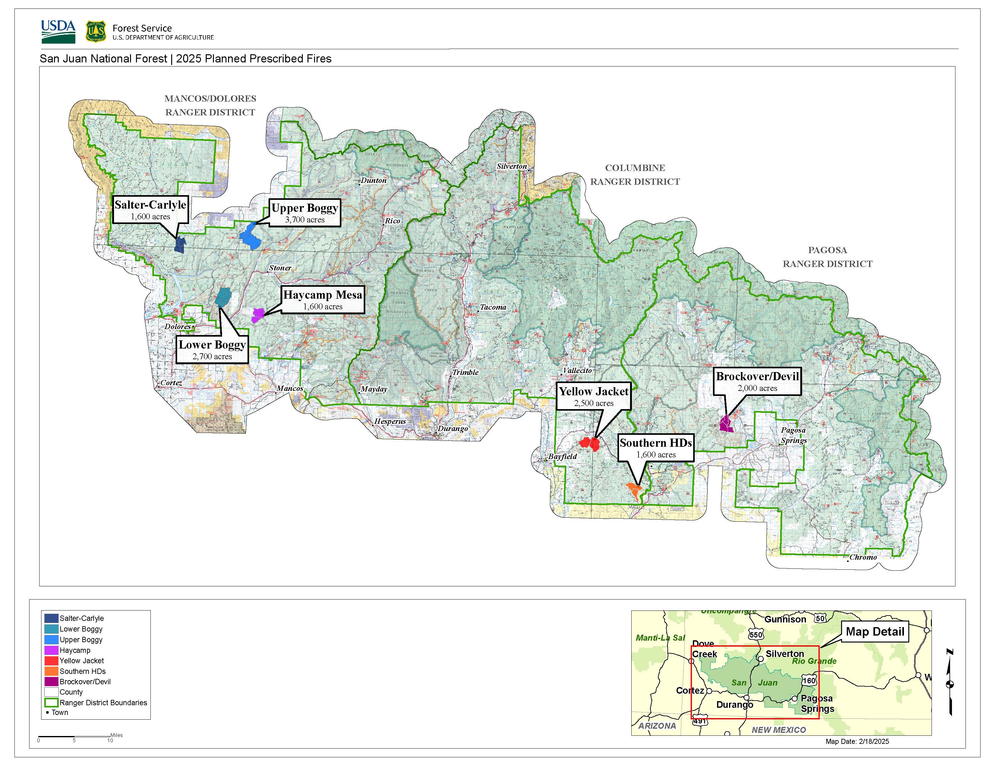
Map of all planned prescribed fires on San Juan NF in 2025
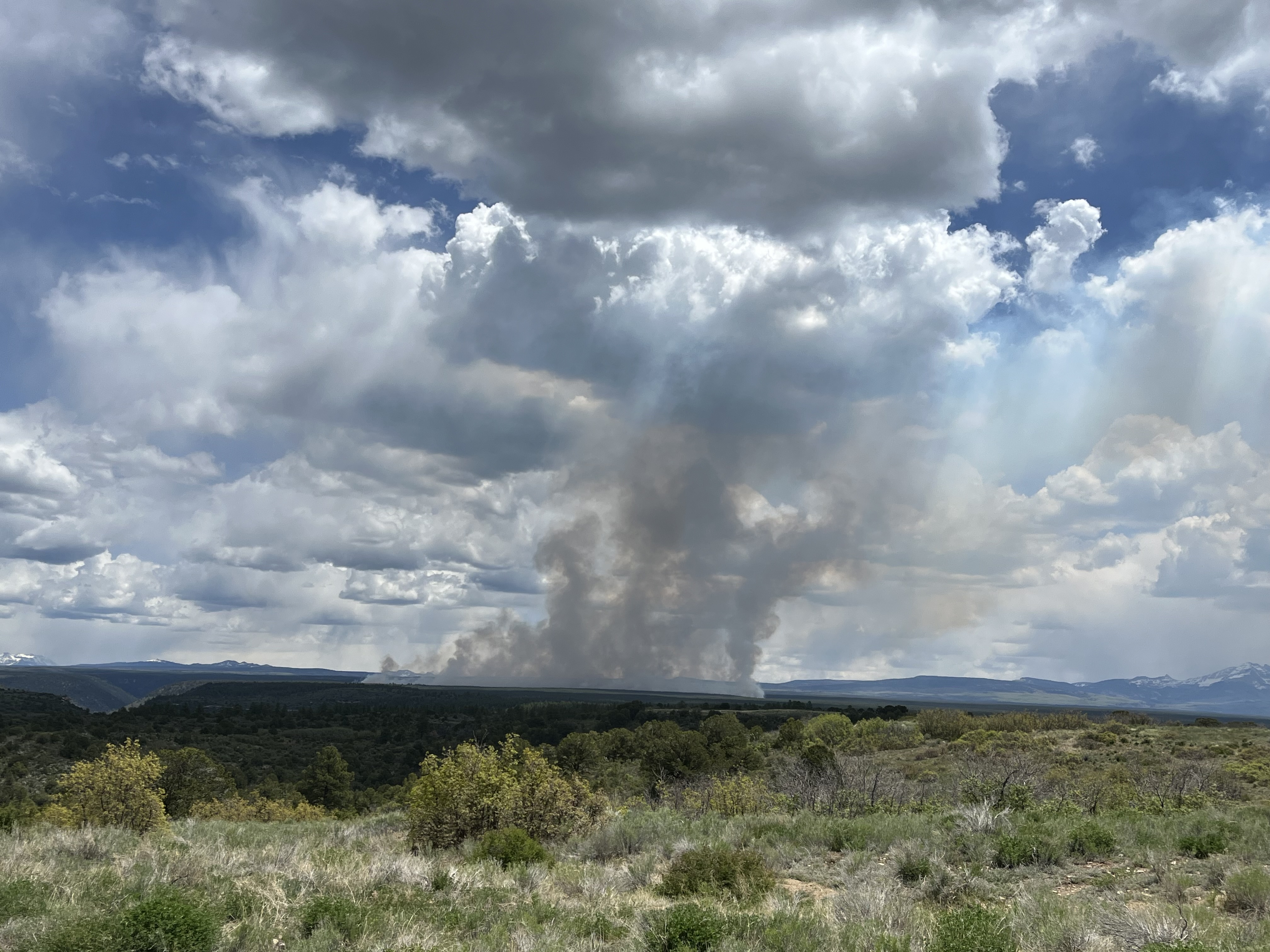
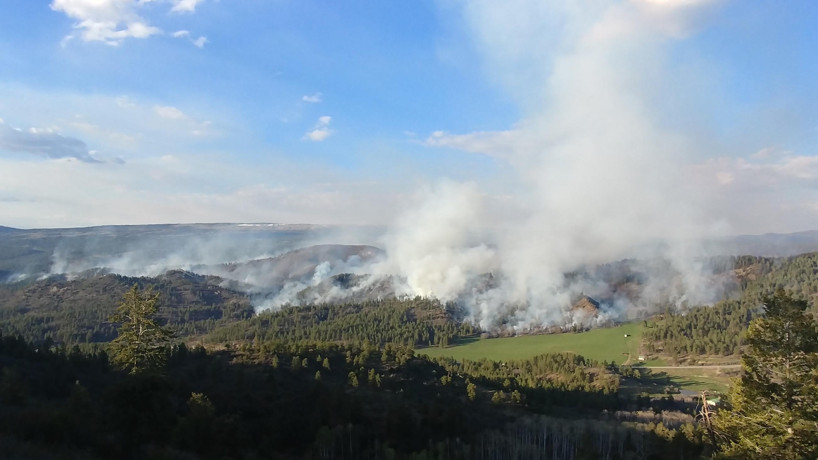
A dispersed smoke column ascends from the 2025 Haycamp Mesa Prescribed Fire
The 2025 prescribed fire season continues. Fire personnel will carry out prescribed fires as weather, fuel, and the availability of fire resources permit.
The forests in Southwest Colorado are part of a fire-adapted ecosystem, which historically experienced frequent, low intensity fires on a large scale. Prescribed fire replicates that fire regime and increases the area on our landscape that has been burned at low and moderate conditions.
Reintroduction of prescribed fire is necessary to improve and restore vegetative conditions. This effort will reduce hazardous ground fuels, lessen the risk of unplanned large-scale wildfire, help restore ponderosa pine ecosystems, and improve wildlife habitat. Prescribed fire also reduces the ladder fuels that can carry fire into the canopy, killing mature trees.
2025 Spring Broadcast Burning Plans
Dolores Ranger District (see full news release):
- Haycamp Mesa, 1,657 acres COMPLETED MAY 27. 5/29: Smoke is still visible on the prescribed fire from smoldering vegetation interior in the unit. Resources remain on scene mopping up and securing fire line.
- Located 10 miles east of Dolores, along the Haycamp Mesa Road, National Forest Service Road (NFSR) 556
- Much of the targeted area has been treated with previous timber sales and pile burning, resulting in lighter fuel loading. Burning under the right conditions helps keep our forest healthy and reduces the risk of bigger, catastrophic fires in the future.
- Prescribed Fire season is often the cusp of wildfire season in order to achieve the desired effect. Fire managers are taking precautions to ensure a safe operation. 85 personnel will be staffing this prescribed fire, well above the minimum required organization of 30 considered adequate for the operation as well as initial attack of new wildfire starts.
------------------------------------
2025 Broadcast Burning Accomplishments:
Dolores Ranger District:
- Boggy Draw, 1,579 acres accomplished as of May 19, 2025
------------------------------------
2024/25 Winter Pile Burning Accomplishments
Dolores Ranger District
- Haycamp Mesa area (250 acres, 800 piles) near FSRs 556, 556.G and 492, south of Beef Pasture Reservoir COMPLETED
- Taylor Mesa area (390 acres, 134 piles) near FSRs 545 and 545.J COMPLETED
Pagosa Ranger District
- Kenney Flats, 30 acres COMPLETED
- Quartz Piles, 20 acres COMPLETED
Columbine Ranger District:
- Saul’s Creek (50 acres, 100 piles) near FS road 755 COMPLETED
- Fossett Gulch (17 acres, 100 piles) near FS road 841 COMPLETED
- Baldy Mountain (117 acres, 10 piles) near FS roads 69 and 601 COMPLETED
------------------------------------
2024 Broadcast Prescribed Fire Accomplishments:
DOLORES RANGER DISTRICT:
- Boggy Draw: 1,156 acres
- Salter Y Units 34 and 37: 1,279 acres
COLUMBINE RANGER DISTRICT:
- Vallecito-Piedra: 235 acres
- Saul's Creek: 1,615 acres
- Southern HDs: 1,080 acres
PAGOSA RANGER DISTRICT:
- Fawn Gulch 1,100 acres
- Mill Creek: 400 acres
------------------------------------
2023/24 Winter Pile Burning Accomplishments:
DOLORES RANGER DISTRICT:
- Haycamp Mesa area (427 acres, 750 piles) near FSRs 556 and 492, south of Beef Pasture Reservoir
- Taylor Mesa area (145 acres, 44 piles) near FSRs 545 and 692
- Salter area (321 acres, 267 piles) near FSRs 514, 504, 519 and 293, northwest of Salter Y
- Lake Canyon area (518 acres, 336 piles) near FSRs 506, 504, 508, 514, 215, and 216 near Cow Canyon
COLUMBINE RANGER DISTRICT:
- Sauls Creek (110 acres, 1800 piles) near FS roads 755, 755.A, 131, and 131.C
- Junction Creek (90 acres, 75 piles) near FS road 171, in the Log Chutes trail area
- Fossett Gulch (40 acres, 100 piles) near FS roads 613 and 841
- Baldy Mountain (623 acres, 60 slash piles) off of Beaver Meadows Road
PAGOSA RANGER DISTRICT:
- Lower portion of Turkey springs Road (FSR 629) near the powerlines
- Turkey Springs Road near the Turkey Springs Guard Station
- Brockover Road (FSR 919), Buckles Lake Road (FSR 633)
- Huerto Creek timber sale between Piedra Road (FSR 621) and Poison Park Road (FSR 644)
| Current as of | Thu, 05/29/2025 - 11:53 |
|---|---|
| Incident Type | Prescribed Fire |
| Date of Origin | |
| Location | San Juan National Forest |
| Coordinates |
37° 16' 24.2796'' Latitude
-107° 53' 34.8822
'' Longitude
|