Incident Media Maps
Settings - change map background and toggle additional layers
Filter - control incident types displayed on map.
Zoom to your location
Reset map zoom and position
Could not determine your location.
Show Legend
 Wildfire
 Prescribed Fire
 Burned Area
Response
Burned Area
Response Other
Other
Maps Gallery
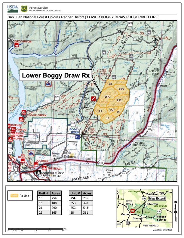
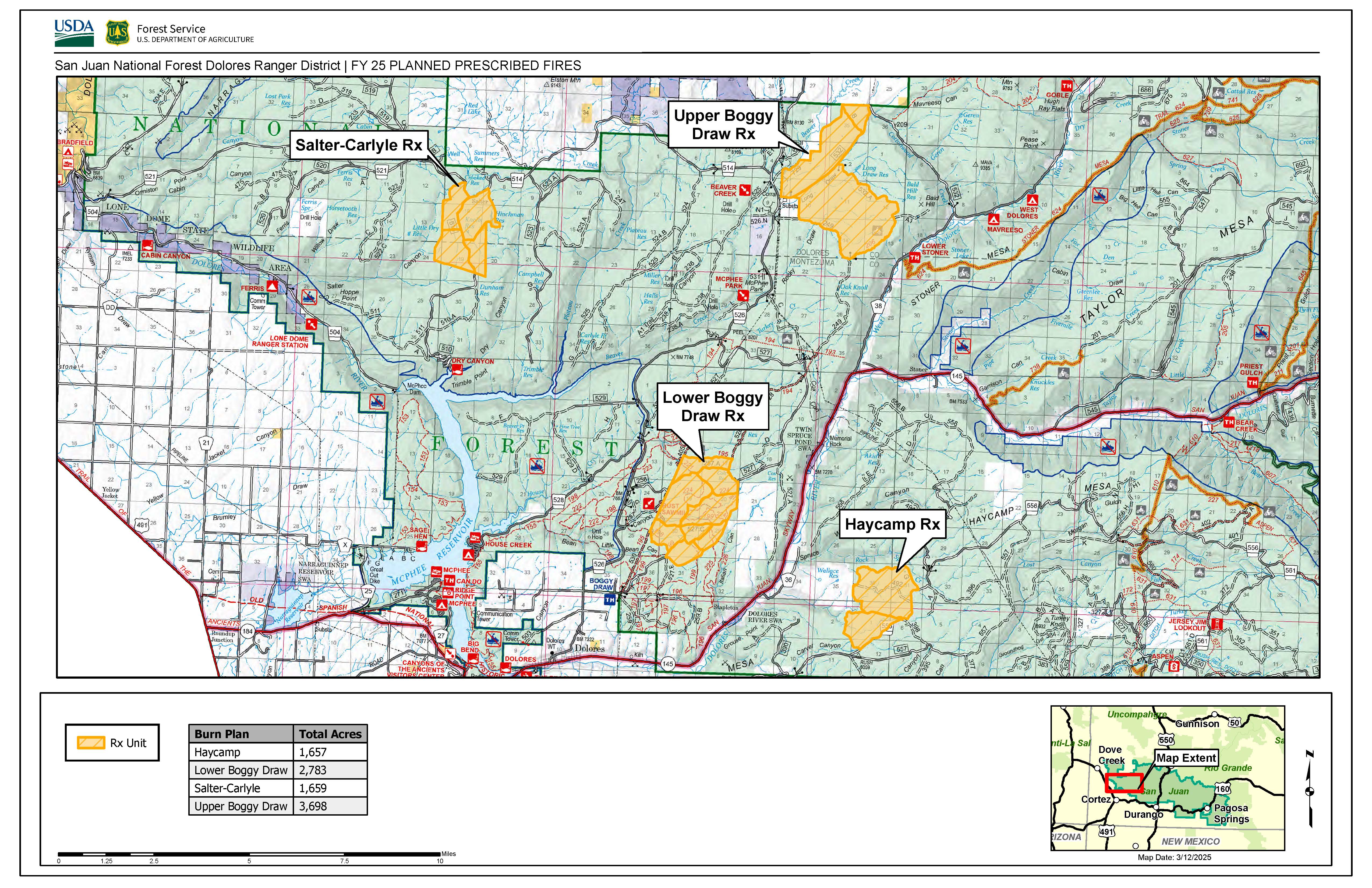
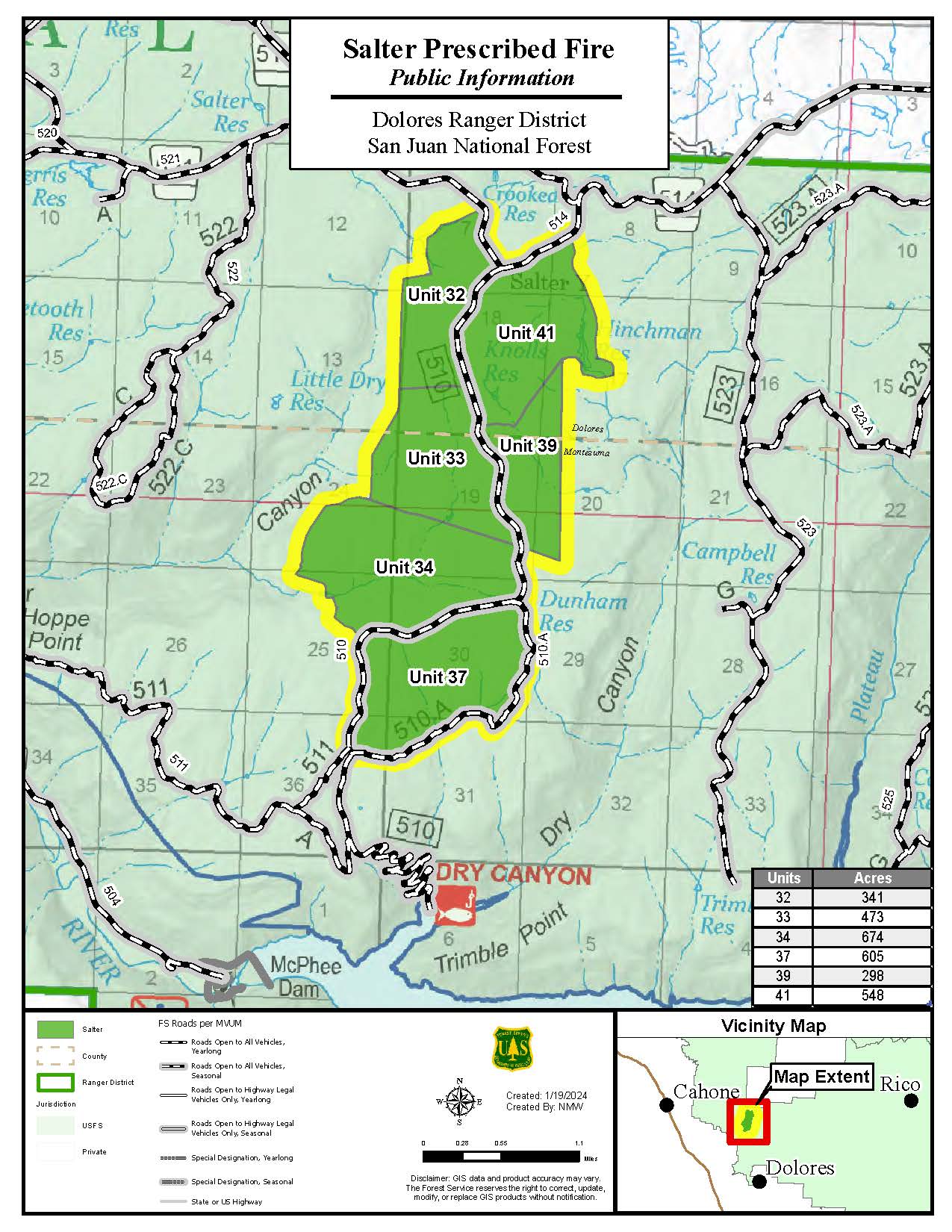
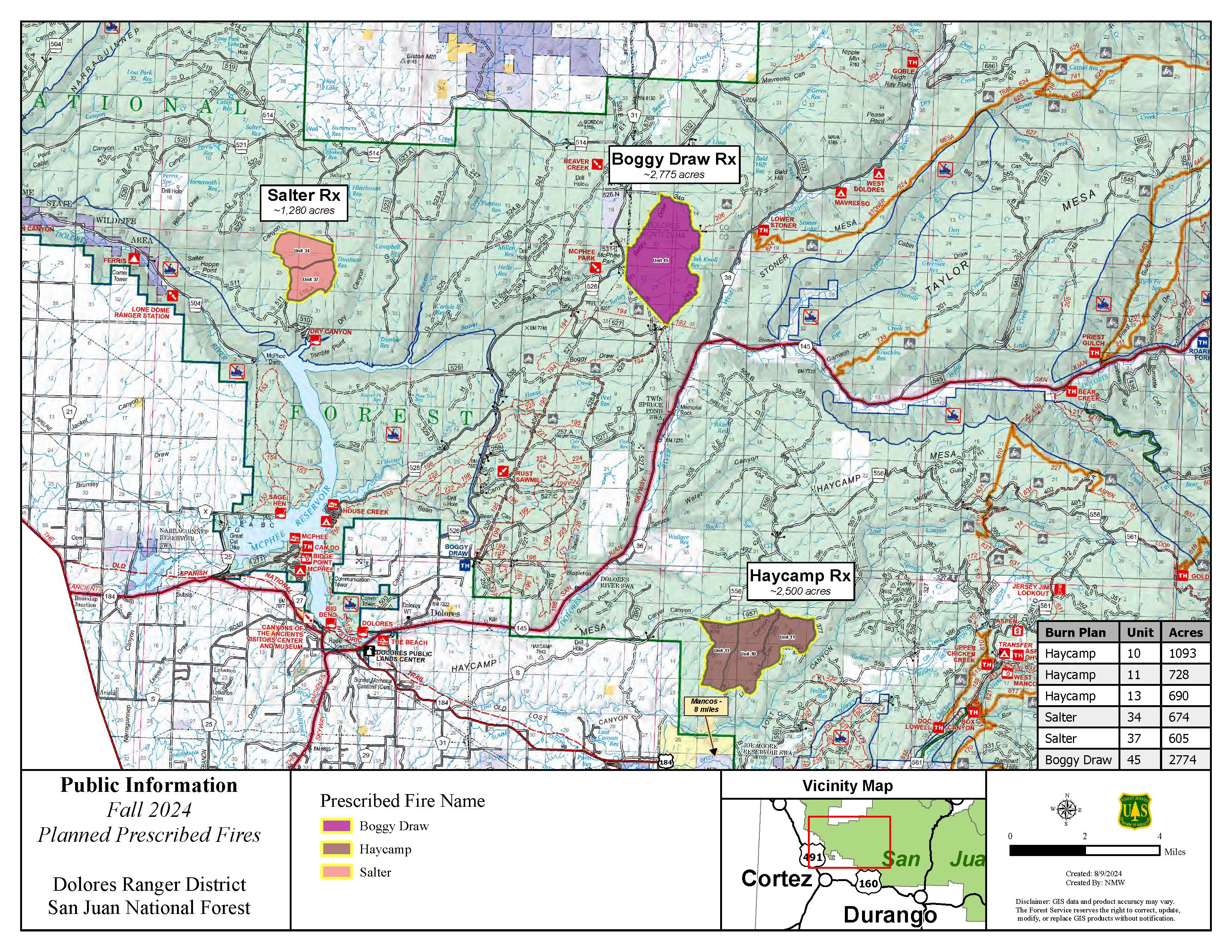
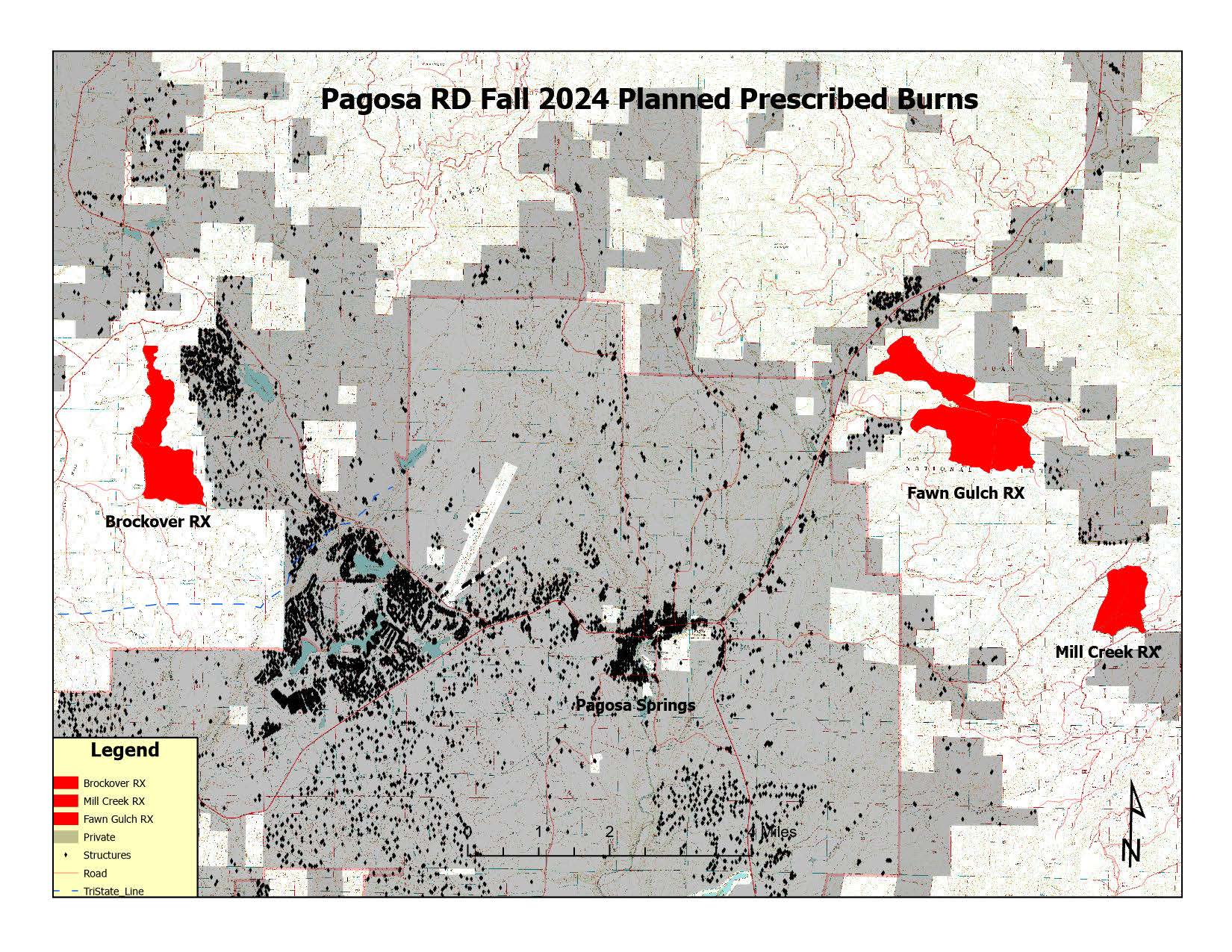
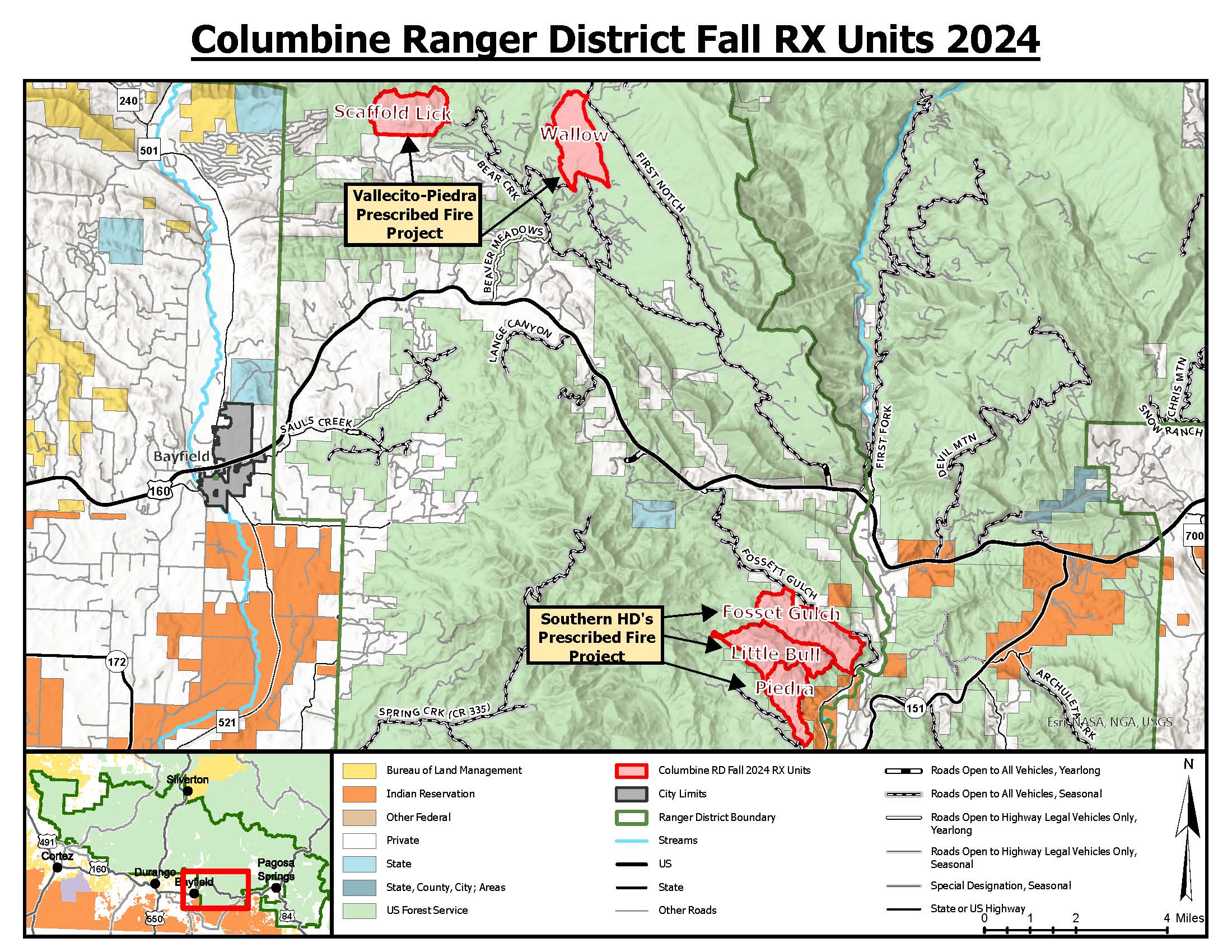
The Dolores Ranger District is planning to conduct a prescribed burn in the Boggy Draw area, approximately 6.3 miles Northeast of Dolores, starting Wednesday May 14th. The area targeted sits on the eastern portion of Boggy Draw northeast of Forest Service System Road 257 A, and west of Road 527 (referenced in the attached map). The planned burn is on Unit 28, approximately 311 acres, pending favorable conditions and smoke limitations. This will be done with hand ignitions, burning in ponderosa pine and Gambel oak understory.