U.S. flag

An official website of the United States government

Here's how you know

Single Incident Information

Zoom to your location
Reset map zoom and position

Could not determine your location.

Davis Fire

Unit Information

1200 Franklin Way 
Sparks, 
Nevada 
89431 
1200 Franklin Way 
Sparks, 
Nevada 
89431 

Incident Contacts

Davis Fire Public Information Hotline
Email: 2024.Davis@firenet.gov
Phone: 775-446-5520
Hours: 8am-8pm

Highlighted Activity

An emergency area closure has been put in place for the safety of the public and firefighters suppressing the Davis Fire in southwest Reno, Nevada. All road, trails, develop recreation sites within this area are closed. The closure boundary runs along the Hunter Creek Trail to the north, Nevada State Route 877 (Franktown Road) to the south, the Forest’s boundary to the east, and U.S. Interstate… Read more
Publication Type: Closures -
A Forest Service Burned Area Emergency Response (BAER) team has been established by the Humboldt-Toiyabe National Forest to begin a post-fire burned area assessment of National Forest System lands that burned in the Davis Fire. BAER assessments can take up to two weeks to complete depending on size and complexity of the fire.“BAER is an emergency program that conducts a risk assessment and… Read more
Publication Type: News -
Any National Forest System lands within the Davis Fire burned area remains closed. This includes Forest Service roads 41040, 41041, and 41727, as well as the Ophir Creek Trail. For detail information on the Davis Fire:• Inciweb: https://inciweb.wildfire.gov/incident-information/nvhtf-davis-fire
Publication Type: Announcement -

Highlighted Media

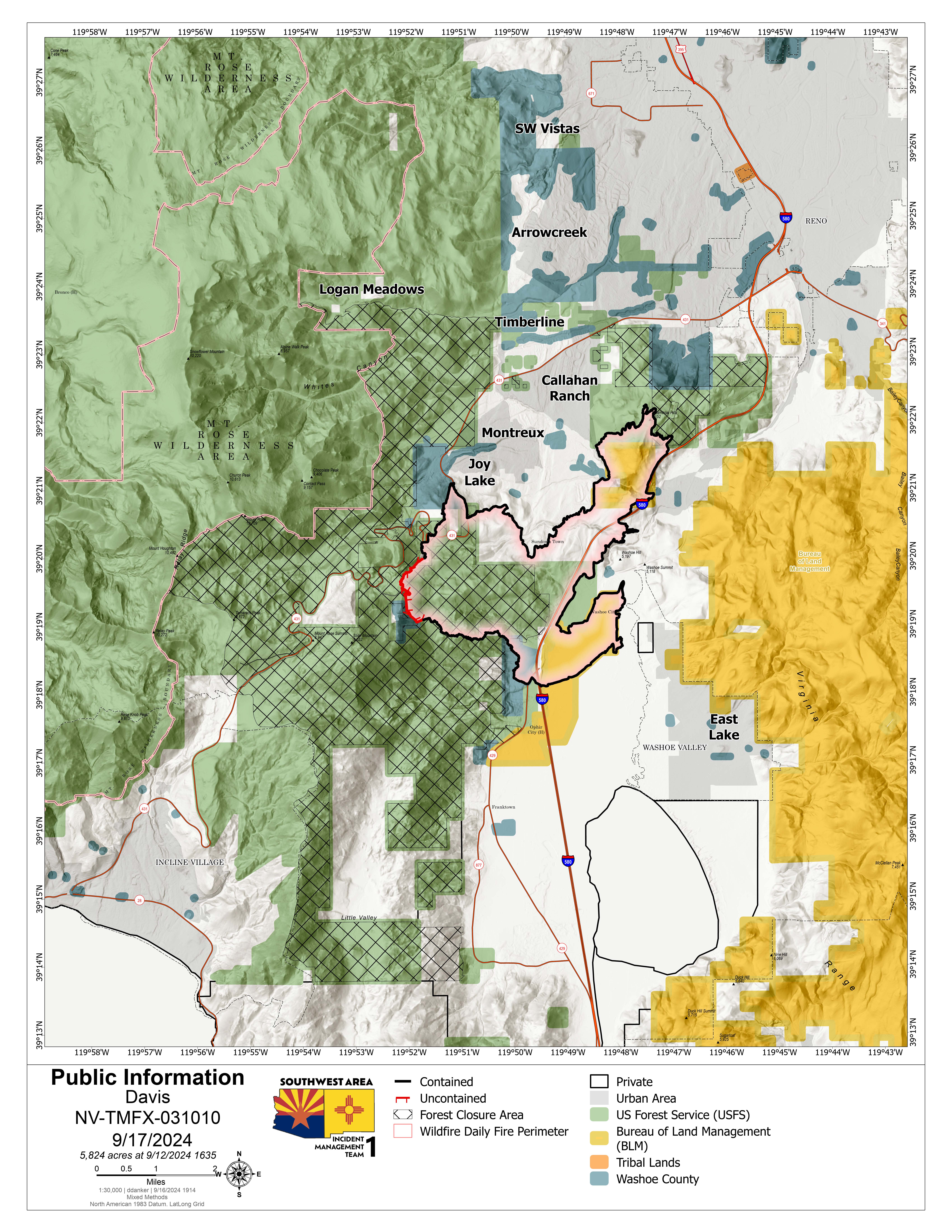
On Sept. 7, 2024, the Davis Fire broke out around 2:30 p.m. in the area of Davis Creek Regional Park located 20 miles south of Reno, Nevada. This wind-driven fire rapidly burned a total of 5,824 acres of private, state, and federal lands, destroying two commercial buildings, 14 residences, and 22 outbuildings. Truckee Meadows Fire Protection District, Humboldt-Toiyabe National Forest, and Bureau of Land Management managed the fire under a unified command. Due to the fire’s complexity, the Southwest Area Incident Management Team 1 was order and took over the management of the fire the evening of Monday, Sept. 9, and transferred it back to a local Type 4 organization on Thursday, Sept. 18. The fire was officially called 100 percent contained at 6 p.m. on Wednesday, Sept. 25. 

Basic Information
Current as of Tue, 11/05/2024 - 20:59
Incident Time Zone America/Los_Angeles
Incident Type Wildfire
Cause Under Investigation
Date of Origin
Location Washoe Valley south of Reno, Nevada
Coordinates 39° 18' 19'' Latitude
-119° 49'
57
'' Longitude
Current Situation
Size 5,824 Acres
Percent of Perimeter Contained 100%
Estimated Containment Date 09/25/2024
Outlook
Remarks