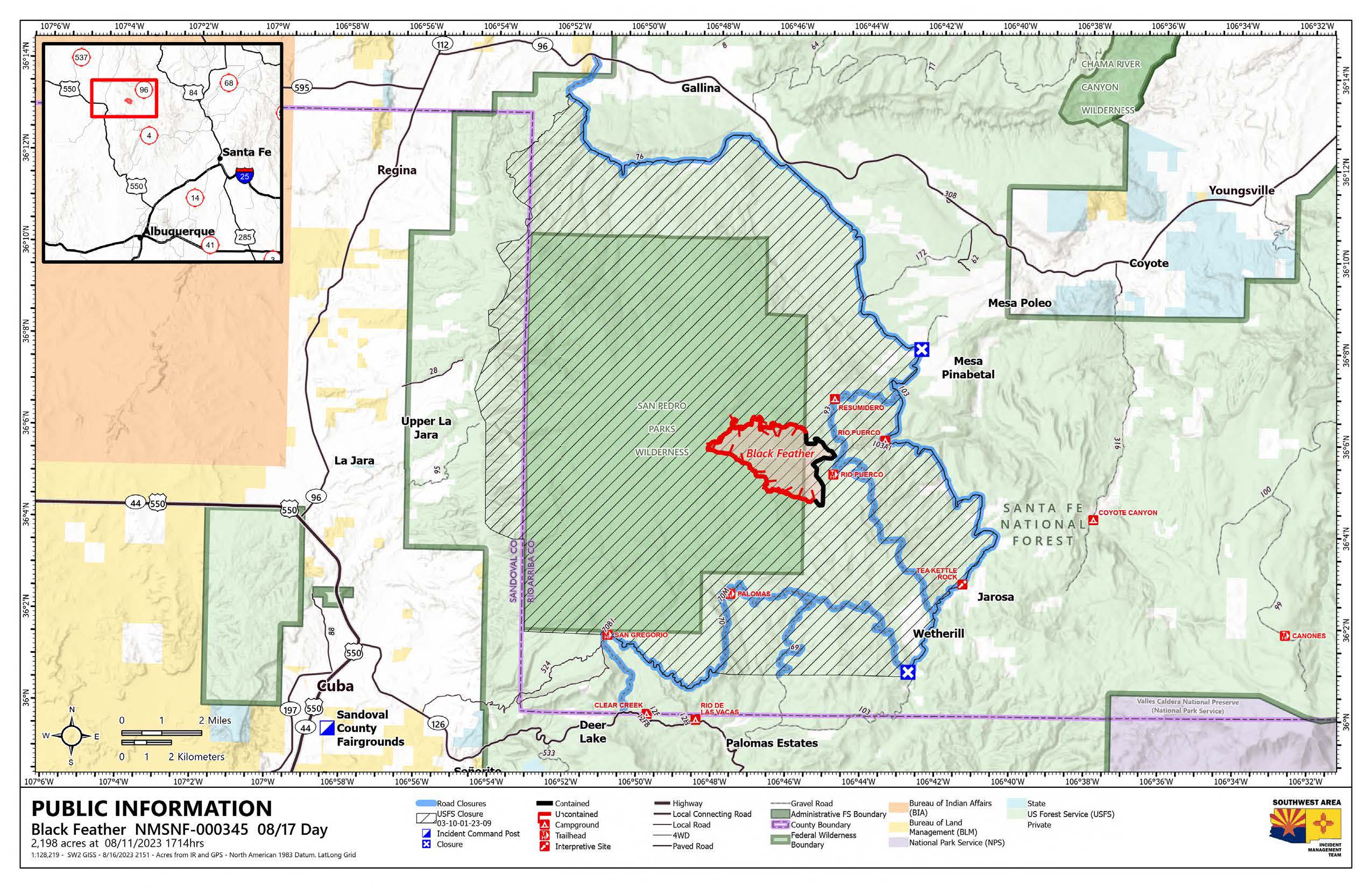
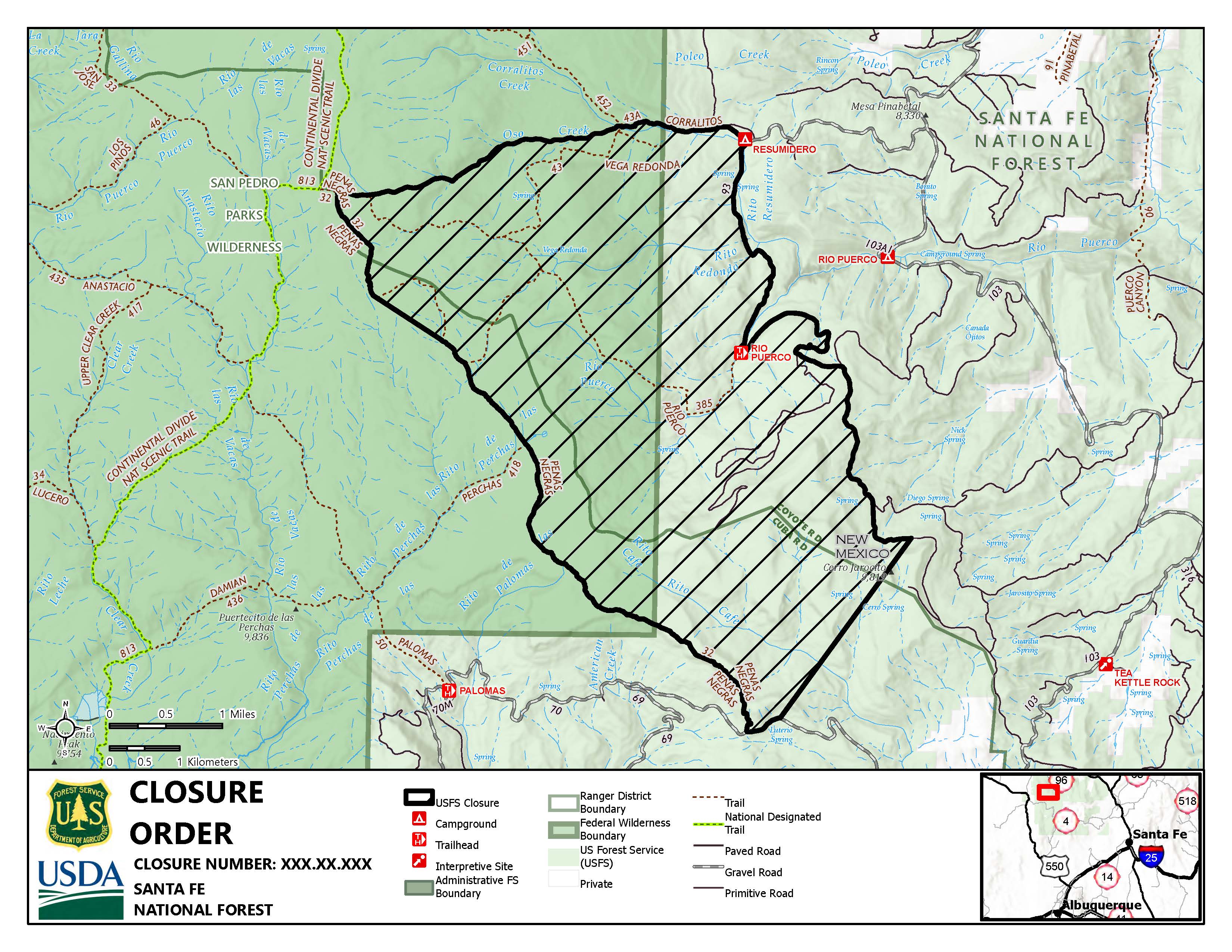
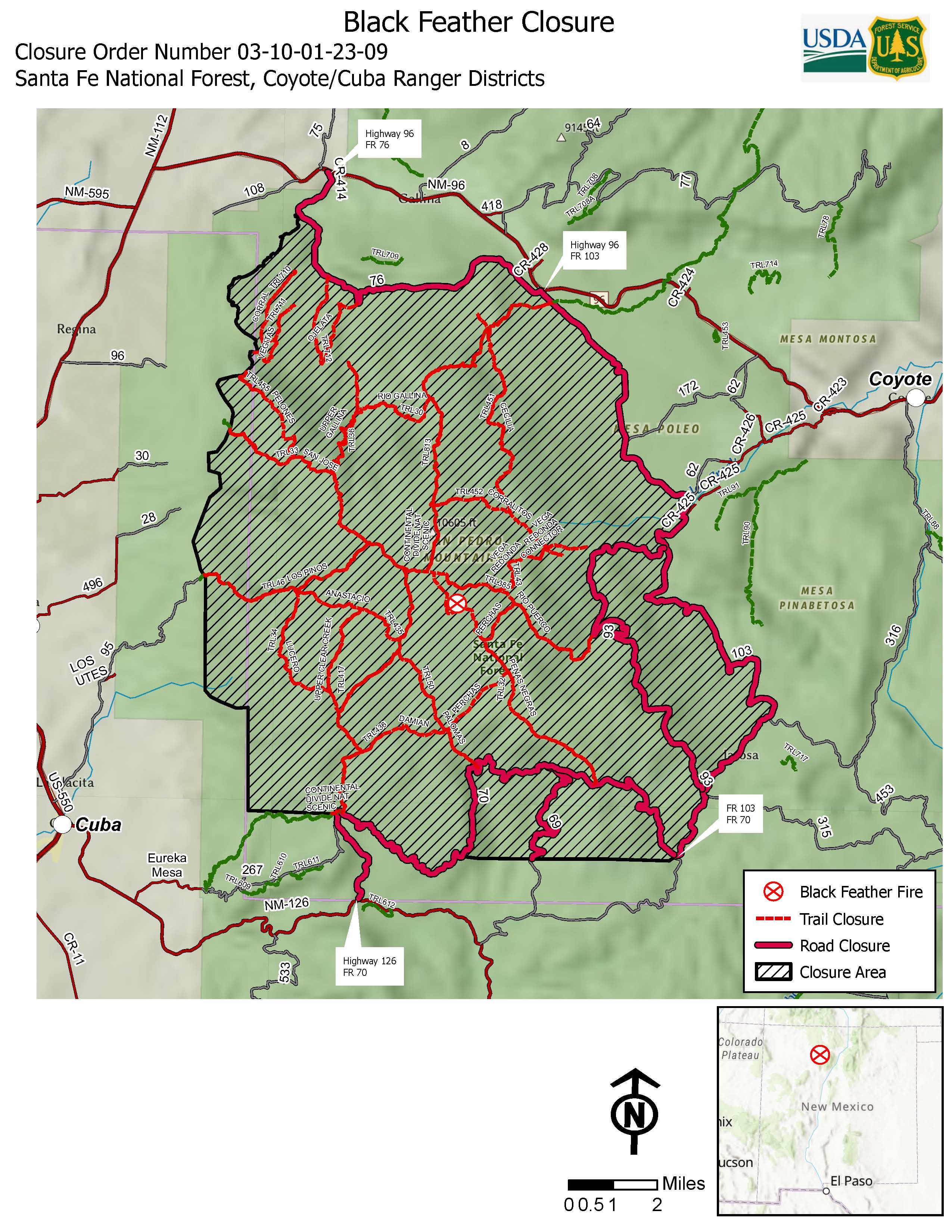
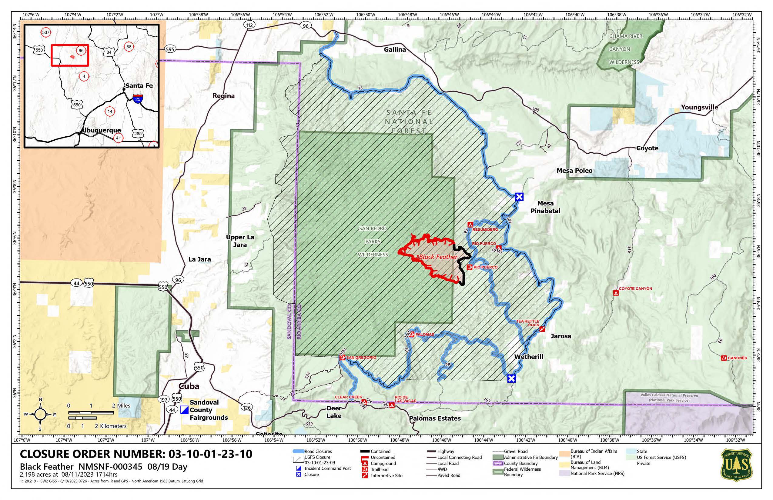
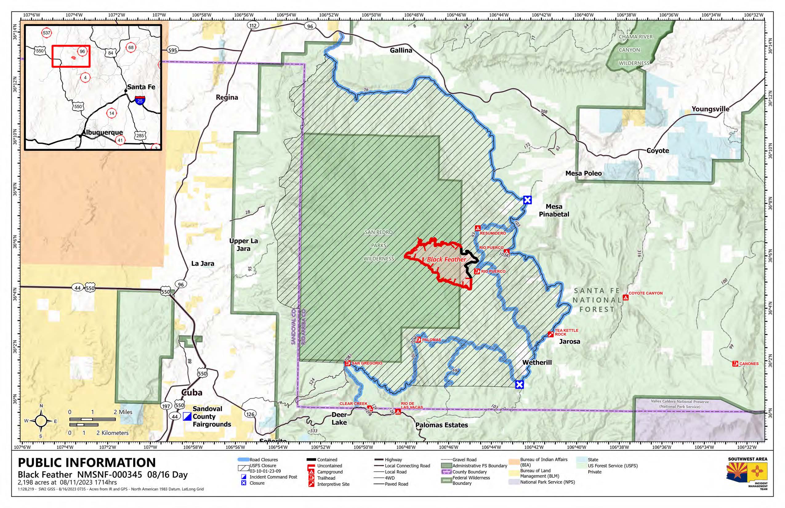
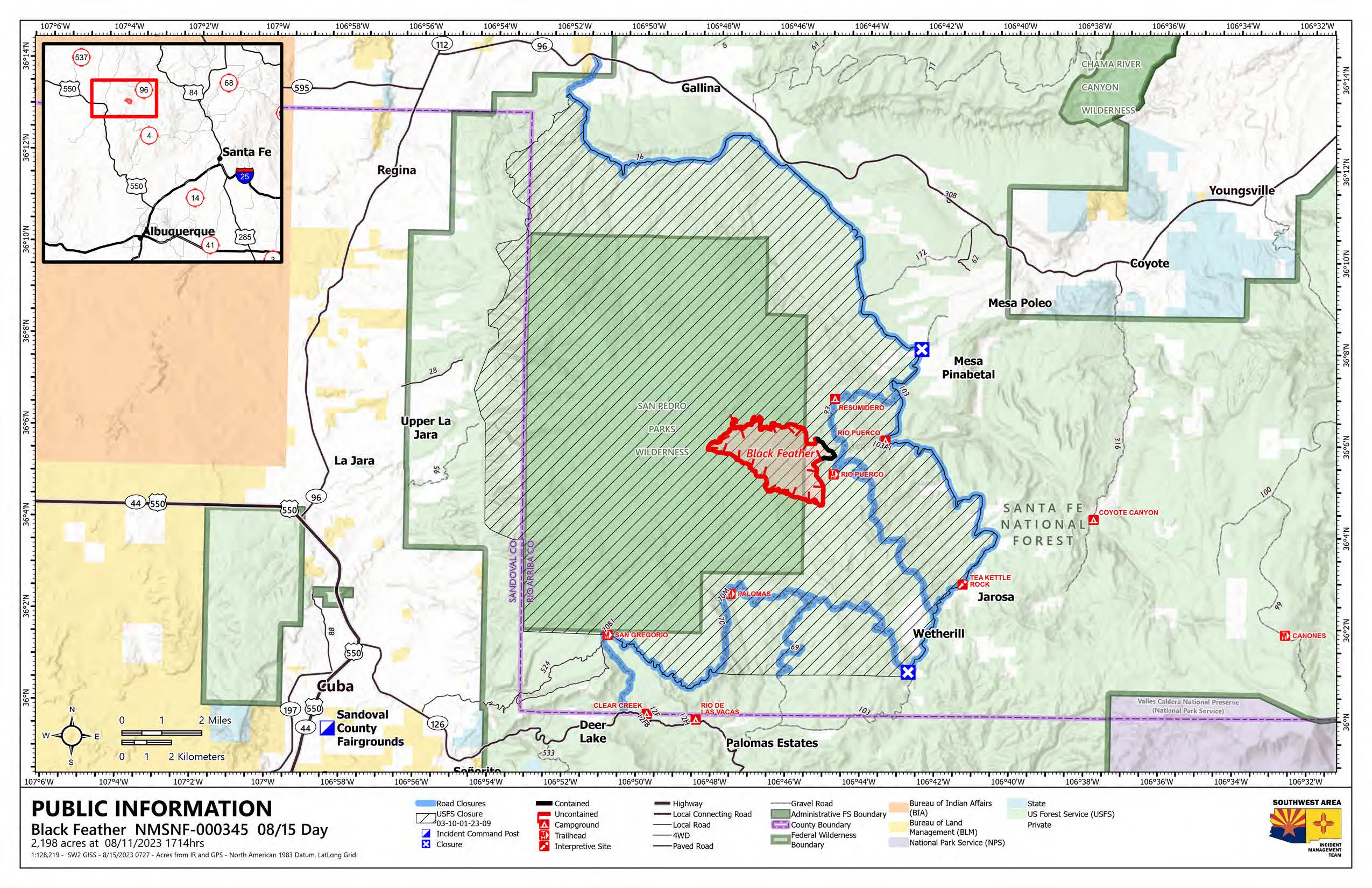
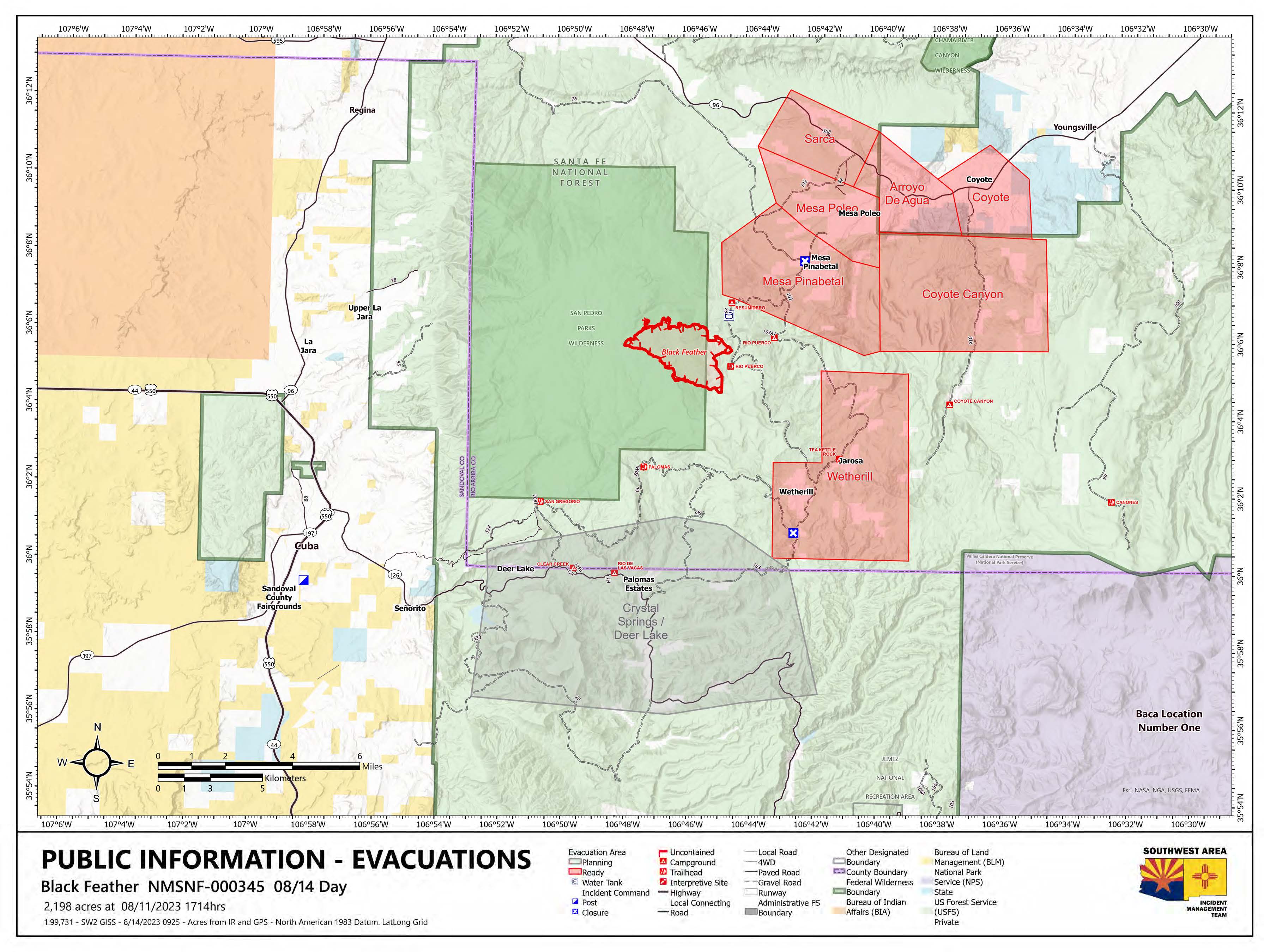
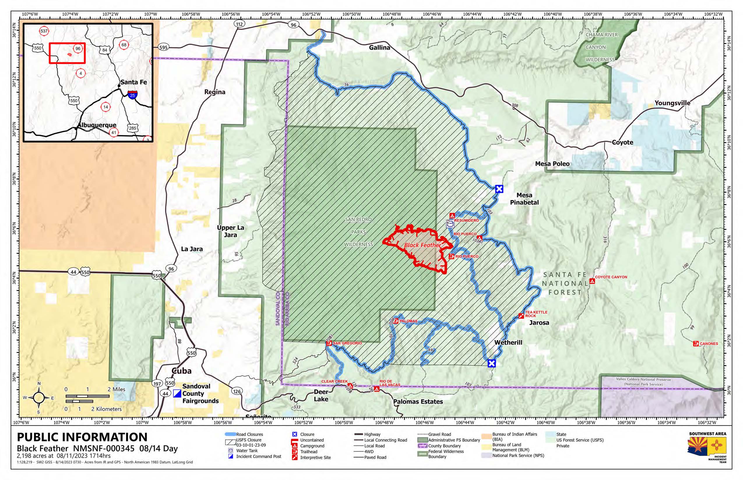
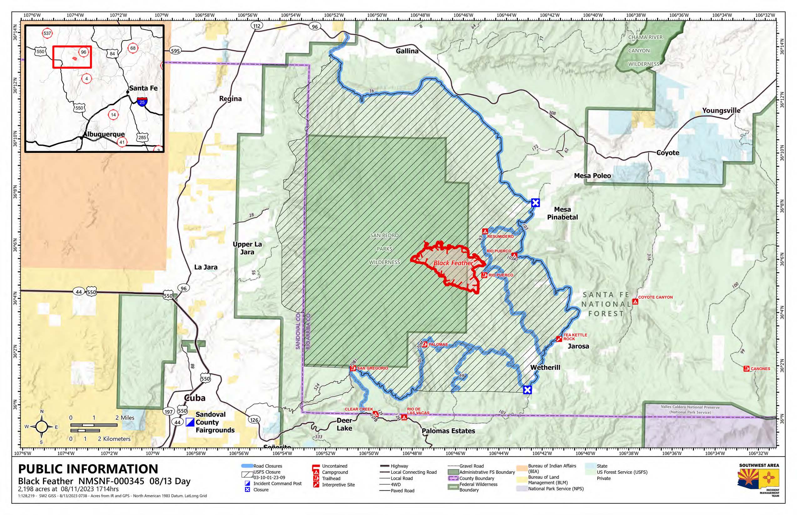
Incident Media Maps
Settings - change map background and toggle additional layers
Filter - control incident types displayed on map.
Zoom to your location
Reset map zoom and position
Could not determine your location.
Show Legend
Maps Gallery
Image options: [ Full Size ] -
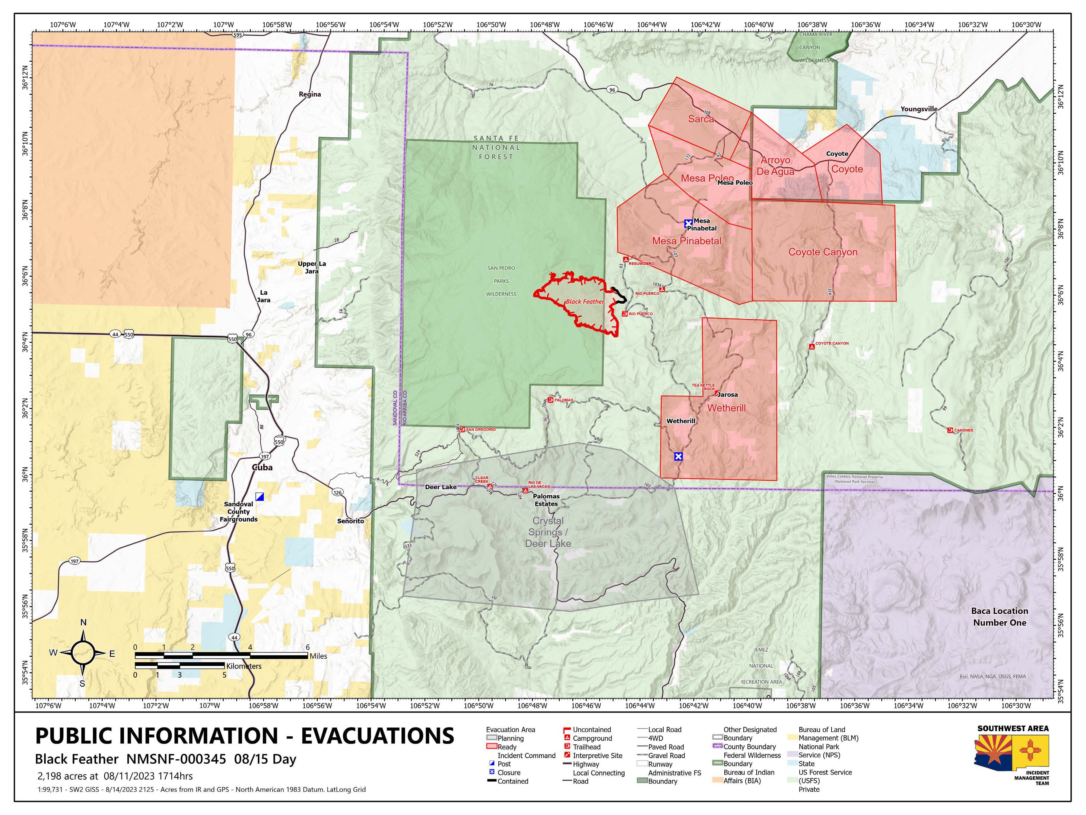
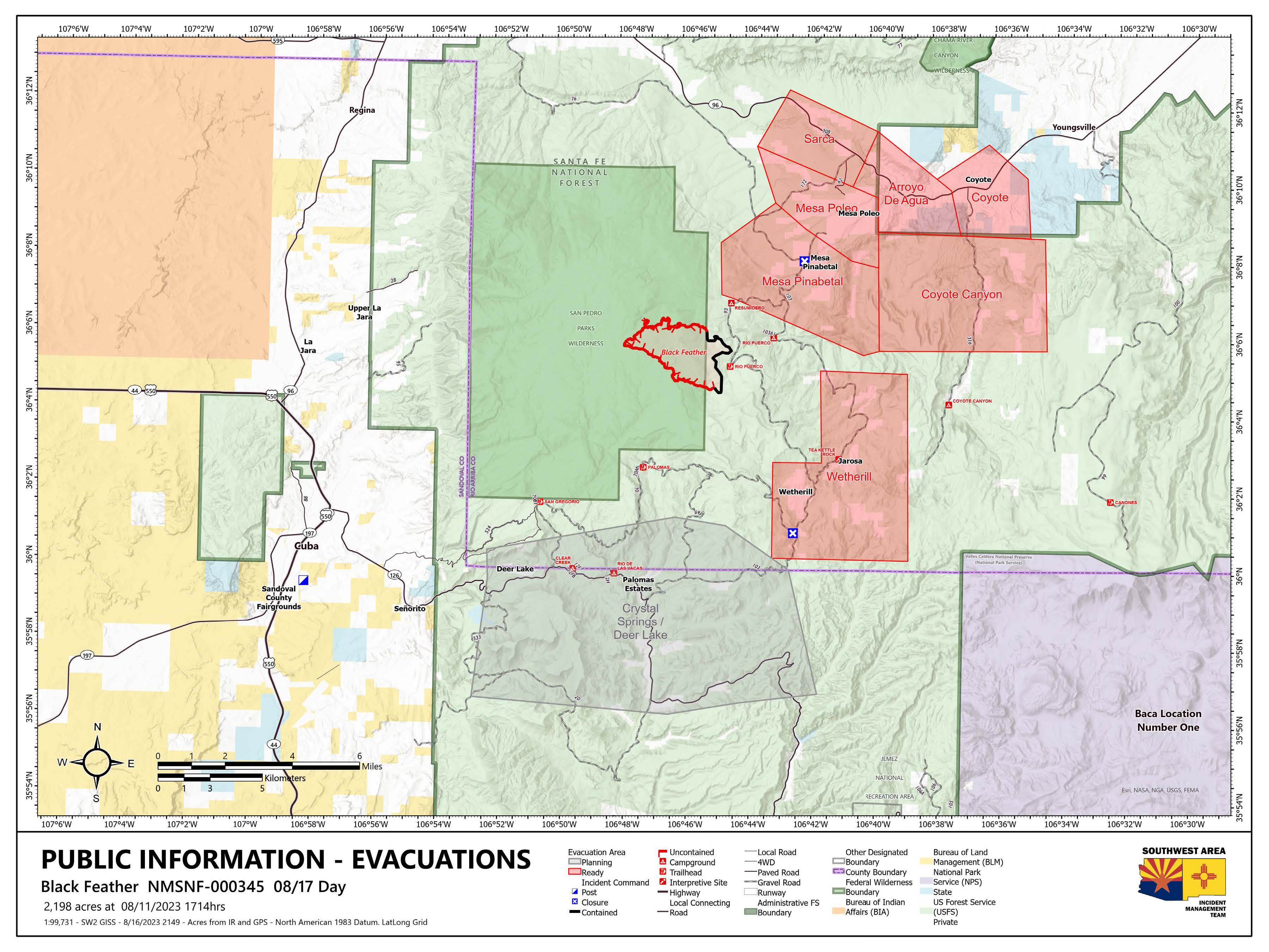
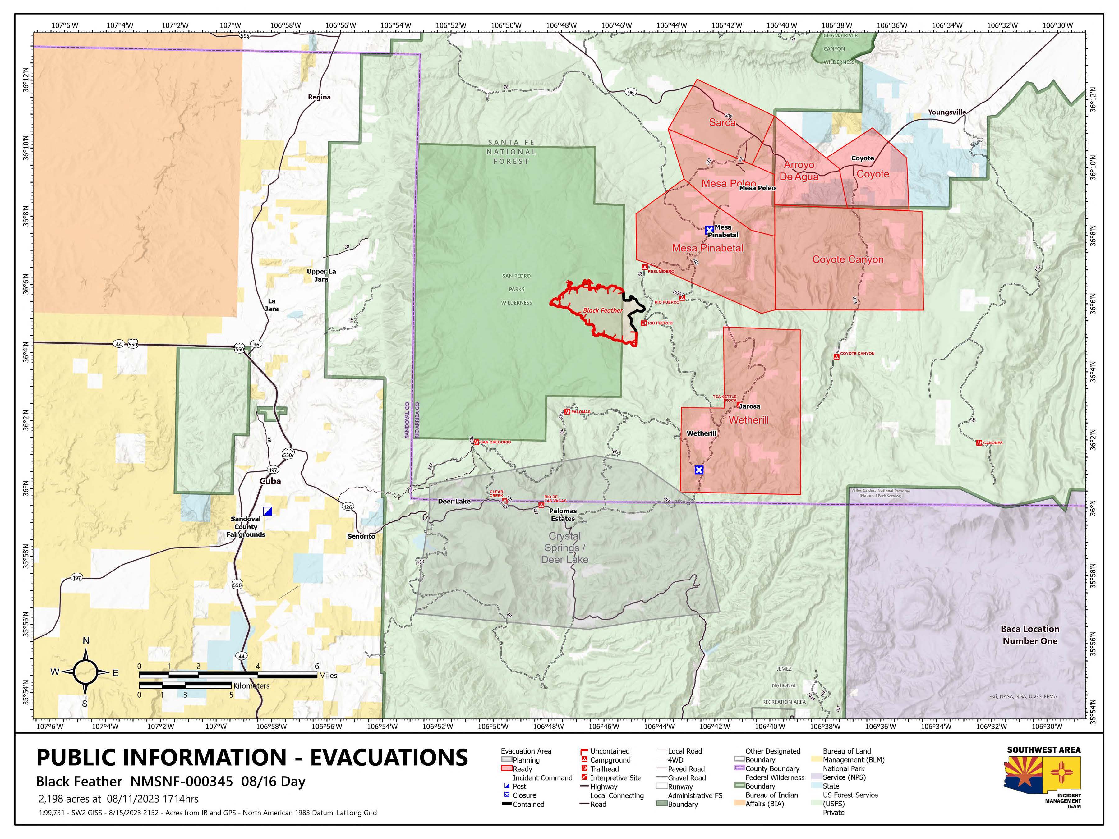
Evacuation orders remain the same as yesterday. The following areas are set to 'Ready": Mesa Pinabetal, Mesa Poleo, Sarca, Arroyo De Agua, Coyote, Coyote Canyon, and Wetherill.

 InciWeb
