
Incident Publication
Bridge Fire Morning Update 09 14 2024
Related Incident: Bridge Fire
Publication Type: News
Unified Command: CIIMT5, Los Angeles County Fire, Los Angeles County Sheriff, San Bernardino County Fire, San Bernardino County Sheriff, CAL FIRE – San Bernardino/Inyo/Mono Unit
Start Date: September 8, 2024, at 2:12 p.m.
Fire Information: (626) 470-0120 ***Original number***
Media Line: (626) 470-1395
Hours: 7:00 a.m. to 9:00 p.m.
Email: 2024.Bridge@firenet.gov
Fire Size: 52,960 acres
Percent Contained: 3%
Personnel: 2,453
Injuries: 2
Cause: Under investigation
Location: Sheep Mountain Wilderness, San Gabriel Mountains National Monument
Public Meeting today, September 14, 2024
Serrano High School Performing Arts Center: 9292 Sheep Creek Rd, Phelan, CA
6:00 p.m. It will also be live streamed via the Angeles NF Facebook page.
CURRENT SITUATION: Friday night, firefighters continued making great progress mopping up established containment lines, especially in the priority areas to the north in Wrightwood and to the southeast in Mt. Baldy Village. In all areas of the fire, firefighters are identifying and strengthening secondary contingency lines. Damage inspection teams will also continue their assessments in affected areas today.
Although a one-acre spot fire got established across a drainage in the Mt. Baldy area yesterday, a hotshot crew was successful in containing it and will complete line around it today.
The most active area of the fire was on the north flank in the Blue Ridge area where fire is backing down toward campgrounds. However, in the Wrightwood area firefighters continue to make good progress with direct attack and structure protection as fire has moderated in that area.
The east side of the fire was less active, and on the west/southwest side firefighters are constructing dozer line on the edge of the Sheep Mountain Wilderness boundary from Rattlesnake Peak.
Evacuation Orders:
- Mt. Baldy Road, North Mountain Avenue and Shinn Roads from San Antonio heights to Wrightwood and east to Cucamonga Peak
- Hwy 138 south to Lone Pine Canyon and Highway 2 east to Lone Pine Canyon Road.
- The community of Wrightwood.
- Lone Pine Canyon from the community of Wrightwood to Highway 138/Lone Pine Canyon Road south to the forest.
- East Fork communities of Camp Williams Resort (café, mobile home park, campground) and River Community (near the resort).
Evacuation Warnings:
- San Antonio Heights and Upland from the foothills south to 23rd Street.
- Piñon Hills from Wrightwood north to Highway 138 and Lebec Road west to Los Angeles County.
- For evacuation warnings in San Dimas, La Verne, and Claremont please visit: Genasys Protect
“Know Your Zone” by visiting the Genasys Protect website or download the app. Protect.genasys.com
If not already registered for emergency alerts, please register here:
- Los Angeles County: https://ready.lacounty.gov/emergency-notifications/
- San Bernardino County: https://wp.sbcounty.gov/sheriff/alerts/
Evacuation Centers:
- San Bernardino County Fairgrounds: 14800 Seventh Street, Victorville, CA
- Jessie Turner Health/Fitness Center: 15556 Summit Ave, Fontana, CA. (909) 854-5100
- Pomona Fairplex: 601 W McKinley Avenue Pomona, CA (Gate 3, corner of McKinley/White)
- Antelope Valley Fairgrounds: 2551 W Avenue H, Lancaster, CA
Animals:
- Devore Animal Shelter: 19777 Shelter Way, San Bernardino, CA. Call (909) 386-9820, or after hours: (800) 472-5609
- Palmdale Animal Care Center (Small Animals): 38550 Sierra Hwy, Palmdale, CA
- Lancaster Animal Care Center (Small Animals): 5210 W Ave I, Lancaster, CA
- Antelope Valley Fairgrounds (Large Animals): 2551 W Avenue H, Lancaster, CA. Call 562-706-8581 prior to arrival
For more information on shelters, visit:
- www.redcross.org/get-help/disaster-relief-and-recovery-services/find-an-open-shelter.html
- https://lacounty.gov/emergency/
CLOSURES:
- SR-138 from Lone Pine Canyon Road to Beekley Road
- SR-2 closed from Big Pines to SR-138
- Big Pines Highway
- Big Rock Creek Road
- San Gabriel Canyon and East Fork of the San Gabriel River
- Highway 39
- East Fork Road
- Glendora Ridge Road
- Glendora Mountain Road
- Mt. Baldy Road at Shinn Road intersection
WEATHER:
Humidity recoveries aided firefighters last night especially in the Icehouse Canyon and Wrightwood areas. This will be the last day of favorable wind patterns, as the incoming cold front will switch from the southwest to the northeast on Sunday, testing containment lines on this fire.
For smoke impacts and an interactive map, visit fire.airnow.gov.
FIRE RESTRICTIONS IN OPEN AREAS OF ANGELES NATIONAL FOREST:
The Fire Danger on the Angeles National Forest is now “Extreme” Angeles National Forest - News & Events (usda.gov)
Additional Information Resources:
- San Bernardino County Evacuation Area Status
- LA County Incident Response Webpage
- Red Cross- Find Open Shelters and Disaster Relief Services
Saturday September 14 2024 RailroadDaly Fire Update and Map 09 14 2024
Related Incident:
Publication Type: News
Daly Fire Acres: 6,811 Completion: 18%
Railroad Fire Acres: 1,006 Completion: 30%
Total Personnel: 29
Current Status
Minimal fire activity is present, with no expected spread on the Railroad and Daly Fires. Today, crews will continue with hazard mitigation along the Skalkaho Highway (Highway 38) and patrol in the Gem Mountain area.
Area closures surrounding the fire area are still in effect. These closures are necessary to protect the safety and welfare of the public and provide for safe firefighting operations and access. Fire managers are working in conjunction with Bitterroot National Forest officials to assess the need and potential boundary changes, shrinking the affected area within the closure.
Temporary Flight Restrictions (TFRs) have been lifted over the fire area and are no longer in effect.
Weather and Fire Behavior
Temperatures will gradually rise into the upper 60s in the afternoon. Partly cloudy skies in the morning will transition to mostly cloudy by the afternoon. The minimum relative humidity will be in the upper 30s, with southwest winds at 10-15 mph. Mid-slope winds could gust 20-25 mph, with ridgetop winds gusting as high as 30 mph in the afternoon. Fire behavior will remain limited to creeping and smoldering.
EVACUATIONS, RESTRICTIONS, CLOSURES
The Skalkaho Highway (Highway 38) is closed from Black Bear Campground on the Bitterroot National Forest to Skalkaho Pass on the Beaverhead-Deerlodge National Forest side.
Gird Point Lookout is closed.
The Anaconda-Pintler Wilderness in the Bitterroot National Forest is currently in Stage I Fire restrictions.
Sharrott Creek Fire Daily Update 09 14 2024
Related Incident:
Publication Type: News
Northern Rockies Team 5, Incident Commander Joe Sampson
Location: Three miles west of Stevensville, Montana
Start Date: 8/23/2024
Cause: Lightning
Size: 3,204
Completion: 80%
Total Personnel: 238
Current Status
Firefighters will work alongside resource advisors from the local Forest to plan and implement suppression repair efforts using hand tools to pull back constructed firelines. Efforts will also include placement of waterbars to prevent erosion from runoff. Starting today, excavators will begin work on the northern and southern equipment lines constructed during initial attack.
Area closures surrounding the fire area are still in effect. These closures are necessary to protect the safety and welfare of the public and provide for safe firefighting operations and access. Fire managers are working in conjunction with Bitterroot National Forest officials to assess the need and potential boundary changes, shrinking the affected area within the closure.
Temporary Flight Restrictions (TFRs) have been lifted over the fire area and are no longer in effect.
Weather and Fire Behavior
Temperatures in the valley will reach the lower 70s while temperatures at higher elevations will stay in the 60s. Partly cloudy conditions will become mostly cloudy in the afternoon. Minimum relative humidity will be in the lows 40s with southwest winds at 6 to 12 mph. Mid-slope winds could gust 15 to 20 with gusts as high as 25 mph on the ridgetops by mid-afternoon. Another system of moisture is expected to move into the region by Monday afternoon.
Fire behavior will be creeping and smoldering through the weekend, primarily in stump holes, large logs, and accumulated fuels. Flare-ups with smoke columns may be visible due to wind and solar radiation.
RESTRICTIONS and CLOSURES
- Area closures are in effect from North Fork Sweeney Creek to Sweathouse Creek. More information on Bitterroot National Forest area closures can be found at: https://www.fs.usda.gov/alerts/bitterroot/alerts-notices
- The Bitterroot National Forest is currently in Stage I Fire restrictions within the Anaconda Pintler Wilderness.
Wapiti Fire Update 09 14 2024
Related Incident:
Publication Type: News
Wapiti Fire Statistics:
- Size: 125,448 acres
- Containment: 13%
- Total Personnel: 981
- Location: Grandjean, ID
- Reported: July 24, 2024
- Cause: Lightning
For More Information
- Information Phone: 208-593-7132
- Email: 2024.wapiti@firenet.gov
- InciWeb: https://inciweb.wildfire.gov/incident-information/idbof-wapiti-fire
- Facebook: https://www.facebook.com/wapitifireinfo2024
- Linktree: https://linktr.ee/WapitiFireInfo2024
- Interactive Map: https://tinyurl.com/WapitiFireInfoMap
Special Notes: Due to ongoing fire activity and the potential hazards caused by rainfall within the burned area, State Highway 21 will remain closed east of Lowman to Stanley from MP84 (Sourdough Lodge) to MP126 (Stanley Lake turnoff). The Idaho Transportation Department is working closely with the Boise County Sheriff, USDA Forest Service and the Fire Management Team to repair any damage to the roadway, and clear debris and hazard trees. An alternative route exists through Highway 75 for those travelling to and from Stanley. Widespread wildfire activity has resulted in numerous forest closures. Hunters and recreationalists should carefully check the latest closure information before planning activities to ensure they can safely enjoy their time outdoors.
Current Situation: Rains and cooler temperatures have tempered fire activity, but crews continue to focus on protecting values at risk along the Highway 21 corridor above Lowman, with a special emphasis on the homes adjacent to the fire’s edge. Firefighters continue to diligently survey the areas behind houses and subdivisions for hotpots that could reignite when the cloud cover dissipates, and warmer temperatures return. By proactively identifying and extinguishing these hidden embers, they help reduce the chance that the fire will spread further and potentially endanger homes and property. Hose lays and pumps are checked daily to ensure everything is working in proper order and can be deployed if necessary. As clouds lifted, visibility improved, and air operations resumed Friday afternoon. Fire managers anticipate ceasing night operations Sunday evening ahead of the forecasted rain.
Incident Managers and Agency Administrators from the Forest Service and Idaho Department of Lands continue to meet daily to evaluate firefighting efforts and incident goals and objectives.
Division KK (Structure Group East) and HH: Infrared data, combined with personal observation, make fire managers comfortable with initiating some repair efforts on the suppression line within the Iron Creek area along Highway 75. Repair work consists of assessing where hand and bulldozer lines were placed and redistributing soil and other vegetation across the bare dirt to limit visible disturbances and soil erosion on the ground. Firefighters will remove hoses, pumps and other firefighting equipment, returning them to fire caches to be cleaned and shipped to other incidents across the West.
Division DD: Crews removed supplies no longer needed for fire suppression efforts and checked Redfish Lake Complex, Goat Falls, Stanley, and Stanley Ranger District for any remaining heat near the containment lines. In the Sawtooth Wilderness the fire remains contained by rock scree in drainages.
Divisions MM and PP: Fire crews continued to extinguish hot spots around Bull Trout Lake & Campground and Martin Lake north to Highway 21. Crews started removing structure protection at the Camp Bradley Boy Scout Camp. The area between Cape Horn and Copper Mountain received heavy precipitation with Thursday’s weather event and remains damp following recent rains.
Division WW and Structure Group West: Resources scouted 8-Mile Ridge and Warm Springs by foot on Friday and reported that the fire had not spread. They will continue to keep watch around the Warm Spring Guard Station and 8-Mile Ridge for fire progression that could compromise contingency lines. Structure protection remains in place. Crews are alert for potential fire growth towards Sourdough and have completed structure protection in the communities along the Highway 21 corridor, in the Bear Creek and Wapiti Summer Homes, and around Sawtooth Lodge.
Division VV: Low temperatures and precipitation contributed to limited fire activity. The containment line continues to hold on lower Chapman Creek.
Weather, Fuels, and Fire Behavior: On Saturday expect low 70s in the valleys and 60s on the ridgetops. Saturday will see a drying trend and potential for increased fire activity. Expect daytime temperatures in the high 40s to low 60s. Winds will be 15-20 mph out of the west south-west on the ridgetops and 8-12 mph in the valleys. Another round of moisture is expected early next week.
Evacuations:
For evacuation information on the Wapiti Fire, please see the Custer County Sheriff’s Facebook page at https://www.facebook.com/p/Custer-County-Sheriff-Idaho-61558947312289/ and the Boise County Sheriff’s Facebook page at https://www.facebook.com/boisecountysheriff/.
To sign up for Custer County CodeRED emergency notifications, text CUSTER to 99411 or enroll online at https://public.coderedweb.com/CNE/BF28E45537FF
To sign up for Boise County Alert Sense emergency notification enroll online at https://public.alertsense.com/SignUp/publicUser.aspx?regionid=1163
Closures and Fire Restrictions:
The Middle Fork Complex Fire Closure Order is amended to provide consistency with the Wapiti Fire Closure. This amended order, Forest Order #0402-06-64, closes the 582 and 563 roads, as well as the 579 road from its junction with 563 eastward to the junction with Highway 21. More information can be found at: https://www.fs.usda.gov/alerts/boise/alerts-notices
State Highway 21 remains closed from MP84 to MP126 for public and firefighter safety.
A Wapiti Fire Area Closure / Forest Order: 0414-04-151 for portions of the Boise, Sawtooth, and Salmon-Challis National Forests can be found at this site: https://www.fs.usda.gov/alerts/sawtooth/alerts-notices
Boise National Forest Stage 1 Fire Restrictions / Forest Order: 0402-00-63 can be found at this site: https://www.fs.usda.gov/alerts/boise/alerts-notices
Sawtooth National Forest Stage 1 Fire Restrictions / Forest Order 0414-00-044 can be found at this site: https://www.fs.usda.gov/alerts/sawtooth/alerts-notices
Fire restrictions on federal, state, and private lands may be found at this site: https://www.idl.idaho.gov/fire-management/fire-restrictions-finder/
Temporary Flight Restriction is in place over the Wapiti Fire. Wildfires are a no-fly zone for unauthorized aircraft, including drones. If you fly, we can’t. For more information, visit http://knowbeforeyoufly.org.
Fish Creek Fire Update Saturday 09 14 2024
Related Incident:
Publication Type: News
Northern Rockies Team 2, Incident Commander Scott Schuster
Location: 7 miles SW of Togwotee Pass
Start Date: Friday, August 16, 2024
Cause: Lightning
Size: 24,909
Percent complete: 69%
Resources: 432 Total Personnel: 10 Hand Crews; 13 Engines; 18 Heavy Equipment; 2 Helicopters
KEY MESSAGES:
Skies cleared up yesterday, which will continue a trend of decreased cloud cover and relative humidities the next few days. Minimal fire activity will continue with heat staying in heavy dead and down fuels on the ground. There may be occasional single tree torching. Spotting continues to be unlikely with high ground fuel moisture. Smoke will continue to impact the Highway 26/287 corridor and the immediate area around the fire. Roadway visibility may be impacted by the smoke from the fire; please slow down and use caution when driving Highway 26/287.
Fremont County has decreased the “GO – Level 3” Evacuation Order to the “SET – Level 2” Notice for the Brooks Lake, Pinnacle, and Breccia areas. These areas are still within Forest Closures, so access to Brooks Lake, Pinnacle, and Breccia areas will be reevaluated next week. Residents are advised to monitor the situation.
CURRENT STATUS:
Fire monitoring continues for any potential threats to Highway 26 and other critical values. Suppression repair work – work that mitigates the fireline to restore a more natural condition - is progressing along Deception Road from Highway 26 to Brooks Lake Lodge campground. A log loader has arrived and will begin moving logs out of Deception Road. The moderated weather and minimal fire behavior has allowed resources to work on a shaded fuel-break along a 2-mile stretch of the Upper Flagstaff Road. Firewise fuels mitigation actions continue to take place around the Togwotee Lodge to ensure improved defensible space for values at risk from the Fish Creek Fire, or future wildfires. Crews are beginning to pull hose and related equipment from areas no longer needed. They are also working on suppression repair tasks throughout the fire area.
WEATHER AND FIRE BEHAVIOR:
Mostly sunny skies and mild temperatures are expected over the weekend with a small chance of light rain Sunday afternoon. A weather system will begin to encroach western Wyoming on Monday, which will begin the next round of showers and thunderstorms next week. The moderating weather conditions has reduced fire behavior. Creeping, smoldering and backing will continue. There will be minimal potential for single tree torching. High ground fuel moisture will greatly reduce the chances of spotting.
AIR QUALITY AND SMOKE:
Although air quality has improved, unhealthy air quality is possible in locations, especially in low-lying drainages and along the Highway 26/287 corridor. For up-to-date air quality alerts, current and predicted smoke conditions and ways to mitigate poor air quality, check out the AirNow website at https://www.airnow.gov/.
CLOSURES AND EVACUATIONS:
The joint Closure Order issued by both the Bridger-Teton and Shoshone National Forests for the fire area, remains in effect. Please do not enter the closure area or use any Forest Roads that are closed. For specific details regarding this closure, please reference the Fish Creek Area, Roads, and Trails Closure Order (map) and the Forest website at https://www.fs.usda.gov/alerts/btnf/alerts-notices.
Under the jurisdiction of Fremont County, the areas of Brooks Lake, Pinnacle Drive and Breccia Drive have decreased to Level 2 “Set” Notice (indicated by yellow blocks on the PIO Incident Map). A Level 2 “Set” Notice means residents should be ready to evacuate at a moment’s notice. If the Level 2 Set notice changes back to a Level 3 “Go” notice, residents must evacuate until advised otherwise by Fremont County. See the alert notice on the Fremont County Fire Protection District Facebook page.
The Teton County Division of Emergency Management utilizes a Ready, Set, Go system for evacuation messaging, visit their website for additional details at www.tetoncountywy.gov/1846/Ready-Set-GO. (Indicated by green blocks on the PIO Incident Map.) They advise all residents to be in a “Ready” status by preparing for evacuations and becoming fire adapted. All residents are encouraged to sign up for Teton County, Wyoming's free alert and warning service, Teton_WY Alerts at: Teton_WY Alerts - Sign Up (everbridge.net).
US HWY 26/287 is open for free-flowing traffic. Motorists may still experience smoke and sometimes limited visibility. A 45-mph speed restriction remains in effect for the fire area. Motorists are encouraged to stay alert for fire personnel and fire vehicles and use caution when travelling through the area. The Wyoming Department of Transportation (WYDOT) continues to work closely with Fremont County Emergency Management, Fremont County Sheriff’s Office and fire officials for the safety of motorists and firefighters. Drivers are encouraged to visit https://www.wyoroad.info/ prior to traveling on US HWY 26/287 for road status and information, or download the Wyoming 511 app at https://www.wyoroad.info/511/WY511Mobile.html to monitor for any changes due to fire activity.
Daily Update for the Chimney Fire 09 14 2024
Related Incident: Chimney Fire
Publication Type: News
Chimney Fire containment rises to 21 percent
Daily Update – Saturday, September 14, 2024
Acres: 6,517
Start Date: 9/2/2024
Location: 9 miles northwest of Fairfield, ID
Personnel: 361
Containment: 21%
Fuels: Timber, brush, grass, understory
Highlights: Due to continued suppression efforts along the southern perimeter, fire containment has increased to 21 percent. A new fire start was detected 5 miles west of Fairfield, just east of the Incident Command Post. Firefighters assigned to perform initial attack of new fires quickly responded to contain this new start.
Operations: Yesterday, firefighters worked alongside Resource Advisors to identify potential suppression repair needs on the southern end of the fire. These efforts aim to remove, repair, or minimize evidence of fire suppression actions on the landscape. On the western flank, firefighting equipment including pumps and hoses that were no longer needed were airlifted out in cargo nets using helicopters. In addition to backhauling, helicopters were also used to complete a communication repeater mission, release water bucket drops, and identify several suitable helicopter landing spots. The initial attack group of firefighters on the ground, along with a bulldozer and a helicopter, worked together to successfully suppress the new fire start east of the command post. Due to a warming and drying trend today through the weekend, more active fire behavior is expected along with additional smoke production. Potential fire activity will likely be limited to dead and down timber along the fire edges that are most exposed to wind. Firefighters remain ready to quickly respond to any new fire starts.
Weather: Today, mostly sunny skies will continue to allow the air to change, becoming warmer and drier. The afternoon high temperatures should range between 62 and 72 degrees. Afternoon humidity should range from 18 to 27 percent. Wind will increase to afternoon gusts between 20 and 26 miles per hour.
Smoke: Smoke may be visible from the Fairfield area, with possible haze in the afternoon today. An interactive smoke map located at https://fire.airnow.gov/ allows you to zoom into your area to see the latest conditions.
Closures: The Sawtooth National Forest has issued an emergency temporary closure area for the Chimney Fire. The purpose of the closure order is to protect firefighters and the public during wildfire suppression activities occurring in and around the area. The full closure order (No. 0414-05-065) and map are available on the Sawtooth National Forest website at https://www.fs.usda.gov/alerts/sawtooth/alerts-notices.
Safety: The health and safety of firefighters and the public are always the first priority. A temporary flight restriction (TFR) is in place over the area, which includes uncrewed aircraft or drones. Flying drones near wildfires is dangerous for pilots and firefighters and can bring wildfire suppression efforts to a halt. Know before you fly. If you fly, we can’t. More information can be found at: https://uas.nifc.gov/.
More Information: https://inciweb.wildfire.gov/incident-information/ideix-chimney-fire /
208-246-8292 / https://www.facebook.com/sawtoothnationalforest / 2024.chimney@firenet.gov / https://www.facebook.com/IdahoDepartmentofLands/
Airport Fire Incident Update Evening 09 13 2024
Related Incident:
Publication Type: News
Location: Trabuco Canyon, CA
Personnel: 1949
Start Date: 9/9/ 2024 01:00pm
Cause: Human
Size: 23,410 acres
Percent contained: 9%
Firefighters continued to make progress, increasing containment to 9% as of this afternoon while holding the fire to 23,410 acres. Crews have skillfully constructed indirect containment lines using dozers and hand crews, particularly in areas like Decker Canyon, where they've reinforced existing lines to prevent further fire spread. Although direct lines have been challenging to build due to rugged terrain, favorable weather conditions have supported their efforts.
An aerial reconnaissance mission was conducted over the Sugar Loaf Canyon area to develop a strategic plan for future operations. Additionally, utility companies like Edison, Caltrans, and Frontier Communications are actively working along the Ortega Highway to restore essential services.
Overall, the firefighters' efforts demonstrate positive results in containing the fire and mitigating damage. However, the situation remains fluid, and crews will continue to adapt their strategies in response to changing conditions.
Bridge Fire Evening Update 09 13 2024
Related Incident: Bridge Fire
Publication Type: News
Unified Command: CIIMT5, Los Angeles County Fire, Los Angeles County Sheriff, San Bernardino County Fire, San Bernardino County Sheriff, CAL FIRE – San Bernardino/Inyo/Mono Unit
Start Date: September 8, 2024, at 2:12
Incident Website:
inciweb.wildfire.gov/incident-information/caanf-bridge-fire
Fire Information: (626) 470-0120 ***Original number***
Media Line: (626) 470-1395
Hours: 7:00 a.m. to 9:00 p.m.
Email: 2024.Bridge@firenet.gov
Fire Size: 52,487 acres
Percent Contained: 3%
Personnel: 2,453
Injuries: 0
Cause: Under investigation
Location: Sheep Mountain Wilderness, San Gabriel Mountains National Monument
PUBLIC MEETING SCHEDULED FOR TOMORROW, SATURDAY, SEPT. 14
Serrano High School Performing Arts Center: 9292 Sheep Creek Rd, Phelan, CA
6:00 p.m. - 8:00 p.m. It will also be live streamed via the Angeles NF Facebook page.
CURRENT SITUATION: Today the Bridge Fire had minimal movement. Firefighters continued to mop-up hot spots, establish or strengthen containment lines along the entire perimeter of the fire where accessible to do so. Resources were focused on the northern area of the fire where air operations dropped water as needed along the fire line near the communities of Big Pines and Wrightwood.
Although the fire is slowly backing downhill on the east side, firefighters are not letting their guard down in Icehouse Canyon where the rugged terrain still presents some challenges. Heat and active flames are also still present in the Mt. Baldy Village area, and crews continue to prioritize structure protection.
A marine weather inversion aided crews along the southern boundary in establishing direct line, extending from the southwest toward the east with mop-up. Favorable winds are also keeping the west side of the fire within its current footprint where the steepest and most rugged terrain lies within the wilderness.
Evacuation Orders:
- Mt. Baldy Road, North Mountain Avenue and Shinn Roads from San Antonio heights to Wrightwood and east to Cucamonga Peak
- Hwy 138 south to Lone Pine Canyon and Highway 2 east to Lone Pine Canyon Road.
- The community of Wrightwood.
- Lone Pine Canyon from the community of Wrightwood to Highway 138/Lone Pine Canyon Road south to the forest.
- East Fork communities of Camp Williams Resort (café, mobile home park, campground) and River Community (near the resort).
Evacuation Warnings:
- San Antonio Heights and Upland from the foothills south to 23rd Street.
- Piñon Hills from Wrightwood north to Highway 138 and Lebec Road west to Los Angeles County.
- For evacuation warnings in the cities of San Dimas, La Verne, and Claremont please visit: Genasys Protect
“Know Your Zone” by visiting the Genasys Protect website or download the app. Protect.genasys.com
Learn more about fire safety and health information: LA County Department of Public Health
Evacuation Centers:
- San Bernardino County Fairgrounds: 14800 Seventh Street, Victorville, CA 92392
- Jessie Turner Health/Fitness Center: 15556 Summit Ave, Fontana, CA 92336. Call (909) 854-5100
- Pomona Fairplex: 601 W McKinley Avenue Pomona, CA 91768 (Enter Gate 3, corner of McKinley and White)
- Antelope Valley Fairgrounds: 2551 W Avenue H, Lancaster, CA 93536.
- Animals:
- Devore Animal Shelter: 19777 Shelter Way, San Bernardino, CA 92407. Call (909) 386-9820, or after hours: (800) 472-5609
- Palmdale Animal Care Center (Small Animals): 38550 Sierra Hwy, Palmdale, CA 93550
- Lancaster Animal Care Center (Small Animals): 5210 W Ave I, Lancaster, CA 93536
- Antelope Valley Fairgrounds (Large Animals): 2551 W Avenue H, Lancaster, CA 93536. Call 562-706-8581 prior to arrival.
For more information on shelters, visit:
- www.redcross.org/get-help/disaster-relief-and-recovery-services/find-an-open-shelter.html
- https://lacounty.gov/emergency/
- If not already registered for emergency alerts, please register for them here:
CLOSURES:
- SR-138 from Lone Pine Canyon Road to Beekley Road
- SR-2 closed from Big Pines to SR-138
- Big Pines Highway
- Big Rock Creek Road
- San Gabriel Canyon and East Fork of the San Gabriel River
- Highway 39
- East Fork Road
- Glendora Ridge Road
- Glendora Mountain Road
- Mt. Baldy Road at Shinn Road intersection
WEATHER:
High winds are expected in higher elevations with low temperatures at night. Warm temperatures and low humidity are still persistent in lower desert areas; however, two cold fronts are forecasted in the coming week.
For information on smoke impacts and an interactive map, visit fire.airnow.gov.
FIRE RESTRICTIONS IN OPEN AREAS OF ANGELES NATIONAL FOREST:
Learn more about current fire restrictions (“Extreme”) in the Angeles National Forest:
Angeles National Forest - News & Events (usda.gov)
Fossil Complex Evening Update 09 13 2024
Related Incident: Fossil Complex
Publication Type: News
FOSSIL COMPLEX
Evening Update:
Friday the 13th, 2024
Social Media and Information Links:
Crews continue progress around Service Fire
SPRAY, Ore. – Crews used the warmer and drier weather to their advantage to make progress around the Service Fire. Fire crews have the north and east fire lines completed with a combination of dozer line and hand line directly on the fire perimeter of the fire. Fire hoses are being laid to aid in mop up operations. The south end of the fire will have direct line completed by the end of day shift tomorrow. ORE 19 is open, and the public is encouraged to drive with caution because there are crews and equipment along the highway and rolling debris is possible.
The east side of the fire did become more active this afternoon with the warmer temperatures and increased wind. Crews were ready as the weather aided in drying the cured fuels since the last rain making them available to burn. Aviation resources were fully engaged with the ground crews and made drops on hot spots where needed to support the continuing line construction.
The acreage of the fire has increased due to more accurate infrared mapping.
Videos: Due to an issue with the Fossil Complex Facebook page, recordings of the Daily Operations Updates and other stories will be available at: https://www.youtube.com/@FossilComplex.
Evacuation: Level 3 evacuations remain inside the perimeter of the Service Fire. For the most recent evacuation levels please go to: https://www.facebook.com/WheelerCountySheriffsOffice/
The Two Cabin, Holmes, Kinzua and Canyon Fires are all in patrol status.
FIRE AT A GLANCE
Fossil Complex
Total Size: 24,171acres
Two Cabin-253 acres
Canyon-192 acres
Kinzua-96 acres
Holmes-15 acres
Service- 23,615 (Infrared)
Containment: 8%
Cause: Lightning
Current Cost: $14.2 M
All Resources
Hand Crews: 42
Engines: 48
Water Tender: 12
Dozers: 21
Skidders: 7
Skidgen: 4
Excavator: 2
Masticator: 2
Feller Buncher: 4
Total Resources: 1,280
Aerial Resources
Type 1: 3
Type 2: 8
Type 3: 4
Evacuations:
Level 3: 11 addresses
https://www.facebook.com/WheelerCountySheriffsOffice/
ODF Incident Commander:
Matt Howard
Incident Management Team 2
Community Meeting in Big Bear Lake at 7pm at 765 North Stanfield Cutoff 09 14 2024
Related Incident: Line Fire
Publication Type: Announcement

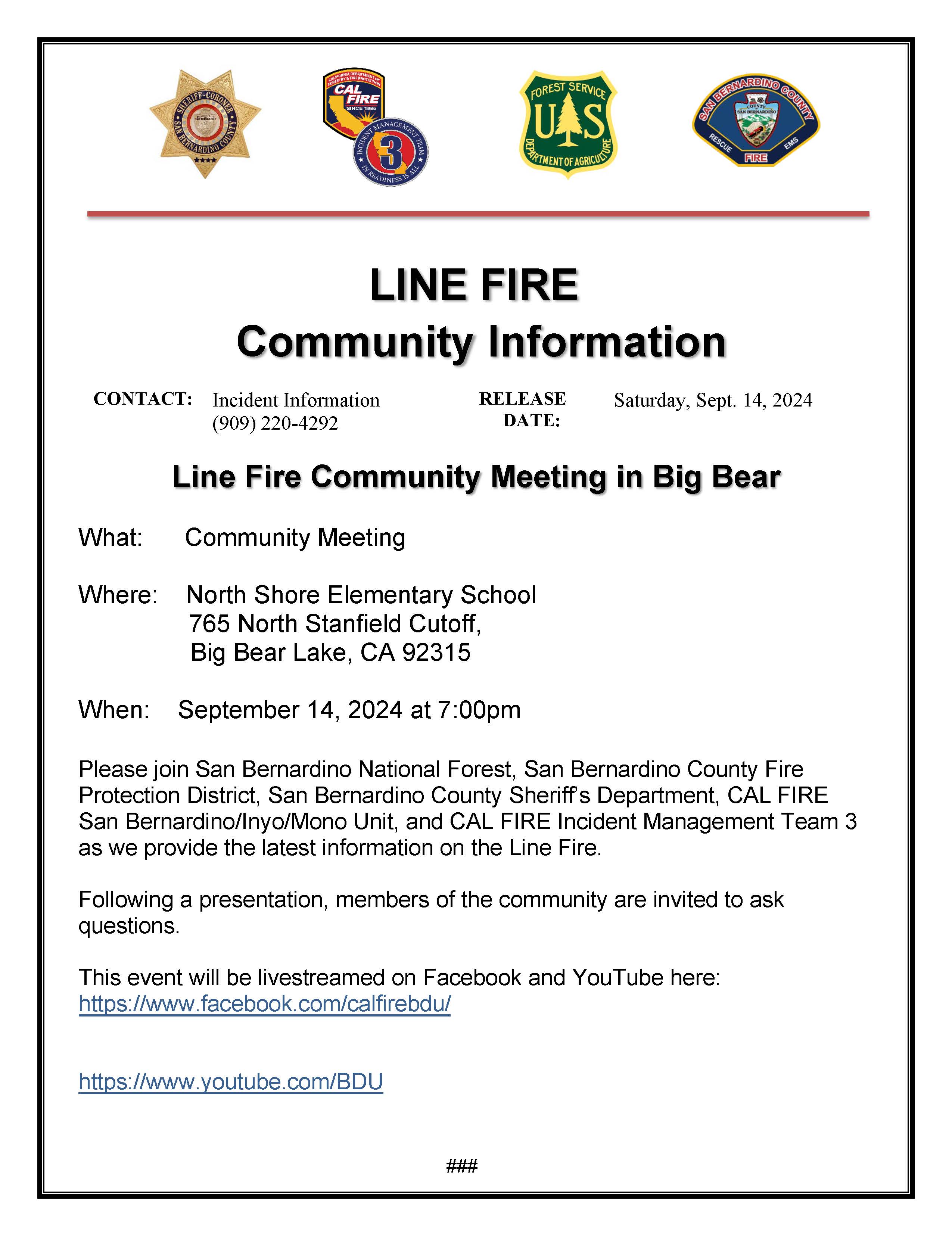
Please join us toady Saturday, September 14th for a community meeting in Big Bear Lake at 7pm at 765 North Stanfield Cutoff. You can also watch the meeting LIVE on Facebook here: https://facebook.com/calfirebdu/ and on YouTube here: https://youtube.com/@calfiresanbernardino…