
Incident Publication
Shoe Fly Fire Morning Update 09 05 2024
Related Incident: Shoe Fly Fire
Publication Type: News
Shoe Fly Fire resources hold lines, construct new ones overnight
MITCHELL, Ore. – Firefighting resources assigned to the Shoe Fly and Two Cabin fires continued to make progress overnight across the majority of the incidents. Firefighters completed line around portions of the Two Cabin Fire and focused on mopping up; this work will continue today. It’s currently 251 acres and 3% contained.
The Shoe Fly Fire grew from yesterday, now at 21,623 acres. On the southwest side, fire continued to make a push past Flock Mountain and toward Keys Mountain. Additional resources were moved into this area. Today, firefighters will focus in on this portion and work to construct line and tie it back into existing fireline.
Powerlines servicing a communications site in the Flock Mountain area may continue to be impacted intermittently today. Lines may be deenergized for firefighter safety, sometimes causing a disruption of service in the local area. Potential damages to lines will be assessed.
On other portions of the fire, resources continued bolstering existing lines across the fires and building new direct ones where possible. Direct line is where firefighters construct fireline against the fire’s edge, which is much stronger than indirect line, where unburned vegetation remains between the fire and line.
Overnight, direct lines were put in on the east side of the fire, tying into existing ones that have already been established. Mop-up operations continued on the south and southwestern borders of the fire. Due to this progress, containment has increased to 5%.
With a 24-hour operational period, dayshift resources are able to build off the work completed by night shift, and vice versa. This model allows firefighters to take advantage of cooler conditions when the sun is down, which typically decreases fire behavior naturally and helps the team to push forward on overall progress.
Two task forces of structural firefighters from the Oregon State Fire Marshal are working under the Wheeler County Fire Defense Board Chief providing structure protection in the area.
Evacuation notices for residents around the fire continue to be evaluated by the Wheeler County Sheriff, Wheeler County Fire Defense Board Chief, and Team 1 Operations personnel. More information on current evacuations is available at https://tinyurl.com/RAPTOR-Evacuation-Info
While there are no current road closures due to the Shoe Fly or Two Cabin fires, other fires nearby may be impacting travel. Check https://tripcheck.com/ for current closures and potential delays.
Sharrott Creek Fire Daily Update 09 05 2024
Related Incident:
Publication Type: News
Northern Rockies Team 3, Incident Commander Mike Behrens
Location: Three miles west of Stevensville, Montana in Ravalli County
Start Date: 8/23/2024
Cause: Lightning
Size: 2,878 Acres
Completion/Containment: 25 percent
Resources assigned: 626 people
Key messages
- A community meeting will be held Saturday, September 7th, at 3 pm at Stevensville High School.
- Spotting from the fire interior continues to be a concern, crews are watching for spot fires.
Current Status
Firefighters built direct dozer and hand line on the northern perimeter in the Larson Creek drainage. Today they will mop up and secure the lines. Water from helicopters will cool the edge of the fire west of the dozer line.
Control lines on the east side, are completed and are reflected on the fire map as a black edge. Firefighters will patrol, monitor, and mop-up as needed on this flank daily.
On the south edge, five Hotshot crews held the fire north of the 739D road in the McCalla Creek drainage, supported by helicopter water drops. Firefighters installed hose lays yesterday to assist with mop-up along the southern perimeter. The rappel module constructed hand line along hot areas of the western fire edge near the St. Mary Trail, spiked out there overnight, and will continue working that section of line today.
Slow fire progression west along the uncontrolled perimeter can still be expected. Further south, contingency plans are being created.
Structure protection resources will begin backhauling equipment from the northern neighborhoods. Night shift resources will assist with mop-up on the northern and southern edge. They also have initial attack responsibilities. Aviation resources will check fire spread and support firefighters with cooling hot spots.
Weather and Fire Behavior
A warming and drying trend will continue for several days. Temperatures will be in the upper 80s. Relative humidity will be 23-27 percent. Winds are expected to be southwest at less than 10 mph. Single tree torching will occur as fire reaches stringers of subalpine fir on the upper half of the face, with the potential for spotting up to a tenth of a mile.
SMOKE
For the current smoke reports, visit https://www.airnow.gov/
EVACUATIONS, RESTRICTIONS, CLOSURES
The Ravalli County Sheriff’s Office has dropped evacuation orders for neighborhoods in the vicinity of the Sharrott Creek Fire. Download the Ravalli Co. Sheriff’s Office app for information or call 406-375-6650. The Bitterroot NF has issued an area closure from North Fork Sweeney Creek to Sweathouse Creek. See https://tinyurl.com/Sharrottclosure for the order and map. There are temporary flight restrictions (TFR) over the fire area west of Highway 93 from Bass Creek to Big Creek.
West Mountain Fires Daily Update 09 05 2024
Related Incident: Boulder FireDollar Fire
Publication Type: News
West Mountain Fires Daily Update 09-05-2024
Boulder, Goat, Snag and Dollar Fires
Fire Location Size Containment Assigned Personnel Inciweb link
Boulder 6 miles SW of Cascade 3,842 acres 24% 516 https://tinyurl.com/ycdfv3tv
Snag 11 miles E of Cascade 32,204 acres 12% 366 https://tinyurl.com/4k9dk3mu
Dollar 18 miles NE of Cascade 4,137 acres 0% 59 https://tinyurl.com/bef6r3tz
Goat 11 miles SE of Cascade 3,952 acres 8% 117 https://tinyurl.com/2h4a3dvr
Cause: Lightning (All Fires) Total Incident Personnel: 1058
Weather | Anticipated Fire Behavior:
Clearing skies and warmer temperatures resulted in increased fire activity by late afternoon yesterday. A high-pressure system will move over the fire area today bringing temperatures in the 70s and clearing skies. Winds will shift to southwesterly with a potential for turbulent, erratic winds. Overall, temps will remain steady, but humidity continues to drop. Fire behavior is generally expected to increase with potential for single and group tree torching, spot fires and smoke column development. It is likely that these fires will continue to burn until a season-ending weather event. Historic average indicates this will occur around mid-October.
- Army crews from the 14th Brigade Engineer Battalion based at Joint Base Lewis McChord are currently assisting with suppression efforts on the West Mountain Fires and adjacent wildfires in the area.
Boulder Fire: Find out about evacuation zones’ status at Valley County Sheriff on Facebook.
- Yesterday, firefighters and army crews worked in the Olson Creek and Brush Creek drainages creating hand and dozer line around the northern end of the fire. They were supported by Type 1 helicopters. The structure protection group worked with dozers to install fuel breaks around the Willow Creek subdivision.
- Overnight, crews patrolled in Willow Creek and on the forest east of the fire area to monitor for spot fires or increased fire activity.
- Today, containment line construction continues using hand crews and heavy equipment, between the fire and residences. Crews are working to tie together two pieces of handline in the Olson Creek drainage. Aviation resources will be used again today, depending on fire and weather conditions and aircraft availability. Structure assessment continues in Willow Creek subdivision.
Dollar Fire:
- Fire growth was minimal on the Dollar Fire. The western edge of the fire has good confinement and containment. Fire personnel are monitoring the northern edge of the fire, tracking minimal spread.
Snag Fire:
- Warm Lake Road continues to be open from 9 a.m. to 6 p.m. with one lane of traffic and a pilot car for individuals vetted through the Valley County Sheriff’s department. Go slow and safely; firefighters and heavy equipment are along the roadway.
- The Snag Fire showed some growth moving slowly along its eastern flank yesterday within a previously burned area. A strike team of engine crews continues to assess structure needs for fuels mitigation and placement of sprinklers, hoses, and pumps in the Warm Lake area.
- Smoke is being monitored across the Clear Creek drainage with support from unmanned aircraft system to locate any possible spot fires.
- Firefighters and army crews continue to mop up and patrol along Forest Road 409. Hoses and pumps have been installed along the road to assist with securing the southern edge of the fire.
Goat Fire:
- Goat fire grew to the north and south and has crossed south of the Middle Fork Payette River drainage. Spot fires crossed the 405 road but were contained with Hotshot crews and dozers.
Crews continue preparing Forest Service Trail 099 as a holding feature and will daily assess the need to burn off of trail 099 to protect values at risk if the fire moves to the west.
House Draw Fire Daily Update for September 5 2024 09 05 2024
Related Incident: House Draw Fire
Publication Type: News
Cloudy skies and cooler temperatures aid in minimal fire activity
Daily Update September 5, 2024
Fire Information Phone: 307-201-3885 (8 a.m. – 8 p.m.)
Media Information Phone: 307-543-7202 (8 a.m. – 8 p.m.)
Email: 2024.housedraw@firenet.gov
Acres: Flat Rock – 52,421; Remington – 196,368; Constitution – 24,630; House Draw – 174,547; Silver Spoon – 1,721
Acreage changes may occur due to overnight operations and infrared mapping.
Containment: Flat Rock – 97% Remington – 88%; Constitution – 95%; House Draw – 94%; Silver Spoon – 63%
Location: Flat Rock – 11 miles northwest of Gillette, WY; Remington – 14 miles northeast of Leiter WY, multiple counties in southeast MT; Constitution – 11 miles northeast of Gillette, WY; House Draw – 9 miles southeast of Buffalo, WY; Silver Spoon – 37 miles north of Gillette, WY
Start Date: August 21, 2024 Personnel: 611 Fuels: Grass, brush and timber
Resources: 9 crews | 31 engines | 5 water tenders | Heavy Equipment
Highlights: The Flat Rock, Remington, Constitution, House Draw and Silver Spoon fires exhibited smoldering fire behavior yesterday, due to cooler temperatures and higher relative humidity. Interior pockets of trees will put up smoke until there is significant rain to wet down big logs and stumps.
Fire Activity: Fire activity remains minimal across all fires, allowing firefighters to concentrate on repairing fences and assisting heavy equipment operators with fireline repair. Good progress is being made with just over 12% of fire suppression repair to complete.
Silver Spoon – Firefighters on the Silver Spoon Fire spent yesterday mopping-up any hot spots on the north and south end. Today, crews will continue to mop-up making sure no heat sources remain near the fireline. They are working in steep country, taking their time, which is a slow process.
Flat Rock – Heavy equipment continued working yesterday on the east side of the fire, finishing up some needed dozer line repair. Today, crews will complete the remaining few pieces of fireline repair and any fence repair still needed.
Remington – Crews spent yesterday working along the north end of the fire area to complete fireline suppression and fenceline repair. Crews will move south today, trying to complete fireline suppression and fenceline repair on the southern end of the fire.
Constitution – Yesterday, machinery completed lots of good work on the Constitution Fire and are nearing completion of needed suppression repair work. Today, heavy equipment will finish up the remaining work with crews completing fence repair as needed.
House Draw – Heavy equipment completed suppression repair work on the south end of the House Draw Fire. Today, heavy equipment work will finish up on the north side of the interstate.
Weather: Partly cloudy skies will gradually clear during the morning, allowing sunshine to lower relative humidity slightly compared to yesterday. A warming and drying trend returns through early next week.
Fire Restrictions and Closures: Fire Restrictions are in place across the fire area including:
- The Custer Gallatin National Forest (Powder River and Rosebud Counties, Montana) implemented road closures within the Remington Fire burned area located on National Forest System lands, effective August 30, 2024. More information available at https://www.fs.usda.gov/Internet/FSE_DOCUMENTS/fseprd1202405.pdf.
- Stage 1 Fire Restrictions for Custer Gallatin National Forest, Ashland Ranger District (effective August 1, 2024). More information available at https://www.fs.usda.gov/alerts/custergallatin/alerts-notices/?aid=89447.
- Stage 1 Fire Restrictions for Bureau of Land Management Buffalo Field Office in Johnson County (as of July 1, 2024) and Campbell and Sheridan Counties (as of July 9, 2024). More information available at https://www.blm.gov/programs/public-safety-and-fire/wyoming/fire.
- Stage 1 Fire Restrictions for Sheridan, Campbell and Johnson Counties in Wyoming (as of July 9, 2024). More information available at https://wsfd.wyo.gov/fire-management/fire-restrictions.
- Stage 1 Fire Restrictions for Thunder Basin National Grasslands within the Douglas Ranger District in Converse, Campbell, Crook, Natrona, Niobrara, Platte, and Weston counties in the State of Wyoming (as of August 7, 2024). More information available at https://www.fs.usda.gov/detail/mbr/news-events/?cid=FSEPRD1199001.
- The Medicine Bow-Routt National Forest implemented a temporary closure of the popular Weston Recreation Area on the Thunder Basin National Grasslands within the Constitution Fire (Johnson County, WY), effective August 23, 2024. More information available at https://www.fs.usda.gov/Internet/FSE_DOCUMENTS/fseprd1201513.pdf.
More Information:
InciWeb (House Draw Fire): https://inciweb.wildfire.gov/incident-information/wyhpd-house-draw-fire
InciWeb (Remington Fire): https://inciweb.wildfire.gov/incident-information/mtgnf-remington-fire
Public Information Linktree: https://linktr.ee/housedrawfire
Facebook: https://www.facebook.com/SWIMT5/
Cozy Cove Campground 09 05 2024
Related Incident:
Publication Type: News
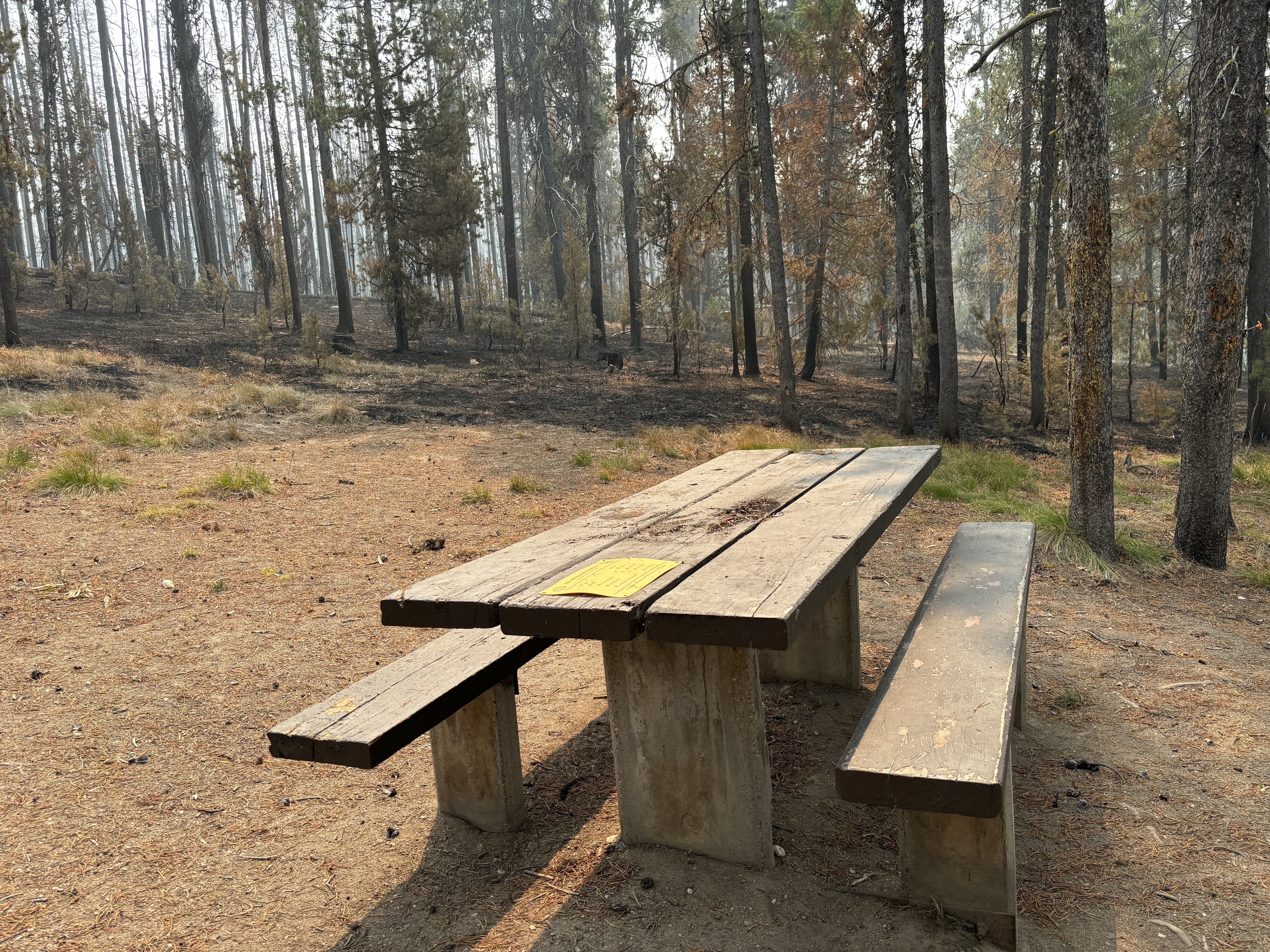
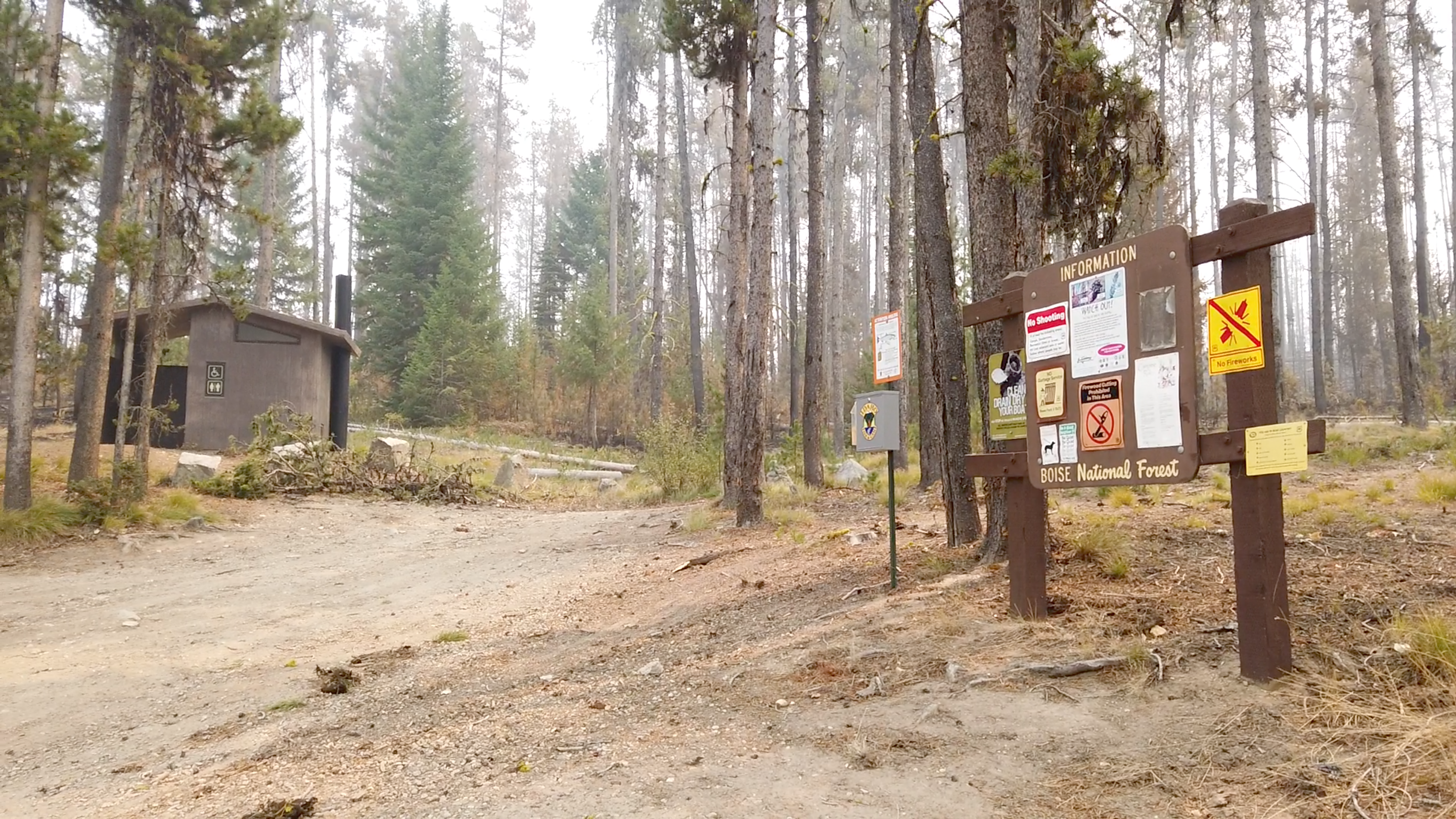
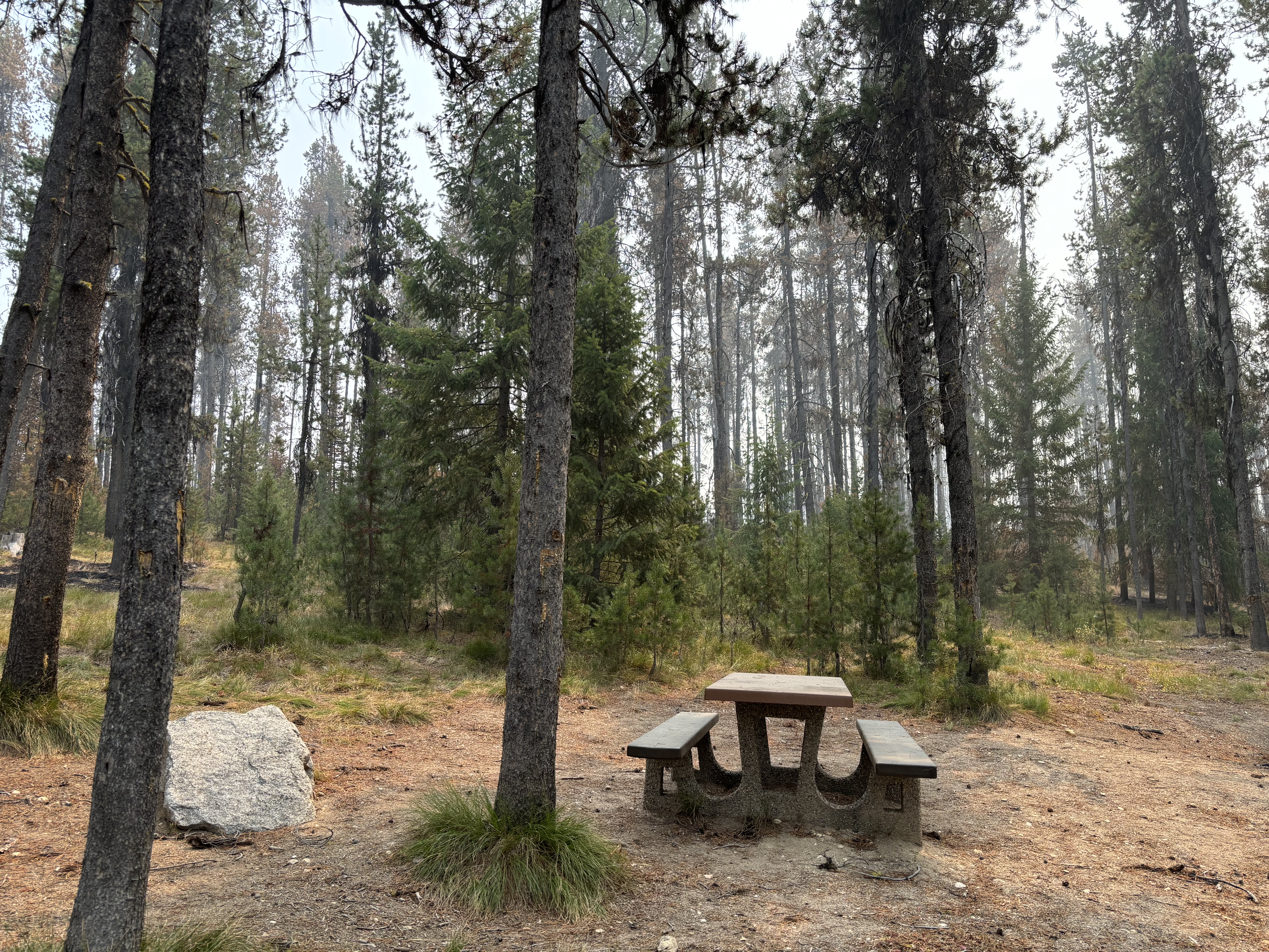
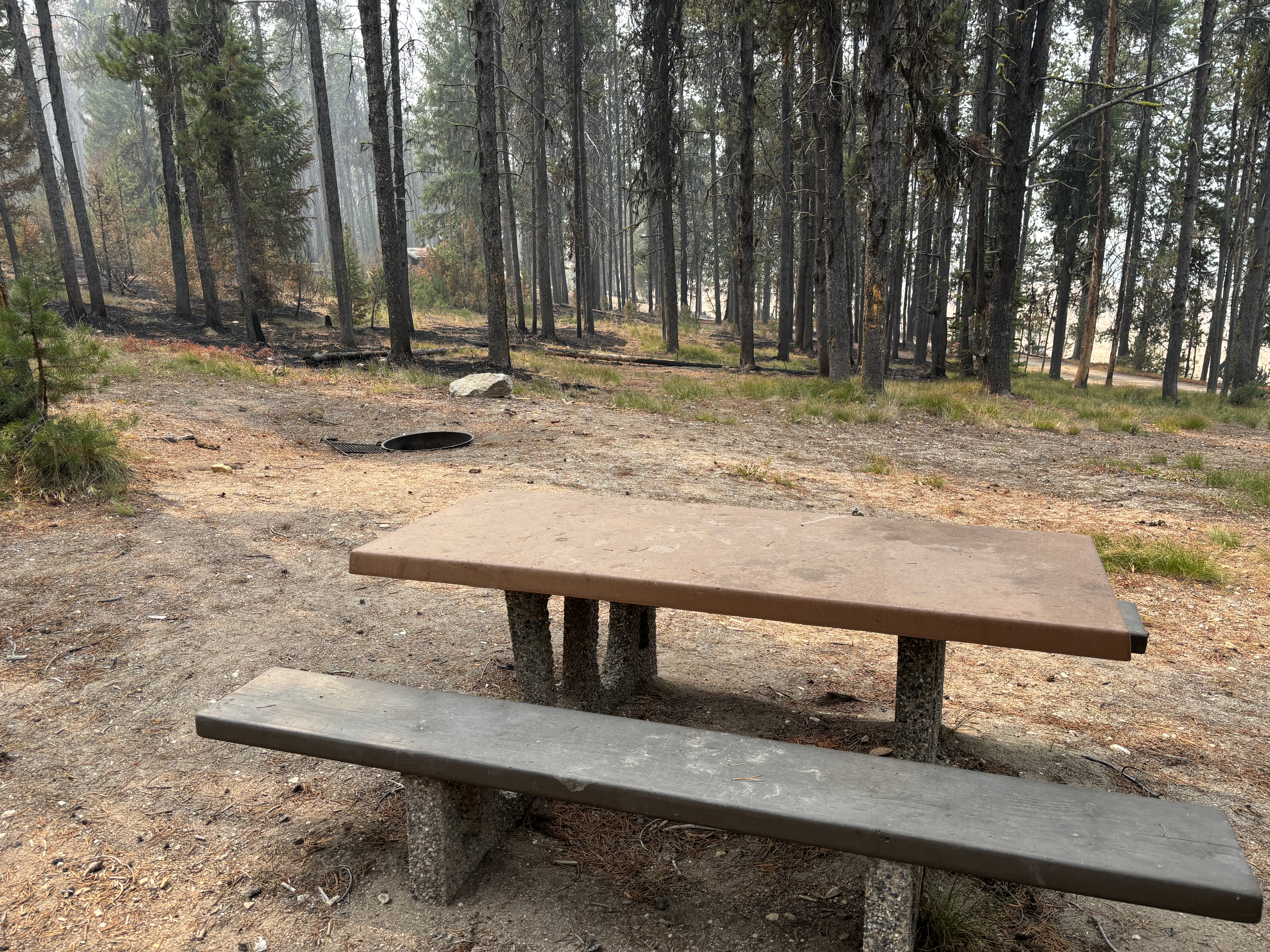
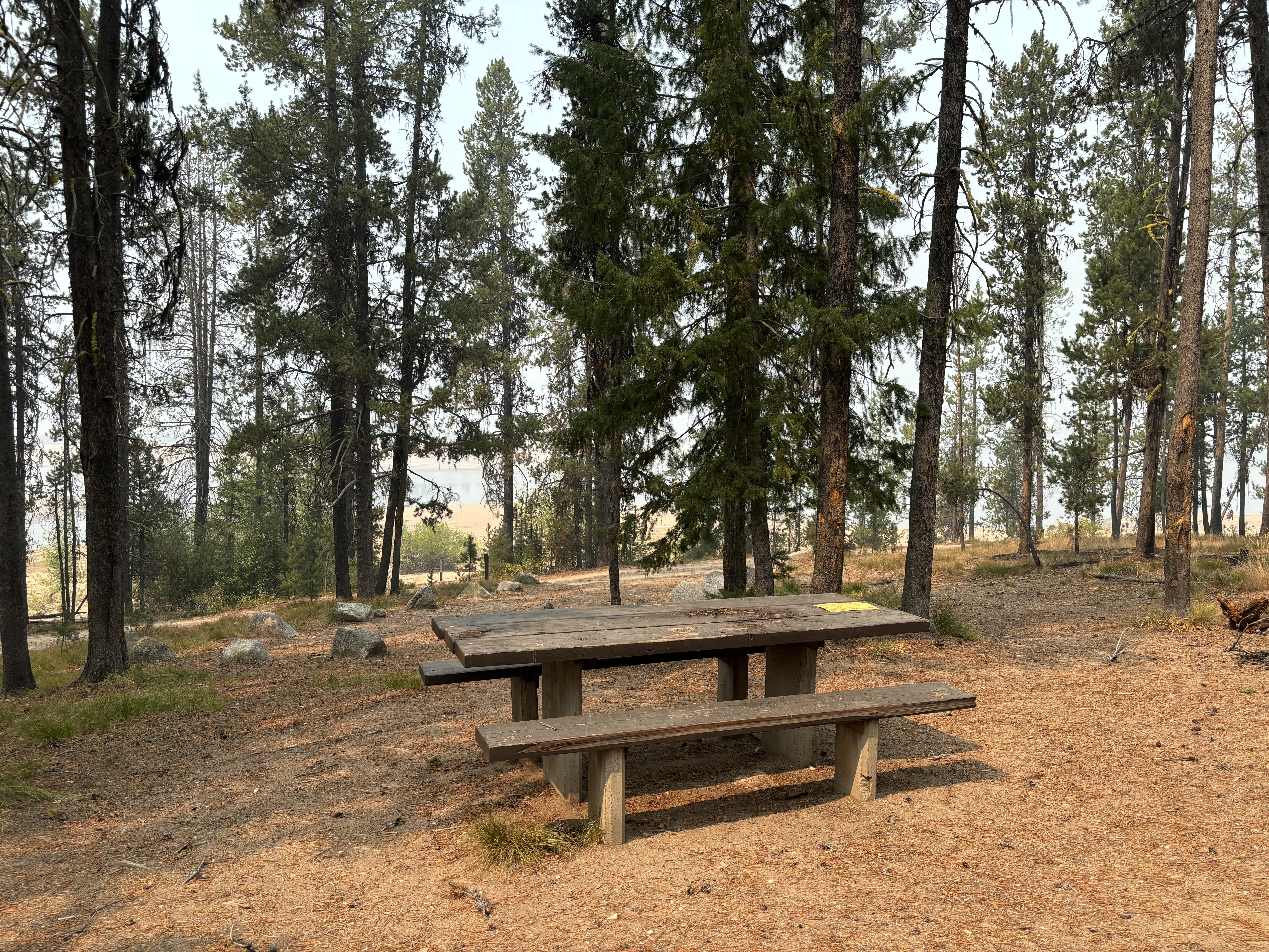
Cozy Cove Campground, located on the southern edge of the Deadwood Reservoir, is a popular place for camping on the Boise National Forest. While some of the area around the campground has been impacted by the Nellie Fire, the infrastructure in the campground remains undamaged, and there are still trees throughout the campground that have not been harmed. See the attached pictures.
Custer County Zone 1 Moves to Set Stage at 10 am Thursday 09 05 2024
Related Incident:
Publication Type: Announcement
The Custer County Sheriff announced that Zone 1 will move to the SET stage as of 10:00 a.m. Thursday, September 5, 2024.
All residents will be required to obtain a pass from the Emergency Operation Office located behind City Hall between 8:00 a.m. and 10:00 a.m. Identification and vehicle information will be required. At 10:00 a.m. all passes will be allowed to proceed to your residence. Please stay alert and be cautious as there will be heavy fire traffic in the area.
Wapiti Fire Community Meeting Stanley Thursday 09 05 2024
Related Incident:
Publication Type: Announcement
A Community Meeting will be held at 6 p.m. on Thursday, September 5 at the Stanley Community Building, 500 Eva Falls Avenue, Stanley, Idaho. The event will be livestreamed on the Wapiti Facebook page and the recording posted later to the Wapiti Facebook page.
Copperfield Fire Morning Update for 942024 09 04 2024
Related Incident: Copperfield Fire
Publication Type: News
Chiloquin, Ore. – Work to clear hazardous trees along the Sprague River Highway was completed yesterday. The highway was opened to the public at a reduced speed at 5:00 a.m. this morning. Motorists are advised to continue to exercise caution when driving through the area due to increased fire traffic in the area. School bus operations were allowed to operate with the opening of the road.
Last night crews strengthened the line around the fire, as well as mopping up around structures to 100’ and prepping the remaining homes. Crews continued to patrol around the perimeter, watching for any hot spots and identifying any areas of heat in the interior for the day shift to extinguish. Crews are also working with local Tribal agencies to identify and respectfully protect any cultural sites in the fire area.
Today will begin the transition to increasing the ‘cold black’ inside the fire perimeter. Three task forces will continue to patrol structures today, and hand crews and heavy equipment will build on last night’s work. Crews continue to increase the cool area along the perimeter of the fire, including hose lays in some areas. Over two miles of hose line has been deployed around the Corbell Butte area and along the southwest portion of fire line to reach interior areas and fortify the perimeter.
Due to the great progress on the fire, the Oregon State Fire Marshal will be demobilizing two task forces from Marion and Polk County to return to their local fire departments.
There have been no accidents or injuries reported during the suppression efforts on the fire.
Evacuation levels will continue to change with the increase of the fire containment. Evacuation levels are determined by the Klamath County Sheriff's Office in conjunction with fire officials and agency administrators. Current evacuation areas and levels can be found at https://www.klamathcounty.org/300/Emergency-Management.
RailroadDaly fires update September 4 2024 09 04 2024
Related Incident:
Publication Type: News
Railroad-Daly Fires update September 4, 2024
Location: Railroad Creek/ Skalkaho Creek confluence, 26 miles SE of Hamilton
Start Date: 7/25/2024
Cause: Lightning
Size: ~1,000 acres for Railroad & ~2,000 acres for Daly
Completion/Containment: 0%
18 Total Personnel
KEY MESSAGE
A portion of Skalkaho Hwy (Hwy 38) is closed to traffic (see details below). There is a temporary flight restriction in place over the fire area.
CURRENT STATUS
The Railroad fire is currently roughly 1,000 acres and the Daly fire is at roughly 2,000 acres (an infra-red flight will be scheduled for tonight to get confirmed acreage). Because of the steep and difficult terrain and high risk to responders, suppression actions have been limited. Crews are spending today finishing wrapping the Gird Point Lookout tower and securing protection for the RAW (weather) Station. In addition, they are working on snagging operations along Hwy 38 (removing trees along the road to reduce risk of falling on the road) and checking bridges to ensure they are safe for traffic. Crews are also scouting and developing plans to address the fire’s movement to the north.
WEATHER
Fire received some wetting rain on Tuesday. Lower relative humidity with some cooler temperatures expected today. Predicted weather may bring rain showers over the fire and moderate fire behavior. If fire does not receive wetting rains, moderate growth is expected.
CLOSURES
Because the Daly Fire exhibited increased fire behavior late on Monday night with fire crossing over the Skalkaho Hwy (Highway 38), an expanded Road Closure is in effect from Black Bear Campground on Skalkaho Hwy (Hwy 38) to the Skalkaho Pass. There are barricades in place, and Gird Point Lookout is closed.
See InciWeb for map and details on area closure: https://inciweb.wildfire.gov/incident-closures/mtbrf-railroaddaly-fire
Find more information on Facebook: https://www.facebook.com/profile.php?id=61565293593729
US Forest Service Closure Order for West Fire 09 04 2024
Related Incident: 2024 - West Fire - TNF2024 - Preacher Fire - TNF
Publication Type: Closures
West Fire Emergency Closure Order
PROHIBITIONS
Pursuant to 16 U.S.C. § 551 and 36 C.F.R. § 261.50 (a) and (b), the following is prohibited on the National Forest System (NFS) area, roads and trails in the Payson and Mogollon Ranger Districts, Tonto and Coconino National Forests, described below and shown on the attached map incorporated into this Order as Exhibit A (the
Described Area:
- Going into or being upon the Described Area. 36 C.F.R. § 261.53(e)
- Being on any road within the Described Area. 36 C.F.R. § 261.54(e)
- Being on any trail within the Described Area. 36 C.F.R. § 261.55(a)
EXEMPTIONS
Pursuant to 36 C.F.R. § 261.50(e), the following persons are exempt from this Order:
- Persons with Forest Service Permit No. FS-7700-48 (Permit for Use of Roads, Trails, or Areas Restricted by Regulation or Order), specifically exempting them from this Order or a written determination by a Forest Service authorized officer that a permit is not required under 36 C.F.R. § 251.50(e)(1) or (2).
- Any Federal, State, or Local Officer, or member of an organized rescue or firefighting force in the performance of an official duty.
- Arizona Dept. of Fire and Forestry Management contractor Suarez Forestry and Canyon Creek Logging to operate on and around Forest Road 64.
- Residents of Camp Geronimo, Geronimo Estates and Bray Creek Ranch being on Forest Service Road 64.
DESCRIBED AREA, ROADS, and TRAILS
The Described Area consists of all National Forest System lands, roads, and trails within the Boundary starting at the intersection of State Route (SR) 87 and National Forest System Road (NFSR) 64 (Control Road), then following northwest along the northeast side of SR-87 approximately 1.75 miles to the intersection with the Non- Forest Service Ownership (Community of Pine), then following east and north around the Non-National Forest System lands approximately 3.35 miles to the intersection with Trail 26 Pine Canyon, then following northeast along the northwest side of Trail 26 Pine Canyon approximately 3.5 miles to the intersection with NFSR 6038, then following north along the west side of NFSR 6038 approximately 0.1 miles to the intersection with SR-87, then following east along the south side of SR-87 approximately 1.5 miles to the intersection with NFSR 300, then following south along the west side of NFSR 300 approximately 0.1 miles to the intersection with NFSR 218A, then following south along the east side of NFSR 218A approximately 1.35 miles to the intersection with NFSR 218, then following east along the north side of NFSR 218 approximately 3 miles to the intersection with NFSR 300, then following southeast and northeast along the southwest and southeast side of NFSR 300 approximately 4 miles to the intersection with Chase Creek, then following southeast along Chase Creek approximately 1.5 miles to the intersection with Motorized Trail (MT) 646, then following south along the east side of MT-646 approximately 2 miles to the intersection with NFSR 32, then following southwest along the northwest side of NFSR 32 approximately 1 mile to the intersection with NFSR 64, then following west along the south side of NFSR 64 approximately 9.25 miles back to the point of beginning at the intersection of NFSR 64 and SR-87.
Routes along and within the Described Area boundary that are closed include: Trail 26 Pine Canyon, NFSR 6038, NFSR 218A, NFSR 218, MT-646, NFSR 64. Boundary
Routes SR-87, NFSR 300, and NFSR 32 remain open. Pine Trailhead, Red Rock Trailhead, and Geronimo Trailhead are also closed.
PURPOSE
The purpose of this Order is to protect public health and safety due to firefighting operations and fire danger associated with the uncontrolled West Fire on the Tonto and Coconino National Forests.
IMPLEMENTATION
- This Order shall be in effect from September 4, 2024, at 12:00pm through October 31, 2024, at 06:00pm, unless rescinded.
- A map identifying the Described Area, Roads, and Trails is attached and made part of this Order as Exhibit A. For a digital version of this Order and Exhibit A, go to https://www.fs.usda.gov/alerts/tonto/alerts-notices
- Unless otherwise expressly defined in this Order, the terms used in this Order are defined by the regulations of the Secretary of Agriculture, 36 C.F.R. Chapter II,
Parts 200-299. If there are terms in this Order that are not expressly defined in the Order or 36 C.F.R. Chapter II, Parts 200-299, their meaning shall be determined by their plain language definitions.
- A violation of the above prohibitions is punishable as a Class B misdemeanor by a fine of not more than $5,000 for individuals and $10,000 for organizations, or by imprisonment for not more than six months, or both. 16 U.S.C. § 551; 18 U.S.C.
§§ 3559, 3571, and 3581.
- Contact the Payson Ranger District in Payson, AZ, (928) 474-7900, and Tonto National Forest Supervisors Office in Phoenix, AZ, (602) 225-5200, or the Mogollon Ranger District in Happy Jack, AZ, (928) 477-2255, and Coconino National Forest Supervisors Office in Flagstaff, AZ, (928) 527-3600 for more information about this Order.
- This Order supersedes any previous Orders prohibiting the same or similar acts on the same Described Roads, Trails, and Area.