
Incident Publication
Daily Update Wapiti Fire Saturday 10 05 2024
Related Incident:
Publication Type: News
Wapiti Fire Statistics
- Size: 125,965 acres
- Completion: 78%
- Total Personnel: 242
- Location: near Grandjean, ID
- Reported: July 24, 2024
- Cause: Lightning
For More Information
InciWeb: https://inciweb.wildfire.gov/incident-information/idbof-wapiti-fire
Facebook: https://www.facebook.com/wapitifireinfo2024
Linktree: https://linktr.ee/WapitiFireInfo2024
Interactive Map: https://tinyurl.com/WapitiFireInfoMap
Special Emphasis: This evening, Great Basin Complex Incident Management Team (CIMT) #4 will transition command of the Wapiti and Frog Fires to Great Basin CIMT #3, who will be the sixth CIMT assigned to the Wapiti Fire. On behalf of Team #4, thank you to the communities, partners, stakeholders, and landowners who worked with us and supported us throughout our assignment.
The Air Quality Index (AQI) in the Stanley Basin is rated yellow/moderate today which indicates acceptable air quality but very sensitive people could be impacted and may want to limit outdoor exposure. You can check air quality and the AirNow Fire and Smoke Map at https://www.airnow.gov/.
With the changing of the closure areas, please ensure you check the boundaries prior to recreating or traveling. Many trails remain closed for public safety because they have not been cleared of potential hazards. The collection of firewood within the closure areas is prohibited; any firewood collection in open areas must be done with a valid firewood permit. For questions on firewood collection on the Sawtooth National Forest, please contact the Stanley Ranger Station at 208.774.3000.
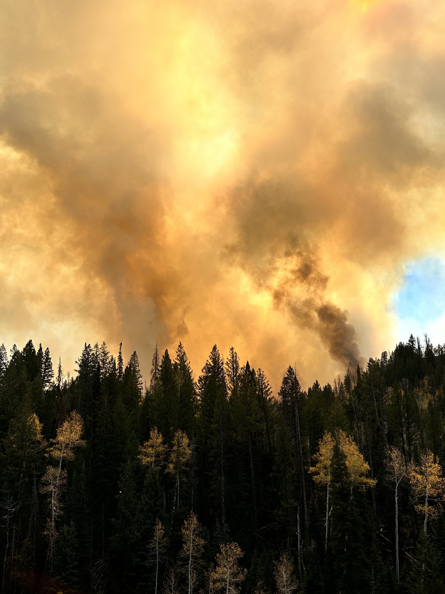
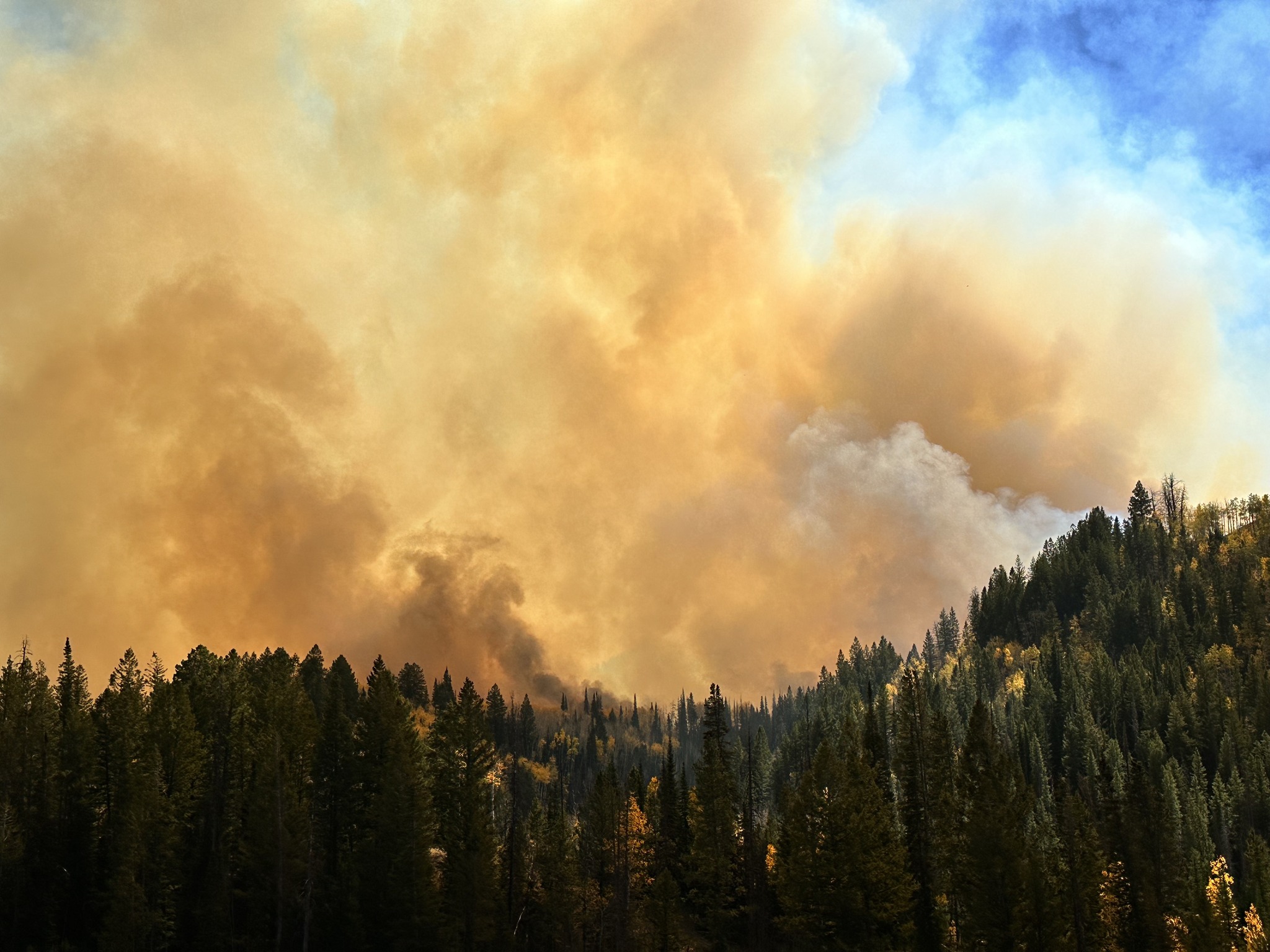
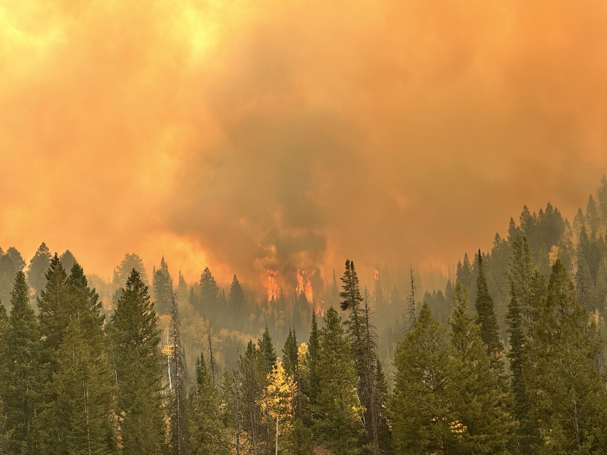
Weather: Yesterday’s winds were slightly muted compared to forecasts by the smoke that drifted over the Stanley Basin from other Idaho fires. Gusts between 20 and 40 mph were recorded over the Wapiti Fire area. Gusts of 50 to 60 mph were recorded over the Frog Fire area. Activity on both fires was minimal despite the winds. Today will be cooler and relative humidity will rise.
Current Situation: Fire crews and engines were spread throughout the fire area yesterday to monitor fire activity and respond as necessary. Smoke from other fires in the state acted like cloud cover to shade out the Wapiti Fire, and the fire was not as active as predicted. Winds were still strong enough to limit aviation flights. Early in the day, one helicopter was sent to assist with the Valley Fire burning just east of Boise, ID; it is expected to return today. Today, firefighters will continue suppression repair work near Stanley Lake. They are nearly complete with repair, having completed 27.9 miles of dozer line and 21.3 miles of handline. The fire perimeter right now measures at 324 miles.
Big Meadows was again the most active portion of the fire area yesterday. The fire continues to grow west, through heavy timber. Where the fire has been actively burning north of Bull Trout Lake, firefighters will return to continue working directly along the fire perimeter with help from helicopters dropping water on the flames. Last night, flames were visible above Trap Creek. The fire is burning through previous unburned vegetation interior to the main fire perimeter. At this time it does not cause concern to fire managers. Firefighters will continue to monitor it. Today’s moderated weather conditions will help in calming fire activity again as well.
Evacuations: Evacuation status for Stanley Zone 1 is currently at READY. All residents should remain alert for any change in conditions that may reinitiate an evacuation status. Sign up for Custer County CodeRED emergency notifications: text CUSTER to 99411 or enroll at https://public.coderedweb.com/CNE/BF28E45537FF. Sign up for Boise County Alert Sense emergency notifications at https://public.alertsense.com/SignUp/publicUser.aspx?regionid=1163.
For evacuation information on the Wapiti Fire, please see the Custer County Sheriff’s Facebook page, https://www.facebook.com/p/Custer-County-Sheriff-Idaho-61558947312289/, and the Boise County Sheriff’s Facebook page, https://www.facebook.com/boisecountysheriff/.
Closures: The Wapiti Fire area closure has been reduced on the southern end, excluding the Lowman, Ten Ax, Two Raven, and Sourdough communities. The closure still covers portions of the Sawtooth, Boise, and Salmon-Challis National Forests. Please reference the map and description at https://inciweb.wildfire.gov/incident-closures/idbof-wapiti-fire. Recreationalists and hunters should reference this map and obey all posted signage regarding the closure area and any related road, trail, and campground closures.
An interactive map for all closures on the Boise National Forest is found at https://experience.arcgis.com/experience/642380b0eb124c8cab6bd9ad3d7146ad/page/Overview/# data_s=id%3AdataSource_5-1888bd00a2c-layer-13-1888bd00b53-layer-16%3A82.
Wapiti Fire Area Road and Trail Closure 10 02 2024
Related Incident:
Publication Type: Closures
The Wapiti Fire area closures have been modified. Please refer to the closure orders on the Sawtooth National Forest’s Alerts and Notices webpage.
Yellow Lake Fire Evening Update 10 04 2024
Related Incident: Yellow Lake Fire
Publication Type: News
Red flag conditions—including high winds, record-breaking temperatures, extremely low humidity, and unseasonably dry weather—have increased both fire activity and visible smoke, as expected.
During the predicted wind event, multiple wind-driven spot fires occurred further north across Highway 35 and the gas pipeline, establishing themselves in timber and producing more visible smoke. Due to this spotting, the fire has grown, with its new size and acreage to be measured overnight using infrared technology.
The fire continues to move in a northeasterly direction. Despite the fire's growth, there are currently no additional evacuations in place. If the fire continues moving northeast, Duchesne County may be the next area to consider evacuation plans. That will follow a standard ready, set, go messaging and plan.
Any additional smoke seen from the northern Uintas is related to the #YellowLakeFire. This smoke is not related to any previous fires burning across the range, including the #ElizabethFire.
To stay informed on evacuation notices and other emergency updates, sign up on the respective county emergency management platform. Information provided by other sources should be confirmed through both the Forest and the counties.
https://emergency-management-operations-wasatch.hub.arcgi...
BAER INFORMATION BRIEF Preparing for Rain after Idaho Wildfires 10 04 2024
Related Incident: Boise NF Post-Fire BAER 2024
Publication Type: News
BAER INFORMATION BRIEF: Preparing for Rain After Idaho Wildfires
POST-FIRE WATERSHED CONDITIONS—KEY MESSAGES
While many wildfires cause minimal damage to the land and pose few threats to the land or people downstream, some fires cause damage that requires special efforts to prevent problems afterwards.
Summer thunderstorms and winter rain events in Idaho mountain areas can result in high water runoff and flooding.
Wildfire increases the potential for flooding, post-fire soil erosion and debris flows that could impact campgrounds, fishing areas, homes, structures, roads, and other infrastructure within, adjacent to, and downstream from the burned areas.
Post-fire, watershed conditions will naturally receive and transport water and sediment differently than during pre-fire conditions.
The public and communities adjacent to and downstream from the wildfire areas should expect increased flooding and debris transport during less than average rain events.
SAFETY CONCERNS CONTINUE AFTER THE FIRE IS OUT
The potential for increased water runoff and debris flows are not just a one-year concern.
We recognize the threat potential of flash floods and debris flows may exist for the next several years, depending on the intensity of these storms.
For life and safety concerns, burned area public land closures are sometimes implemented prior to forecast rain events until the burned area fully recovers.
Residents and visitors should remain alert to weather events and plan ahead when travelling along roads within and downstream from the burned areas.
ASSESSING BURNED WATERSHEDS RESPONSE
Forest Service Burned Area Emergency Response (BAER) teams work with each of the national forests, to assess the condition of the watersheds on National Forest System (NFS) lands burned by wildfires.
BAER assessment teams identify potential emergency threats to BAER critical values that may be considered at-risk on federal lands such as:
- Human life and safety.
- NFS property, such as buildings, water systems and infrastructure, utility systems, road and trail prisms.
- Critical natural resources such as water, soil productivity and hydrologic function, areas where invasive species or noxious weeds may impact native or naturalized communities and may include critical habitat or suitable occupied habitat for federally listed threatened or endangered species.
- Critical cultural and heritage resources such as pre-historic and historic properties and sites.
BAER assessment teams recommend emergency stabilization response actions that are implemented on federal land to reduce potential post-fire threats.
PREPARING FOR POTENTIAL FLOODING AND DEBRIS-FLOWS FROM WILDFIRE BURNED AREAS
For values and resources potentially impacted off federal lands, one of the most effective BAER strategies is interagency coordination with local cooperators who assist affected businesses, homes, and landowners with preparing for rain events.
While multi-agency efforts are being taken to reduce the risks to life and safety adjacent to and downstream from the burned areas, nearby residents should develop individual plans to protect themselves and their property.
The USDA Forest Service and the USDA Natural Resources Conservation Service (NRCS) work together and coordinate with other federal, state and local agencies, and counties that assist private landowners in preparing for increased water run-off and potential flooding impacts.
NRCS and local sponsors prepare damage survey reports for eligible sites on private lands adjacent to and downstream from affected areas. NRCS uses these reports, along with the Forest Service BAER team’s assessment report, to develop emergency measures to reduce the impacts from potential increased water and debris flows, and assist local sponsors to implement recommended emergency measures through its Emergency Watershed Protection (EWP) Program: (NRCS_EWPP_Fact Sheet-2021.pdf (usda.gov)).
All EWP Program–Recovery projects begin with a local sponsor or legal subdivision of state or tribal government. Eligible sponsors include cities, counties, towns, conservation districts, or any federally recognized Native American tribe or tribal organization. Interested public and private landowners can apply for EWP Program–Recovery assistance through one of those sponsors. For more information on NRCS Disaster Assistance Programs: Emergency Watershed Protection | Natural Resources Conservation Service (usda.gov).
The following links provide information and references for state and local county offices of emergency management promote preparedness through its emergency services programs to assist the public to prepare for, respond appropriately to, and quickly recover from natural emergencies that may impact county residents and visitors:
Boise County Emergency Services
Valley County Emergency Management
Adams County Emergency Management
Homes or businesses that could be impacted by flooding from federal land that resulted from wildfires may be eligible for flood insurance coverage from the National Flood Insurance Program (NFIP). Information about NFIP is available through FEMA at www.fema.gov/national-flood-insurance-program, or FEMA Wildfire Increases Flood Risk. Other flood preparedness information is available at www.ready.gov/floods and www.floodsmart.gov/.
LINKS TO ADDITIONAL RESOURCES AND WEBSITES
NRCS Wildfire Disaster Recovery
NRCS Post-Fire Disaster Assistance
FEMA Wildfire Increases Flood Risk
FEMA Flood After Fire—Fact Sheet
Recovering from Wildfire-Damage Assessments
Flood Safety Emergency Preparedness
Be Ready & Prepare for Emergencies
NWS Weather Information-Boise ID
NWS Post-Wildfire Flash Flood-Debris Flow Guide
NWS Burn Scar Flash Flood & Debris Flow Risks
Red Cross Emergency Preparedness
BAER SAFETY MESSAGE: Everyone near and downstream from the burned areas should remain alert and stay updated on weather conditions that may result in heavy rains and increased water runoff. Flash flooding may occur quickly during heavy rain events--be prepared to act. Current weather and emergency notifications can be found at National Weather Service website: www.weather.gov/boi/.
BAER INFORMATION BRIEF Understanding Soil Burn Severity 10 04 2024
Related Incident: Boise NF Post-Fire BAER 2024
Publication Type: News
BAER INFORMATION BRIEF: Understanding Soil Burn Severity
We tend to think of wildfire burn severity in terms of the visual impacts to above-ground vegetation, but the post-fire landscape response (erosion, flooding, and mass movement) is generally more strongly correlated to soil burn severity. When characterizing soil burn severity, looking at the vegetation is a good starting place to understand the conditions on the ground.
Armed with that information, the BAER team’s watershed specialists (soil scientists, hydrologists, and geologists) ground-truth different vegetation burn intensities to tease out patterns of how fire affected and changed the properties of the soil. Pre-fire ground cover, forest type, fire behavior, slope, aspect, and other factors all influence soil burn severity. After field observations are collected, specialists adjust the vegetation severity map to create the soil burn severity (SBS) map. The SBS is broken into four different classes: unburned (green), low severity (blue), moderate severity (yellow), and high severity (red).
So, what do these different classifications mean?
LOW severity areas generally have intact and recognizable litter layers (organic material on the forest floor, such as pine needles and twigs). These litter layers may be charred but are not consumed. Underlying topsoil is intact, and near-surface fine roots are unburned. These soils have enough cover to protect them from erosion during rain events because their natural porosity and structure allow rain to soak into the soil instead of running off, while fine roots provide stability. In low severity areas, burns may have been patchy islands of green vegetation and intact canopies may be present.
MODERATE severity areas generally have more—up to 80% of their pre-fire surface litter layers consumed by fire. Black or gray ash may be present on the soil surface. Fine roots near the surface may be scorched and killed. Topsoil layers are generally intact with minimal impacts to the soil’s ability to absorb moisture. Soils with moderate severity are more susceptible to erosion in post-fire rain events because they have lost protective surface cover and may have less surface stability because of root mortality.
HIGH severity areas generally have had all their pre-fire surface litter layers consumed by fire. White or gray ash may be present on the soil surface. Fine roots are often fully burned/consumed within several inches of the soil surface, and even large tree roots may have burned deep into the soil. Soil may be powdery or grainy and loose, unable to bind together and retain water. These soils are very susceptible to erosion and often have high surface run-off during rainstorms.
So, what does the BAER team do with the SBS map?
The BAER team uses the SBS map to make predictions about how the landscape will respond after fires. Soil scientists consider where soil productivity will be degraded due to erosion losses and where sediment may move into stream channels. Hydrologists use the SBS to predict watershed response—surface runoff from high SBS areas in rainstorms can produce more “flashy” behavior in stream systems. Geologists use the SBS to inform predictions for debris flow or other mass movement potential based on reduced soil stability in steep drainages.
BAER teams focus on emergency responses to stabilize burned areas that may impact Forest Service critical infrastructure or other values located within or immediately downstream of high soil burn severity areas.
BAER SAFETY MESSAGE: Everyone near and downstream from the burned areas should remain alert and stay updated on weather conditions that may result in heavy rains and increased water runoff. Flash flooding may occur quickly during heavy rain events--be prepared to act. Current weather and emergency notifications can be found at National Weather Service website: www.weather.gov/boi/.
BAER INFORMATION BRIEF Fire Severity and Fire Intensity Effects 10 04 2024
Related Incident: Boise NF Post-Fire BAER 2024
Publication Type: News
BAER INFORMATION BRIEF: Fire Severity and Fire Intensity Effects
There are several types of fire severity and intensity maps that you may see. Although they look different for the same fire, they may also all be accurate. This is because fire severity or intensity are different measures of the fire effects on a specific resource such as soils, tree canopies, vegetation or wildlife habitat. Burned Area Emergency Response (BAER) maps are primarily measures of fire effects on soils. The following is a description of BAER fire severity mapping for soil burn severity levels.
SOIL BURN SEVERITY RATING OVERVIEW:
High Soil Burn Severity Rating: (severe damage to the soils): deeply burned soils with high water repellent soils (tend to be places where the fire burned the forest canopy, ground cover, roots, and organic matter in the topsoil).
Moderate Soil Burn Severity Rating: burned soil with moderate water repellent soils (much of the root, soil structure, and organic matter stayed intact and could help buffer the rainstorms that might cause erosion) can produce increased water run-off and soil erosion depending on the timing, magnitude, and duration of future precipitation. The remaining vegetation could quickly re-sprout and provide some cover from dead needles and leaf fall to reduce erosion.
Low Soil Burn Severity Rating: light soil burning includes land that may have burned in recent occurrences with brush or young timber growing on it.
KEY MESSAGES:
• Fire severity and intensity are separate measures of the effects of fire on a defined resource.
• All fire severity or intensity maps view landscapes from different perspectives, so various maps of the same fire can look very different, and all be accurate.
• The BAER soil burn severity maps specifically focus on severity to soils and watersheds.
• There are also several other types of fire severity or intensity maps – many of which focus on different aspects of vegetation such as, Burned Area Reflectance Classification (BARC) and Vegetation severity or intensity maps are both vegetation maps but will also look different for the same location and time.
• Vegetation severity and intensity maps also come from a number of different perspectives and can be short-term or long-term views.
• During post-fire assessments, the BAER team uses the term “soil burn severity” to differentiate post-fire soil properties from fire effects on vegetation (such as tree mortality), and/or general fire effects on the long-term ecosystem health.
• When a fire slowly consumes fuel (long residence time), the fire (soil burn) severity is usually high.
• Ground cover refers to the organic material on the top of the soil layer, and includes vegetative litter, duff, and woody debris.
• When organic material within the ground cover and within the soil structure burns at high intensity, some of the water repellent components vaporize, and condense on the soil at the surface or deeper depending on the severity of the fire.
• The correlation between fire intensity and soil burn severity is not always direct because the amount of heat generated and time duration both plays a critical role in the fire effects to soil.
• Because of the variability of fuel consumption, soil heating typically is non-uniform across landscapes.
• Wildfire does not always impact soils and vegetation in the same way.
• A hot, fast-moving fire can consume much of the vegetation and move through so quickly that the soils remain largely intact.
• Soil scientists evaluate preliminary burn maps from satellite imagery to determine the effects and create a soil burn severity map.
• Hydrologists use that information to model storm runoff over the burned area to estimate potential flood impacts to lives and property.
• Foresters use the same satellite images to create a different map that displays post-fire impacts to the trees.
• A hot, fast-moving fire (wind-driven) can consume the majority of vegetation (especially when dry with low fuel moistures) in a burned area and can be classified as a high intensity fire area by fire ecologists/fire behavior analysts.
• When the duration (also described as residency time) of the fire is short (fast moving, wind-driven), it can result in a low-to-moderate soil burn severity rating by BAER soils scientists because the soil did not get a lot of lingering heat on the ground.
BAER SAFETY MESSAGE: Everyone near and downstream from the burned areas should remain alert and stay updated on weather conditions that may result in heavy rains and increased water runoff. Flash flooding may occur quickly during heavy rain events--be prepared to act. Current weather and emergency notifications can be found at the National Weather Service website: www.weather.gov/boi/.
BAER INFORMATION BRIEF Burned Area Emergency Response BAER Limitations 10 04 2024
Related Incident: Boise NF Post-Fire BAER 2024
Publication Type: News
BAER INFORMATION BRIEF: Burned Area Emergency Response (BAER) Limitations
While many wildfires cause minimal damage to the land and pose few threats to the land or people downstream, some fires result in damage that requires special efforts to reduce impacts afterwards. Loss of vegetation exposes soil to erosion; water run-off may increase and cause flooding, soil and rock may move downstream and damage property or fill reservoirs putting community water supplies and endangered species at-risk.
The Burned Area Emergency Response (BAER) program is designed to identify and manage potential risks to resources on National Forest System lands and reduce these threats through appropriate emergency measures to protect human life and safety, property, and critical natural or cultural resources. BAER is an emergency program for stabilization work that involves time-critical activities to be completed before the first damaging storm event to meet program objectives.
BAER Objectives:
- Determine whether imminent post-wildfire threats to human life and safety, property, and critical natural or cultural resources on National Forest System lands exist and take immediate actions, as appropriate, to manage the unacceptable risks.
- If emergency conditions are identified, mitigate significant threats to human life and safety, Forest Service property and other critical natural and cultural resource values.
- Prescribe emergency response actions to stabilize and prevent unacceptable degradation to natural and cultural resources, to minimize threats to life or property resulting from the effects of a fire, or to repair/replace/construct physical improvements necessary to prevent degradation of land or resources.
- Implement emergency response actions to help stabilize soil; control water, sediment and debris movement and potentially reduce threats to the BAER critical values identified above when an analysis shows that planned actions are likely to reduce risks substantially within the first year following containment of the fire.
- Monitor the implementation and effectiveness of emergency treatments that were applied on National Forest System lands.
BAER Interagency Coordination:
Post-fire emergency response is a shared responsibility. There are several Federal, State and local agencies that have emergency response responsibilities or authorities in the post-fire environment. The BAER team coordinates with these agencies to look at the full scope and scale of the situation to reduce the potential threats to human life and property. It is important that BAER efforts are communicated with all affected and interested cooperating agencies and organizations regarding other post-fire recovery and restoration efforts.
BAER treatments cannot prevent all of the potential flooding or soil erosion impacts, especially after a wildfire-changed landscape. It is important for the public to stay informed and prepared for potentially dramatic increased run-off events.
One of the most effective BAER strategies is interagency coordination to provide post-fire threat information to local cooperators who can assist affected businesses, homes, and landowners to prepare for rain events. For example, the Natural Resources Conservation Service (NRCS) has the Emergency Watershed Protection (EWP) program for post-emergency assistance on private and tribal land, the National Weather Service (NWS) has responsibility for flood warning alerts, the Federal Emergency Management Agency (FEMA) has flood insurance and other responsibilities if the area is a Presidentially-declared emergency, Resource Conservation Districts (RCD) and counties, as well as State and local-highway and emergency services departments, Flood Control authorities, etc. It is important that landowners work directly with NRCS and other agencies to determine appropriate actions needed to protect private structures and other assets.
BAER Process:
BAER assessment teams are staffed by specially trained professionals that may include: hydrologists, soil scientists, engineers, biologists, botanists, archeologists, and others who evaluate the burned area and prescribe temporary emergency stabilization actions on National Forest System lands to protect the land quickly and effectively. BAER assessments usually begin before a wildfire has been fully contained.
A BAER assessment team conducts field surveys and uses science-based models to rapidly evaluate and assess the burned area and prescribe emergency stabilization measures. The team generates a “Soil Burn Severity” map by using satellite imagery which is then validated and adjusted by BAER team field surveys to assess watershed conditions and model potential watershed response from the wildfire. The map identifies areas of soil burn severity by categories of very low/unburned, low, moderate, and high which may correspond to a projected increase in watershed response. The higher the burn severity, the less the soil will be able to absorb water when it rains. Without absorption, there will be increased run-off with the potential of flooding.
The BAER team presents these findings in an assessment report that identifies immediate and emergency actions needed to address post-fire risks to human life and safety, property, cultural and critical natural resources. This includes early detection and rapid response (EDRR) treatments to prevent the spread of noxious weeds into native plant communities. The BAER report describes watershed pre- and post-fire watershed response information, areas of concern for life and property, and recommended short-term emergency stabilization measures for Forest Service lands that burned.
In most cases, only a portion of the burned area is actually treated. Severely burned areas steep slopes, and places where water run-off will be excessive and may impact important resources, are focus areas and described in the BAER assessment report if they affect critical values. Response action timing is essential to ensure the emergency stabilization measures are effective.
There are a variety of emergency stabilization actions that the BAER team can recommend for Forest Service land such as mulching with agricultural straw or chipped wood to protect soil productivity, increasing road drainage to keep roads and bridges from washing-out during post-fire floods, and early detection rapid response invasive plant treatments to prevent spread of weeds into native plant communities. BAER treatments are preventative in nature but cannot prevent all damage, especially debris torrents in areas that are prone to sliding and have lost critical root structure from plants.
The Cans and Cannots of BAER:
What BAER Can Do:
- Install water or erosion control devices
- Seed or mulch for erosion control or stability reasons
- Install erosion control measures at critical cultural sites
- Install temporary barriers to protect treated or recovering areas
- Install warning signs
- Replace minor safety related facilities, like burned guard rails
- Install appropriate-sized drainage features on roads, trails
- Remove critical safety hazards
- Prevent permanent loss of T&E habitat
- Monitor BAER treatments
- Implement EDRR treatments to minimize the spread of noxious weeds into native plant communities
What BAER Cannot Do:
- Prevent all flooding and debris flows
- Replant commercial forests or grass for forage
- Excavate and interpret cultural sites
- Replace burned pasture fences
- Install interpretive signs
- Replace burned buildings, bridges, corrals, etc.
- Repair roads damaged by floods after fire
- Remove all hazard trees
- Replace burned habitat
- Monitor fire effects
- Treat pre-existing noxious weeds
BAER Funding:
Special Emergency Wildfire Suppression funds are authorized for BAER activities and the amount of these expenses varies with the severity of the fire season. Some years see little BAER activity while other years are extremely busy.
Because of the emergency nature of BAER, initial requests for funding of proposed BAER treatments are supposed to be submitted by the Forest Supervisor to the Regional Office within7 days of total containment of the fire. The Regional Forester’s approval authority for individual BAER projects is limited. Approval for BAER projects exceeding this limit is forwarded onto the Washington Office.
BAER SAFETY MESSAGE: Everyone near and downstream from the burned areas should remain alert and stay updated on weather conditions that may result in heavy rains and increased water runoff. Flash flooding may occur quickly during heavy rain events--be prepared to act. Current weather and emergency notifications can be found at National Weather Service website: www.weather.gov/boi/.
BAER INFORMATION BRIEF Key Elements of A BAER Assessment 10 04 2024
Related Incident: Boise NF Post-Fire BAER 2024
Publication Type: News
BAER INFORMATION BRIEF: Key Elements of A BAER Assessment
Forest Service BAER assessment teams are established by Forest Supervisors before wildfires are fully contained. The teams coordinate and work with the USDA Natural Resources Conservation Service (NRCS), Bureau of Land Management (BLM), Fish & Wildlife Service (FWS), National Weather Service (NWS), local counties, State Department of Transportation, and other federal, state, and local agencies to strategically assess potential post-fire impacts to the watersheds burned from wildland fires.
BAER assessment teams are evaluating watershed conditions to determine the level of potential risks to human life, safety, property, critical natural and cultural-heritage resources, and determine if there are appropriate and effective emergency stabilization measures that can be implemented on federal lands in a timely manner to reduce unacceptable risks from potential flooding and debris flow threats.
The BAER assessment team conducts field surveys and uses science-based models to rapidly evaluate and assess the burned area.
BAER assessment teams are staffed by specially trained professionals that may include: hydrologists, soil scientists, engineers, geologists, biologists, botanists, archeologists, geographic information system mapping specialists, recreation and trails specialists, and others who evaluate the burned area and prescribe emergency response actions to protect the land quickly and effectively.
BAER assessments usually begin before a wildfire has been fully contained.
The BAER assessment team generates a “Soil Burn Severity” map by using satellite imagery which is then validated and adjusted by BAER team field surveys to assess watershed conditions and watershed response to the wildfire. The map identifies areas of soil burn severity by categories of low/unburned, moderate, and high which corresponds to a projected increase in watershed response.
The BAER team presents these findings and treatment recommendations to the Forest Supervisor in an assessment report that identifies immediate and emergency stabilization actions needed to address potential post-fire risks to human life and safety, property, cultural-heritage and critical natural resources on National Forest System lands.
The BAER report describes watershed pre- and post-fire response information, areas of concern for human life, safety and property, and recommended short-term emergency stabilization actions for federal lands that burned.
In most cases, only a portion of the burned area is actually treated.
If the BAER assessment team determines there may be potential emergency situations, the short-term goal is to have flood and erosion control protection measures completed before the first large, damaging rain events occur.
Timely implementation is critical if BAER emergency response actions are to be effective.
The BAER assessment team coordinates with other federal and local agencies, and counties that assist private landowners in preparing for increased run-off and potential flooding.
Federal assistance to private landowners regarding post-fire potential impacts is the primary responsibility of the NRCS through the Emergency Watershed Protection (EWP) program (www.nrcs.usda.gov/wps/portal/nrcs/main/national/programs/landscape/ewpp/).
NRCS in coordination with additional state, local and federal agencies conduct damage survey reports for the private land adjacent to and downstream from the burned areas. NRCS uses these reports, along with the BAER team’s assessment report, to develop recommended emergency measures for businesses and private home and landowners to reduce the impacts to their property from potential increased water and debris flows.
BAER SAFETY MESSAGE: Everyone near and downstream from the burned areas should remain alert and stay updated on weather conditions that may result in heavy rains and increased water runoff. Flash flooding may occur quickly during heavy rain events--be prepared to act. Current weather and emergency notifications can be found at National Weather Service website: www.weather.gov/boi/.
BAER INFORMATION BRIEF Forest Service BAER Program Overview 10 04 2024
Related Incident: Boise NF Post-Fire BAER 2024
Publication Type: News
BAER INFORMATION BRIEF: Forest Service BAER Program Overview
The Burned Area Emergency Response (BAER) program is designed to identify and manage potential risks to resources on National Forest System lands and reduce these threats through appropriate emergency measures to protect human life and safety, property, and critical natural or cultural resources. BAER is an emergency program for stabilization work that involves time-critical activities to be completed before the first damaging event to meet program objectives:
BAER Objectives:
- Determine whether imminent post-wildfire threats to human life and safety, property, and critical natural or cultural resources on National Forest System lands exist and take immediate actions, as appropriate, to manage the unacceptable risks.
- If emergency conditions are identified, mitigate significant threats to health, safety, human life, property, and critical cultural and natural resources.
- Prescribe emergency response actions to stabilize and prevent unacceptable degradation to natural and cultural resources, to minimize threats to critical values resulting from the effects of a fire, or to repair/replace/construct physical improvements necessary to prevent degradation of land or resources.
- Implement emergency response actions to help stabilize soil; control water, sediment and debris movement and potentially reduce threats to the BAER critical values identified above when an analysis shows that planned actions are likely to reduce risks substantially within the first year following containment of the fire.
- Monitor the implementation and effectiveness of emergency treatments that were applied on National Forest System lands.
While many wildfires cause minimal damage to the land and pose few threats to the land or people downstream, some fires result in damage that requires special efforts to reduce impacts afterwards. Loss of vegetation exposes soil to erosion; water run-off may increase, and cause flooding, soil and rock may move downstream and damage property or fill reservoirs putting community water supplies and endangered species at-risk.
The BAER team presents these findings in an assessment report that identifies immediate and emergency actions needed to address post-fire risks to human life and safety, property, cultural and critical natural resources. This includes early detection and rapid response (EDRR) treatments to prevent the spread of noxious weeds into native plant communities. The BAER report describes watershed pre- and post-fire watershed response information, areas of concern for life and property, and recommended short-term emergency stabilization measures for Forest Service lands that burned.
In most cases, only a portion of the burned area is actually treated. Severely burned areas steep slopes, and places where water run-off will be excessive and may impact important resources, are focus areas and described in the BAER assessment report if they affect critical values. Time is critical if the emergency stabilization measures are to be effective.
A BAER assessment team conducts field surveys and uses science-based models to rapidly evaluate and assess the burned area and prescribe emergency stabilization measures. The team generates a “Soil Burn Severity” map by using satellite imagery which is then validated and adjusted by BAER team field surveys to assess watershed conditions and model potential watershed response from the wildfire. The map identifies areas of soil burn severity by categories of very low/unburned, low, moderate, and high which may correspond to a projected increase in watershed response. The higher the burn severity, the less the soil will be able to absorb water when it rains. Without absorption, there will be increased run-off with the potential of flooding.
BAER Funding:
Special Emergency Wildfire Suppression funds are authorized for BAER activities and the amount of these expenses varies with the severity of the fire season. Some years see little BAER activity while other years are extremely busy.
Because of the emergency nature of BAER, initial requests for funding of proposed BAER treatments are supposed to be submitted by the Forest Supervisor to the Regional Office within 7 days of total containment of the fire. The Regional Forester’s approval authority for individual BAER projects is limited. Approval for BAER projects exceeding this limit is to the Washington Office.
BAER SAFETY MESSAGE: Everyone near and downstream from the burned areas should remain alert and stay updated on weather conditions that may result in heavy rains and increased water runoff. Flash flooding may occur quickly during heavy rain events-be prepared to act. Current weather and emergency notifications can be found at National Weather Service website: www.weather.gov/boi/.
BAER INFORMATION BRIEF Three Phases of Wildfire Recovery 10 04 2024
Related Incident: Boise NF Post-Fire BAER 2024
Publication Type: News
BAER INFORMATION BRIEF: Three Phases of Wildfire Recovery
THREE PHASES OF WILDFIRE RECOVERY
There are three phases of recovery following wildfires on federal lands:
- Fire Suppression Repair
- Emergency Stabilization-Burned Area Emergency Response (BAER)
- Long-Term Recovery and Restoration
- Fire Suppression Repair is a series of immediate post-fire actions taken to repair damages and minimize potential soil erosion and impacts resulting from fire suppression activities and usually begins before the fire is contained, and before the demobilization of an Incident Management Team. This work repairs the hand and dozer fire lines, roads, trails, staging areas, safety zones, and drop points used during fire suppression efforts.
- Emergency Stabilization-Burned Area Emergency Response (BAER) is a rapid assessment of burned watersheds by a BAER team to identify imminent post-wildfire threats to human life and safety, property, and critical natural or cultural resources on National Forest System lands and take immediate actions to implement emergency stabilization measures before the first post-fire damaging events. Fires result in loss of vegetation, exposure of soil to erosion, and increased water runoff that may lead to flooding, increased sediment, debris flows, and damage to critical natural and cultural resources. BAER actions such as: mulching, seeding, installation of erosion and water run-off control structures, temporary barriers to protect recovering areas, and installation of warning signs may be implemented. BAER work may also replace safety related facilities; remove safety hazards; prevent permanent loss of habitat for threatened and endangered species; prevent the spread of noxious weeds and protect critical cultural resources.
- Long-Term Recovery and Restoration utilizes non-emergency actions to improve fire-damaged lands that are unlikely to recover naturally and to repair or replace facilities damaged by the fire that are not critical to life and safety. This phase may include restoring burned habitat, reforestation, other planting or seeding, monitoring fire effects, replacing burned fences, interpreting cultural sites, treating noxious weed infestations, and installing interpretive signs.
BAER SAFETY MESSAGE: Everyone near and downstream from the burned areas should remain alert and stay updated on weather conditions that may result in heavy rains and increased water runoff. Flash flooding may occur quickly during heavy rain events--be prepared to act. Current weather and emergency notifications can be found at National Weather Service website: www.weather.gov/boi/.