
Smoke Outlook 8262020
Related Incident:
Publication Type: News
See Related File below for Smoke Outlook.
Bear Fire AM UPDATE 8262020
Related Incident:
Publication Type: News
Claremont and Bear – Morning Update
Acres: 25,324 combined (Claremont 20,423; Bear 4,901) Contained: Claremont 7%; Bear 0%
Resources: 14 dozers, 63 engines, 9 handcrews, 7 helicopters, 9 water tenders, and 527 total personnel. These resources are shared with the North Complex.
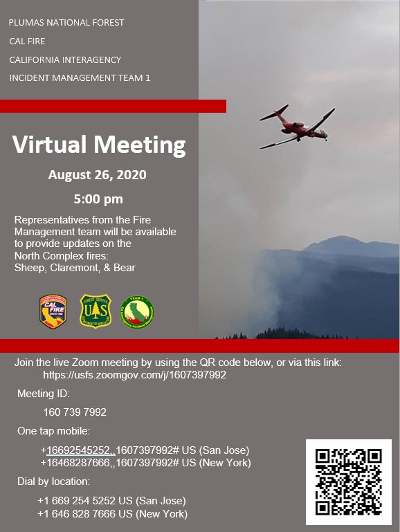
There will be a virtual community meeting tonight at 5 p.m. Representatives from the Fire Management team will be available to provide updates on the North Complex fires: Sheep, Claremont, & Bear. Join the live Zoom meeting at https://usfs.zoomgov.com/j/1607397992
Current Situation on the Claremont: Crews worked overnight to reinforce gains made throughout the day due to favorable weather conditions and increased crew capacity. Today, crews will continue to work to increase containment by reinforcing dozer line heading around the west and southwest perimeter of the fire. The south side of the fire is moving into an old fire area with less fuel to burn, so is moving slowly. Crews will continue to work on building dozer and hand line in and near Greenhorn and Spring Garden to protect residences in the event of a fire breakover.
Current Situation on the Bear: Crews will continue to strengthen a defensive line along Slate Creek Spur on the north side of the fire in an effort to catch any threat of it moving north towards Quincy. They will also work to keep the fire from moving east where it crossed Little Bear Creek. The fire is currently held north of the Middle Fork of the Feather River. The Bear Fire is located on the Pacific Crest Trail, 1-mile northwest of Butte Bar Campground and 1.5 southeast of Lookout Rock.
Evacuations: Evacuation Advisory Alerts remain in effect for the communities of Cromberg and Sloat. Residents there should make preparations to evacuate. The mandatory evacuation order was MODIFIED to ADVISORY STATUS yesterday for East Quincy, south of Highway 70 between Millcreek (to include Mill Creek Road and Forest View Drive) extending east to Quincy La Porte Road. All other evacuation orders and advisories remain in effect.
Plumas County launched a Claremont Fire Evacuation Information website as an online resource to view the fire map, current evacuation zones, sign up for Code Red, follow links to USFS fire incidents pages, and find the Sheriff’s Office Facebook page. http://mgo.ms/s/yokm6
The shelter in Quincy has been closed.
Road Closure: Hwy 70 is currently open with a police escort from Quincy La Porte Road to Spring Garden. Quincy La Porte Road from Hwy 70 to Red Bridge and Peppard Flat Road (dirt portion) remain closed. The Pacific Crest Trail from Onion Valley to Bucks Summit remains closed. For further information on closures go to: https://www.fs.usda.gov/alerts/plumas/alerts-notices.
For immediate text notifications sign up for the Plumas County’s CodeRed Emergency Alert System on their website at https://www.plumascounty.us/2163/.
Visit CalTrans at quickmap.dot.ca.gov or call 1-800-427-7623 for the latest maps and information of road closures in your area.
Weather: It will be mostly sunny today with mild temperatures and modest relative humidities. Winds will be terrain driven until early to mid-afternoon, and then will become generally southwest once again. It's likely to become hotter and drier Thursday into the weekend with temperatures jumping 10 degrees for highs. Dry conditions will lead to bigger diurnal temperature ranges later this week into the weekend. Southeast flow Friday will bring a slight chance of slow moving thunderstorms. Otherwise, hot and dry will be the theme this weekend into early next week.
Air Quality: Quincy and Susanville continue to be impacted by Unhealthy to Hazardous levels of smoke. Southwest winds should keep smoke moving to the northeast of the fires. For more information on air quality and to see monitors near you, visit Airnow or the California Smoke Blog. For more information on what you can do to protect yourself and loved ones, visit the EPA's site on fires and your health. Your local health department is also a great source of information!
COVID-19: California Interagency Incident Management Team 1 has implemented precautionary measures to prevent the spread of COVID-19 in both fire camp and the surrounding communities.
North Complex VIRTUAL COMMUNITY MEETING 8262020
Related Incident:
Publication Type: News
The North Complex is inviting you to a scheduled ZoomGov meeting.
Topic: North Complex Virtual Community MeetingTime: Aug 26, 2020 05:00 PM Pacific Time (US and Canada)
Join ZoomGov Meetinghttps://usfs.zoomgov.com/j/1607397992
Meeting ID: 160 739 7992One tap mobile+16692545252,,1607397992# US (San Jose)+16468287666,,1607397992# US (New York)
Dial by your location +1 669 254 5252 US (San Jose) +1 646 828 7666 US (New York)Meeting ID: 160 739 7992Find your local number: https://usfs.zoomgov.com/u/acuLVPvhPu
Join by SIP1607397992@sip.zoomgov.com
Join by H.323161.199.138.10 (US West)161.199.136.10 (US East)5261100.140Meeting ID: 160 739 7992
Bear Fire AM UPDATE 8252020
Related Incident:
Publication Type: News
Claremont and Bear – Morning Update
Acres: 21,324 combined (Claremont 17,906; Bear 3,418)
Resources: 14 dozers, 68 engines, 8 hand crews, 7 helicopters, 6 water tenders, and 517 total personnel. These resources are shared with the North Complex.
Current Situation on the Claremont: As the Claremont Fire moved east last night, it spread towards Hwy 70, which triggered a new Evacuation Advisory for the communities of Cromberg and Sloat (about 150 structures threatened). The south side of the fire moving along the Feather River is in very challenging terrain, and is now within ½ mile southwest of Hwy 70. The breakover at Massack Rest Area and Hwy 70 now has good dozer line around the slope. Today, crews will work to reinforce that dozer line as well as a large stretch of completed dozer line on the west side of the fire from Quincy down to Claremont in an effort to keep it from moving north. Expect additional Hwy 70 closures and Union Pacific rail closures today. The Claremont Fire is located south of Quincy, CA and north of the Middle Fork of the Feather River.
Current Situation on the Bear: The Bear Fire continues to move aggressively to the north and west up Bear Creek and along Forest Road 23N19 as it moves around constructed dozer line. There was a spot fire across Little Bear Creek where crews were trying to keep it from moving to the north. The Bear Fire is located on the Pacific Crest Trail, 1-mile northwest of Butte Bar Campground and 1.5 southeast of Lookout Rock.
Weather: Lingering moisture and instability will lead to a slight chance of showers and thunderstorms this afternoon into early this evening. The greatest threat for showers and thunderstorms over the North Complex will be in the afternoon hours. It is most likely, however, that showers and thunderstorms will remain north and east of the area similar to Monday. It's still possible that winds could affect the area in the afternoon and building smoke columns are likely to lead to some erratic and gusty winds in the heat of the afternoon and evening.
Air Quality: Heaviest impacts will again be in areas closest to the fires. Lingering smoke may be dense at times in the valleys but thinning is expected, especially south of fires. As fires become more active later in the day, areas will see heavier impacts in the evening into overnight as smoke settles into valleys and local drainages. For a fire and smoke map, go to https://fire.airnow.gov/
Evacuations: Evacuation Advisory Alert is in effect for the communities of Cromberg and Sloat. Residents there should make preparations to evacuate. Evacuation orders in East Quincy remain in effect. For the latest evacuation information, visit the Plumas County Sheriff’s Facebook page - facebook.com/plumascountysheriff.
Quincy High School remains an Evacuation Center for local residences. No small animals are able to be accommodated at the high school. Portola Station Baptist Church (171 S Guiling St.) is serving as an evacuation center for residents of Greenhorn and Spring Garden.
Road Closure: Highway 70 remained CLOSED between Spring Garden and La Porte Road, but escorted groups were allowed through by the California Highway Patrol as conditions allow. La Porte Road and Thompson Creek Road remain closed. Union Pacific Railroad also has a closure affected by the fire. The Pacific Crest Trail from Onion Valley to Bucks Summit remains closed. For further information on closures go to: https://www.fs.usda.gov/alerts/plumas/alerts-notices
For immediate text notifications sign up for the Plumas County’s CodeRed Emergency Alert System on their website at https://www.plumascounty.us/2163/. Evacuation questions should be directed to your County Sheriff's office non-emergency number. Plumas County Sheriff’s Office: (530) 283-6375.
Visit CalTrans at quickmap.dot.ca.gov or call 1-800-427-7623 for the latest maps and information of road closures in your area.
COVID-19: California Interagency Incident Management Team 1 has implemented precautionary measures to prevent the spread of COVID-19 in both fire camp and the surrounding communities.
Bear Fire PM UPDATE 8242020
Related Incident:
Publication Type: News
Claremont and Bear – Evening Update
Acres: 20,684
Resources: 14 dozers, 68 engines, 8 hand crews, 7 helicopters, 6 water tenders, and 517 total personnel. These resources are shared with the North Complex.
Current Situation on the Claremont: Tempered weather today allowed crews to go on the offensive and attack the fire and build line in place of constant structure protection as in previous days. The fire does remain active near Hwy 70 as well as south of the Feather River. The spots that crossed over Hwy 70 had a hand crew working to build line. Crews will continue to defend lines near structures overnight to further stabilize the area. Union Pacific (UP) moved a Fire Train into the area to assist with fire suppression along the railroad tracks adjacent to Hwy 70. The UP locomotive has a water tank car attached with a pump on top that supplies hoses, nozzles, and deck guns to help extinguish fires and hot spots on or along the railroad tracks.
The California Highway Patrol escorted groups of cars today on SR-70 through the burned over area. The area is still considered a closed zone and should be avoided if possible. The highway can close again at anytime in the event the area is not safe to travel.
The Claremont Fire, now at 17,906 acres, is located south of Quincy, CA and north of the Middle Fork of the Feather River.
Current Situation on the Bear: The Bear Fire remains active in all directions. Additional crews were added to support containment. The Bear Fire, now at 2,778 acres is located on the Pacific Crest Trail, 1-mile northwest of Butte Bar Campground and 1.5 southeast of Lookout Rock.
Weather: RED FLAG WARNING REMAINS IN EFFECT FOR THE FOOTHILLS AND MOUNTAINS THROUGH THIS EVENING. A threat of isolated dry thunderstorms remains possible in the foothills and mountains through this evening. Lightning from dry thunderstorms will have the potential to start new fires. Dry thunderstorms may also produce gusty wind.
Air Quality: Hazy smoke continued today and was most dense in the valleys. Light winds pushed smoke to the north/northeast and areas nearest the fires saw the greatest impacts, namely Susanville and Quincy. Those areas can expect to see unhealthy/very unhealthy conditions overall. Locations near Reno should have seen some relief today as scattered showers continued to pass through. Smoke was expected to thin/mix out around noon into the early evening. For a fire and smoke map, go to https://fire.airnow.gov/
Evacuations: Evacuation Advisory Alert is in effect for the communities of Cromberg and Sloat. Residents there should make preparations to evacuate. Due to the continued weather threat into tonight, evacuation orders in East Quincy remain. For the latest evacuation information, visit the Plumas County Sheriff’s Facebook page - facebook.com/plumascountysheriff.
Quincy High School remains an Evacuation Center for local residences. No small animals are able to be accommodated at the high school. Portola Station Baptist Church (171 S Guiling St.) is serving as an evacuation center for residents of Greenhorn and Spring Garden.
Road Closure: Highway 70 remained CLOSED between Spring Garden and La Porte Road, but escorted groups were allowed through by the California Highway Patrol as conditions allowed. La Porte Road and Thompson Creek Road remain closed. Union Pacific Railroad also has a closure affected by the fire. The Pacific Crest Trail from Onion Valley to Bucks Summit remains closed. For further information on closures go to: https://www.fs.usda.gov/alerts/plumas/alerts-notices
For immediate text notifications sign up for the Plumas County’s CodeRed Emergency Alert System on their website at https://www.plumascounty.us/2163/. Evacuation questions should be directed to your County Sheriff's office non-emergency number. Plumas County Sheriff’s Office: (530) 283-6375.
Visit CalTrans at quickmap.dot.ca.gov for the latest maps with road closures in your area.
COVID-19: California Interagency Incident Management Team 1 has implemented precautionary measures to prevent the spread of COVID-19 in both fire camp and the surrounding communities.
Bear Fire AM UPDATE 8242020
Related Incident:
Publication Type: News
Current Situation on the Bear: The Bear Fire made a large advancement on the north side of the fire yesterday to the northwest along both sides of Bear Creek. It is holding on the northeast side at the top of the flats. The south side of the fire advanced towards Middle Fork at Carpenter Bar but stayed east of Carpenter Creek. The Bear Fire, now at 1,934 acres is located on the Pacific Crest Trail, 1-mile northwest of Butte Bar Campground and 1.5 southeast of Lookout Rock.
Weather: There is a Red Flag Warning for Gusty Outflow Winds & Dry Lightning In Effect Until Tuesday Morning. Isolated showers and thunderstorms are expected this morning. In addition to concern for new fire starts, gusty winds and brief light to moderate rainfall will be possible. There's likely to be a break in the weather late morning into the early afternoon before more showers and thunderstorms develop along and near the Sierra Crest. Afternoon to evening thunderstorms east of the North Complex, could cause winds to push into the area.
Air Quality: Smoke impacts to communities are expected to improve somewhat today due to the incoming thunderstorms. However, an increase in fire activity later this afternoon may increase smoke coming into the area. Areas of better air quality are expected above the foothill communities. For a fire and smoke map, go to https://fire.airnow.gov/
Evacuations: Several MANDATORY Evacuation orders and ADVISORIES were issued last night. Emergency responders made door to door notifications where evacuations were taking place. Some the notices were downgraded in level. For the latest evacuation information, visit the Plumas County Sheriff’s Facebook page - facebook.com/plumascountysheriff.
Quincy High School remains an Evacuation Center for local residences. No small animals are able to be accommodated at the high school. Portola Station Baptist Church (171 S Guiling St.) is serving as an evacuation center for residents of Greenhorn and Spring Garden.
Road Closure: Highway 70 remains CLOSED between Spring Garden and Quincy La Porte Road. La Porte Road and Thompson Creek Road remain closed. Union Pacific Railroad also has a closure affected by the fire. The Pacific Crest Trail from Onion Valley to Bucks Summit remains closed. For further information on closures go to: https://www.fs.usda.gov/alerts/plumas/alerts-notices
For immediate text notifications sign up for the Plumas County’s CodeRed Emergency Alert System on their website at https://www.plumascounty.us/2163/. Evacuation questions should be directed to your County Sheriff's office non-emergency number. Plumas County Sheriff’s Office: (530) 283-6375.
Visit CalTrans at quickmap.dot.ca.gov for the latest maps with road closures in your area.
COVID-19: California Interagency Incident Management Team 1 has implemented precautionary measures to prevent the spread of COVID-19 in both fire camp and the surrounding communities.
Smoke Outlook 8242020
Related Incident:
Publication Type: News
See Attached Smoke Outlook for 8-24-2020
Bear Fire PM UPDATE 82320
Related Incident:
Publication Type: News
Claremont and Bear – Evening Update
Acres: 17,317 Containment: 2%
Resources: 14 dozers, 70 engines, 10 hand crews, 6 helicopters, 7 water tenders, and 568 total personnel. These resources are shared with the North Complex.
Current Situation on the Claremont: The Claremont Fire made sweeping movement today and crossed the Middle Fork of the Feather River moving eastward towards Spring Garden. As a result, mandatory evacuation orders were issued for Spring Garden and Greenhorn Ranch. Several helicopters assisted with overhead water drops to try and cool the flames while crews worked to knock down spot fires. Crews will continue to work overnight protecting structures and pushing the fire back if weather cooperates. The Claremont Fire, now at 15,656 acres and 2% contained, is located south of Quincy, CA and north of the Middle Fork of the Feather River.
Current Situation on the Bear: The Bear Fire made a large advancement on the north side of the fire today to the northwest along both sides of Bear Creek. The south side of the fire advanced towards Middle Fork at Carpenter Bar, but stayed east of Carpenter Creek. The Bear Fire is located on the Pacific Crest Trail, 1-mile northwest of Butte Bar Campground and 1.5 southeast of Lookout Rock.
Weather: There remains a RED FLAG WARNING FOR DRY THUNDERSTORMS THROUGH MONDAY EVENING. Lightning from dry thunderstorms will have the potential to start new fires.
Air Quality: For a fire and smoke map, go to https://fire.airnow.gov/
Evacuations:
MANDATORY Evacuation was issued for the residents of SPRING GARDEN and GREENHORN RANCH.
MANDATORY Evacuation notice for the residents along Highway 70 from Chandler Road east to Squirrel Creek Road (also known as the Road to Argentine).
Evacuation ADVISORY Alert for the residents of Chandler Road, from Highway 70 east to Carol Lane East.
Emergency responders were going door to door making notifications.
Quincy High School remains an Evacuation Center for local residences. No small animals are able to be accommodated at the high school. The Red Cross is currently working to establish a secondary evacuation center.
Road Closure: Highway 70 remains CLOSED between Spring Garden and Quincy La Porte Road. La Porte Road and Thompson Creek Road remain closed. Union Pacific Railroad also has a closure affected by the fire. The Pacific Crest Trail from Onion Valley to Bucks Summit remains closed. For further information on closures go to: https://www.fs.usda.gov/alerts/plumas/alerts-notices
For immediate text notifications sign up for the Plumas County’s CodeRed Emergency Alert System on their website at https://www.plumascounty.us/2163/. Evacuation questions should be directed to your County Sheriff's office non-emergency number. Plumas County Sheriff’s Office: (530) 283-6375.
Visit CalTrans at quickmap.dot.ca.gov for the latest maps with road closures in your area.
COVID-19: California Interagency Incident Management Team 1 has implemented precautionary measures to prevent the spread of COVID-19 in both fire camp and the surrounding communities.
Red Flag Warning Weather Update 8232020
Related Incident:
Publication Type: News
RED FLAG WARNING & WEATHER UPDATE
A Red Flag Warning has been issued for Sunday evening into Monday due to a threat of lightning and strong outflow winds. Not the news anyone wants to hear but lightning can create new fires starts and may combine with strong outflow winds to cause a fire to rapidly grow in size and intensity.
The main period of concern for thunderstorms will be Sunday evening through Monday morning. Additional storms are possible Monday and Tuesday mainly across the southern Sierra and western Nevada Basin and Range where a Fire Weather Watch remains in effect.
VIEW the Attachment for a Detailed Report on Conditions.