
Highlighted Activity
Highlighted Media
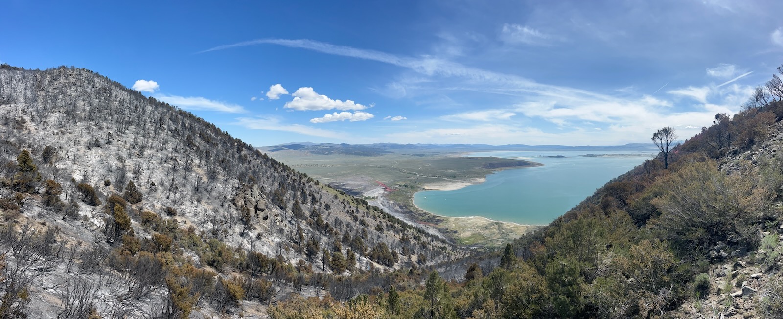
View from the top of the Inn Fire 5-24-25
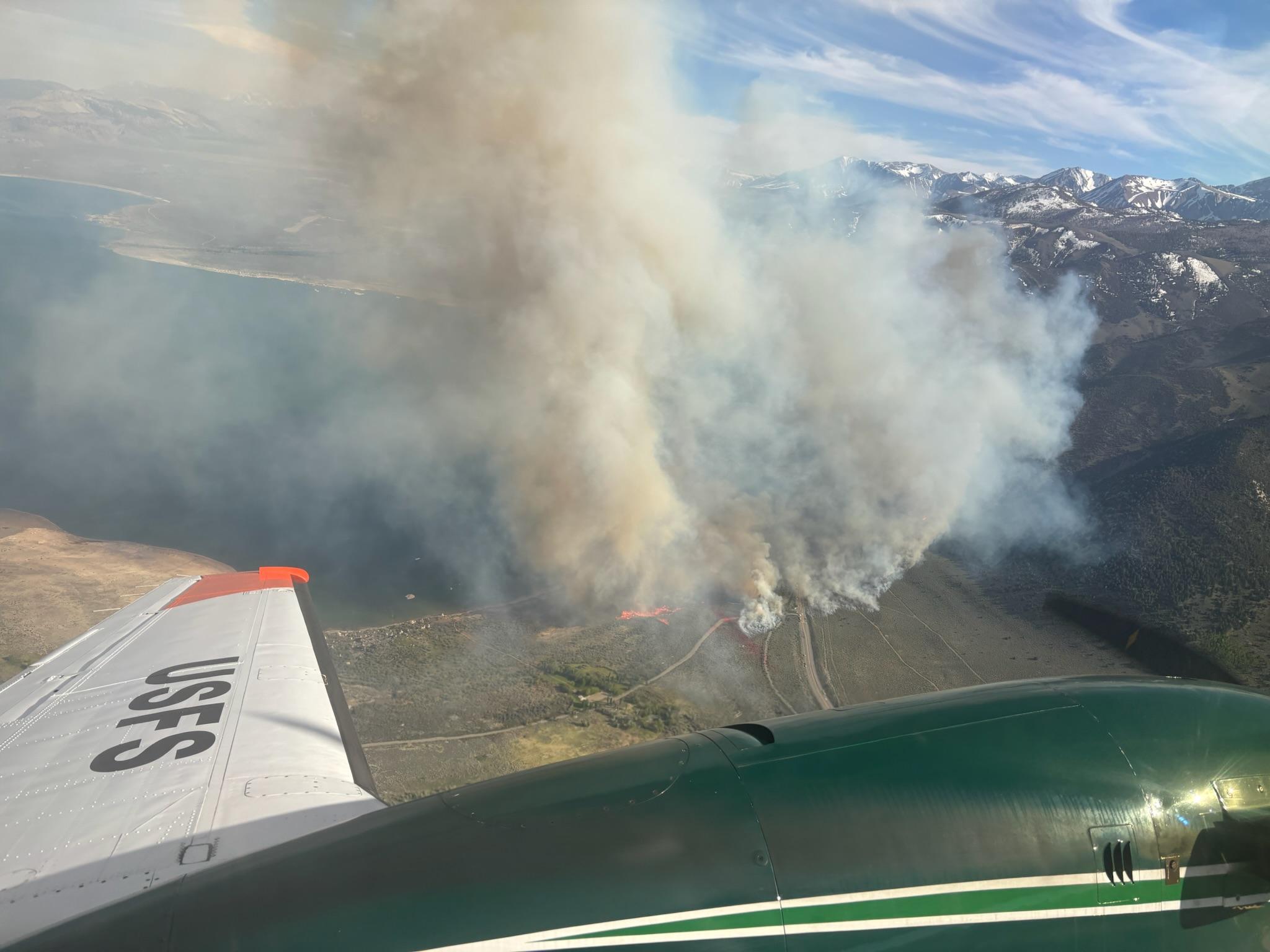
The Inn Fire started on Thursday May 22, at approximately 3:36 p.m. on the west side of Highway 395, just south of Mono City. Erratic winds caused the fire to grow quickly and spot across the east side of Highway 395. A full suppression response was ordered by fire management, including firefighting aircraft. Highway 395 was quickly closed in both directions for safety and for the threat and impacts to power lines. Evacuation orders were issued approximately one half hour after the fire started for Mono City, then Lundy Canyon after.
Breaking fire updates will be posted on the Inyo National Forest Facebook page: www.facebook.com/inyonf
Highway closure information:
- Highway 395 is now fully open with two-way traffic.
- Please use caution and slow down in the fire area!
- Check latest status on the CalTrans District 9: www.facebook.com/Caltrans9/?ref=embed_page# or on Quickmap: https://quickmap.dot.ca.gov/ (filter for full road closures).
Evacuation updates for Mono County Sheriff: www.facebook.com/MonoSheriff/
Download the Genasys Protect App for the latest evacuation map: https://protect.genasys.com/download
| Current as of | Fri, 05/30/2025 - 21:40 |
|---|---|
| Incident Time Zone | Pacific Standard Time |
| Incident Type | Wildfire |
| Cause | Under Investigation |
| Date of Origin | |
| Incident Time Zone | Pacific Standard Time |
| Location | South of Mono City, CA. North of Lee Vining and Lundy Canyon. West side of Mono Lake. |
| Incident Commander | Danny Gallagher, Nevada Incident Management Team 4 |
| Incident Description | Vegetation fire burning on both sides of Highway 395. Due to structure threat, evacuations were ordered on the same evening the fire broke, and were lifted by 9 p.m. on Saturday, 5/24. A full suppression response is being implemented, including aircraft. |
| Coordinates |
38° 0' 23.724'' Latitude
-119° 9' 15.948
'' Longitude
|
| Total Personnel: | 180 |
|---|---|
| Size | 728 Acres |
| Percent of Perimeter Contained | 94% |
| Fuels Involved | Sagebrush, grass |
| Significant Events | Minimal, smoldering |
| Planned Actions |
Interagency hotshot crews will continue to go direct on steep, rocky slopes. Rolling rock and hand crews continue mopping up in the flatter areas. |
|---|---|
| Projected Incident Activity |
Minimal growth, continue line construction and secure the fire's edge. Continue mop-up operations and stop forward progression of fire. |
| Weather Concerns | Sunny and warm, gusty winds. |
|---|