
Amended Greer Fire Incident Area and Road Emergency Closure 05 19 2025
Related Incident: Greer Fire
Publication Type: Closures
U.S. Department of Agriculture, U.S. Forest Service Apache-Sitgreaves National Forests Springerville Ranger District Amended Greer Fire Incident Area and Road Emergency Closure
PROHIBITIONS
Pursuant to 16 U.S.C. § 551 and 36 C.F.R. § 261.50 (a) and (b), the following are prohibited on the National Forest System (NFS) roads, trails, and lands in the Springerville Ranger District, Apache-Sitgreaves National Forests, described below and shown on the attached map incorporated into this Order as Exhibit A (the “Described Area/Roads/Trails”):
- Public health or safety. 36 C.F.R. § 261.53(e)
- Being on the road. 36 C.F.R. § 261.54(e)
- Being on the trail. 36 C.F.R. § 261.55(a)
EXEMPTIONS
Pursuant to 36 C.F.R. § 261.50(e), the following persons are exempt from this Order:
- Persons with Forest Service Permit No. FS-7700-48 (Permit for Use of Roads, Trails, or Areas Restricted by Regulation or Oder), specifically exempting them from this Order or a written determination by a Forest Service authorized officer that a permit is not required under 36 C.F.R. § 251.50(e)(1) or (2).
- Any Federal, State, or Local Officer, or member of an organized rescue or firefighting resource in the performance of an official duty.
DESCRIBED AREA/ROADS/TRAILS
As shown in the map at Exhibit A, the Described Area encompasses all National Forest System lands, roads, and trails within the boundary at the junction of Hwy 260 and School Bus Rd, following a southerly and westerly direction along School Bus Rd to S. Water Canyon Rd, then south along Water Canyon Rd/National Forest System Road (NFSR) #285, then following NFSR #285 in a southerly direction to NFSR #90, then following NFSR #90 in a westerly direction to Hwy 261, then following a southerly direction along Hwy 261 to Hwy 273, then following a westerly and northerly direction along Hwy 273 to NFSR #554, then following a northerly direction to Winn Campground to exclude Winn campground from the closure, and back in a southerly direction to Hwy 273, then following in a northerly direction along Hwy 273 to NFSR #112, then following a northerly direction along NFSR #112 to Hwy 260, then following an easterly direction along Hwy 260 to School Bus Rd.
PURPOSE
The purpose of this Order is to provide for the public’s health and safety during periods of high or extreme fire danger with very limited escape routes out of the described area during the Greer Fire incident.
IMPLEMENTATION
- This Order shall be in effect from May 19, 2025, at 5:00 PM through September 30, 2025, at 8:00 AM, unless rescinded.
- A map identifying the Described Area, Roads, Trails is attached and made part of this Order as Exhibit A. For a digital version of this Order and Exhibit A, go to https://www.fs.usda.gov/alerts/asnf/alerts-notices.
- Unless otherwise expressly defined in this Order, the terms used in this Order are defined by the regulations of the Secretary of Agriculture, 36 C.F.R. Chapter II, Parts 200-299. If there are terms in this Order that are not expressly defined in the Order or 36 C.F.R. Chapter II, Parts 200-299, their meaning shall be determined by their plain language definitions.
- A violation of the above prohibitions is punishable as a Class B misdemeanor by a fine of not more than $5,000 for individuals and $10,000 for organizations, or by imprisonment for not more than six months, or both. 16 U.S.C. § 551; 18 U.S.C. §§ 3559, 3571, and 3581.
- Contact the Springerville Ranger District in Springerville, (928) 333-6200, and Apache-Sitgreaves National Forests Supervisor’s Office in Springerville (928) 333-6200, for more information about this Order.
- This Order supersedes any previous Orders prohibiting the same or similar acts in the same Described Area, Road, or Trail.
Signed and issued on this 19th day of May, 2025.
Munger Shaw Fire Update 05 19 2025
Related Incident: Munger Shaw Fire
Publication Type: News
Munger Shaw Fire Quick Facts
Size: 1259 acres Location: Southeast of Cotton, MN Personnel: 29
Containment: 95% Cause: Under investigation Resources: 2 engines, 1 UAS module.
Start Date: 05/12/2025
KEY MESSAGE: This will be the final update for the Munger Shaw Fire unless significant activity occurs. Over the weekend, firefighters made great progress with improved weather conditions toward containing the Munger Shaw Fire -- now 95% contained. MNICS Team A will be transitioning the management of the fire back to the local Cloquet Area DNR Forestry at 6:00 a.m. tomorrow. After today, the fire organization will be approximately 3-5 people issued to the fire. The Minnesota DNR will continue monitoring and patrolling the fire area. While the fire is largely contained, smoldering hotspots within the fire’s interior may continue to smolder and produce smoke until the fire area receives sufficient precipitation.
Update and Planned Activities:
The un-crewed aircraft system (UAS) or drone finished mapping the fire perimeter yesterday and reported the fire size has decreased to 1259 acres due to more accurate mapping. The advanced infrared technology used by the drone identified a few remaining hotspots within the burn area. Crews have worked to cool these hotspots down using water and stirring the hots embers to the surface. Drone use by the public near a wildfire is illegal. Unauthorized drones pose a serious threat to pilot safety.
Despite the rainy conditions yesterday, crews with tracked vehicles successfully completed all of their repair objectives. Suppression damage repair includes cleaning up any resource damage resulting from fire control lines, roads, trails, staging areas, safety zones, and drop points.
Today, firefighters will continue to patrol and monitor the fire’s perimeter.
National Weather Service Forecast:
High winds and low relative humidities will lead to drying conditions on the fire today. Winds will be from the east at 5 to 10 mph, increasing throughout the day with gusts between 25 to 30 mph. East winds will remain strong and gusty through Tuesday. Temperatures will be cool with a predicted high of 48 degrees.
Evacuations and Road Closures: Road closures and evacuations have been rescinded by the Sheriff. The team is closely coordinating with St. Louis County on updating the evacuation status. Stay alert and continue to monitor county websites for information. St. Louis County Sheriff's Office Divisions of Emergency Management and 911 have a website hub with evacuation and other fire information and Ready-Set-Go map.
St. Louis County: https://sheriff-slcgis.hub.arcgis.com/pages/wildfire
Cooperating Agencies: Minnesota Department of Natural Resources, Bureau of Indian Affairs, US Fish and Wildlife Service, USDA Forest Service, CN Railroad, Northland Fire Department, St. Louis County Emergency Management and St. Louis County Rescue Squad and the American Red Cross.
Burning Restrictions: For current burning restrictions, see https://www.dnr.state.mn.us/forestry/fire/firerating_restrictions.html
Democrat Fire Road Closure 05 19 2025
Related Incident: Democrat Fire
Publication Type: Closures
Highway 178 is open both directions.
Settings - change map background and toggle additional layers
Filter - control incident types displayed on map.
Zoom to your location
Reset map zoom and position
Could not determine your location.
Show Legend
 Wildfire
 Prescribed Fire
 Burned Area
Response
Burned Area
Response Other
Other
Democrat Fire
Unit Information
Incident Contacts
Greer Fire Daily Update 05 19 2025
Related Incident: Greer Fire
Publication Type: News
Containment reported
Acres: 20,324
Start Date: May 13, 2025
Location: Greer, AZ
Cause: Under Investigation
Personnel: Approximately 736
Fuels: Grass, Shrubs, Timber
Containment: 39 percent
Highlights: All lines hold after high winds continue to test fire perimeter.
Operations: An extensive amount of work has been completed on all divisions of the fire since Tuesday. With multiple days of Red Flag Warnings and wind advisories, control lines have been tested and are holding. Crews were able to complete the remaining portions of the firing operation yesterday morning that connected Forest Rd 409 to the main fire on the south/southwestern edge. As a result of substantial work securing heat near the edge of the line, fire managers were able to add some containment to the fire this morning. Today, all available resources are actively working to secure the fire perimeter and cool hot spots to prevent the spread of the fire by wind-driven embers.
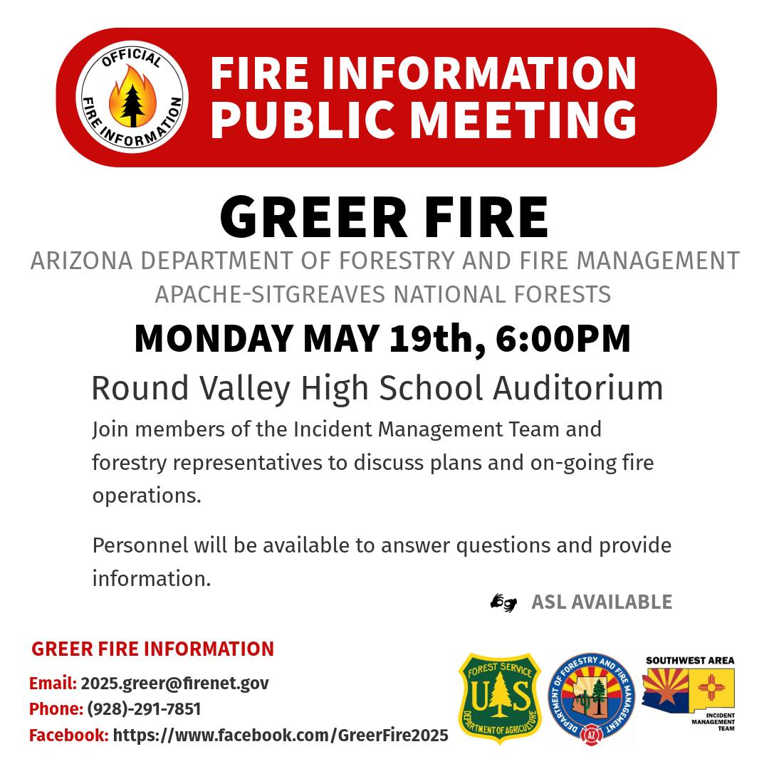
A public meeting will be held today at the Round Valley High School auditorium at 6:00pm. The meeting will also be streamed live on the incident YouTube page at https://www.youtube.com/@GreerFire2025.
Weather: Fire personnel are preparing for another Red Flag Warning issued over the fire today with critical fire weather conditions and strong winds expected – including gusts up to 40 mph.
Smoke: Updated smoke forecast at https://www.azdeq.gov/wildfire/forecast/greerfire
Closures: The Apache-Sitgreaves National Forest has issued a closure order for parts of the National Forest lands. Stage 2 Fire Restrictions are also in effect prohibiting fire, campfire, or stove fire, including charcoal briquettes and smoking.
Evacuations: To check current evacuation statuses, an interactive evacuation map is available from the QR code below.
Shelter for evacuees are open at the County Fairgrounds in St. Johns and the Alpine Community Center.
Highway 260 is closed in both directions near Greer. For updated travel information: az511.com
Safety: A temporary flight restriction has been issued over the fire area. It is illegal to fly drones within the area.
Camp House Jenkins Creek Fires Update May 19 2025 05 19 2025
Related Incident: Jenkins Creek Fire
Publication Type: News
Jenkins Creek & Camp House Fires Update
Community Meeting: A meeting for the Jenkins Creek and Camp House Road wildfires will be held today at 6 p.m., at the Mesabi East School District High School Auditorium—601 N 1st St W, Aurora, MN. The meeting will be live-streamed on the EA IMT YouTube channel. The link will be shared on the MNICS and Superior National Forest Facebook pages.
Jenkins Creek Fire Quick Facts
Size: 16,332 acres Location: T57N R13W Section 3
Personnel: 199 Start Date: 05/12/2025
Containment: 6% Cause: Under investigation
Jenkins Creek Fire: With drier and gustier weather predicted, protection of the Skibo and Hoyt Lakes communities remains a priority. Great progress was made over the weekend as personnel took advantage of the cooler, wetter conditions. Firefighters continued to add existing hose lays and prioritize pre-emptive structure protection. Multiple hotshot crews are working the perimeter and interior of the fire. They will be supported by helicopters and drones to detect and catch flare-ups that may occur today.
Evacuation, Road Closure, and Homeowner Access information for St. Louis County: https://tinyurl.com/StLouisCoSituationMap. For Lake County: https://tinyurl.com/LakeCoMnEvacuationMap. Some changes to evacuation levels were announced by the St. Louis County Sheriff yesterday. St. Louis County Sheriff’s office announced that Hwy-16 (Town Line Rd), is reopened to through traffic. Vehicles should avoid stopping anywhere in the evacuation “Go” zones to minimize exposure and risk. Drivers are also asked to take extra care when driving through due to the continued presence of emergency crews, utility crews, and other curious or distracted drivers.
National Weather Service Forecast: Today will be sunny with a high of 49 and an overnight low of around 30 degrees. Winds will pick up out of the east , blowing a steady 6 to 15 mph, with gusts up to 33 mph. Humidity is also expected to drop to as low as 26%.
Portions of the Laurentian Ranger District are closed. Emergency Forest Order 09-09-25-05 prohibits visitor entry to some camp sites and recreational areas. See Forest Order Exhibit A for a list of closure areas and Exhibit B for a map of the area. The closure may be modified or extended as conditions allow. https://www.fs.usda.gov/r09/superior/alerts/forest-order-09-09-25-05-brimson-complex-emergency-closure
Current Burning Restrictions: https://www.dnr.state.mn.us/forestry/fire/firerating_restrictions.html
Camp House Jenkins Creek Fires Update May 19 2025 05 19 2025
Related Incident: Camp House Fire
Publication Type: News
Camp House and Jenkins Creek Fires Update
Community Meeting: A meeting for the Jenkins Creek and Camphouse Road wildfires will be held today at 6 p.m., at the Mesabi East School District High School Auditorium—601 N 1st St W, Aurora, MN. The meeting will be live streamed on the EA IMT YouTube channel. The link will be shared on the MNICS and Superior National Forest Facebook pages.
Camp House Fire Quick Facts
Size: 12,277 acres Location: Brimson, MN
Personnel: 402 Start Date: 05/11/2025
Containment: 40% Cause: Under investigation
Camp House Fire: Great progress was made all along the fire’s perimeter and more handcrews arrived today, allowing other crews to be moved to active areas of the Jenkins Fire. Crews were working from well-established points of entry (anchor points). They used hand tools and dozers to make headway in both directions from these anchor points, making excellent progress. Hotshot crews and dozers were also able to connect the line to both sides of Brimson Lake on the south end of the fire. On the north end, firefighters continued to build protection around structures and key infrastructure. This work will continue today with helicopter and drone support as well. Masticating equipment is clearing snags and downed trees from areas near roads and within the fire perimeter.
Evacuation, Road Closure, and Homeowner Access information for St. Louis County: https://tinyurl.com/StLouisCoSituationMap. For Lake County: https://tinyurl.com/LakeCoMnEvacuationMap. Some changes to evacuations levels were announced by the St. Louis County Sheriff yesterday. St. Louis County Sheriff’s office announced that Hwy-16 (Town Line Rd), is reopened to through traffic. Vehicles should avoid stopping anywhere in the evacuation “Go” zones to minimize exposure and risk. Drivers are also asked to take extra care when driving through due to the continued presence of emergency crews, utility crews, and other curious or distracted drivers.
National Weather Service Forecast: Today will be sunny with a high of 49 and an overnight low of around 30 degrees. Winds will pick up out of the east blowing a steady 6 to 15 mph, with gusts up to 33 mph. Humidity is also expected to drop to as low as 26%.
Portions of the Laurentian Ranger District are closed. Emergency Forest Order 09-09-25-05 prohibits visitor entry to some camp sites and recreational areas. See Forest Order Exhibit A for a list of closure areas and Exhibit B for a map of the area. The closure may be modified or extended as conditions allow. https://www.fs.usda.gov/r09/superior/alerts/forest-order-09-09-25-05-brimson-complex-emergency-closure
Current Burning Restrictions: https://www.dnr.state.mn.us/forestry/fire/firerating_restrictions.html
Greer Fire Public Meeting Scheduled for Monday May 19 202505 18 2025
Related Incident: Greer Fire
Publication Type: Announcement
A public meeting for the Greer Fire will be held this Monday May 19th at the Round Valley High School Auditorium at 6:00 PM. There will be a presentation about current fire conditions and operations that will be followed by an opportunity for community members to have their questions answered by the fire response team.
This event will be hosted by the Incident Management Team and will have representatives from Arizona Department of Forestry and Fire Management, U.S. Forest Service - Apache-Sitgreaves National Forests , and local safety officials on hand to answer your questions. We will also broadcast this meeting live from our incident YouTube page: https://www.youtube.com/@GreerFire2025
Munger Shaw Fire Update 05 18 2025
Related Incident: Munger Shaw Fire
Publication Type: News
Munger Shaw Fire Update Sunday, May 18, 2025
Minnesota Incident Mgt. Team A Incident Commander: Mike Hill
Fire Information: 218-360-4484
Email: 2025.mungershaw@firenet.gov
Munger Shaw Fire Quick Facts Size: 1600 acres Location: Southeast of Cotton, MN Personnel: 51 Containment: 75% Cause: Under investigation
Resources: 1 engine, 1 dozer, 1 tracked vehicle, 1excavator, 1 Type One crew, 1 UAS Modue
Start Date: 05/12/2025
Munger Shaw Overview – The Munger Shaw fire was detected late in the afternoon on Monday, May 12. Minnesota DNR along with local fire departments responded. Multiple aircraft were brought in to help slow down the active flame fronts, supporting the ground firefighting efforts. St. Louis County Sheriff’s Office and Emergency Management are coordinating public safety efforts. The cause of the fire is still under investigation.
Update and Planned Activities: Good progress continues to be made on the Munger Shaw Fire with containment now at 75%. Today, crews continue patrolling and monitoring of the fire line as well as with suppression damage repair work. Fire suppression damage repair is work done immediately following fire suppression actions to repair damages and minimize potential soil erosion and related impacts from the suppression actions. The repair work is completed on hand and dozer fire control lines, roads, trails, staging areas, safety zones, and drop points that were used during fire suppression efforts.
MNICS Team A ordered a UAS module which arrived on Saturday with an Un-crewed Aircraft System (UAS) or drone along with experienced operators. The UAS provides valuable low altitude photos and infrared imagery while also reducing the inherent risk that goes with traditional crewed aircraft and firefighters working under fire-weakened timber. The drone will be flying over the fire, mapping the perimeter and identifying any areas of remaining heat where crews can follow up using water and equipment to tamp down hotspots.
National Weather Service Forecast: It will continue to be cloudy and cool today with rain showers and drizzle tapering off into the afternoon. Light winds from the north will shift to east winds at 5-9 mph gusting to 14 mph. A high pressure system moving into the region will bring cold temps and drier air this week.
Evacuations and Road Closures: The St. Louis County Sheriff rescinded the evacuation and road closures for the Munger Shaw Fire ONLY. Due to improved weather conditions and the successful work on preventing further fire spread, residents will be allowed to return to their property immediately. Residents are reminded to be mindful of people working in the area to restore essential services. Drive cautiously as roads may have been impacted by the fire. Stay alert and pay attention.
St. Louis County Sheriff's Office Divisions of Emergency Management and 911 have a website hub with evacuation and other fire information and Ready-Set-Go map.
St. Louis County: https://sheriff-slcgis.hub.arcgis.com/pages/wildfire
Lake County: https://www.co.lake.mn.us/emergency-management/
Donations: Staff and firefighters working on the Munger Shaw Fire greatly appreciate all the support from the local businesses and communities. At this time, we are unable to use all of the food and drink donations we are receiving. Please be assured that our firefighters are well taken care of. Once again, we greatly appreciate the generosity of those who want to assist. As an alternative we recommend making a contribution to these great organizations who support firefighters:
Wildland Firefighter Foundation at: https://wffoundation.org/
The Red Cross: https://www.redcross.org/donations/ways-to-donate.html
The United Way: https://www.unitedwaynemn.org/give
Cooperating Agencies: Minnesota Department of Natural Resources, Bureau of Indian Affairs, US Fish and Wildlife Service, USDA Forest Service, CN Railroad, Northland Fire Department, St. Louis County Emergency Management and St. Louis County Rescue Squad, Burning Restrictions: For current burning restrictions, see https://www.dnr.state.mn.us/forestry/fire/firerating_restrictions.html
Forsythe II Update 05 18 2025
Related Incident: Forsythe II Prescribed Burn
Publication Type: Announcement
Fire crews successfully completed work on 125 acres yesterday, Saturday May 17, on the Forsythe II Prescribed Burn Project. No further ignitions are planned for this operational period. Crews remain on site working to ensure that the exterior edge of the burn is secure and to continue monitoring conditions. In the interest of public and firefighter safety, a forest closure remains in effect for the area.
Smoke may continue to be visible for the next several days while interior pockets of the prescribed fire continue to burn down. Fire managers work closely with experts to minimize the impacts of smoke. Air quality is carefully monitored before and during a prescribed fire and all prescribed burns comply with state air quality regulations to minimize impacts to communities. To learn more about the potential health impacts of smoke visit www.colorado.gov/pacific/cdphe/wood-smoke-and-health.
Email notifications will be sent out periodically for any additional ignition periods. To receive these updates, make sure to join our email list. Additional information can be found here on InciWeb.